
Just a little update on my progress. The Map Quest open router is working perfectly, so I think that's as good as it's going to get.
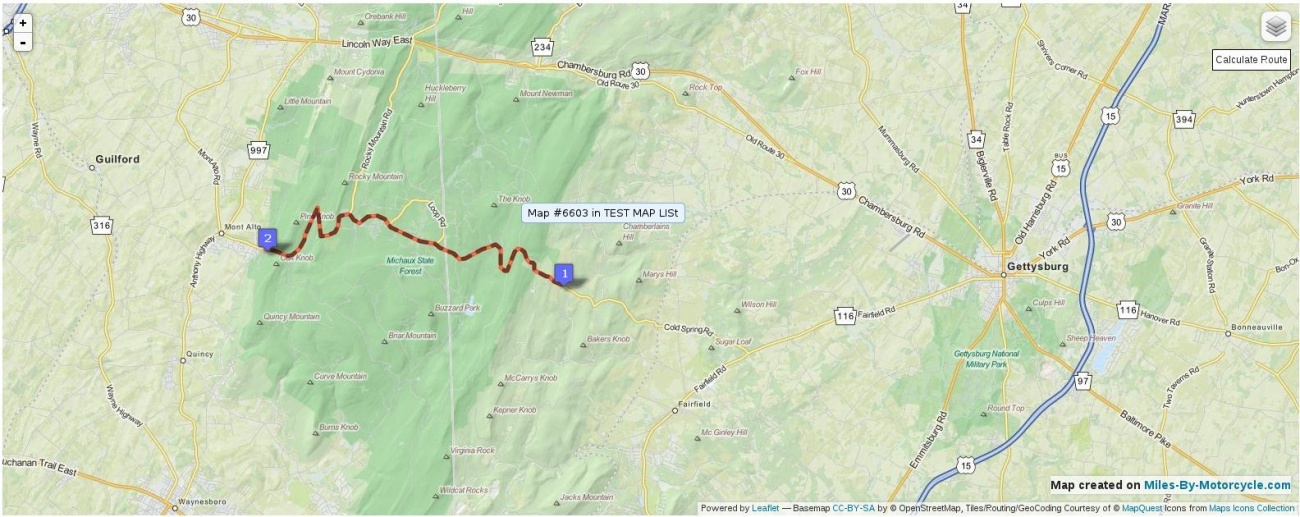
I've also come up with a way that we can select routes or even sections of a route to tag. For instance, here I've selected Cold Spring Road, PA. You'll be able to recognize tagged roads on a map by the dashed lines.
It's coming along nicely. I'll keep posting updates as I make progress. Before too long we'll be able to build and share these maps on the site. I'm working hard to make that happen.

The Original Miles-By-Motorcycle Group
established 11 years ago
You must be logged in and belong to this group to post to this forum.
Of course, if you can upload and see your GPS tracks on a Miles By Motorcycle map, you're gonna want to be able to mess with it. In my first test, I wanted to see my tracks through Olney but not the ones up through Jessup.
So now you can click two points on a route and delete sections.
I did not expect editing of tracks to be quite that challenging or time consuming.
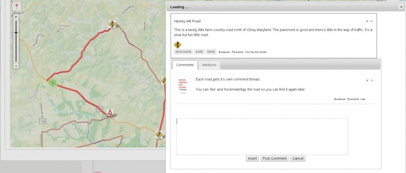
It was made more difficult because of one cool feature that I decided I needed. You go for a ride. You upload the track from your GPS to the map. Of course there are some sections of road you want to remember. There are some you'll want to single out.
So per Duncan's request, you can now click on two points anywhere along a route and "tag" them as a shared road which will show up in search results separately. It's actually pretty cool. You can bookmark it and apply your own tags to make it easier to find and, of course, you can like/unlike it.
With this, by far the most difficult part of the maps project is at least working. I still have to finish the hookup between the map and the database so the entire map can be saved out. Right now, only saving of tags roads works. But this is not a big deal to do. I also need to implement Points of Interest and hook everything up so that you can apply a Point of Interest onto a map or along a tagged road.
I would really like to get static maps working where you can get an image version of a map that can be shared out on twitter or facebook, but I'm running into some technical problems. The problem lies with one or the other of these two major open source projects I'm using. I'm waiting on responses. If I don't get them, I may just release with every map being interactive. It'll mean pages with lots of maps on them will load kind of slowly, but we can probably live with it for now.
The last feature I want to build before releasing, which "should" not a big deal, is exporting the GPX files. This means you'll be able to build a map on the site and then download it to your GPS. Once I have that basically working, I think I'll call it done for an initial release.
There's are a huge number of other features to build. I'd like to be able to pan and zoom the map and automatically load whatever things have been tagged in that area. I'd like to be able to overlay multiple maps or tagged roads on the same map when I'm searching. And so forth and so on ...
But it's coming along and I can't wait to start using it.
So now you can click two points on a route and delete sections.
I did not expect editing of tracks to be quite that challenging or time consuming.
It was made more difficult because of one cool feature that I decided I needed. You go for a ride. You upload the track from your GPS to the map. Of course there are some sections of road you want to remember. There are some you'll want to single out.
So per Duncan's request, you can now click on two points anywhere along a route and "tag" them as a shared road which will show up in search results separately. It's actually pretty cool. You can bookmark it and apply your own tags to make it easier to find and, of course, you can like/unlike it.
Hipsley Mill Road North of Olney, Md.
Another example of the maps code I'm working on. Editing of tracks works now.
With this, by far the most difficult part of the maps project is at least working. I still have to finish the hookup between the map and the database so the entire map can be saved out. Right now, only saving of tags roads works. But this is not a big deal to do. I also need to implement Points of Interest and hook everything up so that you can apply a Point of Interest onto a map or along a tagged road.
I would really like to get static maps working where you can get an image version of a map that can be shared out on twitter or facebook, but I'm running into some technical problems. The problem lies with one or the other of these two major open source projects I'm using. I'm waiting on responses. If I don't get them, I may just release with every map being interactive. It'll mean pages with lots of maps on them will load kind of slowly, but we can probably live with it for now.
The last feature I want to build before releasing, which "should" not a big deal, is exporting the GPX files. This means you'll be able to build a map on the site and then download it to your GPS. Once I have that basically working, I think I'll call it done for an initial release.
There's are a huge number of other features to build. I'd like to be able to pan and zoom the map and automatically load whatever things have been tagged in that area. I'd like to be able to overlay multiple maps or tagged roads on the same map when I'm searching. And so forth and so on ...
But it's coming along and I can't wait to start using it.
Im not sure this is in the cards, but including mobile support would be fantastic. If we could hit a button a MBM app and have it upload the last____ miles we traveled and be able to add comments right to the map at a stop/gas station.
ie: the last 25 miles were amazing. watch out for a sharp un marked right hand about 5 miles in. and then see the last 25 miles of gps data from the phone populate into the maps section of MBM.
im not sure if its possible, but its an idea. ( its easy to talk about development when i have no code experience) but i do hope it could be possible someday.
Exactly! 
Building the backend on the server is the huge part of the work. I'm "close" to "done enough" with it. The plan is to start working on the mobile app for iPhone, Android and Windows Phone in June with the hope of having "something small" working by August. Given my track record, I suspect I won't make that goal, but I will at least try.
Building the backend on the server is the huge part of the work. I'm "close" to "done enough" with it. The plan is to start working on the mobile app for iPhone, Android and Windows Phone in June with the hope of having "something small" working by August. Given my track record, I suspect I won't make that goal, but I will at least try.