oh cool! Thanks for posting that! We plan on going back up there soon and checking out more roads.
We rode some of the MABDR last year up North there.
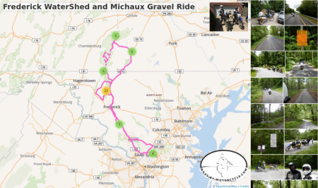
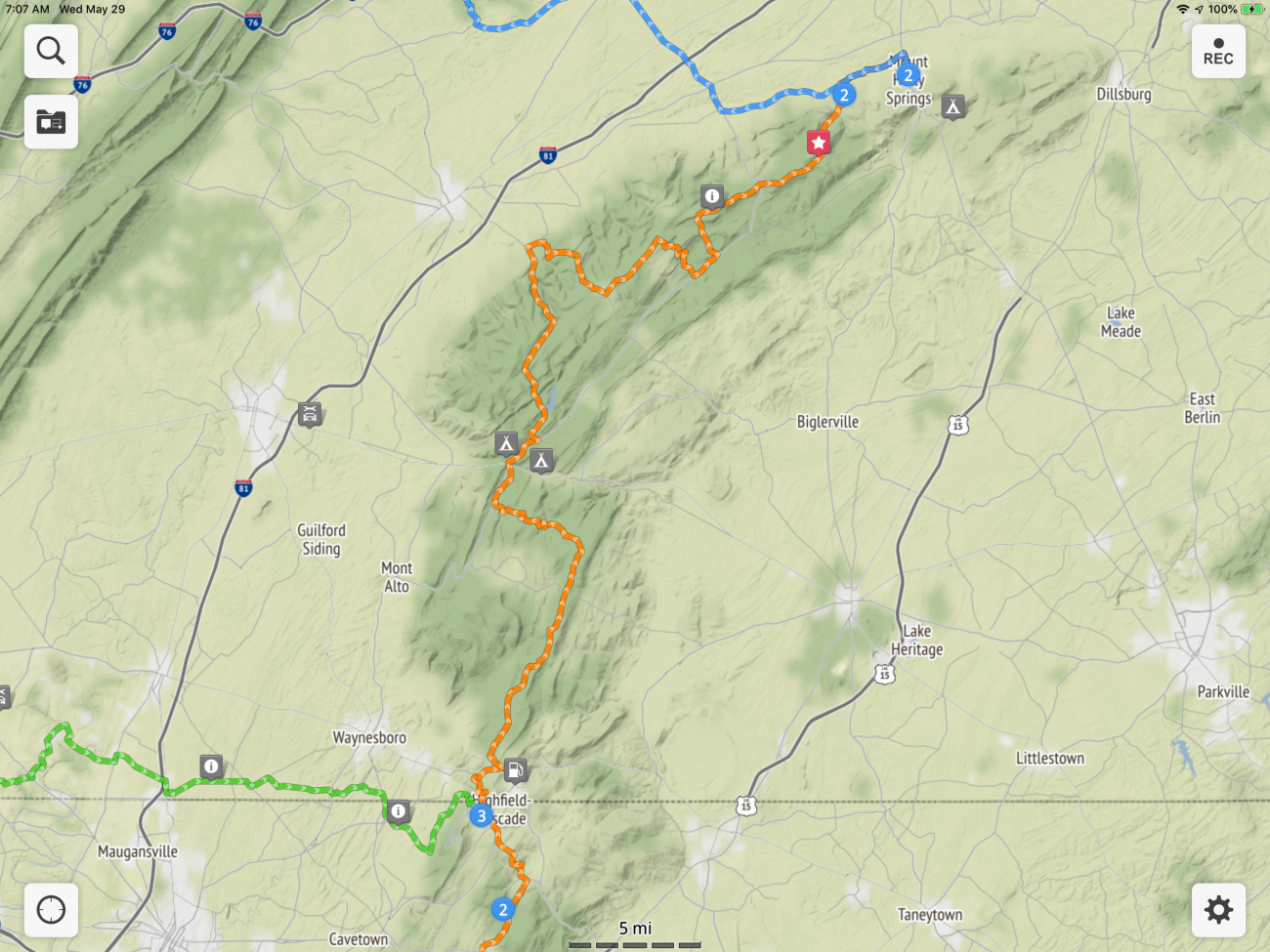
Plans have changed. Now the plan is to take the DR’s up to Michaux State Forest and ride a section of the MABDR which cooncidentally runs over some of the dirt we are familiar with.
As for the maps, it's what I've been working on building here for some ages now.
You can create maps based on your GPX tracks. You can add photos, points of interest, videos, links, etc to you maps. You can plot routes and export GPX of your routes for your GPS.
When you create a map it also creates a large shareable image.
While you can do it on a phone, it's super awkward. It's best, for the moment to use a PC.
To create a map click in your profile click your user name in the upper right corner, (Robermcm) then click on Maps, then +New Map. Or if you want to create a public map in the group here you can click on the Maps tab at the top and click +New Map.
In either case, that'll bring up the map editor.
The button in the top left is the search button. It lets you search for places by city,state. Sometimes addresses work, sometimes they don't so I find it's best to search for a known town, state and then manually move the map over to a place I want to mark.
For example, click on the magnifying glass and enter:
Thurmont, Md
Then press ENTER.
There's only one so it'll automatically zoom you there and pop up the "click window".
Here you can add a waypoint to start a route ( the blue 1 icon), or you can add a point of interest, a photo, etc.
So click the waypoint.
You'll see a blue 1 on the map starting in Thurmont, md.
Now let's say you want to end your ride over in Mont Alto, PA.
Click the search magnifying glass button and enter
Mont Alto, PA
and press ENTER.
It'll zoom you over to Mont Alto and will show you the same click window.
You'll notice now the window has a blue 2 icon in it showing you that you can place the second waypoint.
Go ahead and click on it to place your second waypoint.
You'll now see a grey line on the map for a route calculated between Thurmont and Mont Alto.
It's not a fun route obviously.
You can click and drag the waypoints if you want to adjust the points to some exact location.
Unlike Google where you can just drag the route all over the place to force it to change, here you have to use waypoints. You can carefully click on the grey route line and it'll bring up a similar window.
For example, click on the line just below Mont Alto near Quincy.
This will bring up the route window. You'll notice on the right a blue 2 waypoint icon. Click that.
You'll see a blue 2 waypoint added to the route and you'll notice the waypoint in Mont Alto is now a 3.
Drag and blue 2 waypoint over to route 233, which is an awesome road.
Depending on where you dragged it you'll get a new route.
You can add as many waypoints as you like either by clicking on the map to add some new destination or by clicking in the line and dragging the waypoints to force it to go over a particular route.
I find if I want to make sure that I route along a certain road when I export the route to my Zumo 550 that it's best to add at least three waypoints along the road. Sometimes my Zumo, Google, and the route engine I use here don't agree on the route, so forcing it usually works.
One cool feature you might like is the "Gravel Waypoint".
Click on the route and add a waypoint somewhere. Drag it to the start of a gravel road in Michaux somewhere.
Click on the route again to insert another waypoint. Drag it somewhere in the middle of your gravel road.
Click on the route again right near the start of the gravel road. This time click the Gravel icon which is the brown icon.
You'll see a gravel icon added and you'll see that the route is now a dashed line indicating unpaved.
Click near the end of your gravel road. Click the brown gravel waypoint icon. Now you'll see it marks the end of the gravel section.
If you want to remove a waypoint, just click on the waypoint and click remove. To remove the whole route, it's similar. Click on the route and click remove.
Often you'll need to tweak the positions of the waypoints a bit to get the route you want. You'll want to make sure to zoom in all the way so you're hitting the roads exactly the way you want.
Sometimes, especially for off road, it won't properly calculate a route for a section. I use GPX tracks which I edit in that case. More on that later.
You can give your map a name by clicking on the settings button in the upper right. There's an options tab if you want people to be able to download a GPX file of your map.
You can upload a GPX file to the map using the GPX with the up arrow button just below settings.
This will then render any waypoints and tracks you have. You can edit tracks a bit but it's a bit awkward. I've got to rebuild the track editor which will happen when I finally get around to building the new improved map editor.
Downloading a GPX file is easy. Just click the GPX down arrow button.
To save your map, just click the save button.
If you added your map to the group here, everyone will be able to see it. For the moment, if you add it to your own profile only people on the site will be able to see it unless you set your profile to public. I'll be improving how all that works as well.
One you save you can share the URL (if public). You can also embed the map anywhere in the site where you can enter content, for example this post.
So here's the example map I created following the instructions I wrote above. To embed it, just click the map marker icon next to the plus icon in the window you use to reply to this thread.
Click Search for maps.
Enter @ robermcm (without the space). It'll give you a dropdown with your username. Click that. (We're searching for maps you've created).
Click the search button.
You should see your map. Click embed.
You should see something like the following:
Embedded Object Error

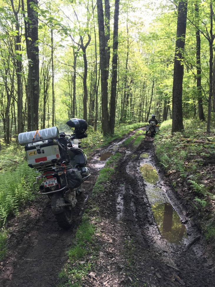
 MrOleynik and
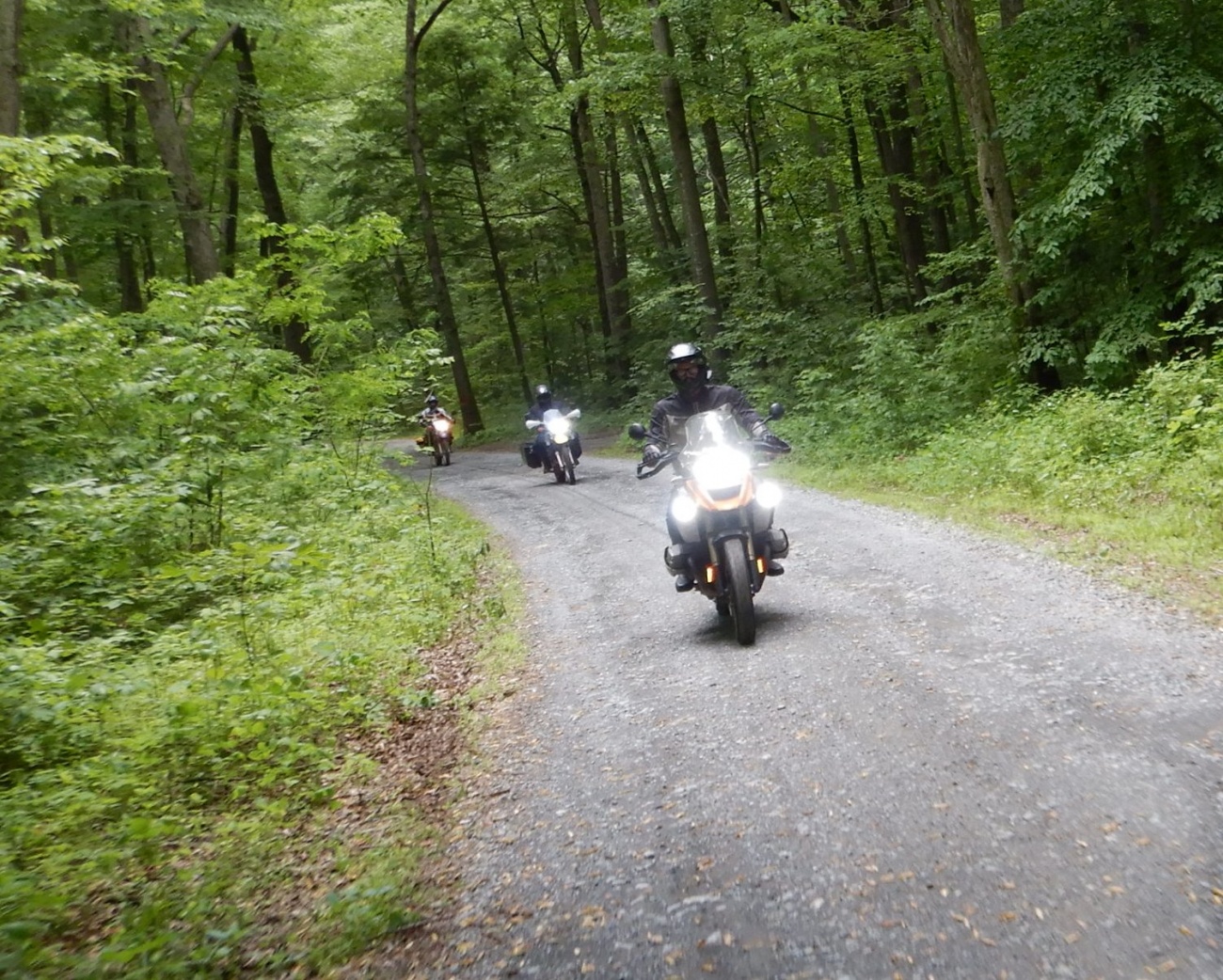
  buffalo , and I had ridden together and it was Dave’s first time in gravel and mud on his newly acquired DR650SE.