

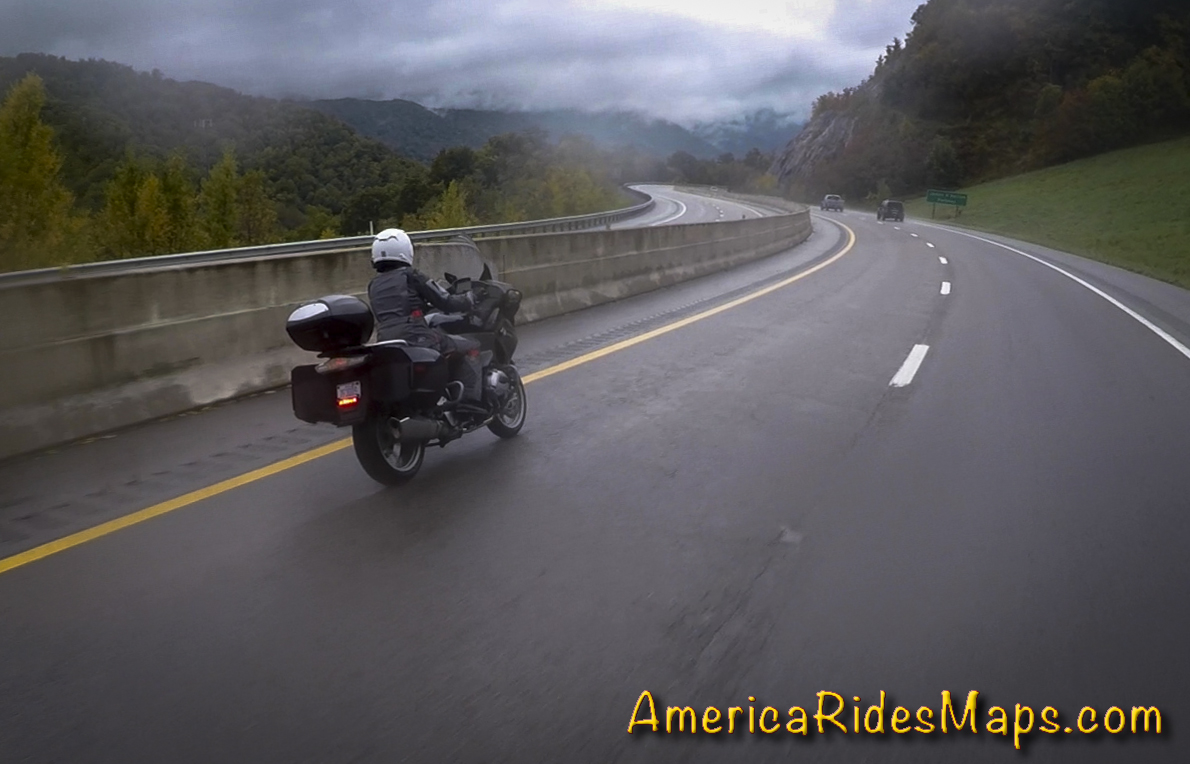
Motorcycle Touring in the Blue Ridge
Best Motorcycle Rides along the Blue Ridge Parkway and around Great Smoky Mountains National Park.

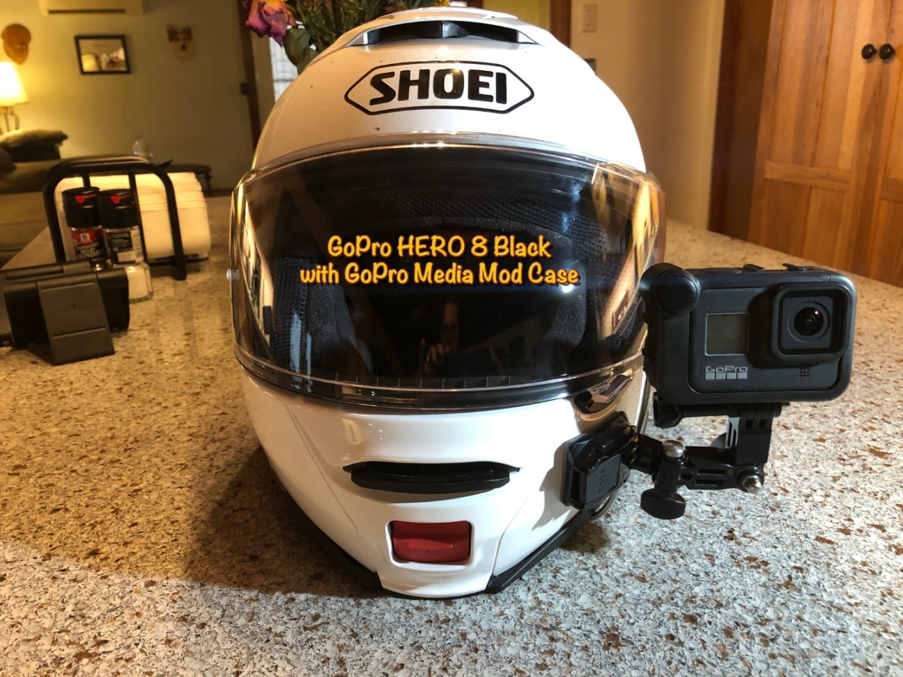
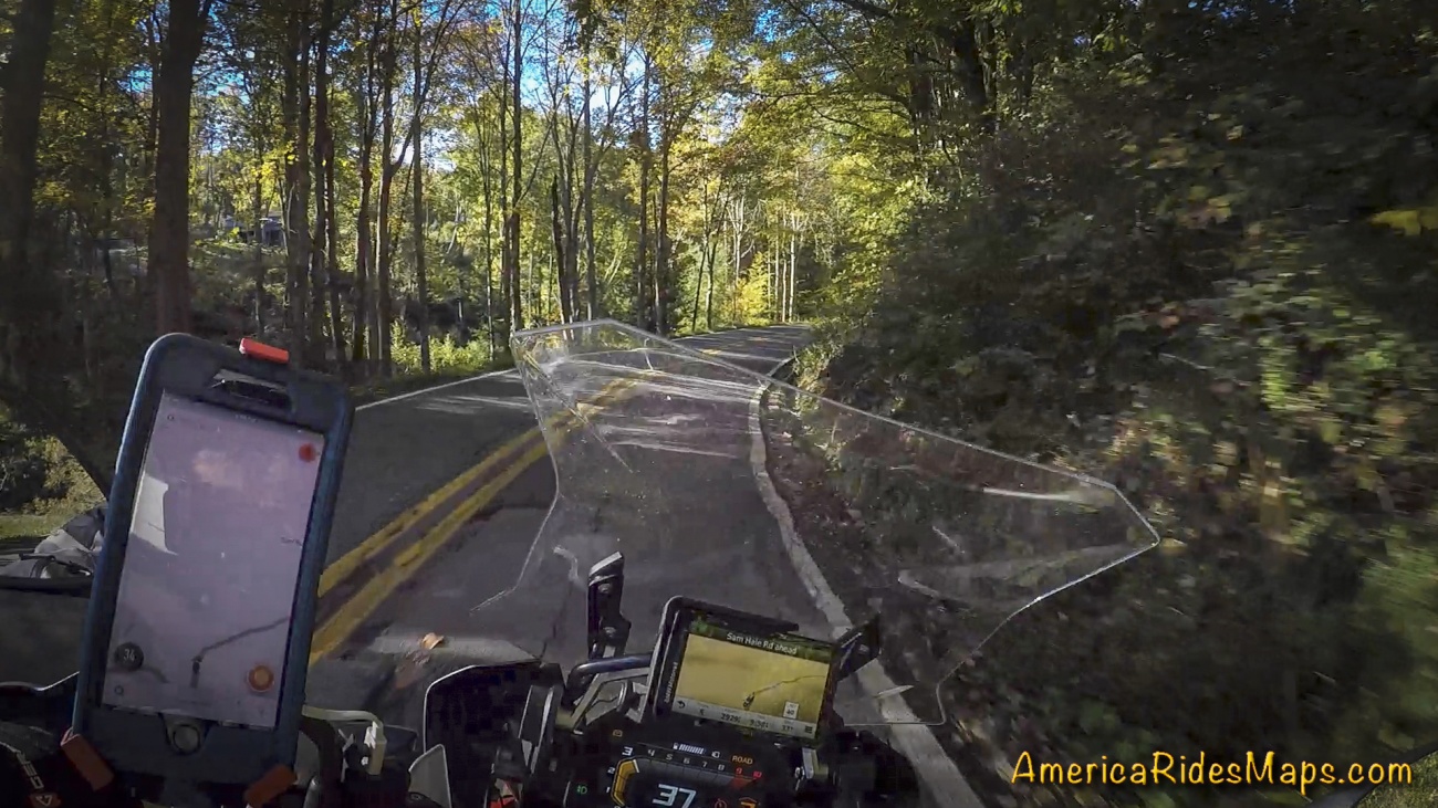
The GoPro 8 camera is easier to set up for VLOGing than the GoPro 7 but is it worth the effort and expense?
In an earlier post (Ulanzi V2 Vlogging Case for GoPro - see below) I showed my VLOG setup for my helmet mounted GoPro HERO 7 Black. The GoPro 7 is a pretty good all around camera and gives decent image quality for full screen viewing. Still, the GoPro 8 brings upgrades that eventually coaxed me into making the change. While the GoPro 7 can shoot in 4K resolution it cannot do image stabilization above 2.7K so you are resigned to shoot at the smaller size. The GoPro HERO 8 Black has improved image stabilization and it works at 4K. This was the main drive for me to switch.
Ulanzi V2 Vlogging Case for GoPro
How many times have you suffered through a GoPro video online that's overwhelmed with loud and distracting wind noise? They are really hard to watch. You can turn off the audio on your GoPro when recording or mute the audio from the captured video, but you really lose the feel for the experience, the sounds of the bike engine, the sense of movement, the atmosphere that makes for a good video. You've probably also enjoyed videos narrated from the bike while riding. Again, you can dub in narr ...Read More
Do you really need to shoot at 4K? Probably not. In a YouTube video you're not going to notice a difference between 2.7K and 4K. However, the better quality comes into play when editing and you want to crop and zoom in on a video clip. This often comes into play when your camera is not perfectly aligned and the horizon in the image is not level. When you rotate the image to level the horizon you need to zoom in a bit to crop out the edges which now are slanted with black spaces at the margins. It's surprising how much just a few degrees of rotation affect the screen image and it takes a significant amount of zoom to make those edges go off screen, about 10% zoom for every degree of rotation. With 4K you can really zoom into an image without significant degradation. I simply find editing easier when I have more options to manipulate the videos.
GoPro 8 Vlog Setup
There are also improvements in color management that give better results with the GoPro 8, and the GoPro 8 uses an upgraded battery that provides enough power for the additional features and gives noticeably longer life. Unfortunately you will want to use these new batteries as the older HERO 7 batteries can't handle the draw needed for the advanced features in the HERO 8. They will work in a pinch but things like the advanced image stabilization won't work. The new HERO 8 batteries will work fine in the GoPro 6, GoPro 7, and you'll get the increased life, so if you're buying additional batteries for your GoPro 7 buy the newer GoPro 8 batteries instead. (Do not buy GoPro 9 batteries, they are larger and will not fit the other cameras).
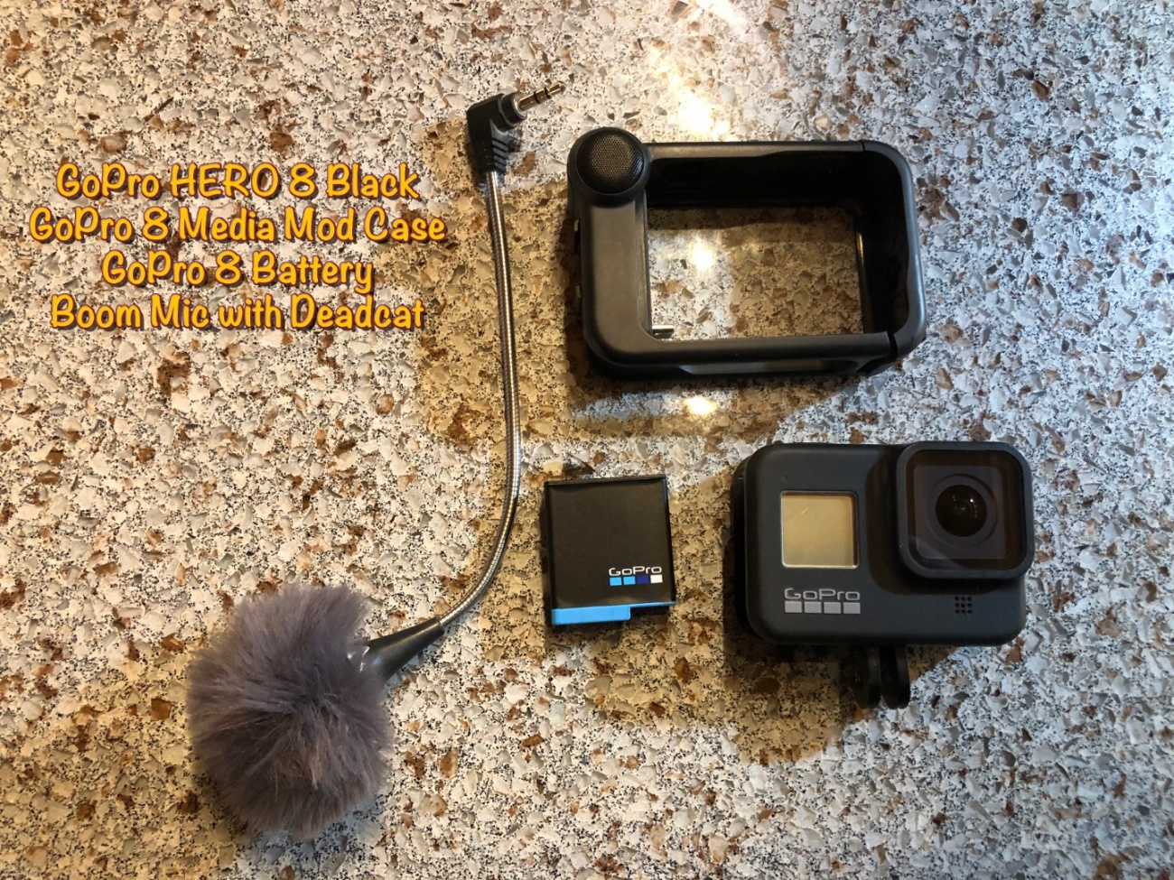
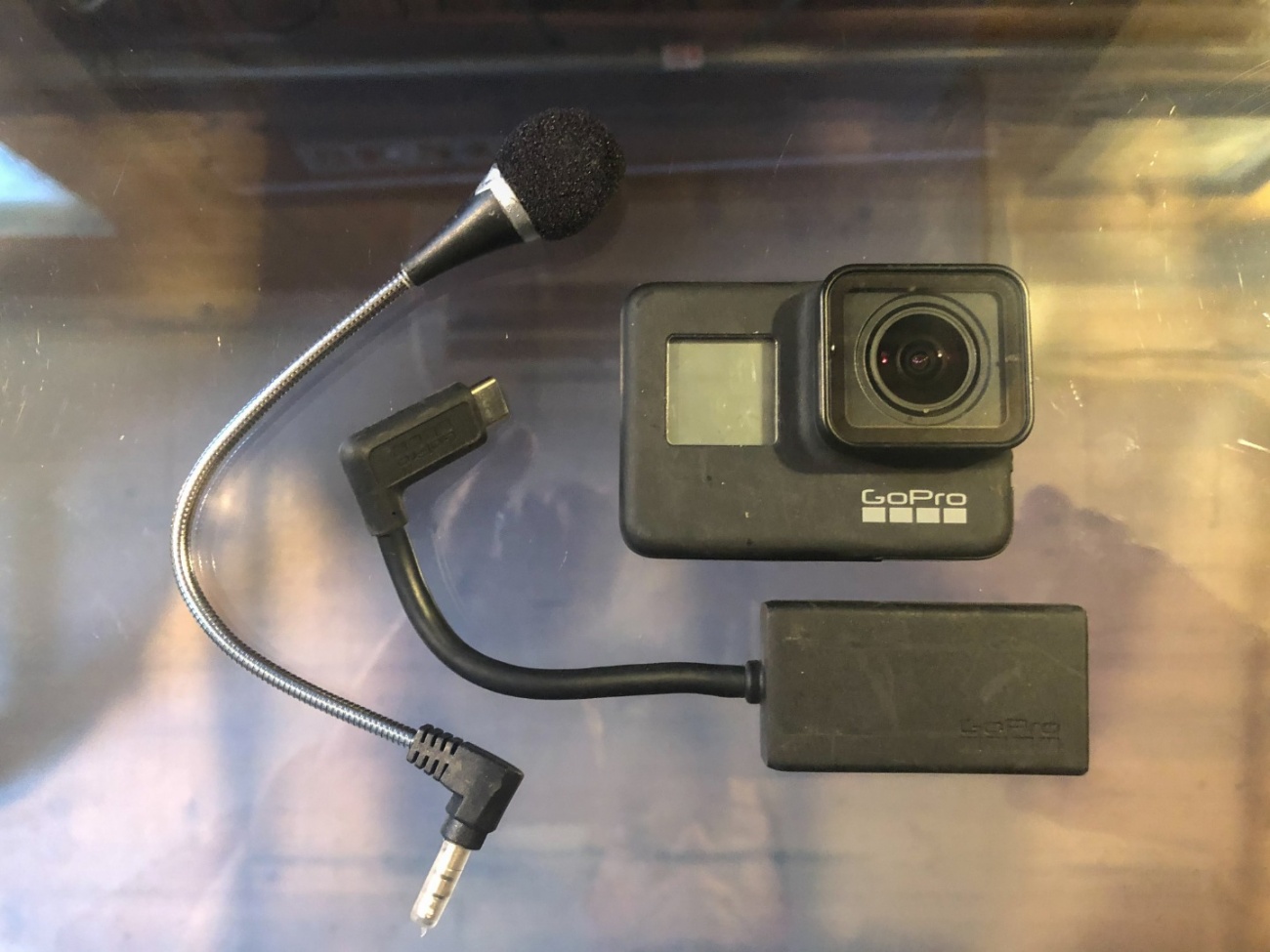
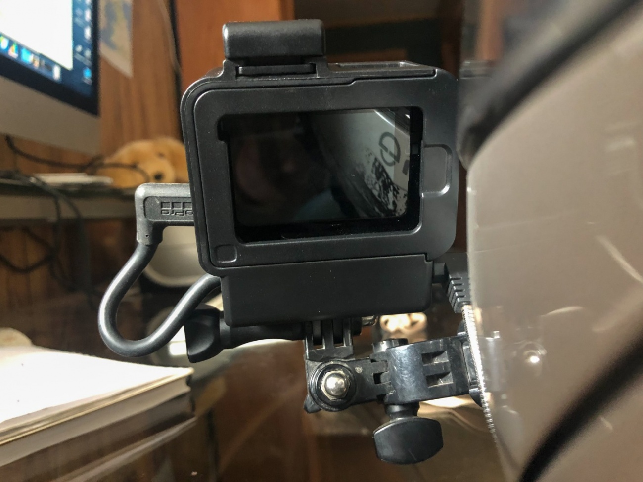
GoPro 8 Vlogging Components
The other advantage of moving to the GoPro 8 is the option to use the accessory Media Mod Case (purchased separately). You will need a case to mount your GoPro 7 as the older cameras do not have mounting "feet" to mate with other GoPro mounts, but the case comes bundled with the camera when you buy it. As I showed in that previous blog post the GoPro 7 requires you remove the side door and use a bulky microphone adapter in order to accept a remote microphone (these microphone adapters are getting hard to locate). The best way I found to address that was the Ulanzi camera case which has a slot to hold the adapter. I liked the setup. It was a little bulky but pretty easy to use and I could pop the camera in and out of it quickly to change batteries. The Ulanzi case was fairly inexpensive with cutouts to access the camera buttons. (Get the plastic case. Ulanzi makes a metal case for about 3 times the cost and my cameras would not fit in them).
GoPro 8 Vlogging Setup
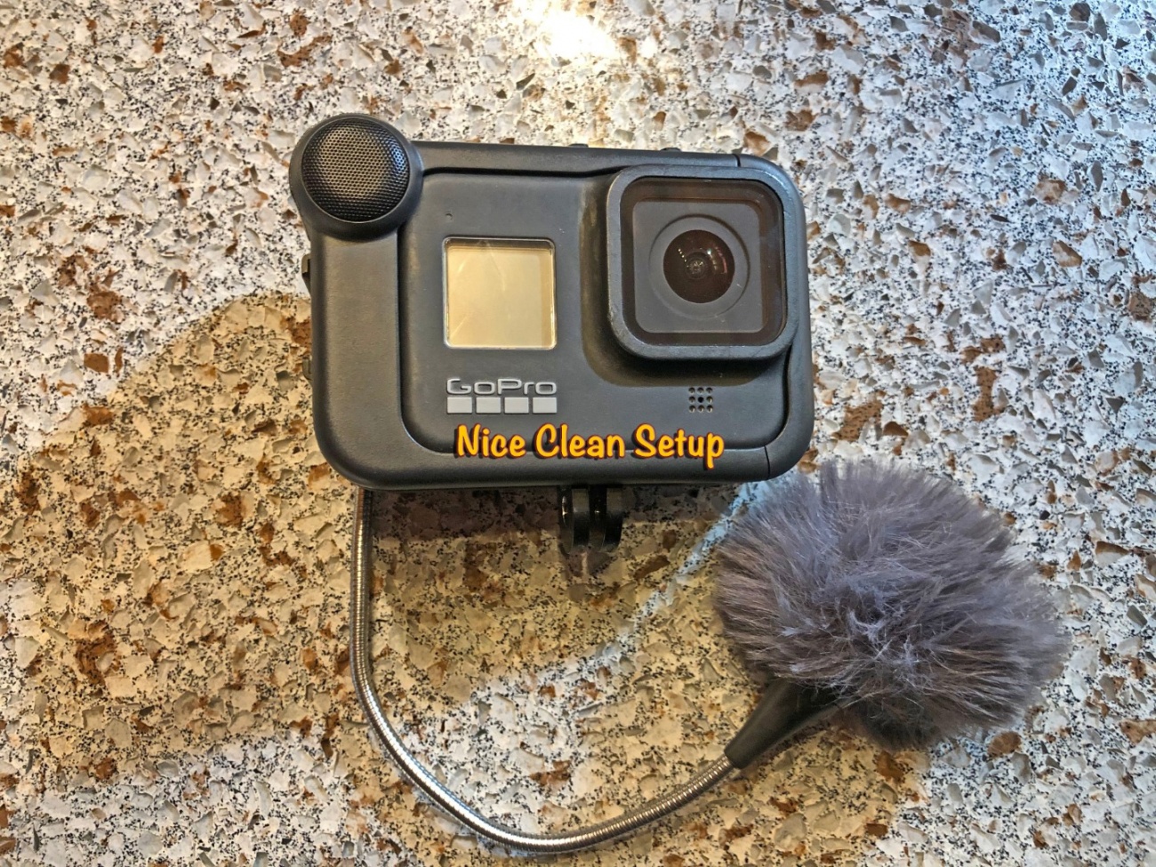
The GoPro 8 Media Mod case wraps around the camera, you slide it in and it it locks with a side door. There is a built in microphone which I've never really used. It also has a jack for an external mic with no adapter required, you just plug your microphone right into the available jack. The GoPro 8 camera does have mounting "feet" which fold out from the bottom of the camera and these extend through the bottom of the media mod case for easy mounting of the whole setup. While the Media Mod case is a bit bulky, it still smaller than the Ulanzi setup with the GoPro 7.

GoPro Media Mod Case - Rear
Now for the bad news - The Ulanzi setup with the GoPro 7 is easier to use. You can feel the camera buttons better with a gloved hand, and it's pretty quick and easy to pop the back door off the Ulanzi case and pull out the camera for battery changes.
While the GoPro 8 with the media mod case is a much cleaner setup it falls short in several areas. The most annoying thing is I find the camera buttons which are now on the Media Mod Case hard to feel with a gloved hand. They are not raised enough to detect easily. Another weakness is the Media Mod Case is not waterproof. While I've had no issues so far in a few light rains, I've not used it in a downpour or on a long wet day. The other annoyance is you can't just slide the camera in and out to change the batteries as the camera mounting feet extend through the case. You have to unscrew the camera and case from the mount to fold the camera feet in so you can slide the camera out of the Media Mod Case to change a battery. It takes twice as long.
In review -
GoPro HERO 7 Black with Ulanzi Case
Pro's
- cheaper
- easier to use camera control buttons
- no electronics / waterproof
- faster, easier battery changes
Con's
- requires bulky adapter and new case to hold it
- Forced to shoot at 2.7K to have image stabilization
- shorter battery life unless you upgrade
- Bulkier overall
GoPro HERO 8 Black with Media Mod Case
Pro's
- Cleaner less bulky setup
- Able to shoot at 4K with better image stabilization and image quality
- Longer battery life
Con's
- More expensive
- Camera control buttons are hard to feel and use
- Not waterproof
- Has to be dismounted to change batteries
If video quality is your goal it's a worthwhile upgrade. There are drawbacks but so far I'm satisfied with the results and willing to work through the issues.

Article by Wayne Busch, America Rides Maps
See examples of use at the Mountain Rider MotoVLOG at http://Youtube.com/americaridesmaps
We produce detailed maps of the best roads to enjoy on your motorcycle travels in the Blue Ridge and Allegheny Mountains. Get the maps at America Rides Maps.com
On the south side of Great Smoky Mountains National Park you'll find the town of Bryson City, North Carolina. It's a popular vacation spot with a vibrant town center, home to the Great Smoky Mountains Railroad and the origin of "The Road to Nowhere".
Unable to embed shared object. Sharing permissions error?
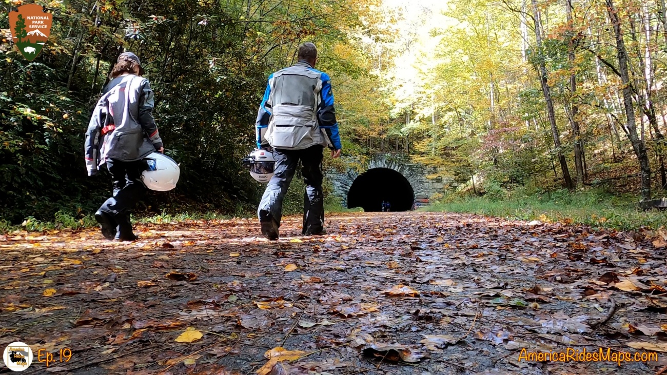
There is a road on the north side of town which winds up into the mountains and becomes part of Great Smoky Mountains National Park. This road is known as the "Road to Nowhere". It starts as Everett Street, becomes Fontana Road once it exits town, and finally is officially named E. Lakeview Drive once it crosses the park border. It's a very nice road, winding and twisting through the mountains near the edge of Fontana Lake similar in experience to riding the lower sections of the Blue Ridge Parkway. 5.8 miles into the park the road suddenly ends at a set of gates with a small parking area. Just beyond it continues into a lovely tunnel. Emerging from the tunnel the road becomes a footpath leading up into the woods.
Embedded Object Error
It was not supposed to be this way, the road was supposed to go on for 30 miles looping around the north shore of Fontana Lake. Instead, it leads - nowhere. Here is the story of what happened -
Riding the Road to Nowhere Tunnel
In the 1930's and 1940's the war effort precipitated the construction of the Fontana Dam, the tallest in the eastern north America, to generate power for aluminum production in Alcoa, Tennessee as well as the secret Manhattan Project in Oak Ridge which developed the atom bomb. The lake which would form behind the dam would submerge several communities as well as Old US 288, the road which led through them. Swain County, North Carolina agreed to cede hundreds of acres of private land to the government with the promise a new road would be constructed to provide access to what remained above water including several family cemeteries.
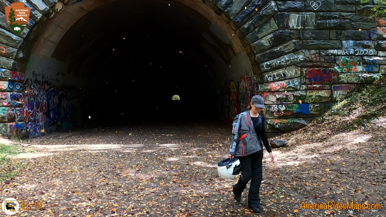
Approaching the Road to Nowhere Tunnel
Road construction began and the current pathway was cut through the mountains for several miles. Reaching an insurmountable ridge, a 1200 foot long tunnel was dug, then work came to an abrupt halt. Sources say it was because of environmental concerns, I'd suspect there were also some political maneuverings, but it was the last work done on the new road and it was abandoned. A contentious litigation ensued for many years as Swain County demanded compensation when the government failed to finish the road. The locals came to call it the Road to Nowhere, an angry outcry for justice simmered on and on. It was finally resolved in 2010 when the Federal government agreed to pay Swain County $52 million dollars in restitution. The final payment was made in 2018. Additionally, the park service ferries families across the lake periodically for visits to the cemeteries and reunions.
the Road to Nowhere Tunnel
The road is now one of the attractions in Great Smoky Mountains National Park, popular as a scenic drive, the source of a slew of hiking trails, and for the curious who just want to see and walkthrough the impressive tunnel. It's a pleasant ride, there are a few improved overlooks along the way, something to enjoy on your motorcycle travels.
Here is some video of it we shot on a recent visit -
Embedded Object Error
Does the world need yet another article on winter motorcycle riding? I say NO!
As I sat writing a post on riding your motorcycle through the winter months I began to wonder "what would it really accomplish"? For a large number of riders across the south winter riding is nothing unusual. In fact, growing up riding in Florida it was one of the best times to ride, it was cool(er). For another large number of riders across the north winterizing and storing the bike is the sensible option. No need to rub it in and add to their misery. That leaves just a fraction of riders who live the swath of the country where winters are mild enough to get out on the bike every once and a while.
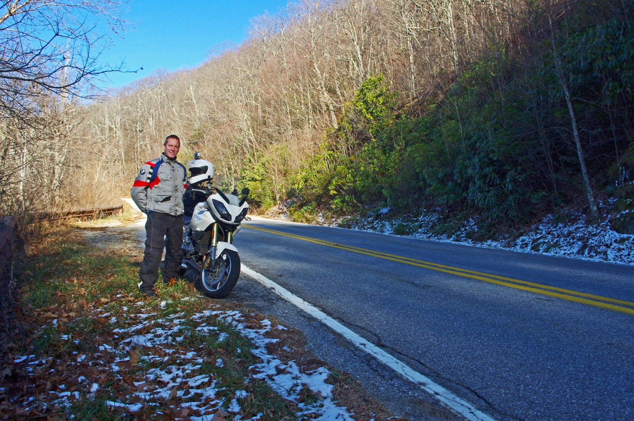
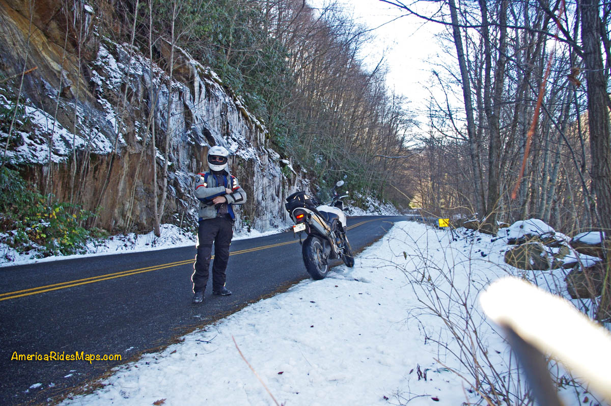
Wayne rides in the winter
I live in one of those mild winter areas where putting the bike up for the season is optional. We have ice and snow sometimes, other times temperatures can rise to near 60. My fellow riders in my area are pretty comfortable dealing with temps from 40 - 60. Any nice winter day you'll see at least a few bikes out. That's not what I think of as winter riding. So long as the roads are clean of salt and smut and there are no icy spots to worry about, it's just making the best of a nice day.
Winter Riding in the Smokies
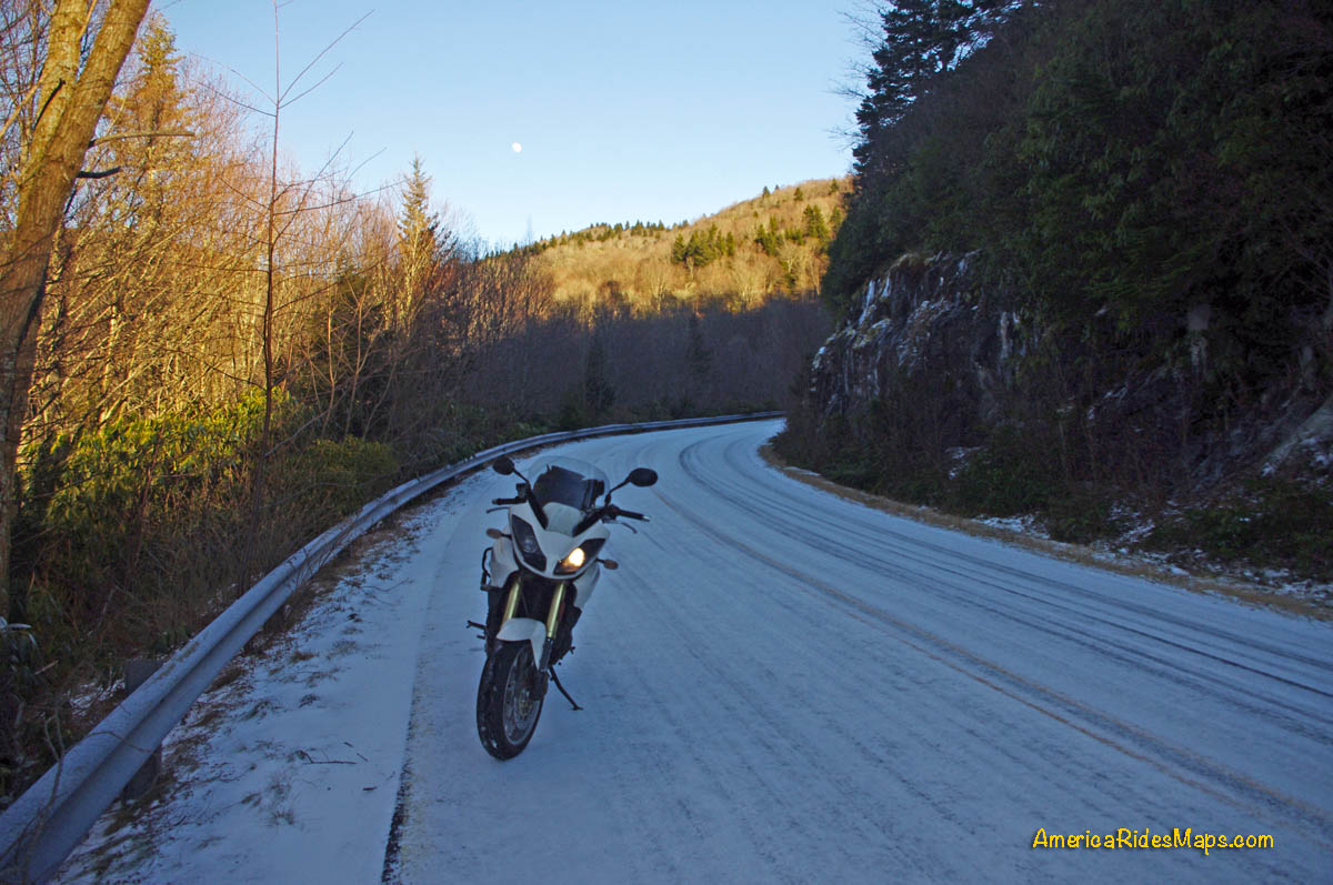
I have to argue winter riding involves freezing weather when temperatures drop into the 30's or lower. Riders who routinely go out in these conditions are few and if they do, they've already got things figured out in order to do it.
Winter Riding in the Blue Ridge
Therefore, I see no point in writing about riding your motorcycle in winter.
PS - superb long underwear, balaclava, heated gear, wind tight shell, drop tire pressure, rinse the bike after riding, keep it on a battery tender, bring mad skills to the game.
Article by Wayne Busch, America Rides Maps
We produce detailed maps of the best roads to enjoy on your motorcycle travels in the Blue Ridge and Allegheny Mountains. Get the maps at America Rides Maps.com
How many times have you suffered through a GoPro video online that's overwhelmed with loud and distracting wind noise? They are really hard to watch.
You can turn off the audio on your GoPro when recording or mute the audio from the captured video, but you really lose the feel for the experience, the sounds of the bike engine, the sense of movement, the atmosphere that makes for a good video. You've probably also enjoyed videos narrated from the bike while riding. Again, you can dub in narration later but you lose the spontaneity of the experience, the live response to what's happening, and it sounds artificial.
Basic Vlogging Components
The answer to these problems is a Vlogging setup. You need three main components - the camera, a microphone, a microphone adapter for the camera, and of course a variety of mounts to position the camera correctly on your helmet (how to do that will be covered in another article). The video quality of the newer GoPro cameras is quite an improvement over the earlier ones, I'm using a GoPro 7. You will need to remove the little door over the microphone / power sockets on the camera, it can be reinstalled later if the camera is needed for other uses. You don't need a high quality microphone. I use very inexpensive Chinese flexible boom mics that come in packs of 3, 10, etc. It's no big deal when I lose one or it succumbs to the environment, I carry spares and just pop on another. The rub is the microphone adapter for later model GoPros - you can't plug a microphone directly into the camera. The adapter is big and unwieldy, they cost $50 or more, you don't want one of those going missing.
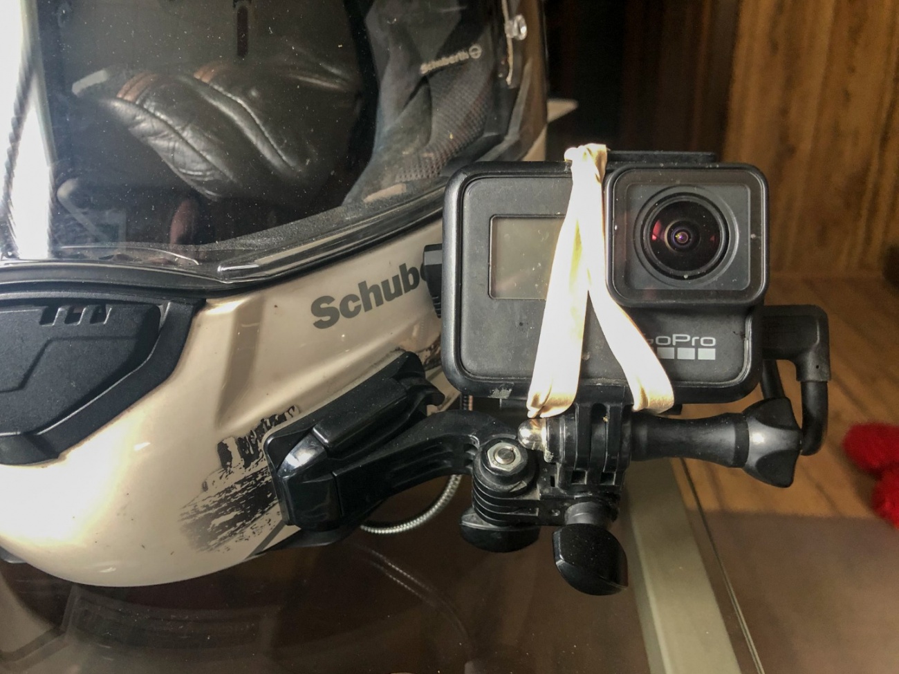
Using Rubber Bands to Mount the Microphone Adapter
The crux of this article is how to deal with that bulky microphone adapter. Until recently the simplest solution I found was to use rubber bands to strap it to the back of the camera. While it works, it's an awkward remedy.

Adapter mounted with rubber bands covers the screen
Mounted with rubber bands the adapter covers the view screen on the rear of the camera, you can't see it. That makes it tough to insure the camera angle is correct or access the touchscreen camera functions. You can't see if the camera is turned on. The rubber bands don't last long out in the weather, they are prone to fail, hence I use two and replace them frequently. Rubber bands also look ugly and cheap.

Ulanzi V2 Vlogging Case for Gopro Cameras

Ulanzi V2 Vlogging Case for Gopro Cameras
The Ulanzi V2 Vlogging case for Gopro cameras solves this problem.

Standard GoPro case / Ulanzi Case
The Ulanzi case replaces your standard GoPro housing. There is a slot under the case for the microphone adapter, it slides in snug and secure. Pass the cable through and it is easy to plug it into the camera port. The other end of the slot is open so the microphone plugs right in.
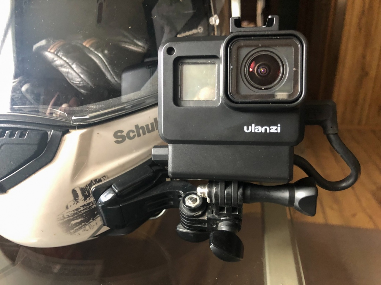
Ulanzi case on the helmet
The Ulanzi case is taller due to the added adapter slot. In my case it raised the camera case away from the helmet which gives more more flexibility and range of movement for positioning the camera. This is a much cleaner, more secure, professional look.
Ulanzi Gopro Case rear view
The new case also brings the rear camera screen more into my line of sight which is helpful. There is a removable shoe atop the case for mounting a microphone or other accessories, I leave that home. The rear door of the Ulanzi case slides on with a simple click lock instead of the hinged door of the standard case.
I'm pretty happy with this Ulanzi V2 Gopro Case. I found it online from Walmart for about $15 though the link below has it listed on Amazon for $9.95. Ulanzi also makes the V3 housing which is aluminum and has more features for about $45. https://www.ulanzi.com/products/v2-protective-housing-case-ulanzi

Wayne Busch
Posted by Wayne Busch, America Rides Maps
See examples of Vlogging at http://Youtube.com/americaridesmaps
Find America Rides Maps motorcycle ride maps at AmericaRidesMaps.com
Easy-to-see Bible Covered Bridge near Greeneville is a good stop on your motorcycle ride in East Tennessee.
Embedded Object Error
When your motorcycle finds Warrensburg Road (TN 349) in East Tennessee you're in for an enjoyable ride. The road is big and in good shape, a little hilly, and has some nice twisty sections along the creek. It's a pleasant way to pass through the are near Greeneville avoiding the traffic on the more prominent roads.
Embedded Object Error
Along the way you'll pass the easy-to-spot Bible Covered Bridge where Bible Branch Road turns off from TN 349. Once you cross the creek a gravel parking lot connects to that road. The covered bridge spans the creek.
Embedded Object Error
The Bible Covered Bridge straddles Little Chuckey Creek connecting the Bible farm with Warrensburg Road. In 1923, the E.A. Bible family hired A.A. McLean to build this bridge to improve access to the main road from their farm. At the time, it had no side windows. In 1940, Greene County purchased it for $750. The Greene County Heritage Trust rehabilitated it, including a new exterior covering with three pedimented windows on each side, also roof bracings and a shingle roof. in 1975 it became a historical structure. Restoration of the bridge was completed in the fall of 2004 by the Greene County Highway Department with the help of a grant from the Tennessee Department of Transportation. The bridge retains the original wooden and steel truss members from 1923, the original concrete substructure, the original floor. Sources: https://bridgehunter.com/tn/greene/bible-covered/ , https://www.tnvacation.com/local/greeneville-bible-covered-bridge
Embedded Object Error
This area of East Tennessee is 15 minutes north of the mountains found along the border with North Carolina. It's not a highly scenic area, there are not a lot of reasons to stop your motorcycle ride. The Bible Covered Bridge is one of them. You can't ride across the bridge, but it is an easy place to visit, close to parking, perfect for a short break and some photos of a historic sight.
Unable to embed shared object. Sharing permissions error?
Article by Wayne Busch, America Rides Maps
We produce detailed maps of the best roads to enjoy on your motorcycle travels in the Blue Ridge and Allegheny Mountains. Get the maps at America Rides Maps.com
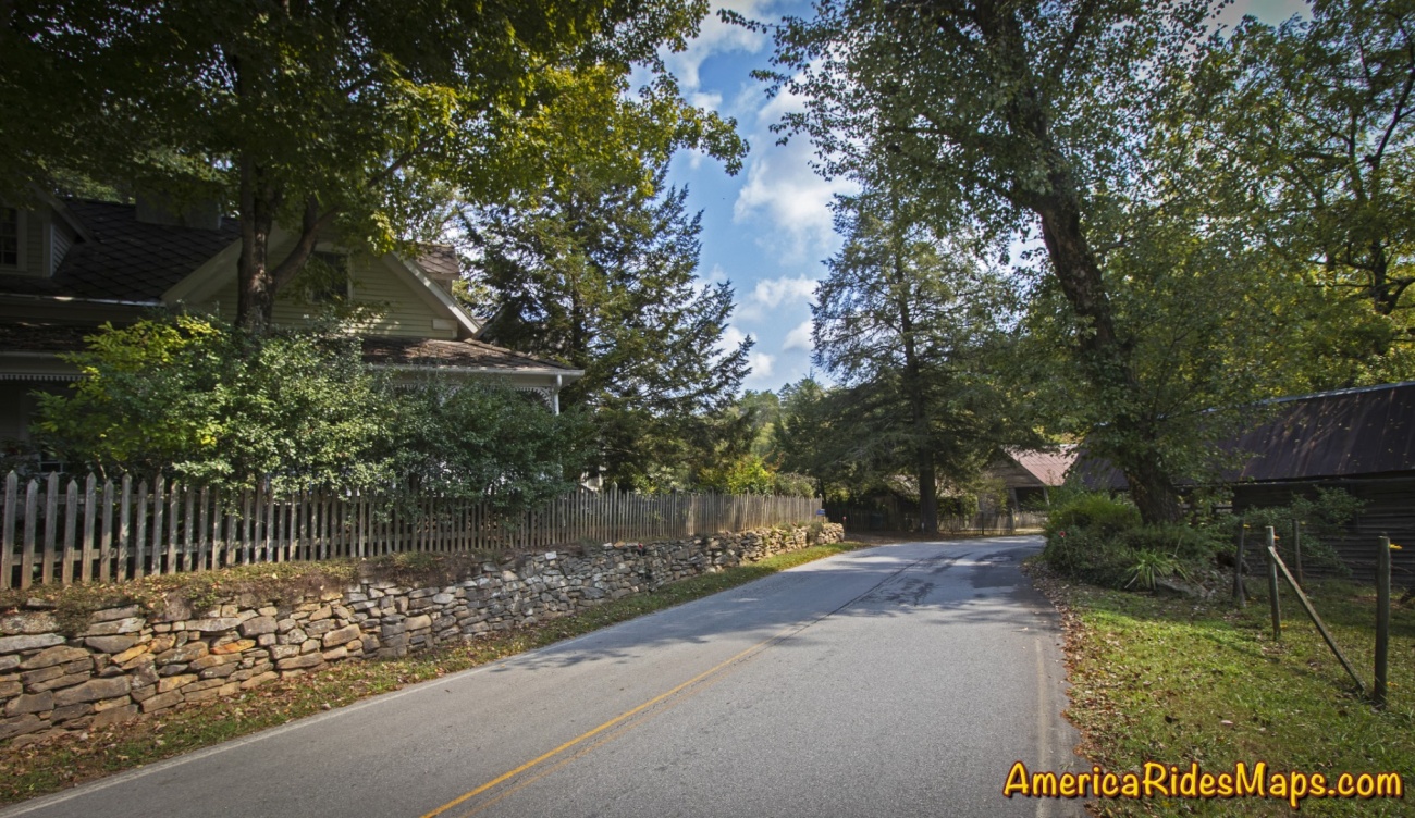
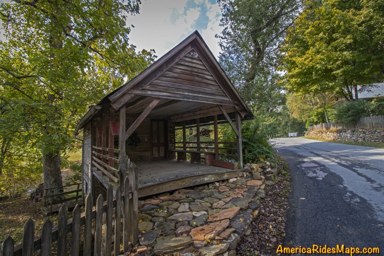
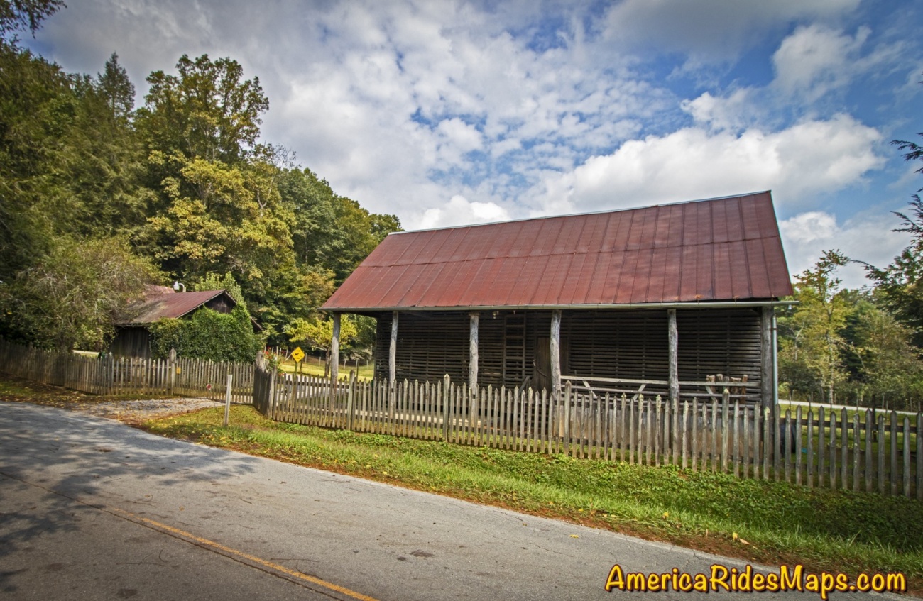
The road narrows to cut through this historic farm in Dial, Georgia.
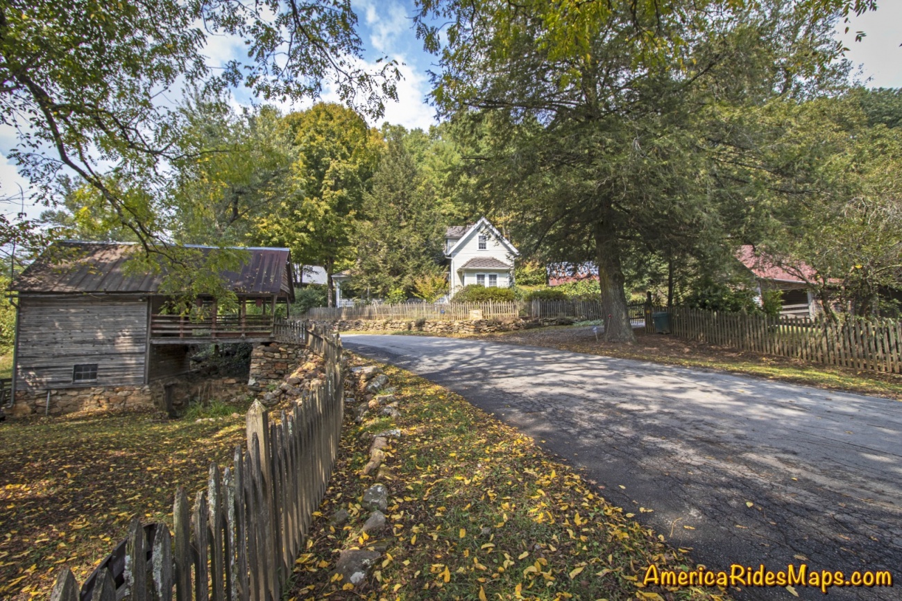
Roadside Farm in Dial, GA
Hearing a car approaching I'd stepped to the grass to let it pass. Though I'd been through several times before, something today made me appreciate this spot along the Toccoa River where the road narrowed to thread through the old wooden buildings of the homestead. The approaching car slowed then stopped, the window down.
"Beautiful, isn't it?" came a voice from the driver.
Roadside Farm in Dial, GA
"I used to manage this farm" the woman in the car said to me. Her broad smile conveyed her pride.
Roadside Farm in Dial, GA
"Yes, it is beautiful, I just had to stop and take a few shots" I said, resisting the urge to snap a candid photo of her. It just didn't seem polite.
She nodded acceptingly then added - "Watch out, there's some crazy folks on this road".
I smiled and added "I'm probably one of them".
Roadside Farm in Dial, GA
She laughed then continued on her way.
One of the most enjoyable things about cruising the backroads on your motorcycle are the wonderful sights and beautiful views you come across. The hundreds of roads that weave through the southern Blue Ridge Mountains hold many secrets. There are little spots here and there that touch us in special ways, appeal to things deep within us, reward us with emotions of appreciation and admiration. Don't let them all pass by, savor the good ones.
Unable to embed shared object. Sharing permissions error?
Article by Wayne Busch, America Rides Maps
We produce detailed maps of the best roads to enjoy on your motorcycle travels in the Blue Ridge and Allegheny Mountains. Get the maps at America Rides Maps.com
Located at the corner of Wayah Road and Old Murphy Road just west of Franklin, Loafer's Glory is back.
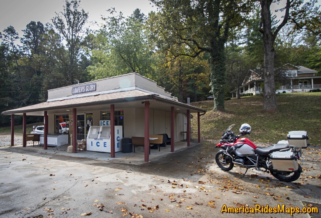
Loafer's Glory
In an area with such notable motorcycle rides as the The Dragon and the Cherohala Skyway, Wayah Road ranks highly as another curvy cruise. It climbs from the upstream end of scenic Nantahala Gorge along the whitewater river to reach alpine Nantahala Lake which feeds the flow. The ride then crosses Wayah Bald for several miles before it plunges down the east side of the mountain through a series of winding switchbacks. When the 30 mile ride ends, Loafer's Glory sits on the corner, a convenient spot for a break.

Loafer's Glory
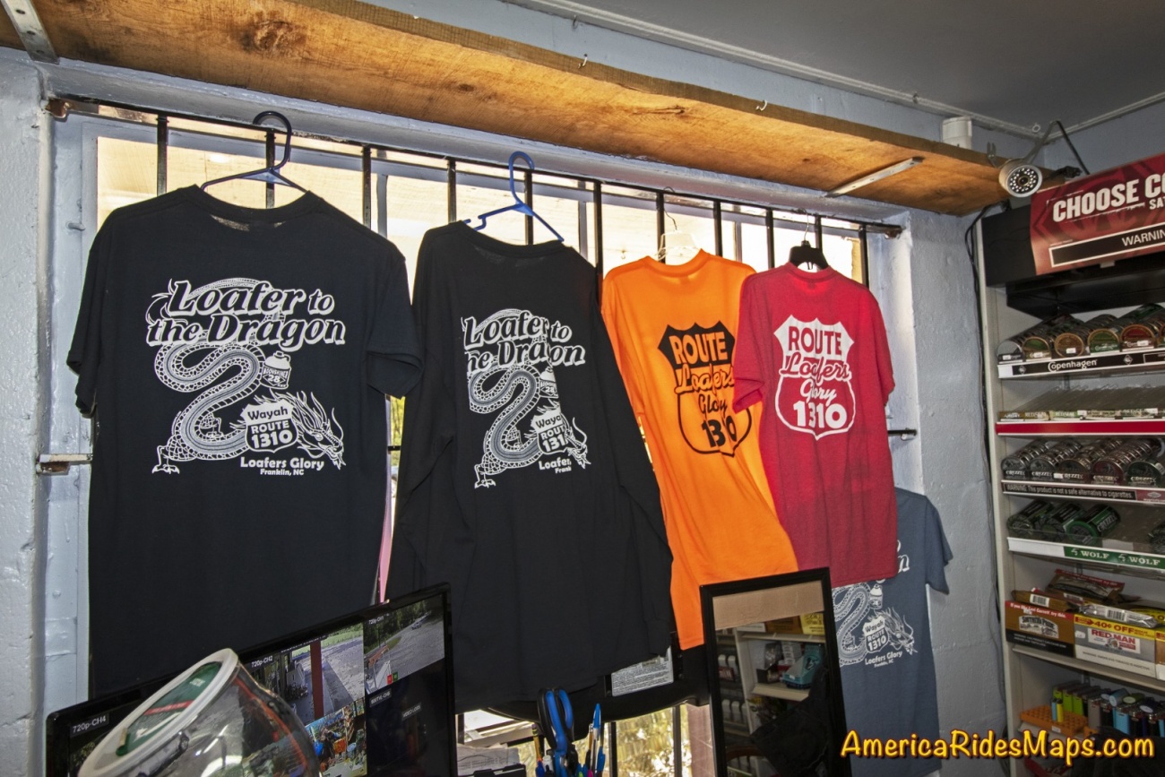
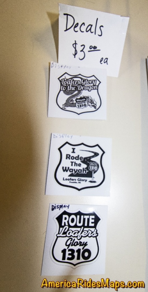
Loafer's Glory was once a popular stop for the kayakers, rafters, hikers, and of course the riders that enjoy this beautiful area of the Nantahala National Forest. It closed for a while, then reopened only to close again. Now, it gets another start. The gas pumps remain idle but the store provides cold drinks, ice cream, and snacks. Riders can get a T-shirt or a sticker as a souvenir of their Wayah ride.
Loafer's Glory
While there's not much to it, Loafer's Glory makes a good rest stop, a place to savor the ride and make strategy for the next. Glad to see it back.
Loafer's Glory

Wayah Rd
A classic ride out of Nantahala Gorge, Wayah Road climbs along the whitewater river up to Nathahala Lake, crusies along the top of the ridge, then plunges down the steep slopes to roll out across a valley. Loafer's Glory is a popular stop at the Franklin, NC end of the ride. There is a nice pulloff at the waterfalls on the climb up.
Article by Wayne Busch, America Rides Maps
We produce detailed maps of the best roads to enjoy on your motorcycle travels in the Blue Ridge and Allegheny Mountains. Get the maps at America Rides Maps.com
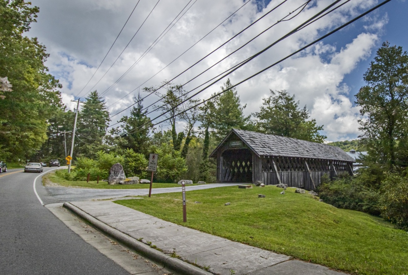
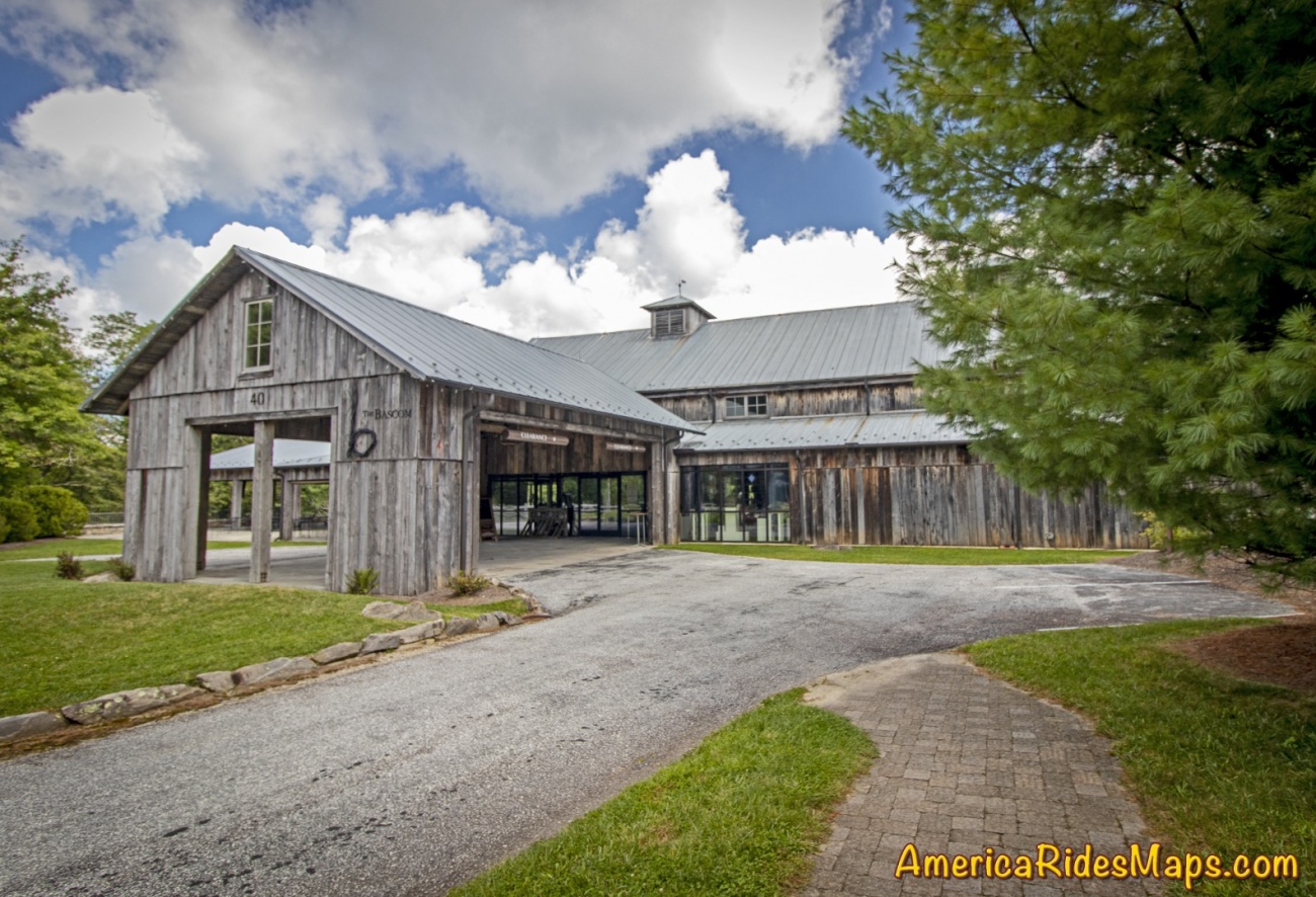
An easily overlooked spot in Highlands, NC - The Will Henry Stevens Covered Bridge at the Bascom Art Center makes a great stop on your motorcycle ride to see the waterfalls.
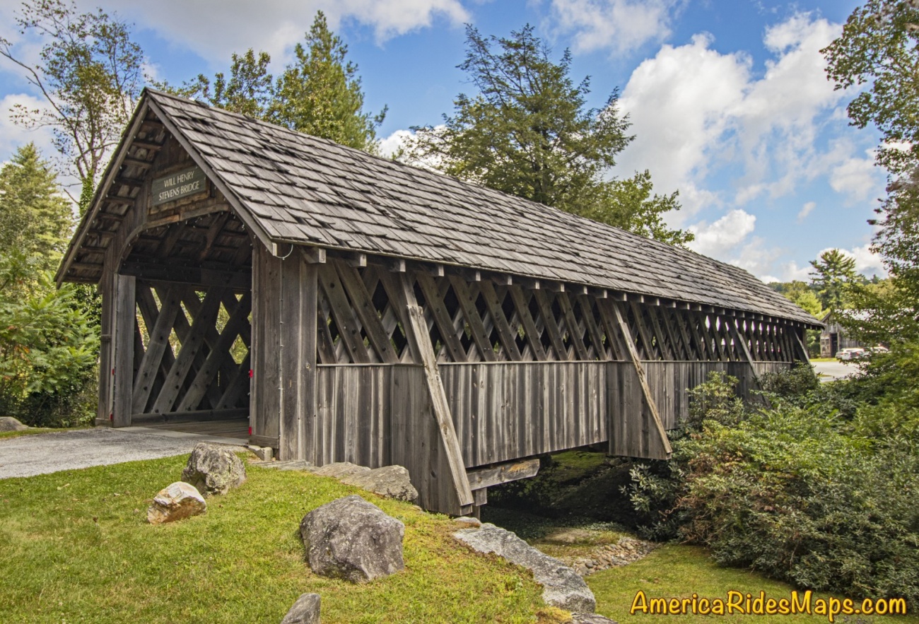
Will Henry Stevens Covered Bridge at the Bascom Art Center
We've ridden past this roadside attraction for years yet it never registered as a place to stop on our motorcycle rides to see the fabulous waterfalls in the Cullasaja River Gorge. I suppose it's because I'm so eager to get out of the congestion in Highlands, NC. The roads surrounding the upscale town are outstanding but traffic crawls through the popular picturesque community. Reaching the edge of town the twists and turns ahead are so tempting yet a stop at the Bascom is time well spent and adds to the ride.
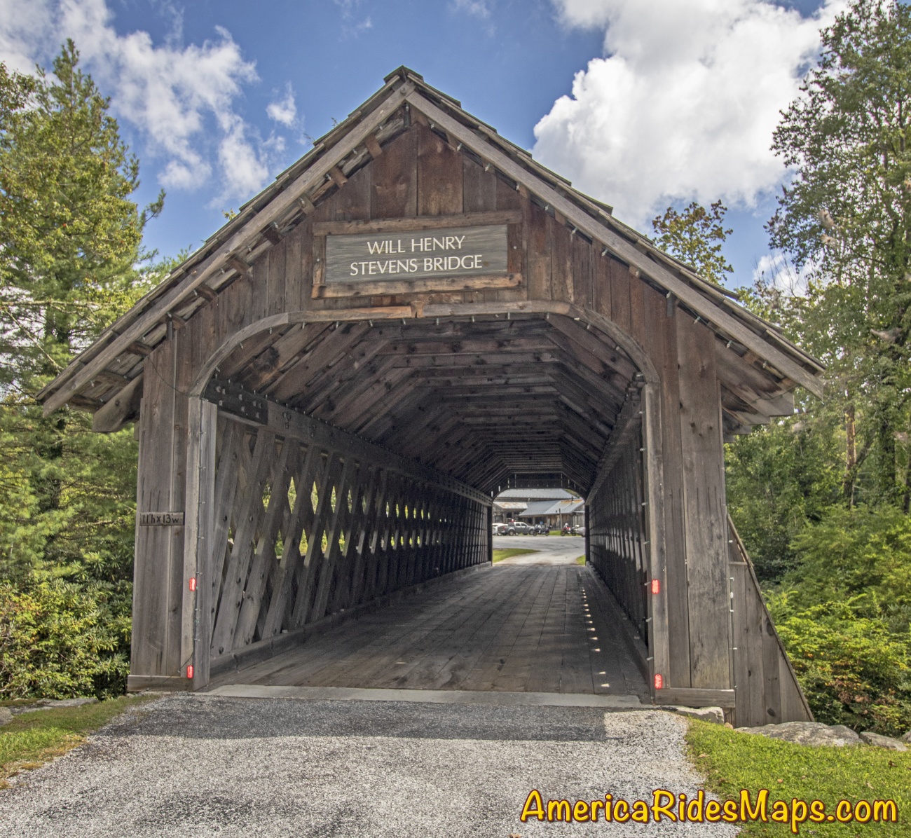
Will Henry Stevens Covered Bridge - Highlands, NC
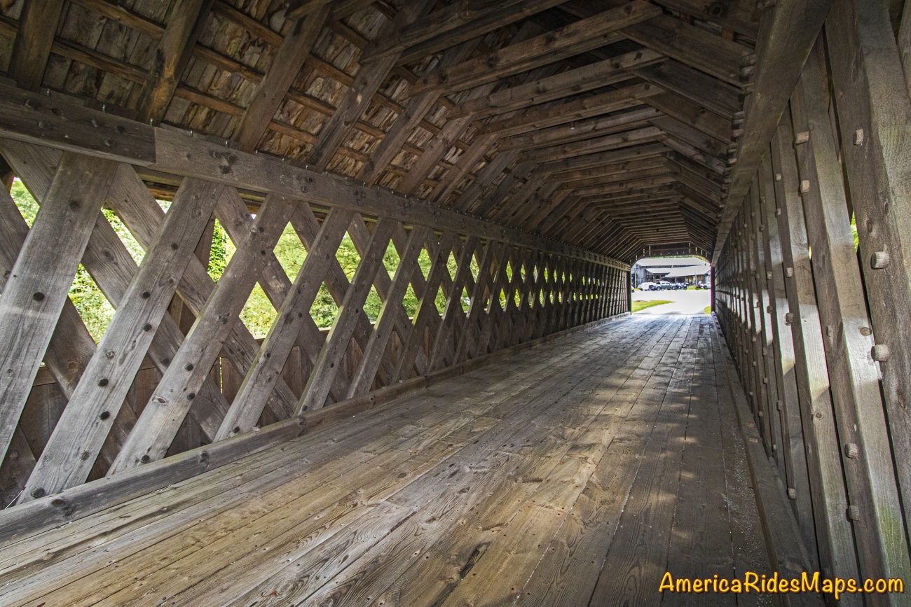
Will Henry Stevens Covered Bridge - the lattice
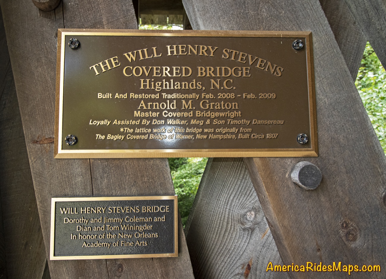
Will Henry Stevens Covered Bridge - History
As you head west from Highlands towards the Cullasja Gorge to see the 4 big roadside waterfalls on NC 28 / US 64 you'll find the Will Henry Stevens Covered Bridge on the right. The road it covers leads to the Bascom Art Center, a collection of historic restored horse farm buildings which house the art and museum. It's a one-way ride entering through the bridge, a short paved road loops you back to US 64 from the parking area at the museum.
Will Henry Stevens Covered Bridge - from the road
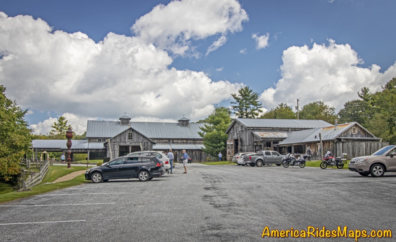
Bascom Art Center - Highlands, NC

Bascom Art Center
Bascom Art Center
Bascom Art Center
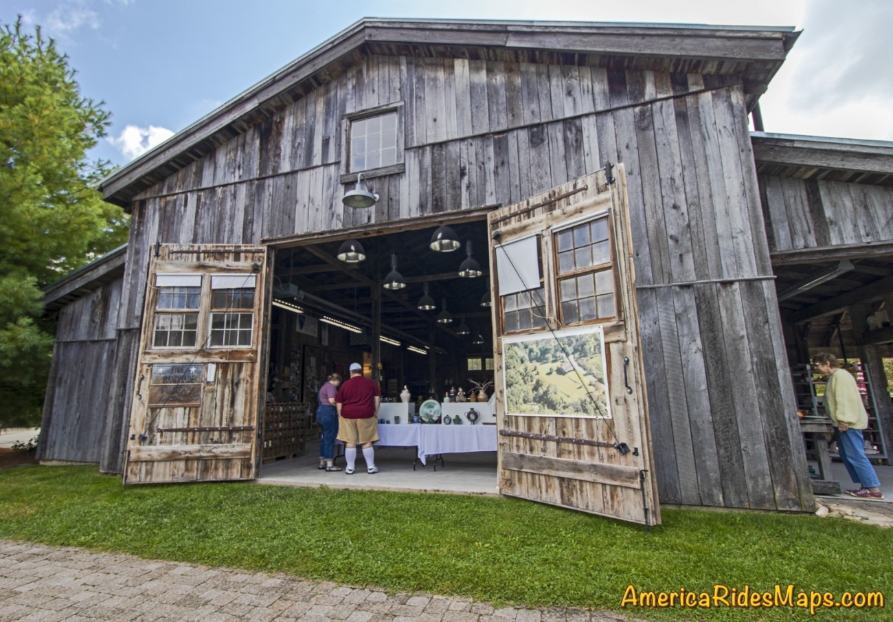
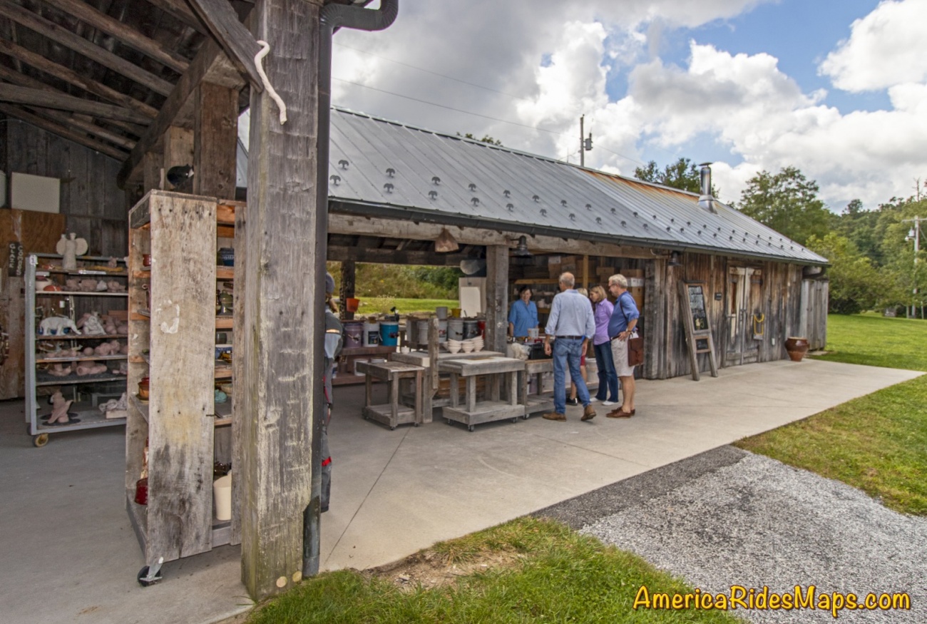
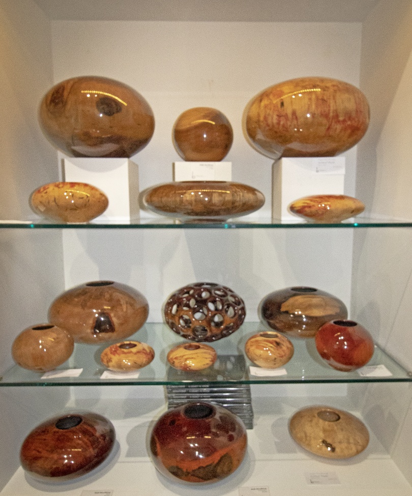
The covered bridge is exquisite, worth the stop to see. It's not original, the timbers were brought from New Hampshire then reconstructed at the site from a bridge dating from 1807. The beams are secured with hammered wooden pegs, it's truly a work of lost craftsmanship. You'll find an appreciation for historic preservation throughout the Bascom Art Center in the barns and stables now hosting the artists and their work.
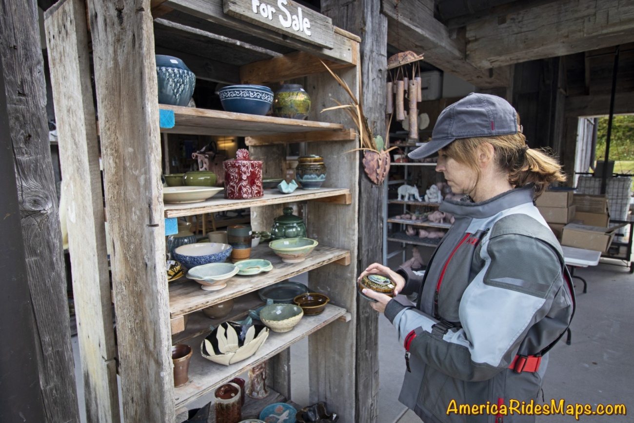
Bascom Art Center - Pottery
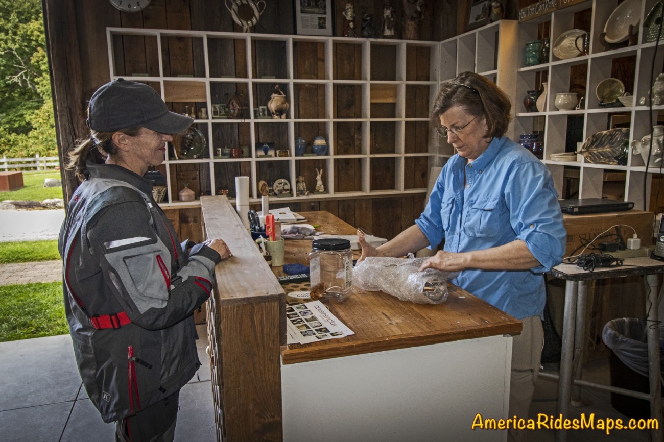
Bascom Art Center - Taking some home
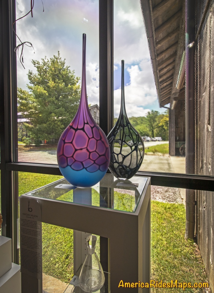
Bascom Art Center - Gallery
Bascom Art Center - Gallery
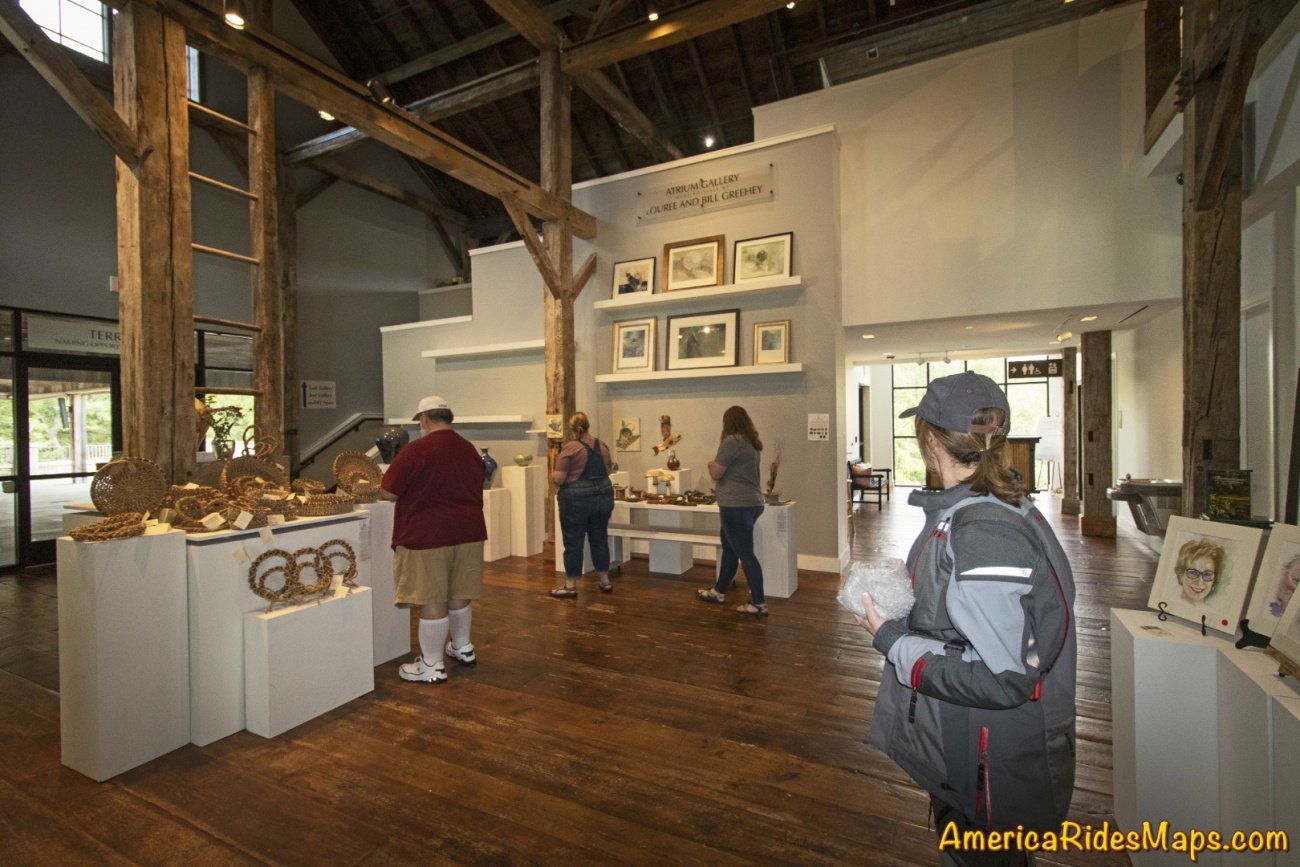
The Bascom Art Center is worth the time for a visit. You'll find artists in residence producing beautiful pottery and crafts and a gift shop if any catch your eye. The three story museum in the largest building features collections from historic South Carolina, Japanese calligraphy, woodworks, and other eclectic exhibits. A short walking trail loops from the gallery through the grounds.

Bascom Art Center - exhibits

Bascom Art Center - exhibits
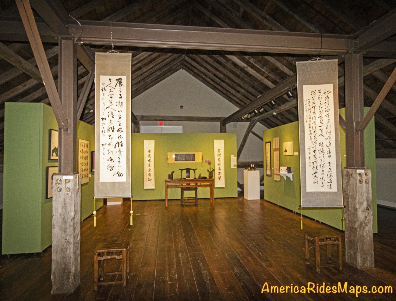
Bascom Art Center - Exhibits
Bascom Art Center - Exhibits
Bascom Art Center - Exhibits
The Will Henry Stevens Covered Bridge & Bascom Art Center make a nice addition to your waterfall ride passing through Highlands, NC. Be it a quick stop to snap some photos or a more extended visit to the art center, this is a nice scenic addition to your motorcycle adventures. Explore the map below to discover more and download a GPS track of the loop ride.
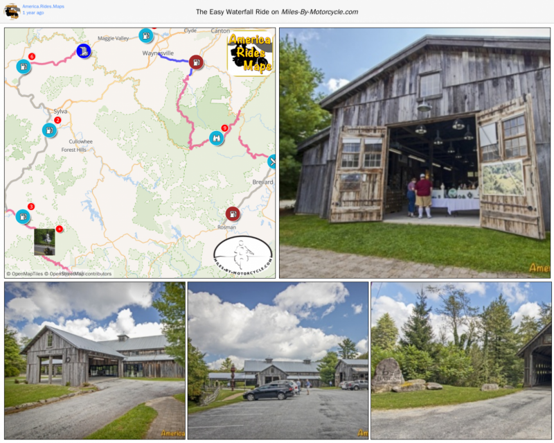
The Easy Waterfall Ride
This is a nice 165 mile loop ride that will take you to a dozen roadside waterfalls in a day. I suggest you run it counter-clockwise as the section between Franklin and Highlands can get busy later in the day and you'll get the 4 lane riding out of the way early. You'll ride some very curvy roads, hit some nice scenery, and take in one section of the Blue Ridge Parkway. Bring the camera!
Article by Wayne Busch, America Rides Maps
We produce detailed maps of the best roads to enjoy on your motorcycle travels in the Blue Ridge and Allegheny Mountains. Get the maps at America Rides Maps.com
Our motorcycle trip to West Virginia to explore the mountain back roads. The focus was on the south tip of the state - Coal Country.
Who: Jackie Busch, Wayne Busch, Yermo Lamers
What: Motorcycle Trip
When: October 20 - 23, 2018
Where: Glade Springs, WV, Blowing Rock, NC, Waynesville, NC
Why: Explore Roads in Southern West Virginia

Yermo and Jackie
Saturday, October 20 - started with cold showers in the NC mountains.
Jackie on I-26
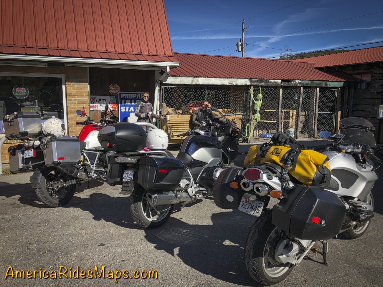
Morning found Jackie and I droning along I-40 under grey skies and a pelting of rain that came and went in soft waves. Warm and dry with our heated gear, we had a lot of miles to cover. Tonight and tomorrow night we'll be staying at the The Resort at Glade Springs south of Beckly, WV. We started on the highways, hoping for better conditions later in the day. First to Asheville, NC, then north on I-77 to Johnson City, TN, then northeast on I-81 to Bristol, VA. We stopped north of Bristol to top up the tanks and get some hot coffee at a Dunkin' Doughnuts then peeled off the Interstate through Marion, VA to start our ride north on the mountain back roads.
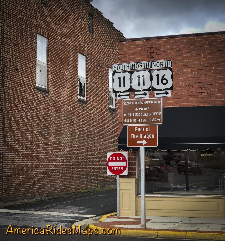
Tazwell, VA
VA 16 is familiar turf, "The Back of the Dragon". The well promoted road winds through rocky cuts and long stretches of tight curves north to Tazwell, VA. We've done it before, it's a fun motorcycle ride, one of the classics. The rain tapered off as we entered the hills and it was a decent ride at a wet-road pace.
VA 16 - The Back of the Dragon
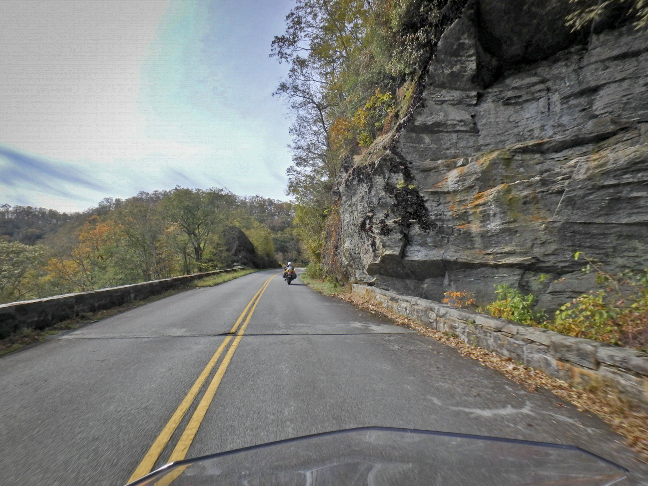
Reaching Tazwell, VA, we needed to arc north to Beckley, WV. VA 16 becomes WV 16 and leads to Beckley - it was the obvious route. We enjoyed nearly every mile of it. While the southern portion in VA gets all the attention, this extensive section north is better. WV 16 winds its way through long wooded valleys and twisty passes between roadside coal towns. It's mostly a wide two lane road with good pavement, generously curvy. The mountains and valleys are seriously rugged, the scenery stunning, especially with the bright fall color that was now lighting up as the sun burned off the clouds. Passing lanes on grades are common letting you leapfrog the industrial traffic this road was built for.
WV 16
WV 16 is one of the best rides in southern WV. It's a major road, you can make good time on it and it's is a good introduction to the area with coal mines, small mining towns, and miles and miles of dramatic rugged mountains. Near the middle of our ride, we dodge off WV 16 onto WV 97 for a while before returning to WV 16 again, a really sweet long stretch of curves we liked. It's common to find the road on one side of a river with railroad tracks running on the parallel shore, long trains of gray rail cars topped in black gold slinking along. Rows of aging roadside company houses cluster near mines and at cross roads. The are few amenities like fast food, motels, stores and shops. Small roadside businesses take care of local needs. Larger towns host the vacant buildings of past industrial prosperity. Traffic is as likely commercial as not, trucks and trailers of equipment moving between sites. You my hit the occasional snag but the chance to pass is usually coming up soon. The interstate highway will take you from Marion to Beckley in less time than WV 16 but it's a longer distance on the main roads. This ride is so good the extra time it takes is worth it to get off the four lane highway and frolic in the turns.
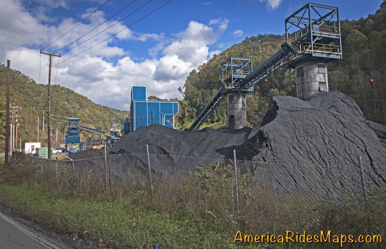
Coal Mine
While the coal industry chugs along, one new business is surprisingly widespread - ATV rentals, tours, and facilities. We started seeing signs for the extensive Hatfield-McCoy Trail Systems and passing through ATV friendly towns where unlicensed vehicles roam the public roads unhindered. We passed businesses with fleets of the 4 wheeled toys, trucks with trailer loads of them, and witnessed several large groups of riders gathered at trailheads or emerging covered in gray muck. The bulk of the motorcycles I saw were light weight trail bikes, the machines you want for the more extreme trails, but they were vastly outnumbered by the 4 wheeled crowds. What little I saw of the trails was impressive - steep, wet, rocky climbs up from the road, or winding muddy roads full of big puddles. It looks like serious territory.

The Resort at Glade Springs
The sun grew low as we cut across a web of GPS generated roads to The Resort at Glade Springs. The golf resort south of Beckley also caters to the public with a restaurant and events on the grounds. Currently, there was a Halloween attraction that was drawing visitors. We got the required passes at the gate then rode a mile or so to check in at the main lodge. It was not quite what I'd expected.
Our executive suite
I was expecting an all-in-one-place, a room with a walk to dining and a bar. Instead, facilities were spread across the large property. The layout resembled a college campus. Breakfast was in the lodge. Our rooms were in a group of small 4 room buildings a short drive away. The bar and restaurant were a half-mile walk and it was getting cold. We got our exercise staying here. Yermo arrived not long after we did and we walked to the pub to top the evening.
Sunday, October 21 - Snow.
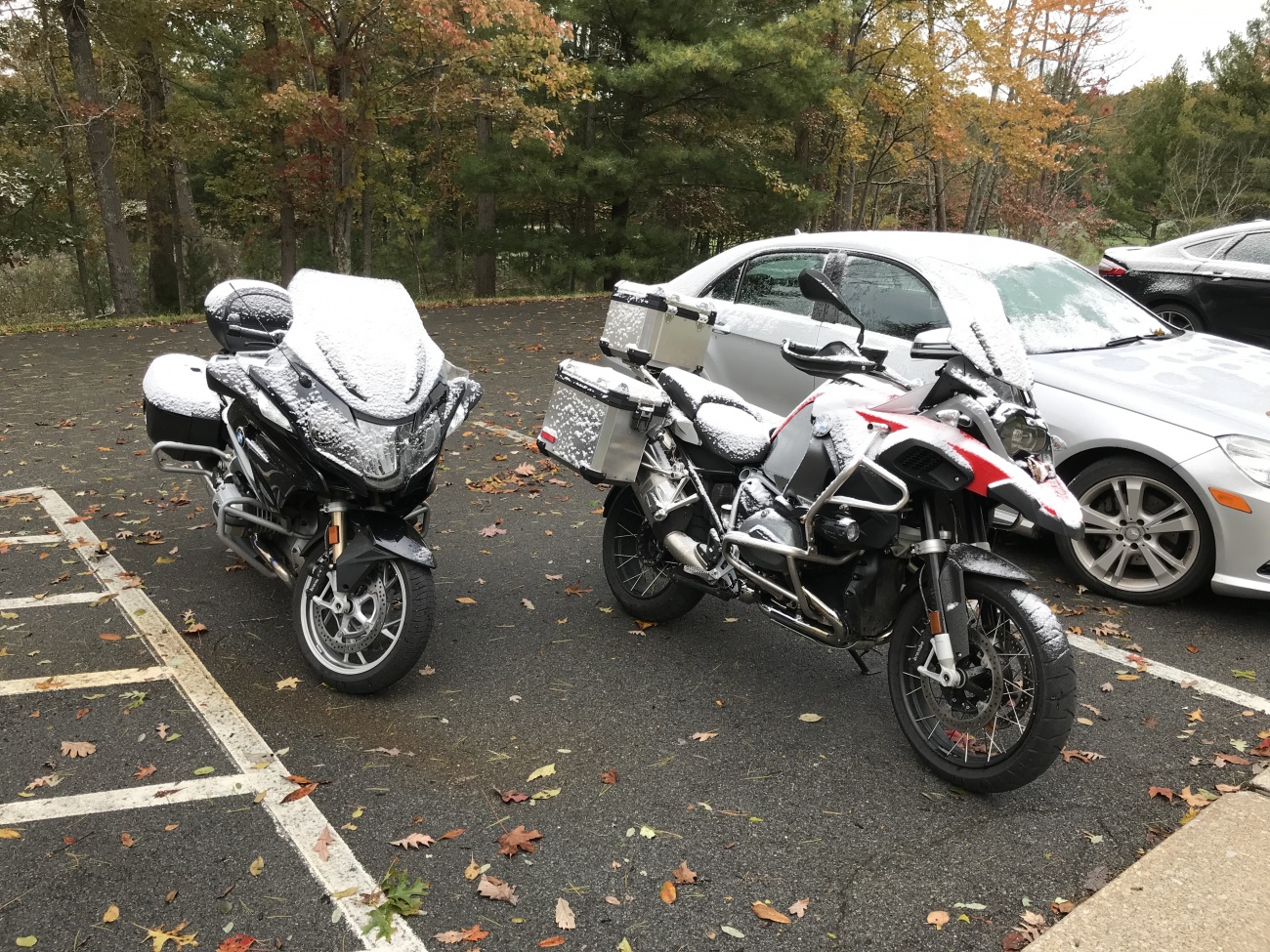
A strong front moved through overnight. We later learned 60,00 in the area lost power. Breakfast dragged on deciding how to play this day we'd been dealt. Even with heated gear it was pretty darned cold and there was concern for ice. Ultimately we chose to make a visit to a demonstration coal mine in Beckley and take a tour underground.
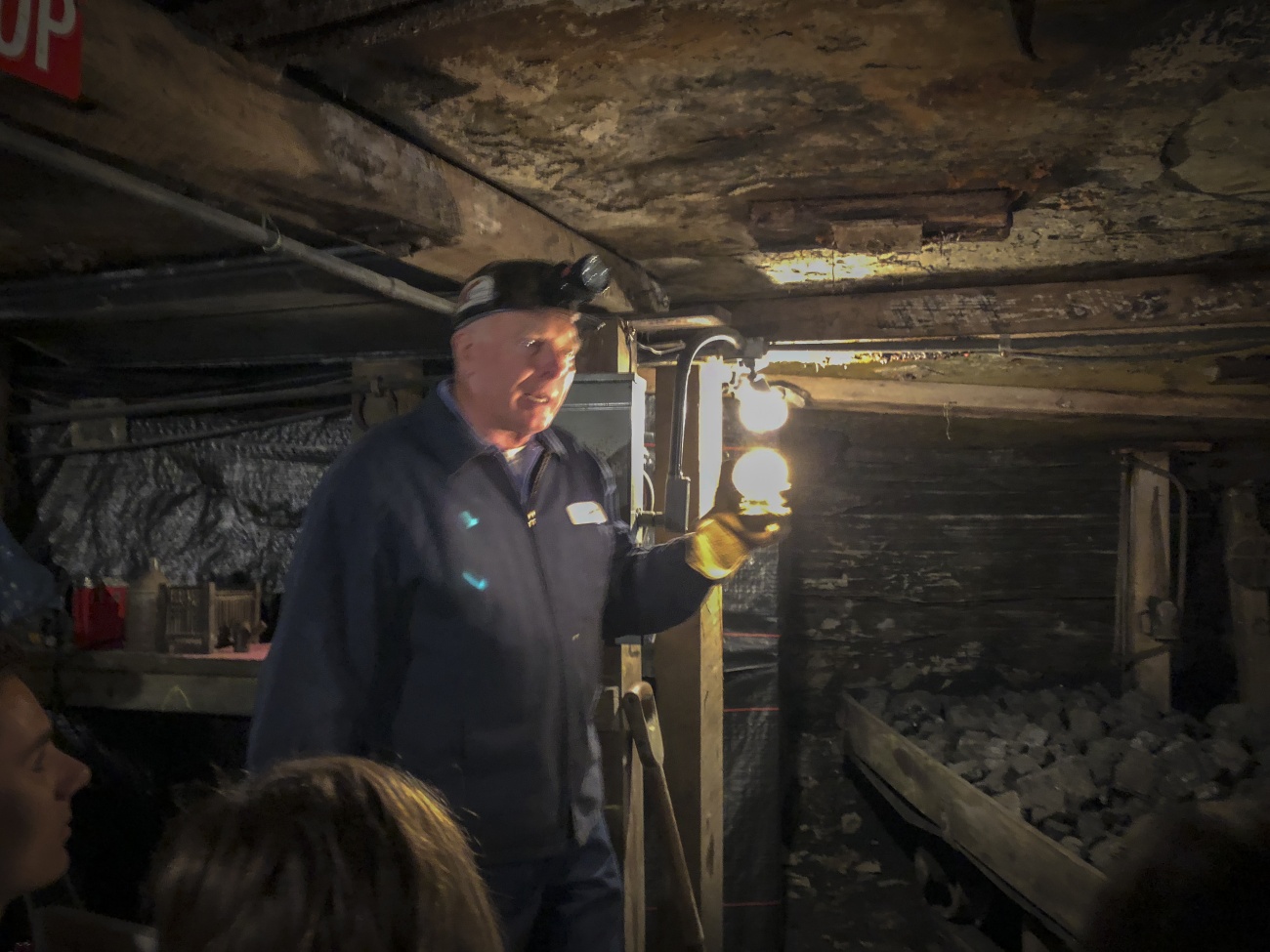
In a coal mine
It took a frustrating hour to get a ramshackle cab then another half hour to get to the mine. Then, it was a great experience. The tour starts at the museum and gift shop. We piled into ore cars fitted with seats and the engine drove us into the mine 1500 ft under ground. The train stopped periodically as our tour guide explained the equipment, history, and life of a coal miner along the way. We all enjoyed the experience and came away with a deeper appreciation of the area we were riding through.

Mountview Rd, WV
Returning to the resort with a couple hours of daylight left we suited up and plugged in. Heading south I first led the crew out a road our driver had mentioned as pretty, Mountview Road. It was OK, not a bad way to traverse between larger roads, but not exceptional. We got on VA 3 continuing south. Mountview Road had taken us a dozen or so miles east, I was looking for a way to loop us back west.
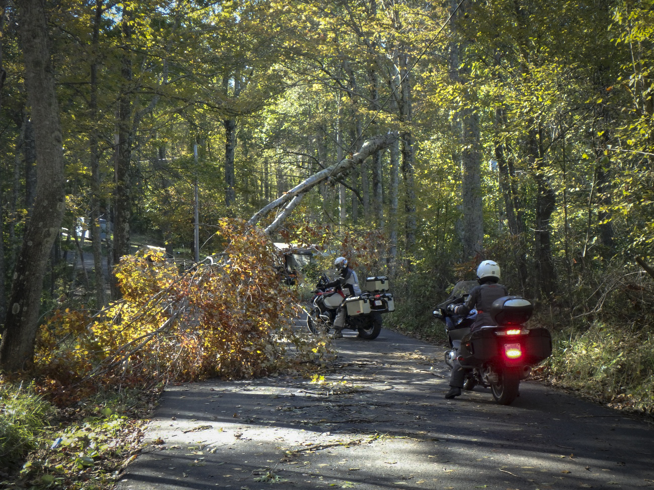
Ellison Ridge Road - tree on power lines
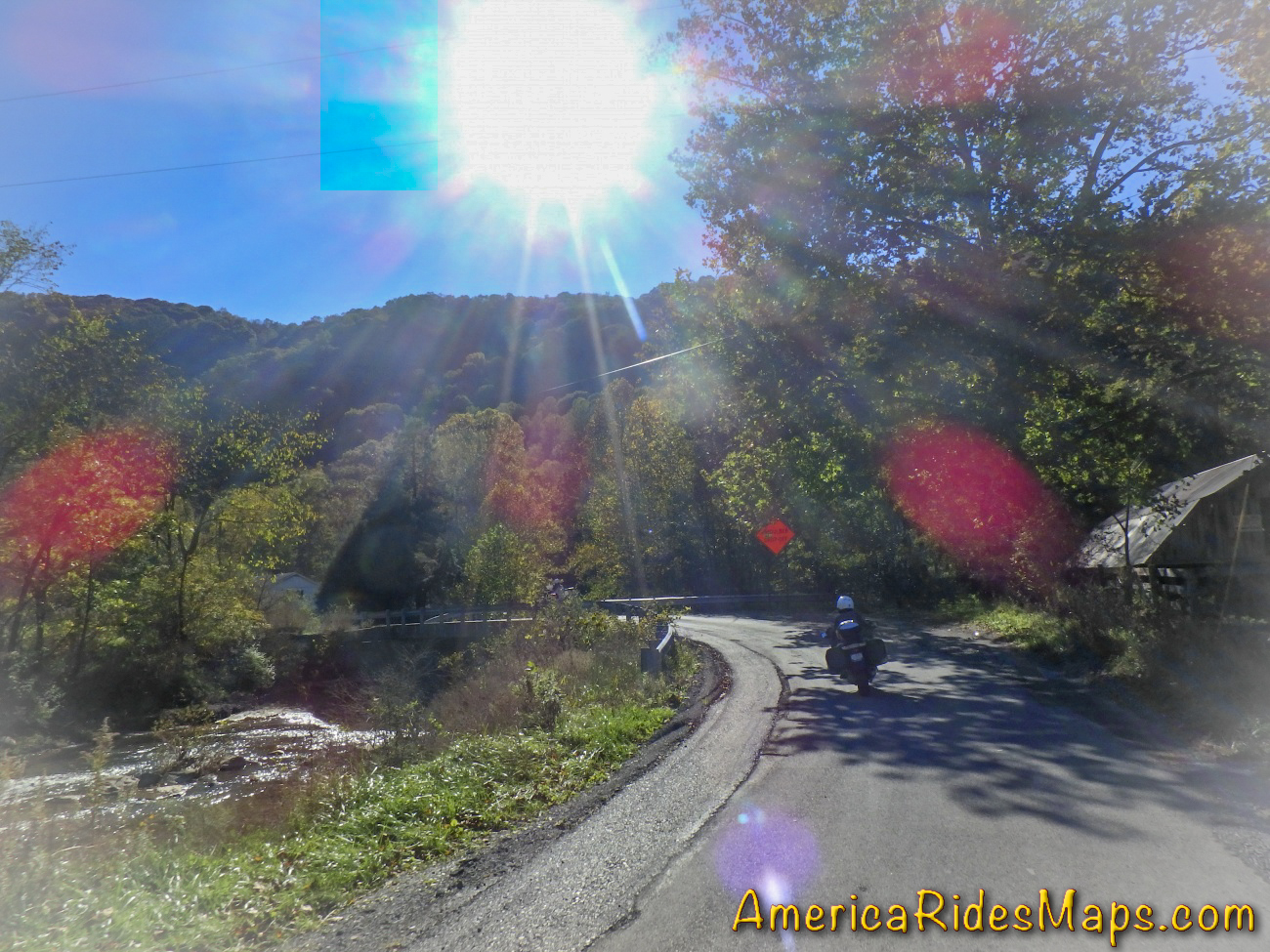
Coming into Nimitz I spied a small side road and I instinctively I cut right. Chances were high Ellison Ridge Road would be a waste of time, a long run to a dead end, but I went on and so did the single lane country road. It was paved though there were times it was hard to tell. Mile after mile we rode deeper into the hills passing farms and forest always expecting the end of the pavement around the next blind curve. The road was littered with blowdown from the night before, wash from the roadside, and wet areas. We passed under a fallen tree held aloft only by power lines. Crossing a small river the road climbed an endless steep and dirty grade, then coasted gradually down to meet the main road we sought. Ellison Ridge Road was 27 miles of adventure, what a ride!
Ellison Ridge Rd, WV
Heading back, we made a short detour to see the local "ski slopes". Nothing but a muddy mess today, then returned to haunt the pub another night.
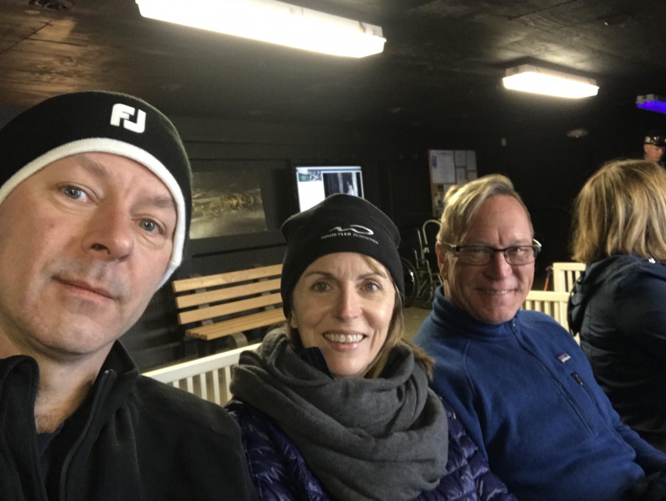
Yermo, Jackie, and Wayne
Monday, October 22 - Destination Blowing Rock, NC
We packed up, bundled up, and plugged in on another chilly morning. Our rooms are waiting tonight at the Chetola Resort in Blowing Rock, NC a few hours south. The bulk of our day is for exploring more of WV, then a run to Blowing Rock passing through Damascus, VA. We turned south for several miles to reach our first new WV back road - Odd Road.
Odd Rd, WV
Odd Road was a great start. It quickly turned into a tight and twisty romp passing through the town of Odd then rolled on to meet WV 16. It was a lot of fun. We then followed WV 16 to WV 10 diving south to Matoaka. WV 10 is a larger two lane road with generally easy curves. There is a 6 mile section in the middle that is just wonderful, a beautiful section of tight curves and exposed rock walls. Needing gas, we continued on WV 10 for quite a stretch to reach a station. The gas break turned into an entertaining coffee break as 3 locals stopped to talk bikes with us. All had fondly owned BMWs at some point. The sun was out and the day warming.
WV 10 Gas stop near Lake Shawnee
Tanks topped, I led the way back to Matoaka then veered west onto WV 71 - Lorton Lick Road. A small tight winding two lane road, WV 71 was beautiful and an adventure. We passed through a small settlement of close houses then rolled high on a bluff above a small river before we entered a long wooded stretch. The sunshine ignited the fall leaves and they blazed in color above us. We emerged onto US 52.
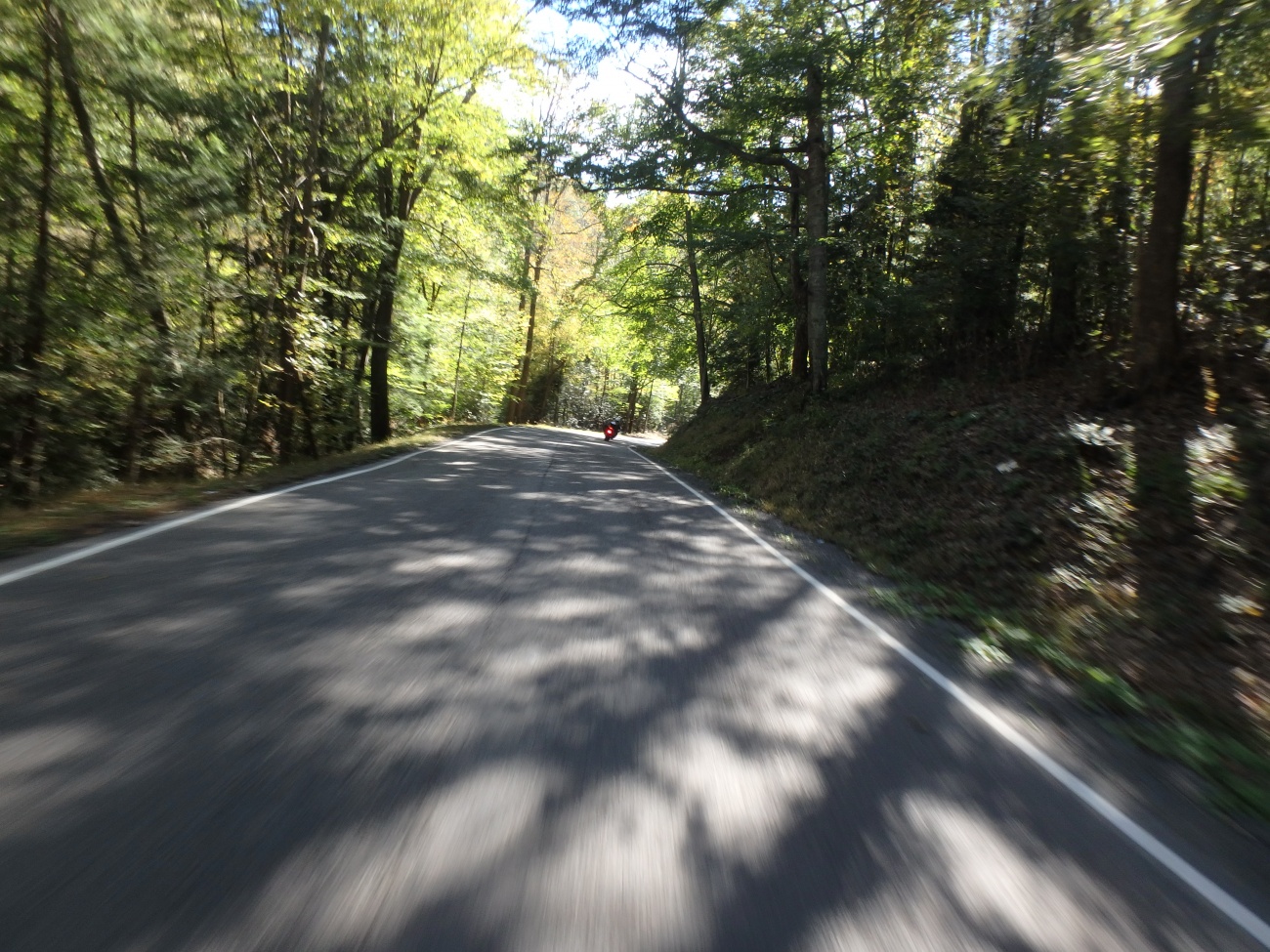
WV 71 Clips From A Motorcycle Visit
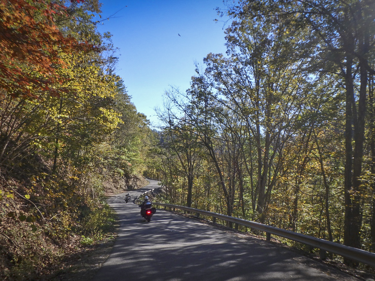
We recently spent several days scouting nice motorcycle roads in West Virginia. Here are clips from one back road we enjoyed.
US 52 is a major road and not especially scenic overall. We used it to jump to WV 161. A broad road with no centerline, two white lines mark the edges. It started with nice hairpins, then got slick and wet from the coal trucks from a couple mines along this route. We managed to skirt around one truck but not a second. It wasn't long before it turned off and the rest of the ride was good. WV 161 is a useful road and a decent rides taking the coal trucks into account. One coal road leads to another, WV 161 intersected WV 103 and we turned north again. A bigger road, WV 103 - Riverside Drive carries more traffic. It traces one side of a river with the railroad on the other passing a couple mines on the way to Welch.

WV - US 52
US 52 came in handy again taking us west to meet WV 80. This section of the main road is more wooded with nice flowing curves. It was well into the afternoon when we turned south on WV 80 for the twisty run flowing into WV 83. When 83 turned west I hopped onto WV 635 to continue due south to WV 638. WV 638 was a nice road for a while then veered off as a smaller unmarked road. It seemed to be petering out. We passed ATV trails and signs ATV's used these roads. Sure enough, miles out in the boondocks the pavement ended. Consulting the GPS I found a possible alternate route and we started backtracking to reach it.
WV 638 - Dismal River Rd
WV 636 didn't look much better than WV 635 but it did point in the right direction so off we went. Tiny, twisty, technical and fun, the pavement continued on a true adventure road. WV 636 flowed into slightly larger WV 67 and as we reached Virginia it was time to head for the rooms.
An Evening Motorcycle Ride on The Snake
US 421, a.k.a. "The Snake" is a wonderful mountain ride. We passed through one evening this week. What a fun road!
We worked our way south crossing the interstate then on to Damascus, Virginia. Shadows were getting long now and it was time to plug the heated gear in again as we whipped south into Tennessee on TN 133. At Shady Valley we turned east on US 421 to enjoy an evening ride on The Snake. It was a nice run, the golden sunlight of the evening making the trees glow. The road was nearly empty this late in the day. Leaving the Snake we passed through Mountain City then entered North Carolina. The congested main roads took us around Boone and on to Blowing Rock.
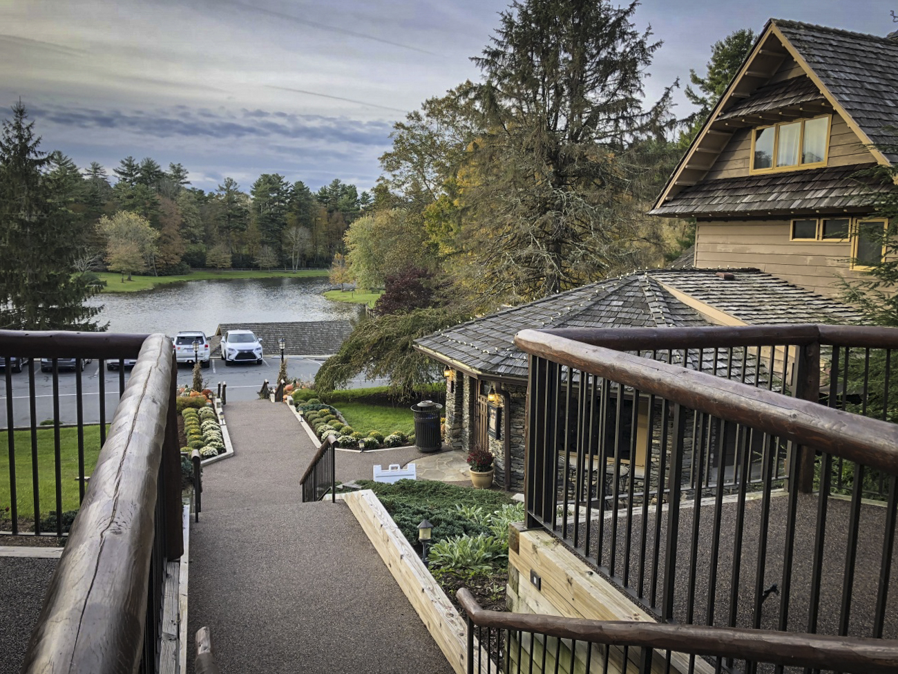
Chetola Lodge, Blowing Rock, NC
Rolling up to the Chetola Resort I was pleased to find just what I was looking for. It was a beautiful setting, the buildings posh, the warm glow from the pub windows beckoned as we checked in. Just what I wanted after a good day on the road.
Tuesday, October 23 - The Parkway of course!
You could tell early on it was going to be a nice day and we got off to a good start riding US 221 from Boone to Grandfather Mountain. This section of US 221 clings to the slopes below the Blue Ridge Parkway. It's a fun and technical ride freshly paved in places. We paused for the photo below the Linn Cove Viaduct then enjoyed the rest of US 221 into Linville for fuel.
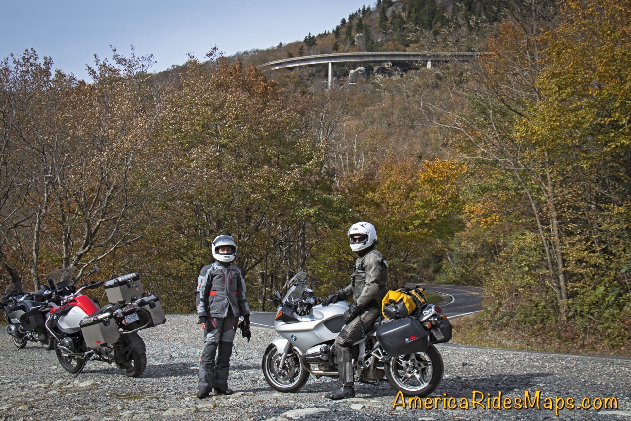
US 221 - below the Linn Cove Viaduct
I handed Yermo my keys and we switched bikes. It was quite a transition getting on his BMW R1100s after spending the last few days on my new BMW 1200 GSA. Linking to the Blue Ridge Parkway via tricky little Roseboro Road was a challenge on the unfamiliar ride, but after 20 minutes on the parkway I'd started to get more comfortable with the bike. The fall color was gorgeous as the day warmed. We flicked our way south through the bends enjoying the light mid-week traffic. After an hour or so we stopped and switched bikes again - I stayed on the 1100, Jackie got on my GSA 1200 and Yermo hopped on her 2017 BMW 1200 RT.
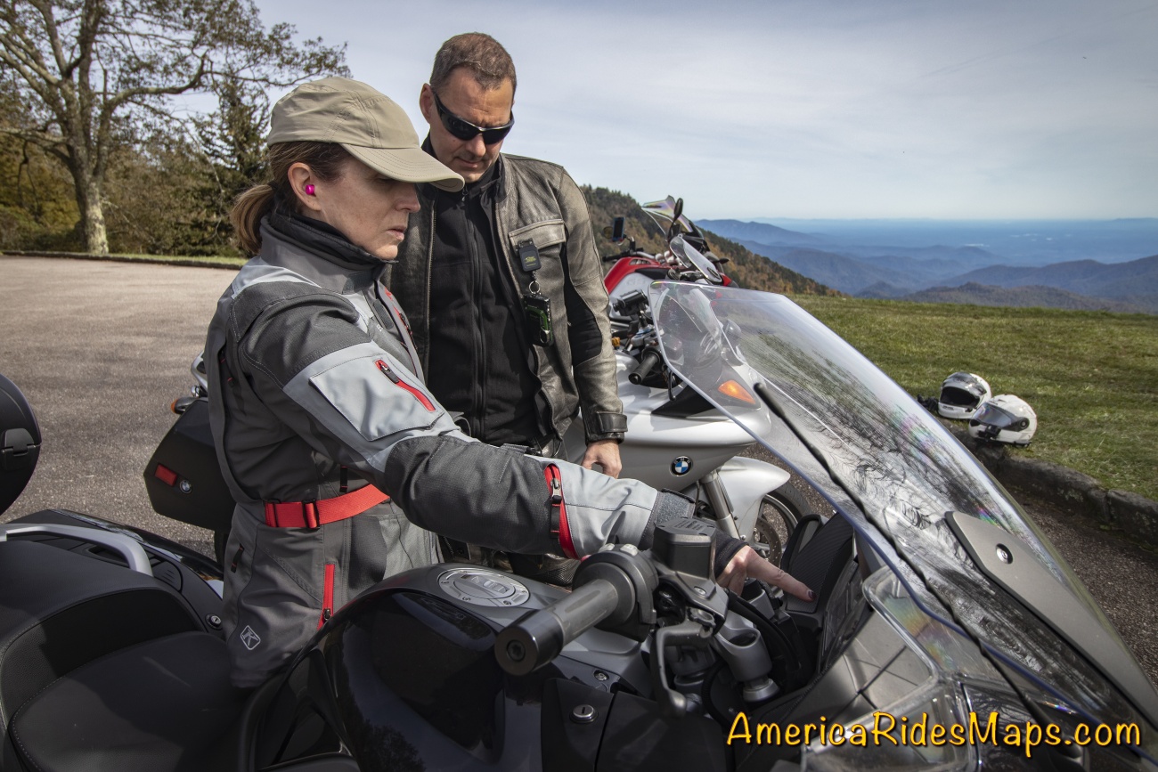
Jackie shows Yermo the controls
The day just got better and better. The fall leaves were at peak in places. The air was so clear, you could see forever. We passed up early chances to head for home to keep enjoying the high road and hit all the classic stops.
Blue Ridge Parkway near Linville, NC
We left the parkway at US 19. It took us through Maggie Valley and home to Waynesville.
Impressions from this trip:
Our previous explorations in West Virginia have been in the hills and valleys west of the Shenandoah area. This southern tip of the state is more rugged and mountainous. The northern areas are more agricultural and pastoral, this region is both more industrial and and more rural. Coal mining dominates, there is little else. I'd expected to see vast extractive wastelands, and while there are roadside mines, most are out of sight. Instead, the mountains and valleys are ruggedly beautiful, winding rivers link gritty towns, forests dominate.

WV 103
What a variety of roads! The riding here is outstanding. You'll find few sections of four lane, two lane roads of various sizes dominate. The bulk of the roads are in excellent shape, seemingly built to accommodate the commercial traffic to and from the mines. There are many good single lane roads and we strayed on to a few "adventure roads" - paved, but just barely. Off road adventure looks to be the growing industry.
Ellison Ridge Rd, WV
The challenge here is the lack of amenities. Towns are small and there is little in them. Next task is to look for the good spots, food, gas stations, and lodging, then explore the roads that link them.
Wayne Busch searches out the most entertaining roads in the Blue Ridge Mountains then records them on a series of maps which span the region.
There are more great motorcycle roads in the Blue Ridge and Smoky Mountains than anywhere else. I highlight the best roads then show you the best ways to connect them together into rides. More than a decade of searching has discovered more than 1000 good roads to enjoy. We continue to search so you may enjoy.
Review the maps, order online here - AmericaRidesMaps.com
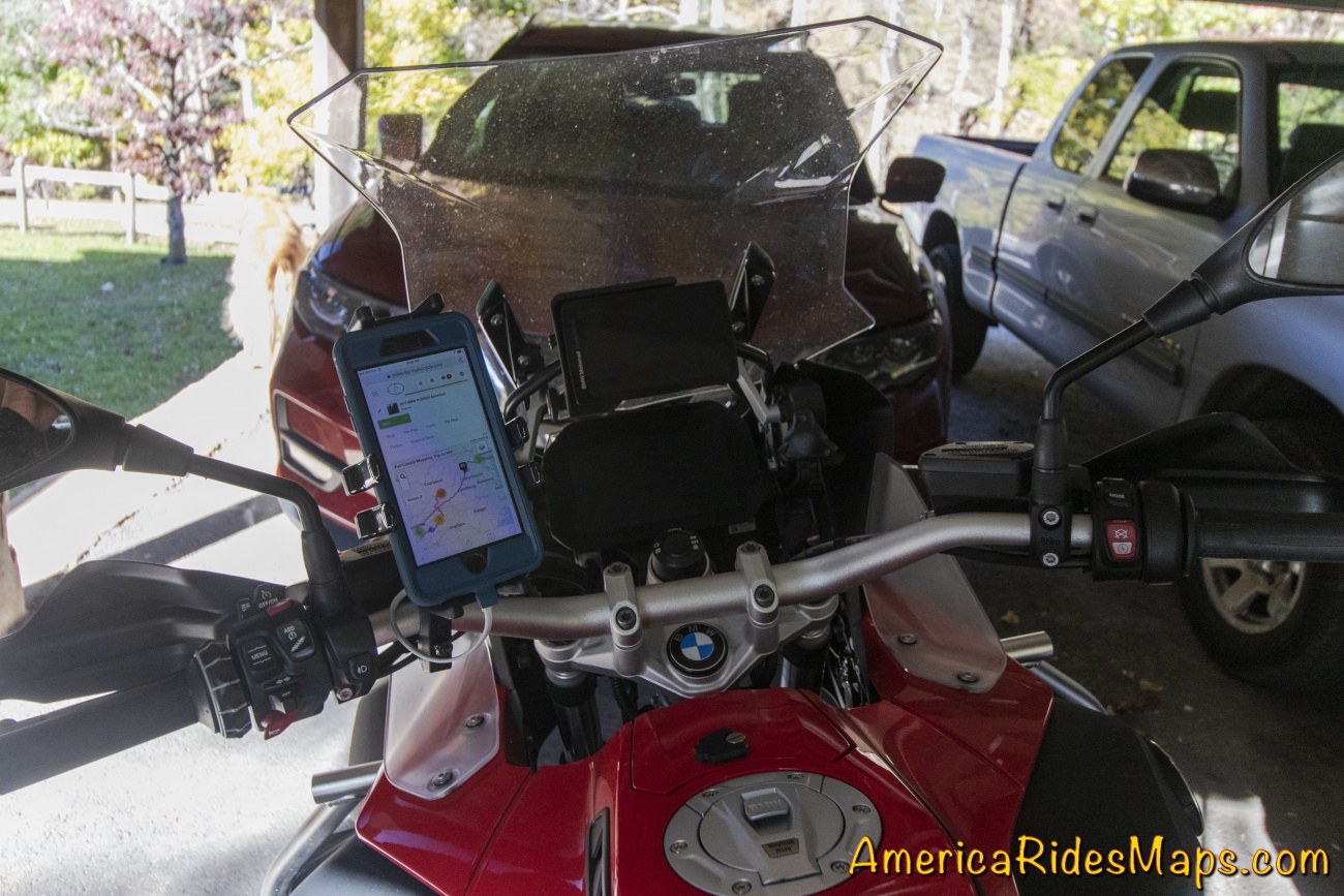
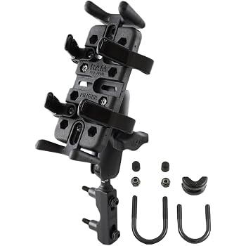
Looking for a more permanent mount for my phone on my new motorcycle I came across the RAM Finger Grip mount. It's a simple clamp to install on the bars and holds the phone securely on all 4 sides. The RAM ball mounts make it easy to reposition it just right.
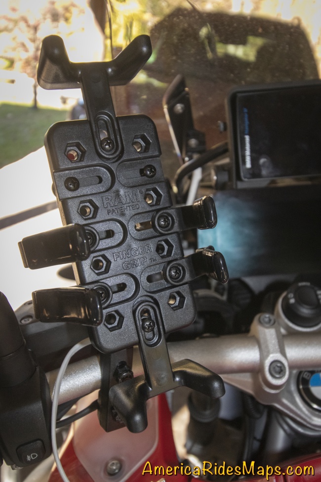
RAM Finger Mount
The trickiest part is custom fitting the phone to the mount, made a little more difficult as there were no instructions in the kit. It was easy to find a diagram online.
Phone in Ram Finger Mount
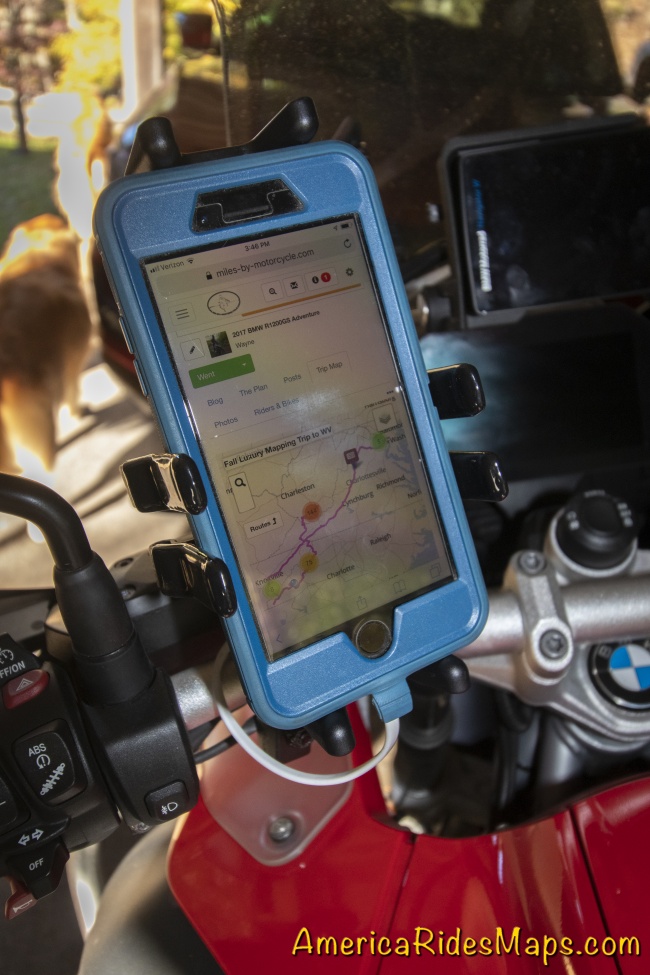
The kit comes with two sizes of top / bottom mounts, and 3 sizes of side clips so you can custom fit it to your device. It's a matter of trial and error to find the correct location so the clips do not fall on buttons on the side of the phone. For my iPhone 8S in an Otter case it took the larger top / bottom clamps and the middle sized side clips.

Ram Mount on bike
The mount seems very secure, the spring clips are quite robust and have vinyl covers to protect the device. It's solid when clamped in. There are no screw clamps to deal with so it's easy to pop the phone in and out of the mount to take photos.
Phone on bike
As this mount moved the phone closer in I was able to use existing wire harness clamps to run the accessory USB port so not zip ties were needed - nice and clean. A 6 inch phone cord makes the link to power.
Amazon.com: RAM MOUNTS (RAM-B-174-UN4U Combination Brake/Clutch Reservoir U-Bolt Mount with Universal Finger-Grip Holder: Automotive
Buy RAM MOUNTS (RAM-B-174-UN4U Combination Brake/Clutch Reservoir U-Bolt Mount with Universal Finger-Grip Holder: Vehicle Mounts - Amazon.com FREE DELIVERY possible on eligible purchases
https://www.amazon.com/RAM-MOUNTS-R...
(affiliate link)
Wayne Busch searches out the most entertaining roads in the Blue Ridge Mountains then records them on a series of maps which span the Blue Ridge Mountains.
There are more great motorcycle roads in the Blue Ridge and Smoky Mountains than anywhere else. I highlight the best roads then show you the best ways to connect them together into rides. More than a decade of searching has discovered more than 1000 good roads to enjoy. We continue to search so you may enjoy.
Review the maps, order online here - AmericaRidesMaps.com
America Rides Maps
Maps of Great Motorcycle Rides in the Blue Ridge Mountains. Blue Ridge Parkway, Tail of the Dragon, hundreds of great biker roads for motorcycle touring. Tennessee, North and South Carolina, Virginia, Georgia motorcycle ride maps,
http://AmericaRidesMaps.com
America Rides Maps makes the most detailed and comprehensive maps of the Blue Ridge Mountains. A series of easy-to-use pocket maps cover the mountains from Virginia to Georgia showing all the best roads and good roads to link them together.
100 Great Motorcycle Rides in the Smoky Mountains | America Rides Maps
100+ Great roads surrounding the Smoky Mountains
https://americaridesmaps.com/produc...
Southeast Blue Ridge Map Package | America Rides Maps
Full Southeast Package, motorcycle maps, motorcycle touring, touring the blue ridge, ride the Blue Ridge Parkway, best motorcycle rides
https://americaridesmaps.com/produc...
Motorcycle Rides surrounding Great Smoky Mountains National Park | America Rides Maps
Motorcycle Rides surrounding Great Smoky Mountains National Park maps, motorcycle smoky mountains, great rides near Great Smoky Mountains, Best motorcycle rides
https://americaridesmaps.com/produc...
3 Map Smoky Park Unpaved Set | America Rides Maps
The unpaved roads in and surrounding Great Smoky Mountains National Park
https://americaridesmaps.com/produc...
#6 The Best Motorcycle Rides Near Smoky Mountains Park - EAST | America Rides Maps
East and south of the Smoky Mountains, the land of the Waterfalls.
https://americaridesmaps.com/produc...
#7 The Best Motorcycle Rides Near Smoky Park - SOUTH | America Rides Maps
South and west of the Smoky Mountains, Waterfalls, The Dragon, and some of the best riding.
https://americaridesmaps.com/produc...
Best Rides NORTH of Smoky Park | America Rides Maps
Rides on the North side of the Smoky Mountains around Gatlinburg, Pigeon Forge, an the surroundings.
https://americaridesmaps.com/produc...
Tags
- 5 americaridesmaps
- 4 north_carolina
- 4 map100smokies
- 3 map6
- 3 scenic
- 3 Map12ClassicRides
- 2 vlogging
- 2 overlook
- 2 historic
- 2 tennessee
- 2 video
- 2 attraction
- 2 MapOR2
- 1 Virginia
- 1 classic
- 1 GoPro
- 1 named
- 1 map2
- 1 MapOR1
- 1 map7
- 1 map8
- 1 mapor1
- 1 Roanoke
- 1 Map100SouthernRides
- 1 Connects_To_Parkway
- 1 Blue_Ridge_Parkway
- 1 view
- 1 map9
- 1 Georgia
- 1 books
- 1 west_virginia
- 1 swag
- 1 store
- 1 Good_Rest_stop
- 1 TN
- 1 coveredbridge
- 1 gopro
- 1 mapOR3