


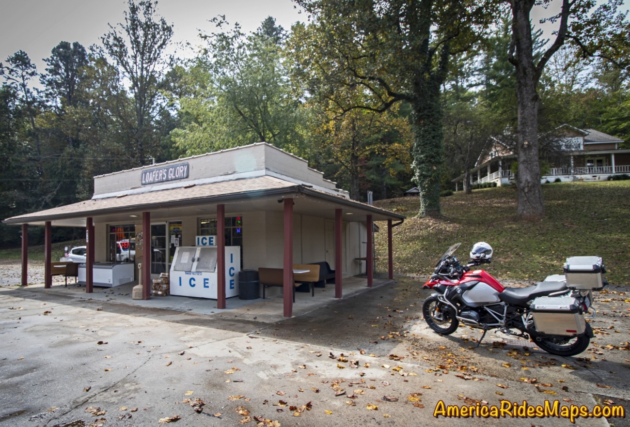
Located at the corner of Wayah Road and Old Murphy Road just west of Franklin, Loafer's Glory is back.
Loafer's Glory
In an area with such notable motorcycle rides as the The Dragon and the Cherohala Skyway, Wayah Road ranks highly as another curvy cruise. It climbs from the upstream end of scenic Nantahala Gorge along the whitewater river to reach alpine Nantahala Lake which feeds the flow. The ride then crosses Wayah Bald for several miles before it plunges down the east side of the mountain through a series of winding switchbacks. When the 30 mile ride ends, Loafer's Glory sits on the corner, a convenient spot for a break.

Loafer's Glory
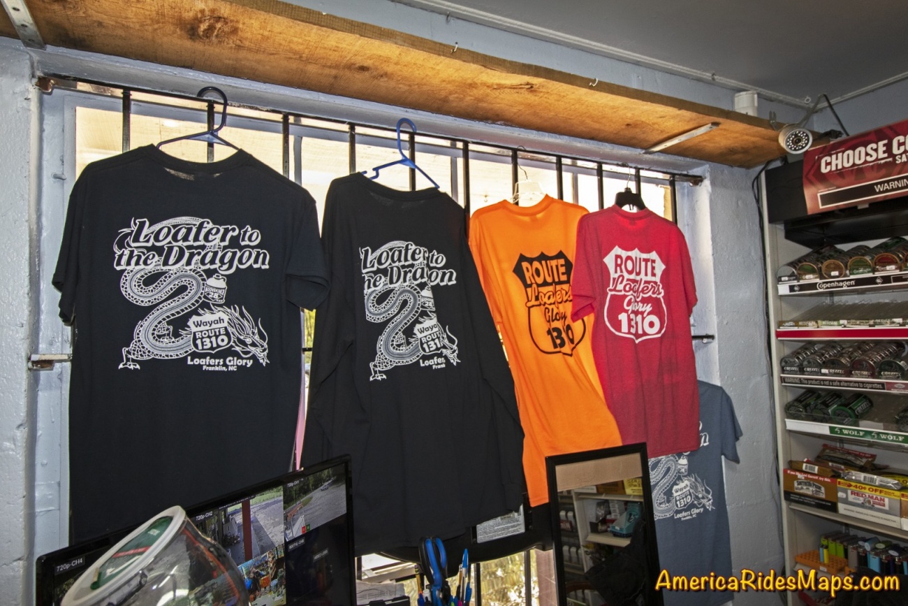
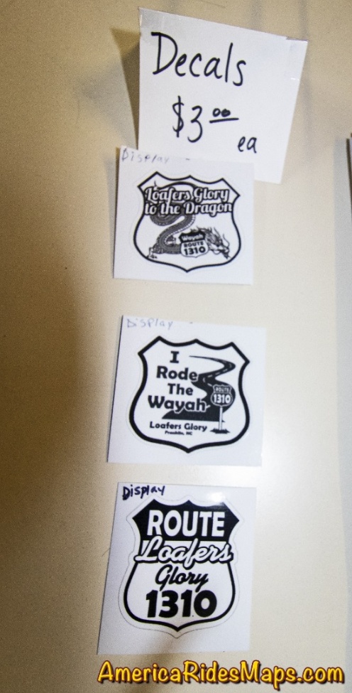
Loafer's Glory was once a popular stop for the kayakers, rafters, hikers, and of course the riders that enjoy this beautiful area of the Nantahala National Forest. It closed for a while, then reopened only to close again. Now, it gets another start. The gas pumps remain idle but the store provides cold drinks, ice cream, and snacks. Riders can get a T-shirt or a sticker as a souvenir of their Wayah ride.
Loafer's Glory
While there's not much to it, Loafer's Glory makes a good rest stop, a place to savor the ride and make strategy for the next. Glad to see it back.
Loafer's Glory

Wayah Rd
A classic ride out of Nantahala Gorge, Wayah Road climbs along the whitewater river up to Nathahala Lake, crusies along the top of the ridge, then plunges down the steep slopes to roll out across a valley. Loafer's Glory is a popular stop at the Franklin, NC end of the ride. There is a nice pulloff at the waterfalls on the climb up.

Article by Wayne Busch, America Rides Maps
We produce detailed maps of the best roads to enjoy on your motorcycle travels in the Blue Ridge and Allegheny Mountains. Get the maps at America Rides Maps.com
America Rides Maps
Maps of Great Motorcycle Rides in the Blue Ridge Mountains. Blue Ridge Parkway, Tail of the Dragon, hundreds of great biker roads for motorcycle touring. Tennessee, North and South Carolina, Virginia, Georgia motorcycle ride maps,
http://AmericaRidesMaps.com
America Rides Maps makes the most detailed and comprehensive maps of the Blue Ridge Mountains. A series of easy-to-use pocket maps cover the mountains from Virginia to Georgia showing all the best roads and good roads to link them together.
100 Great Motorcycle Rides in the Smoky Mountains | America Rides Maps
100+ Great roads surrounding the Smoky Mountains
https://americaridesmaps.com/produc...
Southeast Blue Ridge Map Package | America Rides Maps
Full Southeast Package, motorcycle maps, motorcycle touring, touring the blue ridge, ride the Blue Ridge Parkway, best motorcycle rides
https://americaridesmaps.com/produc...
Motorcycle Rides surrounding Great Smoky Mountains National Park | America Rides Maps
Motorcycle Rides surrounding Great Smoky Mountains National Park maps, motorcycle smoky mountains, great rides near Great Smoky Mountains, Best motorcycle rides
https://americaridesmaps.com/produc...
3 Map Smoky Park Unpaved Set | America Rides Maps
The unpaved roads in and surrounding Great Smoky Mountains National Park
https://americaridesmaps.com/produc...
#6 The Best Motorcycle Rides Near Smoky Mountains Park - EAST | America Rides Maps
East and south of the Smoky Mountains, the land of the Waterfalls.
https://americaridesmaps.com/produc...
#7 The Best Motorcycle Rides Near Smoky Park - SOUTH | America Rides Maps
South and west of the Smoky Mountains, Waterfalls, The Dragon, and some of the best riding.
https://americaridesmaps.com/produc...
Best Rides NORTH of Smoky Park | America Rides Maps
Rides on the North side of the Smoky Mountains around Gatlinburg, Pigeon Forge, an the surroundings.
https://americaridesmaps.com/produc...
Tags
- 5 americaridesmaps
- 4 north_carolina
- 4 map100smokies
- 3 map6
- 3 scenic
- 3 Map12ClassicRides
- 2 vlogging
- 2 overlook
- 2 historic
- 2 tennessee
- 2 video
- 2 attraction
- 2 MapOR2
- 1 Virginia
- 1 classic
- 1 GoPro
- 1 named
- 1 map2
- 1 MapOR1
- 1 map7
- 1 map8
- 1 mapor1
- 1 Roanoke
- 1 Map100SouthernRides
- 1 Connects_To_Parkway
- 1 Blue_Ridge_Parkway
- 1 view
- 1 map9
- 1 Georgia
- 1 books
- 1 west_virginia
- 1 swag
- 1 store
- 1 Good_Rest_stop
- 1 TN
- 1 coveredbridge
- 1 gopro
- 1 mapOR3
You must be a member of this group to post comments.
Please see the top of the page to join.