

Motorcycle Touring in the Blue Ridge
Best Motorcycle Rides along the Blue Ridge Parkway and around Great Smoky Mountains National Park.

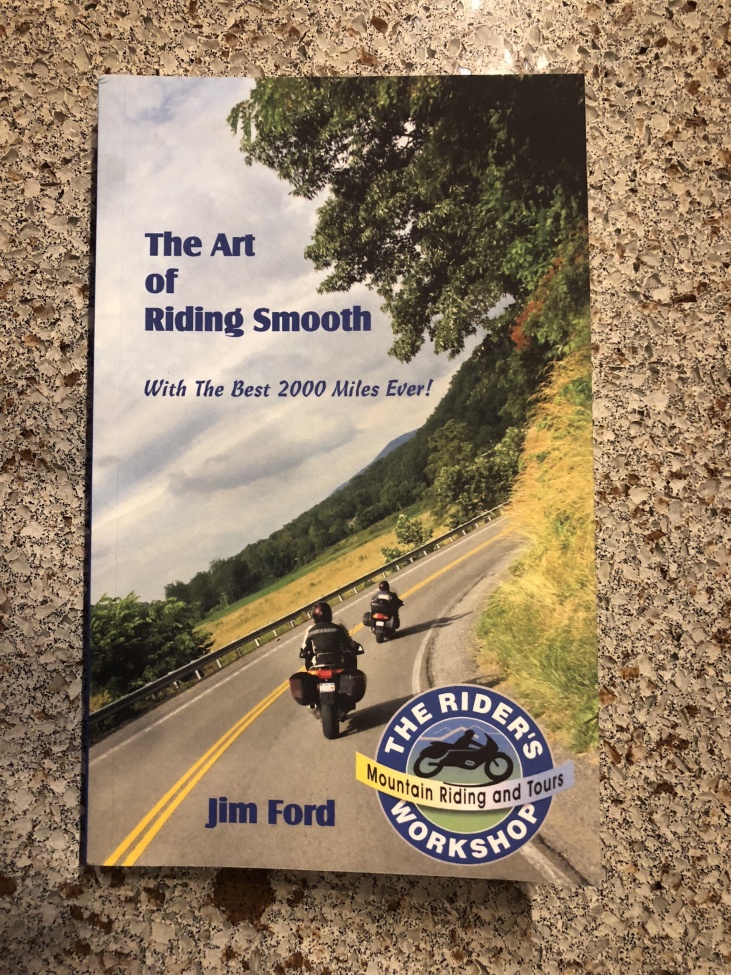
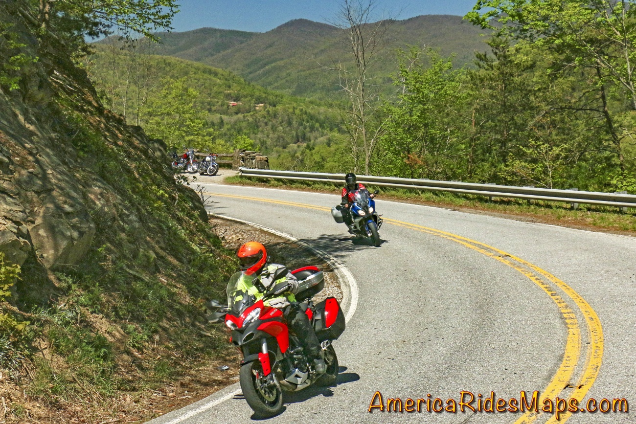
The Art of Riding Smooth
The Art of Riding Smooth
by Jim Ford
Get this new book! The Art of Riding Smooth by Jim Ford is simply the best work on the techniques of riding in the mountains well. It’s an easy and fun read with simple to understand methods you can learn to become a safer and more confident rider. For more than a decade Jim has been teaching riders the advanced and unique techniques needed to master the challenges Appalachian mountain riding throws at you. He enthusiastically shares some of his best hidden roads and a wealth of info on historic sights, restaurants, favorite places to stay, and little known attractions. This is a great book, you should have it!
Get the book here -
https://www.amazon.com/Art-Riding-Smooth-Best-Miles-ebook/dp/B073D251MC
Jim Ford has been teaching mountain riding through The Riders Workshop for more than a decade. Learn more here -
I am beginning to think Georgia does not want to be mapped. For more than a year now I have been trying to complete the most comprehensive and detailed map of the northeast corner of Georgia's unpaved roads and trails. Things could have gone better at times.
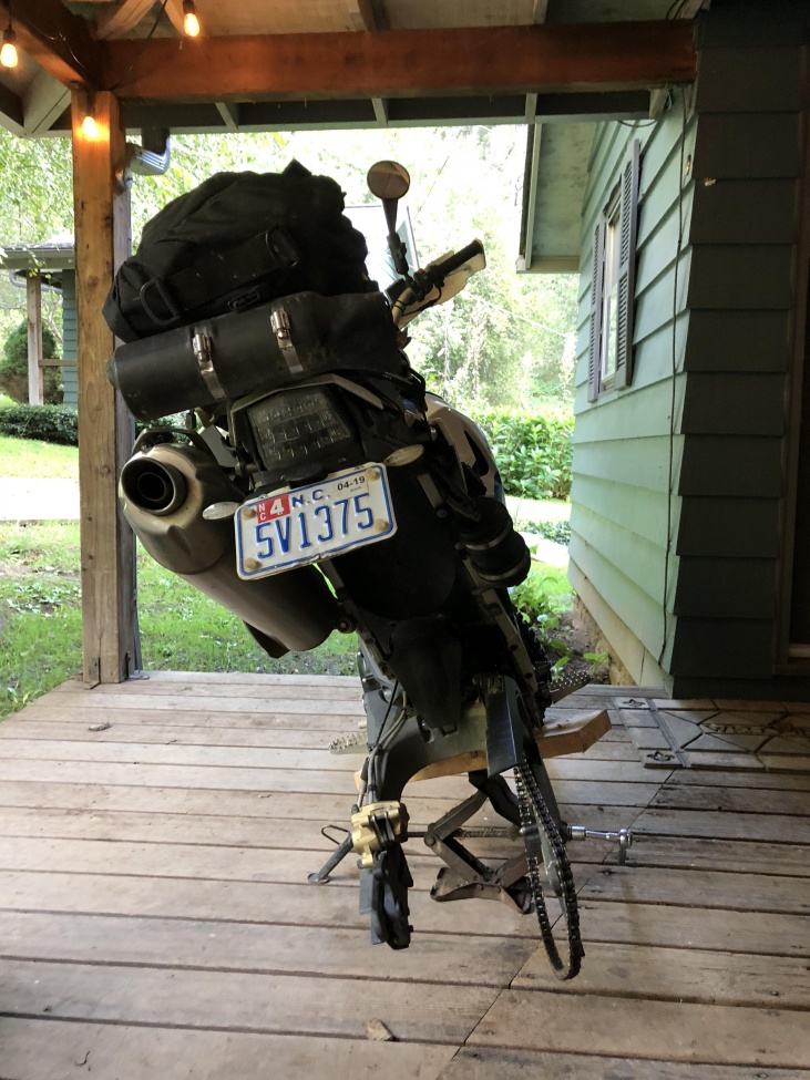
Rear wheel is in the shop for new tire
I've made tremendous progress, I can see the light at the end of the tunnel, but it's been a costly process. It takes about 2 hours for me to get to heart of the map(s) from my home in western NC. I've both stayed locally in GA and strategically commuted to knock out sections of it. I'm so bored with the ride down and worse yet, the ride back. I think this will be the 5th rear tire on this project. I've had GPS fails requiring replacement and re-riding of the areas, lost a 1 month old iPhone with all my notes and photos, replaced brake pads, sprockets, chain, and had to expand my carrying capacity for all the tools and spare parts I'm coming to need.
Today was yet another costly learning experience. I made a judgement error.
I'd just replaced my rear tire on the trail bike, a BMW G650 XChallenge with another aggressive off-road tire. It was exactly what I wanted for the job. A week or so after the hurricane followed by a week long rainy spell I expected sloppy and muddy conditions at best. I dropped my rear tire pressure from 29 PSI to 20 PSI, checked the front was holding steady at 16 PSI, I'd had good performance with these settings many times prior. I was ready.
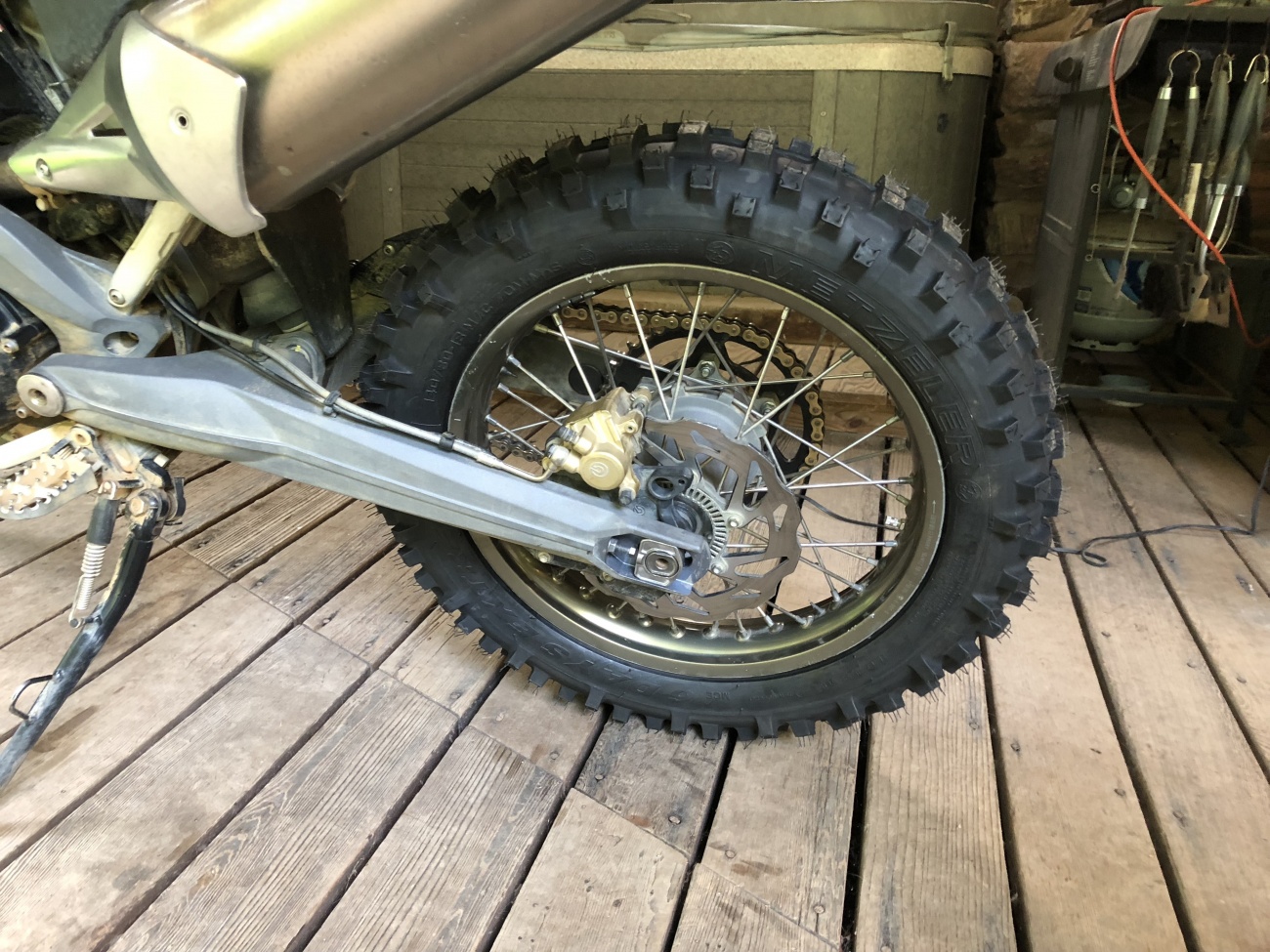
XChallenge New Tire
I needed an epic day to complete the map, essentially edge-to-edge across both sides of the map. Most of it was expected to be easy forest roads, though I had some difficult parts on the list. I set out early, as soon as there was enough light to see for the long drone south on the highways.
This new tire felt odd, but that's not unusual with these knobby tires. Each feels different. They take a bit to scrub in and square off on the road before things settle down to a predictable performance. I reached my 120 mile tank range and stopped for gas.
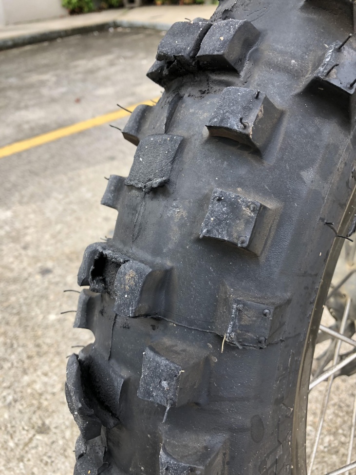
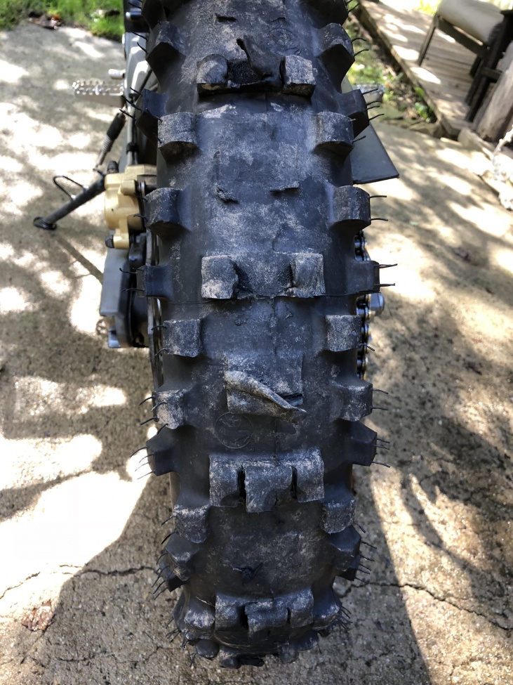
My rear tire overheated from the long run on the highways.
120 miles on this tire
The tire was coming apart, melting. It was so hot I could smell it. Half the center knobs were gone, others peeling away from the carcass in shreds. While I'd had no issues running other brands of tires at off-road pressures this one did not tolerate it at all.
I stopped, called home to let my wife know to watch my progress on her tracker program as limped home. I aired the tire up and hit the highway with fingers crossed her help would not be needed. I kept to just below the speed limits and made stops to let the tire cool down periodically.
I made it home with not much of that tire left. Sadly I pulled the wheel and headed for the dealer to get the tire replaced. Another day lost, another adventure added to the list.
Tire at the end of the ride
Perhaps it is "the hand of providence" telling me to take my time, look harder, there's more to be found, don't rush too early for the finish line. I do keep finding new roads, new trails, places I'd missed earlier or discovered through research.
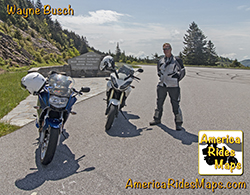
Wayne Busch searches out the most entertaining roads in the Blue Ridge Mountains then records them on a series of maps which span the Blue Ridge Mountains.
There are more great motorcycle roads in the Blue Ridge and Smoky Mountains than anywhere else. I highlight the best roads then show you the best ways to connect them together into rides. More than a decade of searching has discovered more than 1000 good roads to enjoy. We continue to search so you may enjoy.
Review the maps, order online here - AmericaRidesMaps.com
Project Ridemore is sponsored by Smoky Mountain Harley Davidson in Maryville, TN on the north side of Great Smoky Mountains National Park. It's goal is to get folks riding through guided weekly rides. I've seen many of these rides on the Project Ridemore Page on Facebook, they are well promoted, and now that I've met a group riding I can say they are well run.
I got an early morning Facebook message from Tom Ronn who leads these fun rides in the Smoky Mountains. The Wednesday group was stopping for lunch at Caffe' Rel in Franklin, NC. Let's meet.
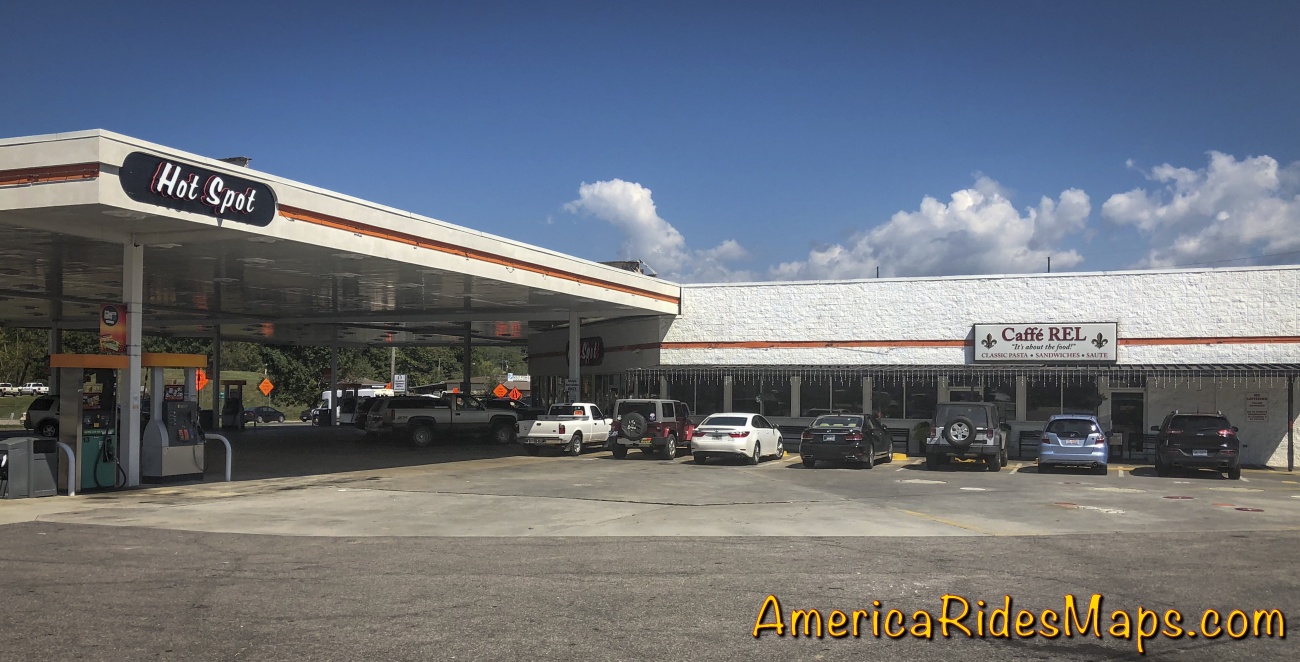
Caffe Rel, Franklin, NC
Caffe Rel is a unique experience. It's built into the side of a big modern gas station, an unusual place to find great food. They do not take reservations. There is no waiting area save a few benches outside. There's usually a line. It's that good.

Tom rolls up at Caffe Rel
The group rolled in on time and I met Tim. There were about a dozen riders enjoying this nice day. I didn't get to meet but a few of them as we were spread amongst several small tables. Two of the riders at our table were down from St. Louis, I believe the remainder were more local. It looked like everyone was having a good time.

Bridal Veil Falls
After lunch, the group was headed to see the nearby waterfalls on NC 28. I ran ahead to get photos of them. They came up on me quicker than expected and I botched the job.
The group stopped at Dry Falls, then rode on to get the classic photo of the bikes under Bridal Veil Falls. Here they started back west while I headed east for home.
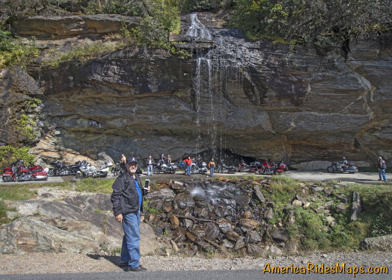
Bridal Veil Falls
I've been watching Project Ridemore on Facebook. They have numerous well attended rides. They pick unique destinations to visit. My impression is they are well run.
Contact Smoky Mountain Harley via their website - Smoky Mountain Harley Davidson in Maryville, TN
Follow Project Ridemore online - Project Ridemore Page on Facebook
Wayne Busch searches out the most entertaining roads in the Blue Ridge Mountains then records them on a series of maps which span the Blue Ridge Mountains.
There are more great motorcycle roads in the Blue Ridge and Smoky Mountains than anywhere else. I highlight the best roads then show you the best ways to connect them together into rides. More than a decade of searching has discovered more than 1000 good roads to enjoy. We continue to search so you may enjoy.
Review the maps, order online here - AmericaRidesMaps.com
It didn't take long once the approach road was paved for this Georgia scenic attraction in Hiawassee to get noticed.
Unable to embed shared object. Sharing permissions error?
Bell Mountain is a rocky outcropping overlooking Lake Chatuge in Hiawasse, Georgia. I've read that it is the scars and remnants of a somewhat sketchy and ultimately failed mining effort in 1963.

Yermo at Bell Mountain, Georgia
It's reported a local resident bought Bell Mountain to protect it from further abuse then gave it to the town when he died. The town turned a local eyesore into an attraction.
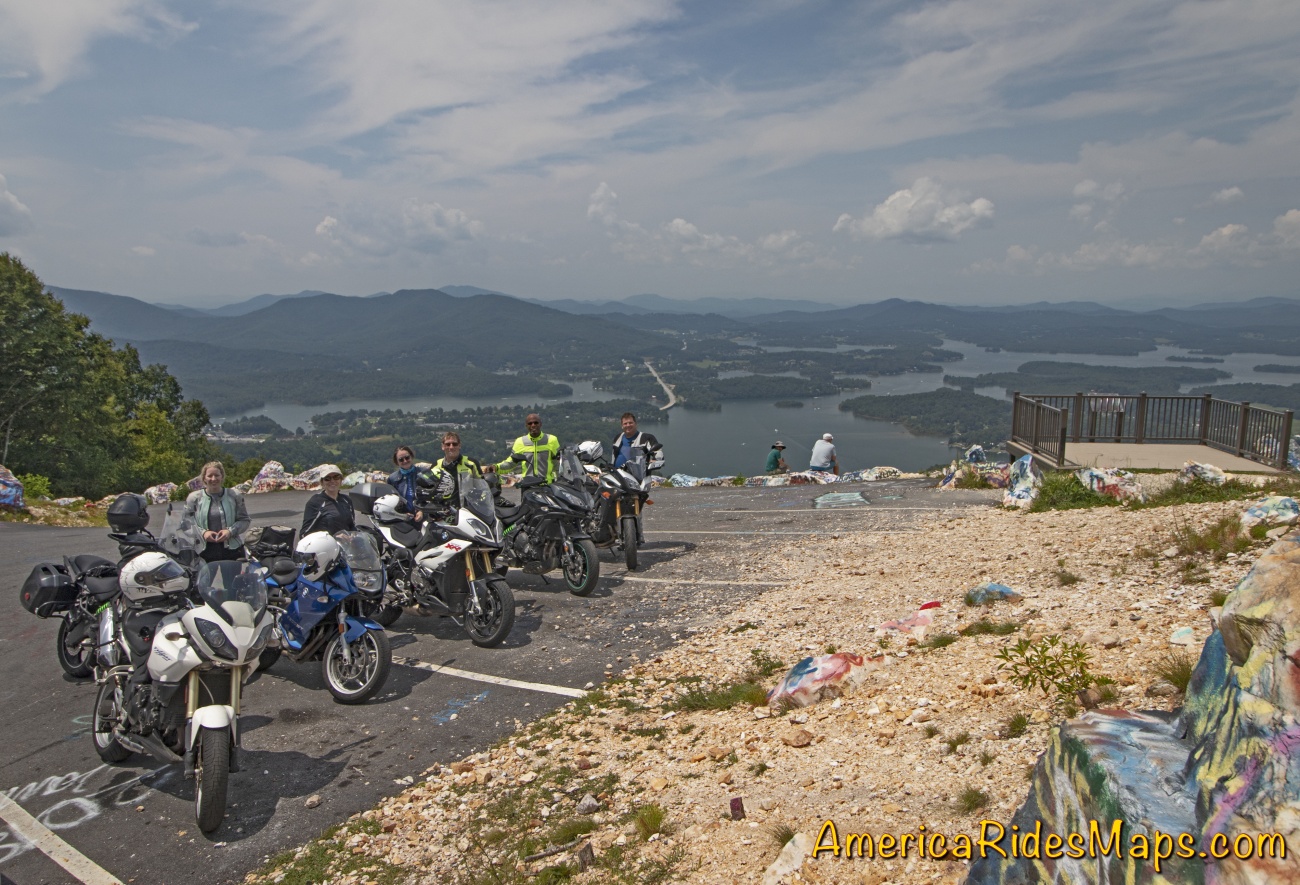
Bell Mountain, Georgia
As to the graffiti at Bell Mountain - I think it's just a fad that caught on. Most anything that can be tagged with spray paint has been marked. The rocks, the stairs, the walkways, tree stumps....
Embedded Object Error
Some find this painting an insult. I find it unique and quirky. The views from the boardwalks at the top of the stairs are grand, it's worth the effort to go up.
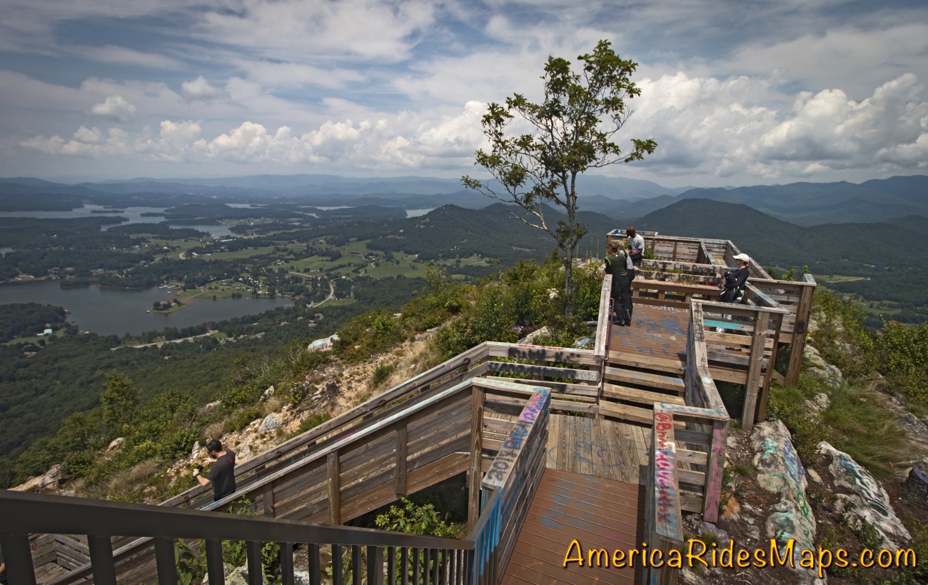
Atop Bell Mountain, Georgia
It takes less than 10 minutes to ride from US 76 in Hiawassee to the top of the mountain. Shake Rag Road starts off curvy then gets very steep, narrow, and tight. Only one car can pass at a time in places, be alert.
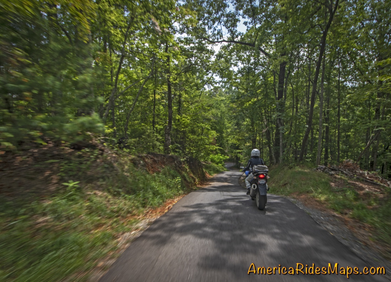
Shake Rag Road to Bell Mountain
Bell Mountain is a nice place to take a break on a ride passing through Hiawassee. The views that overlook the town, Lake Chatuge, and the surrounding mountains are some of the best you'll find in Georgia.
This area is detailed on:
Map #9 - The Best Rides in the North Georgia Mountains
Map - 100 Great Motorcycle Rides in the Southern Blue Ridge
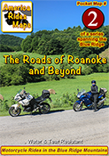
It's too easy to ride past two great Blue Ridge Parkway attractions at Roanoke - Mill Mountain and Roanoke Mountain. Both are just south of the city and worth a visit. The Park Service roads which lead to them are well marked.
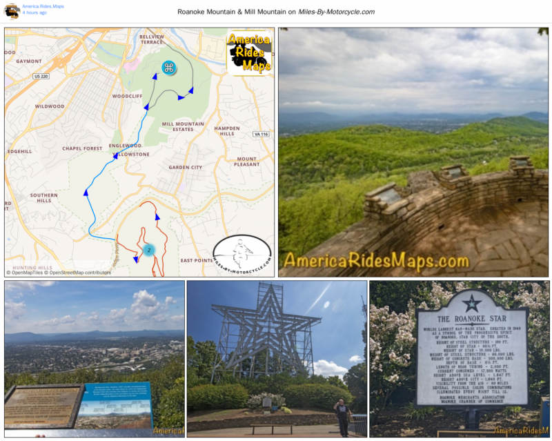
Roanoke Mountain & Mill Mountain
There are two attractions on the Blue Ridge Parkway many travelers miss. Roanoke Mountain has a single lane paved one-way loop road that takes you to a couple nice overlooks. Mill Mountain is home to the Roanoke Star which shines down on the city each night.
Roanoke Mountain Loop Road at Milepost 120.3 is on the east side of the parkway. The 3.75 mile single lane one-way paved road winds up then down the mountain to reconnect with the Blue Ridge Parkway. There is an overlook at the top of the mountain but the better view is from the Mill Mountain Overlook on the climb up. It takes about 20 minutes to ride it though I always stop at the overlook.
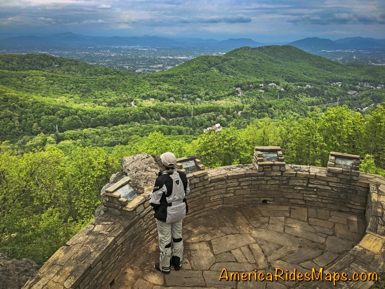
Roanoke Mountain, Mill Mountain Overlook
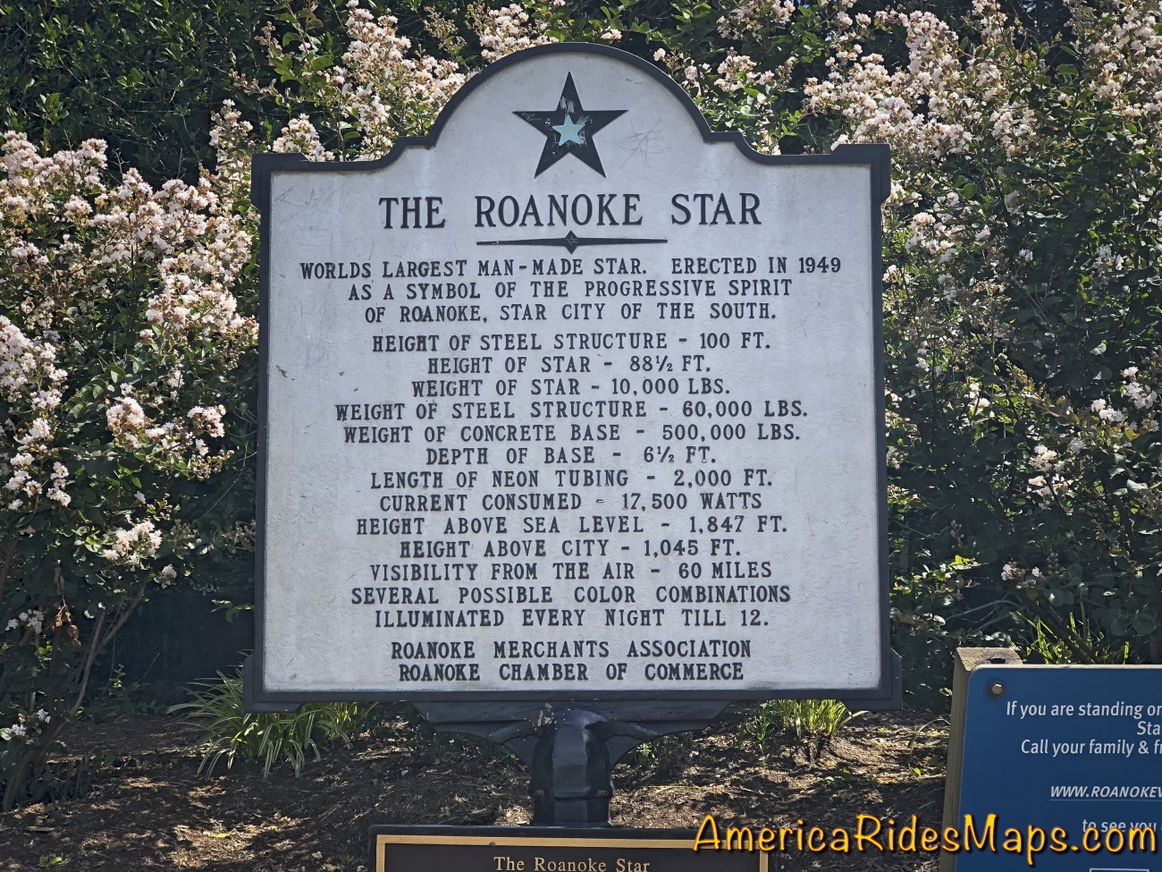
Mill Mountain is home to the famous Roanoke Star which looms above the city. You reach it via the Mill Mountain Parkway at Milepost 120.5. Mill Mountain Parkway is virtually identical to riding the Blue Ridge Parkway, gently curving and climbing to the spur road (Mill Mountain Spur, Prospect Rd SE) that leads to the park at the top. Just walk around the corner from the parking lot and you stand beneath the largest star in the world overlooking the city below.
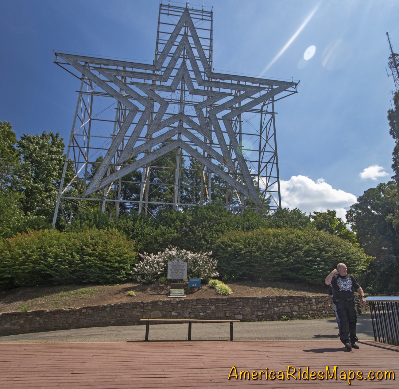
Roanoke Star, Mill Mountain, Roanoke, VA
A zoo, gardens, and visitor center are nearby. It takes about 10 minutes to ride from the parkway to the star. Beyond the spur road, Mill Mountain Parkway becomes JP Fishburn Parkway leading into the city.
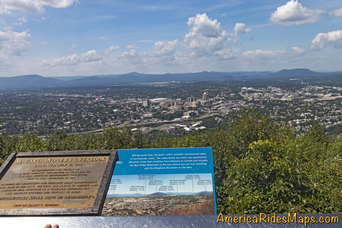
View of Roanoke from Mill Mountain
Both of these attractions offer better views than you'll find from the parkway as well as a unique experience.
Roanoke Star on Mill Mountain
This area is detailed on America Rides Maps Map #2 - The Roads of Roanoke and Beyond
Map2
July 19, 2018 - I've been meticulously categorizing the unpaved forest roads and trails in the mountains of north Georgia as I complete a map of them. Yermo came along with me on this trip for several days of explorations and great roads. This was one of the most memorable challenges -
Mapping Georgia Tallulah River
A river crossing while exploring the unpaved roads in the North Georgia mountains. This new map is nearly done. We've found some great roads! http://AmericaR...
NC 28 / US 64 between Franklin and Highlands, North Carolina is well known for it's 4 beautiful roadside waterfalls.
Few notice there is a 5th waterfall, at least that's what the sign says.

Sequoyah Falls
Sequoyah Falls is located just outside Highlands. Truth is it's not a natural waterfall, rather the spillover from the dam on Lake Sequoyah.
There's an unpaved pull off, a sign and a plaque here and it does make a nice place for a stop on your motorcycle ride.

NC 28 / US 64 - Highlands Road
This is section of NC 28 / US 64 is known as "The Waterfall Ride". The Cullasaja Gorge lies between Franklin and Highlands and has 4 of the best known roadside waterfalls. Expect traffic on this road as it's also the main east-west route through the area.
Is it a waterfall? You decide while you savor this beautiful spot on your motorcycle tour of the Blue Ridge. Enjoy!
You'll find this road and 99 other outstanding motorcycle rides in the area on
100 Great Motorcycle Rides in the Smoky Mountains
100 Rides in the Smokies
Do you like riding to see waterfalls? You might also like -
The Easy Waterfall Ride
Got questions about this ride or others great roads in the Blue Ridge? - Ask Below!
How do motorcycle riders choose from more than 100 outstanding biker roads in the Smoky Mountains?
While all those roads have something to offer, America Rides Maps suggests these are the roads to hit first when you visit on your motorcycle tour -
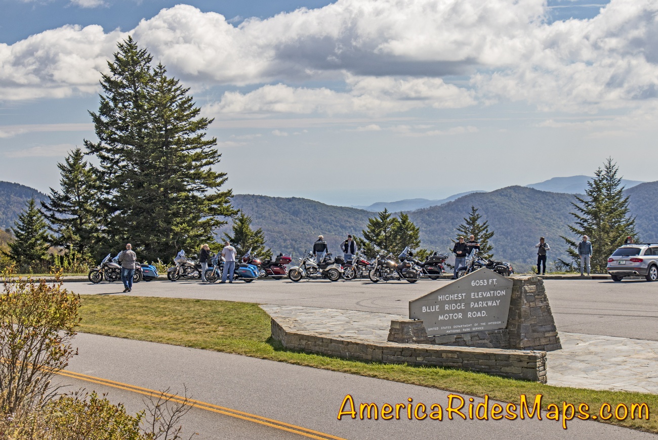
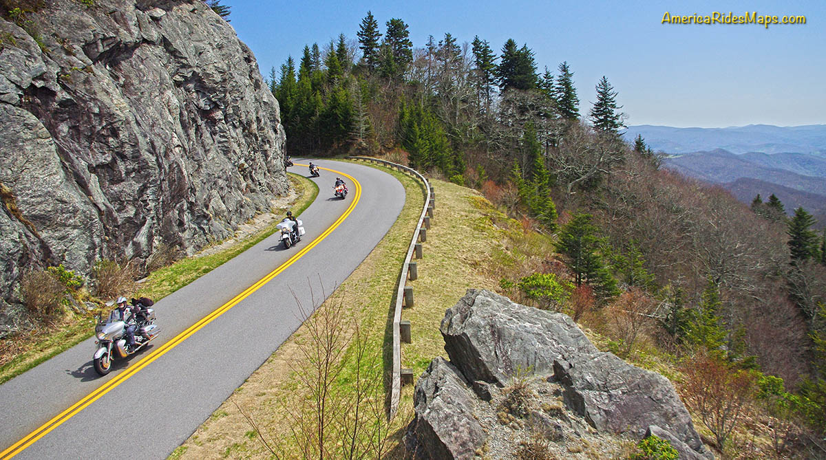
Blue Ridge Parkway - Highest Point
The Blue Ridge Parkway -
Hands down this should be at the top of your list. The best 50 miles of the 469 mile long scenic road are right here and easy to get to. It's the highest section of the parkway filled with stunning overlooks as it cuts along the tops of the mile high mountains. Ride the section between US 19 (near Maggie Valley) to US 276 (south of Waynesville). Highlights on this stretch include Waterrock Knob, The Highest Point (classic photo with the sign), the Devils Courthouse, Looking Glass Rock, Second Falls at Graveyard Fields, and so many beautiful viewpoints to enjoy. The grades are gentle, the curves are satisfying. It's a relaxing and enjoyable ride.
You can do it in a couple of hours or spend the time to stop and savor the sights. If you want to make a day of it, follow the parkway to Great Smoky Mountains National Park and ride across the heart of it on US 441. In the other direction the parkway leads through Asheville then gradually climbs to reach Mt. Mitchell State Park, the highest peak in the east.
More info - https://miles-by-motorcycle.com/51999/blog/53348/the-best-section-of-the-blue-ridge-parkway

US 129 - The Dragon
The Dragon & Cherohala Skyway -
Located on the west side of Great Smoky Mountains National Park, these roads are two of the most popular rides in the Blue Ridge. The legendary Dragon (US 129) draws motorcycle and car enthusiasts to the 13 miles of tight, technical, challenging curves that hug the border of the park. It can get crowded on weekends and while the road has a notorious reputation a casual run is a lot of fun. You'll see numerous photographers along the route to capture your vacation shots as you pass. Nearly 100 paved pull-offs let you escape the speed demons on your tail or just pause to watch the carnival. It takes about half an hour to run the Dragon.
The Cherohala Skyway is very much like the Blue Ridge Parkway running 50 miles between the small towns at either end. It climbs to the highest ridges as it courses through the vast wilderness of the Cherokee and Nantahala National Forests. There are numerous nice overlooks to appreciate the views. The curves are more sweeping, the grades easy, and it's rarely anything you'd call crowded. There are some tighter sections of road as you come off the Skyway at the North Carolina end to choose from. At the Tennessee end of the ride, look for tiny River Road to lead you out to Bald River Falls and Baby Falls. Plan a couple hours for this road if you go out to the falls.
To make a day of it a popular loop ride combines both passing the Vonore, TN. In NC, US 129 is an easy ride south to Robbinsville, or NC 28 takes you on an awesome curvy ride when headed east.
More info - https://miles-by-motorcycle.com/51999/blog/52688/ride-the-dragon-and-the-cherohala-skyway---loop-ride
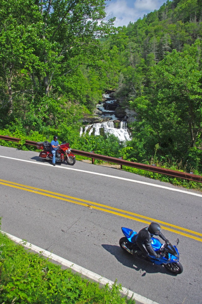
US 64 - Cullasaja Falls
US 64 - The Waterfall Ride -
There are many versions of this ride which is anchored to the section on NC 28 / US 64 between Franklin and Highlands, NC. Cullasaja Falls, Dry Falls, Quarry Falls, and Bridal Veil Falls are found in the Cullasaja Gorge making this one of the easiest spots to see a lot of falls in a short distance. West of Franklin, Wayah Road climbs over the mountains to the Nantahala Gorge. Upper Nantahala Falls is on the way. Wesser Falls and Nantahala Falls are found in the Gorge. To the east of Highlands, Toxaway Falls is on US 64, Whitewater Falls is just a few miles south. A bit further east you'll find Birdrock Falls and Mill Shoals Falls on NC 215, and Looking Glass Falls and Sliding Rock on US 276. There are so many waterfalls you can take a couple days to see all the easy ones.
This map shows one way to see a dozen falls in a day on a reasonable length ride. There are many other ways to link the roads and tour the cascades.
More info - https://miles-by-motorcycle.com/51999/blog/52558/the-easy-waterfall-ride
NC 209 - The Rattler
NC 209 - The Rattler -
This easy to access ride on the east side of Great Smoky Mountains National Park is a gem. The 37 mile run from Junaluska to Hot Springs gives you a little bit of everything in nicely spaced doses. There are gentle valley rides, twisty mountain climbs, pretty scenery, rushing rivers, and historic sights. There are a couple spots to eat in Hot Springs and a spa where you can soak in the natural hot spring waters.
The ride takes about an hour. There is a popular loop that can make it a half day ride passing through Marshall then winding over the mountains to return back to NC 209.
More info - https://miles-by-motorcycle.com/51999/blog/52309/the-classic-rattler-loop-ride
NC 215
The Copperhead Loop -
This ride has a few versions which are all built off two outstanding roads - US 276 and NC 215. Both of these roads run north to south. The Copperhead Loops are made with roads which run between them. Think triangle, not loop - US 276 and NC 215 meet in Bethel, NC. They then both run south more or less parallel to one another crossing the border into South Carolina.
US 276 is the better known of the two roads. From Bethel, it runs along a valley then makes a dramatic climb to intersect the Blue Ridge Parkway. South of the parkway it descends to Brevard with attractions and waterfalls along the way. It then runs into town then shoots south again passing Connestee Falls into South Carolina. It has engaging curves, nice scenery, one of the most popular waterfalls (Looking Glass Falls) , and can get a bit crowded on weekends as so many flock to the beautiful area around the waterfalls.
NC 215 also leaves Bethel to follow a valley, then begins a gradual and twisty climb. It's more technical than US 276 and the challenges are more sustained. There's little if any traffic. There are waterfalls along the way.
Both roads reach their first connection at the Blue Ridge Parkway then drop down the south slopes to reach US 64. US links between Rosman and Brevard, it's the classic easy connecting route, the "standard" loop. South of US 64, NC 215 becomes US 178. Both it and US 276 continue south into South Carolina to reach the southernmost linking road, SC 11.
More info - https://miles-by-motorcycle.com/51999/blog/53429/best-rides-in-the-blue-ridge---the-copperhead
These roads and many more are catalogued on motorcycle ride maps published by America Rides Maps. Buy them online at http://AmericaRidesMaps.com
With so many great motorcycle roads in the Smoky Mountains - How do you choose which to ride?
Start with the named motorcycle rides. If it's popular enough to be named, it's a good one. The Copperhead Loop Ride in North Carolina is one of the best.
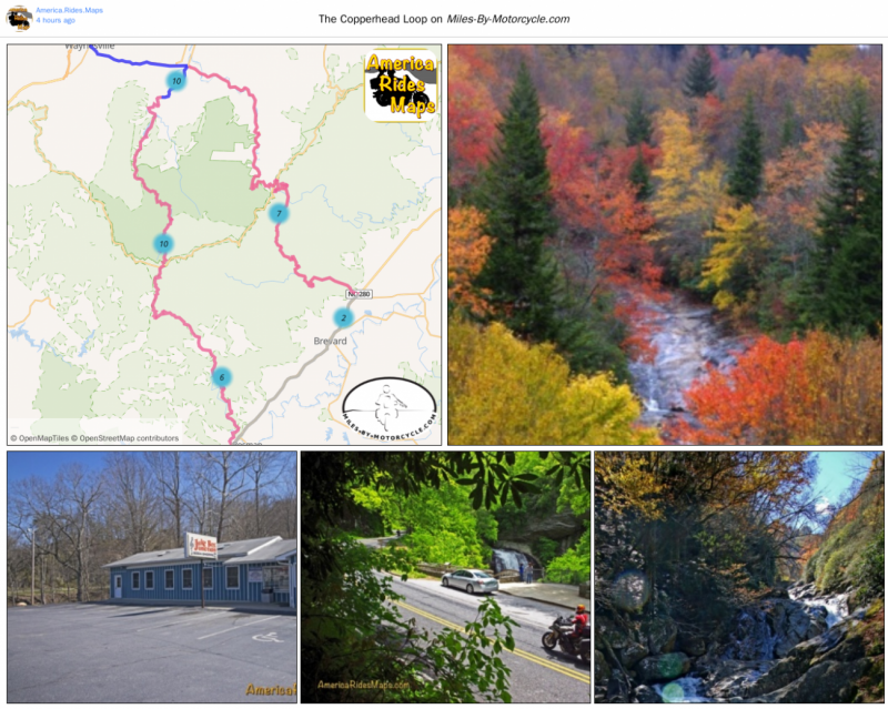
The Copperhead Loop
US 276 and NC 215 are two of the finest motorcycle rides you’ll find. The Copperhead Loop ride links them using US 64 through Brevard. You'll enjoy wonderfully twisty roads, waterfalls, and intersect the Blue Ridge Parkway at two points.
You can use your smart phone to view the map when you do this ride.
Be aware, cell service is spotty in the mountains, it's a good idea to take printed maps too.
100 Great Motorcycle Rides in the Smoky Mountains, #6 The Best Motorcycle Rides Near Smoky Mountains Park - EAST, 12 Classic Deals Gap Motorcycle Rides, The Best Unpaved Roads SOUTH of Smoky Park, Full Southeast Package - All 9 Maps
There is no "one size fits all" place for motorcycle riders touring in the Smoky Mountains. Each has it's advantages and disadvantages, strengths and weaknesses depending on what you want to get out of your motorcycle trip.
Great Smoky Mountains National Park - takes up a huge chunk of real estate on the North Carolina / Tennessee border. Staying within the park means camping, and numerous options present. You'll find these campgrounds fairly busy and congested though that also means basic facilities are assured and they are in stunningly beautiful settings. It's nice from a camping standpoint, but you'll be starting and ending each day on the few park roads as you commute to the surrounding areas cutting into your ride time each day.
US 441 - Newfound Gap Road - GSMNP
Outside the Park - Towns around the park can be divided by compass direction - north, south, east, west. Each of these areas is distinctly different reflected in the towns within.
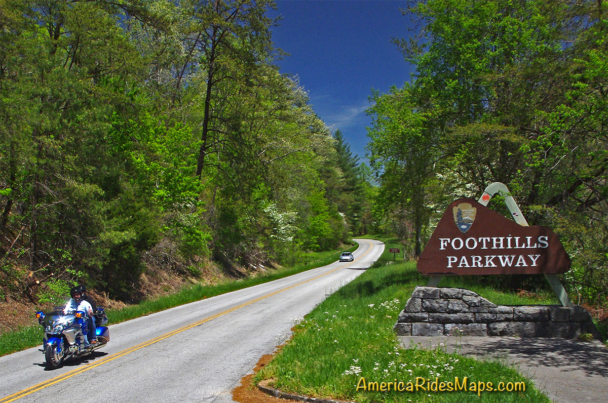
Tennessee Foothills Parkway
North of the Park:
Gatlinburg / Pigeon Forge - Tourist Mecca. Easy to get to and just half an hour south from Knoxville, these towns are dominated by tourist attractions like Dollywood, Ripley's, Ober Gatlinburg, the Space Needle, Smoky Mountain Opree, and all kinds of venues geared to kids, families, shopping, nightlife, and the scenic park views. It's a busy, bustling, and energetic place with loads of places to stay. Riding in this area is comparatively limited and the major roads congested. North of the park the mountains quickly subside into the broad Tennessee River Valley. The riding is to the east and west, look to the lesser traveled valleys and back roads. South takes you into the park.
Townsend - West of the big towns, Townsend stretches along the Little River into the park. It has a large tourism focus but is not as built up. Riding to the east means passing through the big towns, to the south is one entrance to the park. The Tennessee Foothills Parkway takes you west to US 129 on the north side of The Dragon and access to the western rides.
Cosby / Newport - This is pretty rural country except for the main road (US 321) which passes though it. The tourist focus diminishes as you stray north from the park to Newport and it's more characteristic of the east side of GSMNP. For ADV riders, it sits on the edge of some decent unpaved riding in the Pisgah National Forest.
NC 209 - The Rattler
East of the Park:
Hot Springs - The area on the east side of GSMNP is dominated by the Pisgah National Forest. The mountains continue their arc north from the park to the highest of the peaks still miles distant. This area is rural and undeveloped. The few roads that do run through it are outstanding mountain rides, even Interstate 40 cutting through the Tennessee River Gorge is spectacularly scenic. Small mountain towns dot the landscape, Hot Springs is one of them. The historic town has limited places to stay and eat and a campground on the French Broad River.
Asheville - A vibrant and beautiful small city. The Blue Ridge Parkway passes through it. You'll find ample places to stay in the surroundings, and the city traffic can be escaped fairly quickly. Known for its food and beer culture, parking is an issue to the point walking is the way to go when downtown. You'll be paying city prices but also have access to some luxurious and scenic places to stay if that's your style.
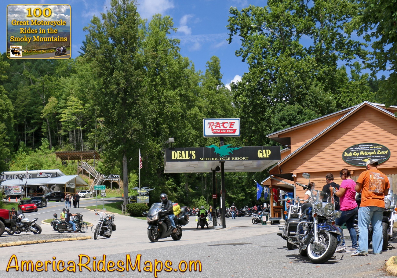
US 129 - Deals Gap - The Dragon
West of the Park:
Deals Gap - Both south and west of the park, Deals Gap sits at the NC end of The Dragon. It's relatively remote with few lodging options, but if you're a Dragonista it's heaven.
Robbinsville - at the crossroads of The Dragon and the Cherohala Skyway, Robbinsville is a small town. There's one large motel, a few motorcycle centered lodgers, and a handful of restaurants. There's a nice mix of riding in the surroundings.
Tellico Plains - across the Cherohala Skyway, Tellico Plains is a small town. You find a handful of restaurants, a few lodgers, and camping nearby. The best riding is to the east and south, a loop north takes you to the Dragon.
Blue Ridge Parkway
South of the Park:
Waynesville - The largest town in western North Carolina hosts the best food west of Asheville and a popular downtown. Lodging options are scattered. It's at the hub of the best riding with great roads in every direction. The are numerous roads leading from town which intersect the Blue Ridge Parkway and the Land of the Waterfalls to the south.
Maggie Valley - On the edge of the park, Maggie Valley has the most places to stay. Like Waynesville, it sits at the epicenter of the best riding and makes an ideal base for a longer stay. Wheels Through Time motorcycle museum is a popular attraction. There are numerous motorcycle events throughout the season. Easy access to the Blue Ridge Parkway and many great rides are found nearby.
Cherokee - Located at the south end of the Blue Ridge Parkway and the entrance to Great Smoky Mountains National Park, Cherokee offers ample places to stay and lots of small restaurants. It's the heart of Cherokee culture with museums and attractions. Harrah's Cherokee Casino dominates the landscapes on the outskirts of town. There is riding in all directions though the town itself can be congested and busy and many commutes will be on major roads.
Bryson City - Somewhat isolated, Bryson City is a small town with several good places to eat and limited lodging. The Great Smoky Mountains Railroad is the big tourist draw as is camping at the edge of the park at Deep Creek. Riding is to the east, west, and south.
Stecoah - Barely a town, you'll find campgrounds and cabins in this area. Few places to eat. It sits on NC 28 leading to Robbinsville and Deals Gap. The best riding is to the west. It's good location for ADV riders looking to explore the unpaved roads.
Fontana Village - An isolated location, you find the Fontana Village Resort has all you need in one spot. It sits on NC 28 close to the Dragon and rides west. The Fontana Dam is nearby.
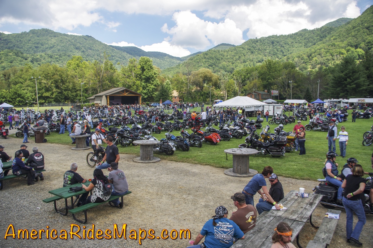
Maggie Valley Fall Rally
Which is best?
If your focus is being surrounded by the best roads so you can spend your visit riding, the south side of Great Smoky National Park is best. You'll find the most options for lodging, eating, and other attractions on the southeast side, more remote and quiet places on the southwest side. Now matter which area you stay in, you'll find more great motorcycle rides in the Smoky Mountain area than anywhere else. Enjoy!
100 Rides In the Smokies - Full Sized Map
America Rides Maps
Maps of Great Motorcycle Rides in the Blue Ridge Mountains. Blue Ridge Parkway, Tail of the Dragon, hundreds of great biker roads for motorcycle touring. Tennessee, North and South Carolina, Virginia, Georgia motorcycle ride maps,
http://AmericaRidesMaps.com
America Rides Maps makes the most detailed and comprehensive maps of the Blue Ridge Mountains. A series of easy-to-use pocket maps cover the mountains from Virginia to Georgia showing all the best roads and good roads to link them together.
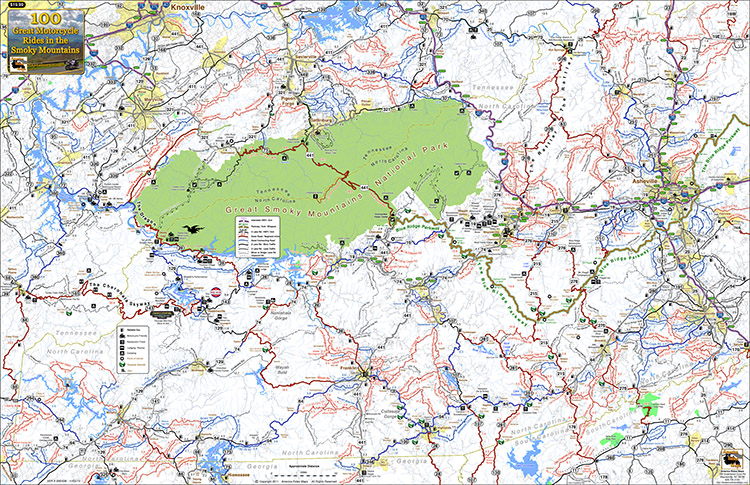
100 Great Motorcycle Rides in the Smoky Mountains | America Rides Maps
100+ Great roads surrounding the Smoky Mountains
https://americaridesmaps.com/produc...
Southeast Blue Ridge Map Package | America Rides Maps
Full Southeast Package, motorcycle maps, motorcycle touring, touring the blue ridge, ride the Blue Ridge Parkway, best motorcycle rides
https://americaridesmaps.com/produc...
Motorcycle Rides surrounding Great Smoky Mountains National Park | America Rides Maps
Motorcycle Rides surrounding Great Smoky Mountains National Park maps, motorcycle smoky mountains, great rides near Great Smoky Mountains, Best motorcycle rides
https://americaridesmaps.com/produc...
3 Map Smoky Park Unpaved Set | America Rides Maps
The unpaved roads in and surrounding Great Smoky Mountains National Park
https://americaridesmaps.com/produc...
#6 The Best Motorcycle Rides Near Smoky Mountains Park - EAST | America Rides Maps
East and south of the Smoky Mountains, the land of the Waterfalls.
https://americaridesmaps.com/produc...
#7 The Best Motorcycle Rides Near Smoky Park - SOUTH | America Rides Maps
South and west of the Smoky Mountains, Waterfalls, The Dragon, and some of the best riding.
https://americaridesmaps.com/produc...
Best Rides NORTH of Smoky Park | America Rides Maps
Rides on the North side of the Smoky Mountains around Gatlinburg, Pigeon Forge, an the surroundings.
https://americaridesmaps.com/produc...
Tags
- 5 americaridesmaps
- 4 north_carolina
- 4 map100smokies
- 3 map6
- 3 scenic
- 3 Map12ClassicRides
- 2 vlogging
- 2 overlook
- 2 historic
- 2 tennessee
- 2 video
- 2 attraction
- 2 MapOR2
- 1 Virginia
- 1 classic
- 1 GoPro
- 1 named
- 1 map2
- 1 MapOR1
- 1 map7
- 1 map8
- 1 mapor1
- 1 Roanoke
- 1 Map100SouthernRides
- 1 Connects_To_Parkway
- 1 Blue_Ridge_Parkway
- 1 view
- 1 map9
- 1 Georgia
- 1 books
- 1 west_virginia
- 1 swag
- 1 store
- 1 Good_Rest_stop
- 1 TN
- 1 coveredbridge
- 1 gopro
- 1 mapOR3