

Motorcycle Touring in the Blue Ridge
Best Motorcycle Rides along the Blue Ridge Parkway and around Great Smoky Mountains National Park.

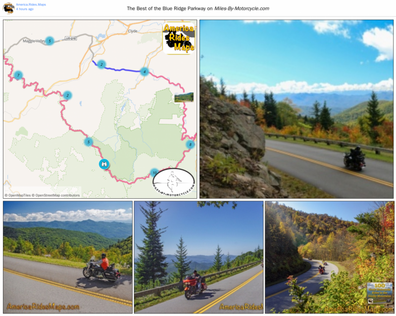
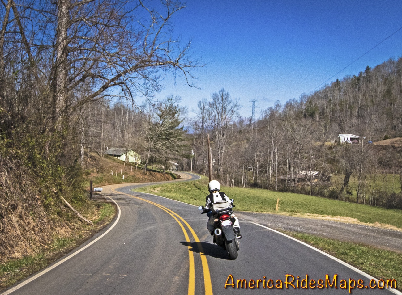
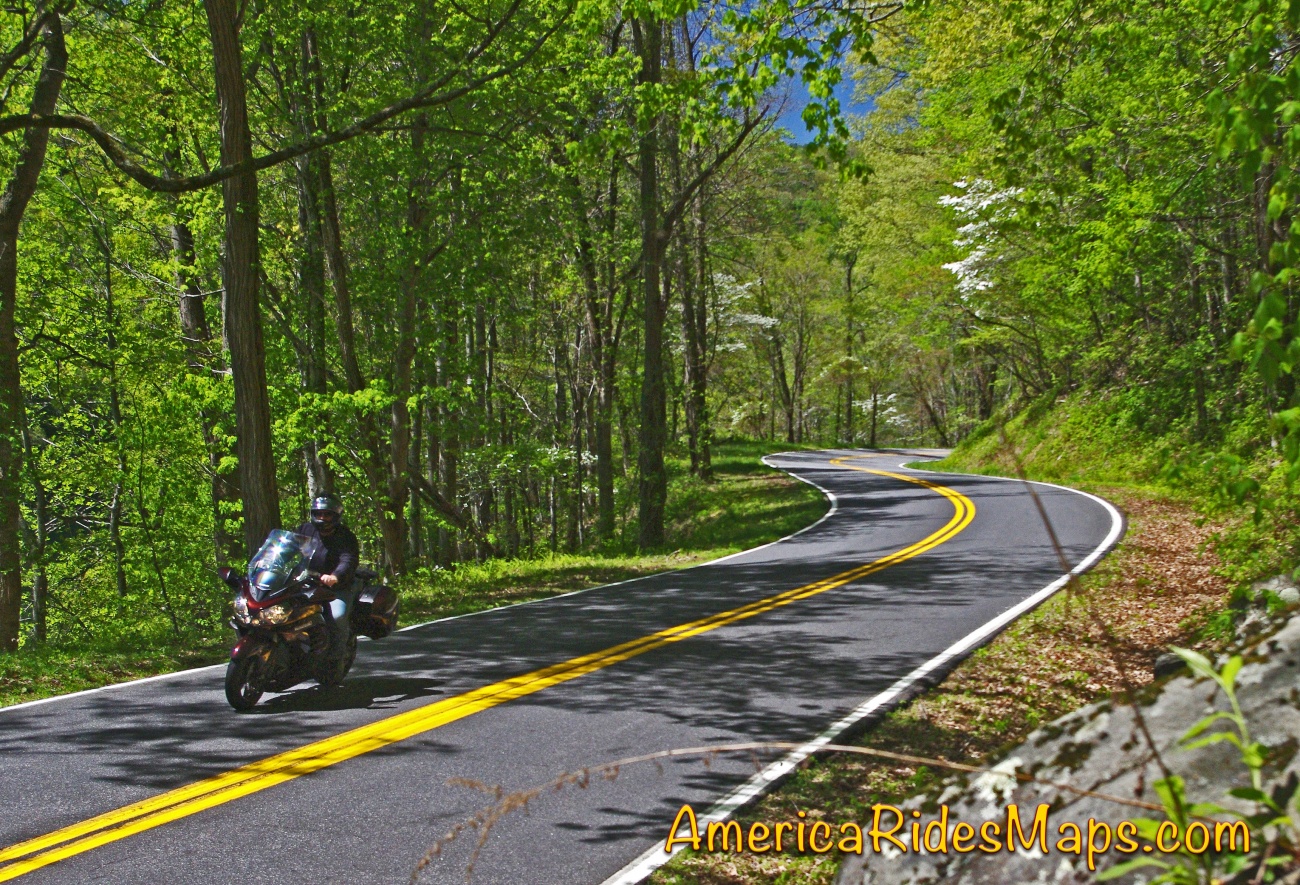
This 43 mile section is the best of the 491 mile long world famous motorcycle ride. It's the highest, the twistiest, and has the most scenic overlooks to stop and enjoy.
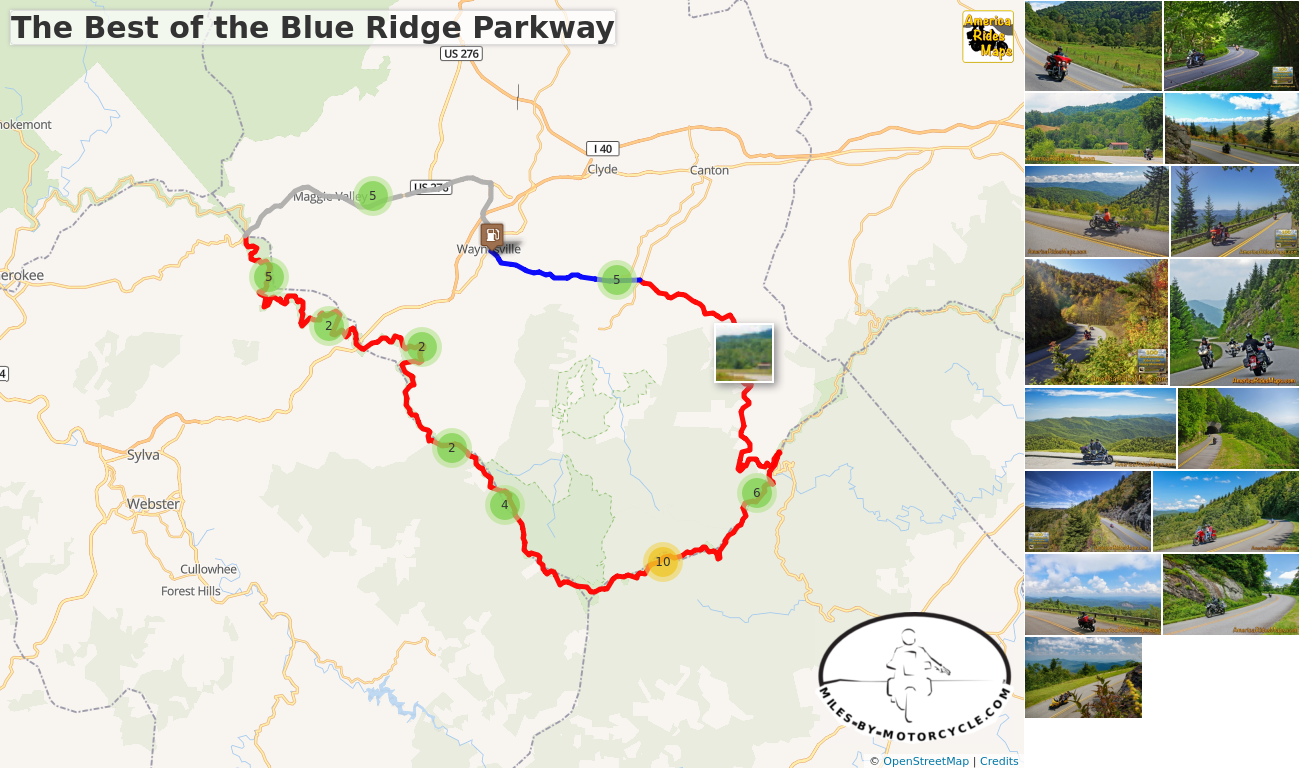
The Best of the Blue Ridge Parkway
Enjoy views from the Highest Point, see the Devil’s Courthouse, Looking Glass Rock, Graveyard Fields, and more. Some of the best overlooks are listed on each parkway section by milepost in this guide.
Soco Gap (Milepost 455.7) to Wagon Road Gap (Milepost 412.2)
Distance: 78 miles to make the loop
Ride Time: 3 hours or more
Blue Ridge Parkway - Highest Point
START: Maggie Valley
Ride: Maggie Valley to the Blue Ridge Parkway
- From the Haywood Visitor Center follow US 19 - Soco Road. You'll pass Wheels Through Time Motorcycle Museum in Maggie Valley on your way to Soco Gap and the entrance to the Blue Ridge Parkway. Get on the parkway heading towards Asheville.
Ride: Soco Gap (US 19) to Balsam Gap (US 74)
- MP 452.1 Cranberry Ridge Overlook - nice views towards Cherokee
- MP 451.2 Waterrock Know Overlook - visitor center, panoramic views from top
- MP 450.2 Yellow Face Overlook - long range views over valley
- MP 445.2 Mt Lynn Lowery Overlook - View Mt. Lyn Lowery cross on top, Woodfin Cascades across valley
- MP 443.1 - Balsam Gap - US 74 exit
Ride: Balsam Gap (US 74) to Beech Gap (NC 215)
- MP 439.7 Pinnacle Ridge Tunnel
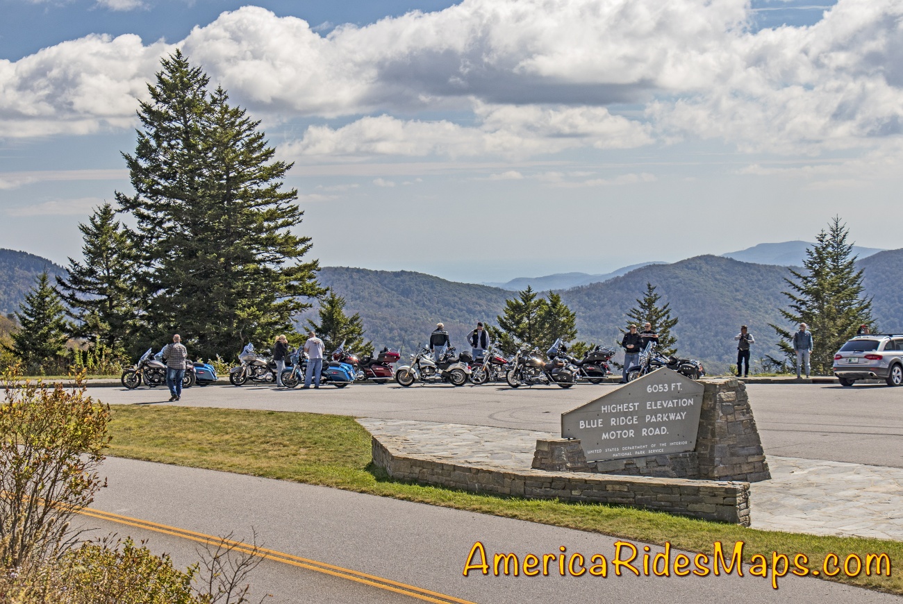
- MP 431.4 Richland Balsam Overlook - Highest point on the Blue Ridge Parkway
- MP 430.7 Cowee Mountains Overlook - nice panoramic views
- MP 428 Caney Fork Overlook - Panoramic views
- MP 423.5 Courthouse Valley Overlook - Nice views, good rest stop
- MP 423.3 Beech Gap - NC 215 exit
Blue Ridge Parkway
RIde: Beech Gap (NC 215) to Wagon Road Gap (US 276)
- MP 422.4 Devil's Courthouse Overlook - View from base of rock formation and valley below
- MP 422.1 Devil's Courthouse Tunnel
- MP 418.8 Graveyard Fields Overlook - popular stop with waterfalls, parking gets congested
- MP 418.3 Looking Glass Rock Overlook - Popular stop, good views of rock formation
- MP 413.2 Pounding Mill Overlook - panoramic views from point
- MP 412.9 Cold Mountain Overlook - Good rest stop near exit, views
- MP 412.2 Wagon Road Gap - Junction with US 276 exit
Ride: Blue Ridge Parkway to Maggie Valley
- The drop from the parkway on US 276 - Cruso Road is a thrill. It then winds through the forest for several miles and emerges along the Pigeon River as it flows towads the Bethel Valley. US 276 - Pigeon Road takes you through Pigeon Gap into downtown Waynesville. Follow Main Street then US 276 - Russ Avenue to the junction with US 19. Follow US 19 - Dellwood Road back to Maggie Valley.
END: Maggie Valley
The Best of the Blue Ridge Parkway
This 43 mile section is the best of the 491 mile long ride. It's the highest, the most scenic and has more overlooks to enjoy it.
The Best Section of the Blue Ridge Parkway is found on maps -
Map #6 - The Best Motorcycle Rides Near Smoky Mountains Park - EAST
Map - 12 Classic Deals Gap Motorcycle Rides
Map - 100 Great Motorcycle Rides in the Smoky Mountains
Map OR2 - The Best Unpaved Roads SOUTH of Smoky Park
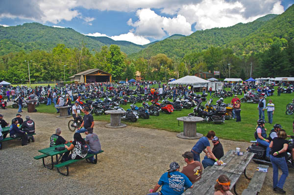
Located on the quiet south side of Great Smoky Mountains National Park, Maggie Valley is the hub of the best motorcycle rides in the USA.
More than 100 great motorcycle rides surround the mountain town. It's home to the Wheels Through Time Motorcycle Museum. Numerous rallies and festivals take place throughout the warm season.
Here are three of the best motorcycle rides nearby -
1) The Best of the Blue Ridge Parkway -
The Best of the Blue Ridge Parkway
This 43 mile section is the best of the 491 mile long ride. It's the highest, the most scenic and has more overlooks to enjoy it.
2) The Copperhead Loop -
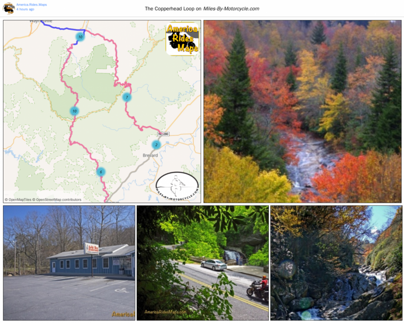
The Copperhead Loop
US 276 and NC 215 are two of the finest motorcycle rides you’ll find. The Copperhead Loop ride links them using US 64 through Brevard. You'll enjoy wonderfully twisty roads, waterfalls, and intersect the Blue Ridge Parkway at two points.
3) The Rattler -
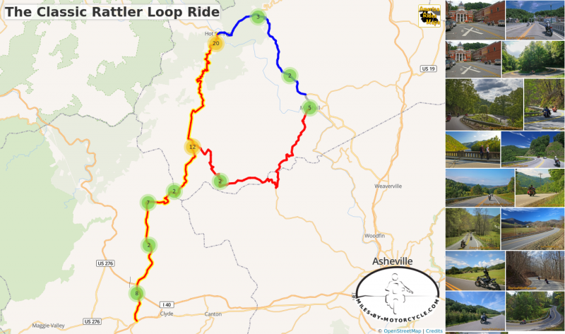
The Classic Rattler Loop Ride
This is the most common loop ride done with "The Rattler" - NC 209. It starts and ends at Junaluska covering about 100 miles. This is one of the best Blue Ridge Mountain riding experiences with mountain climbs, beautiful valleys, a nice mix of easy and challenging terrain, historic places and sights, lots of stops, and great scenery.
GPX tracks of these rides can be downloaded from the individual ride plans.
These Roads are found on America Rides Maps -
#6 The Best Motorcycle Rides Near Smoky Mountains Park - EAST
12 Classic Deals Gap Motorcycle Rides
100 Great Motorcycle Rides in the Smoky Mountains
The Best Unpaved Roads EAST of Smoky Park
This useful mountain backroad lets you bypass the traffic and congestion around Dillsboro, Sylva, and Cullowhee, NC.
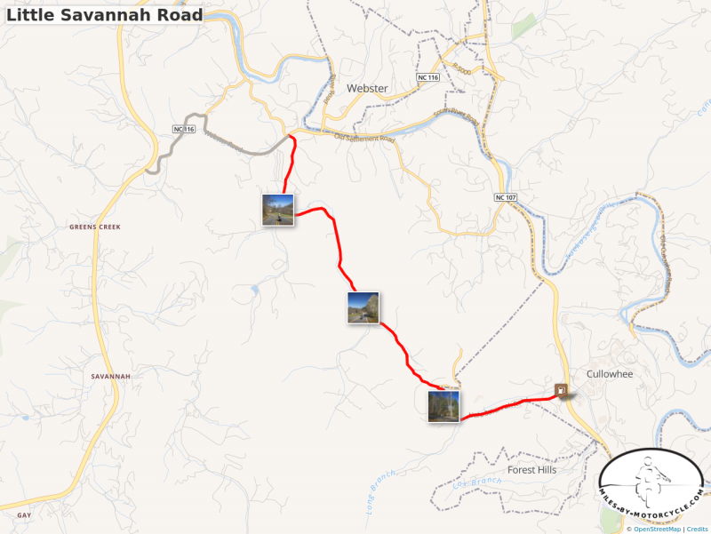
Little Savannah Road
A useful and fun way to avoid the traffic in Dillsboro, Sylva, and Cullowhee. GPX download enabled.
While it's only 5 miles long, Little Savannah Road can save you time and give you a much better ride than the main roads. This two lane twisty backroad is a great way to link US 441 to NC 107 without passing through Dillsboro and Sylva. A short section of Webster Road (NC 116) completes the bypass.
These Good Motorcycle Rides and many others can be found on motorcycle ride maps -
Map #7 - The Best Motorcycle Rides Near Smoky Park - SOUTH
Map - 100 Great Motorcycle Rides in the Smoky Mountains
Map - 100 Rides in the Southern Blue Ridge
Map OR2 - The Best Unpaved Roads SOUTH of Smoky Park
ADV Motorcycle Ride - Hurricane Creek / Wesley Creek Road
Just east of Great Smoky Mountains National Park you'll find one of the most challenging unpaved motorcycle rides in the area.
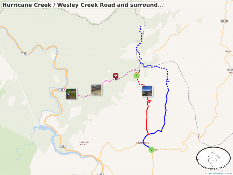
Hurricane Creek / Wesley Creek Road and surroundings
The ride on Hurricane Creek Road / Wesley Creek Road is one of the most challenging unpaved rides in the area.
There are plenty of good national forest roads in the area near the North Carolina / Tennesse border. The bulk of them are well maintained gravel roads. Hurricane Creek Road is an exception.
Unable to embed shared object. Sharing permissions error?
The west end of this route connects to Interstate 40 in the scenic Pigeon River Gorge. It can only be reached from the northbound lane heading into Tennessee. The tiny road disappears into the forest just beyond the large "Harmon Den - 1 Mile" highway sign.
The east end of the route connects to Max Patch Road north of the Fines Creek Community. Here it starts as paved Wesley Creek Road marked with a "No Outlet" sign. The narrow paved section of Wesley Creek Road climbs through some very steep switchbacks. The pavement ends as it approaches Bear Wallow Gap then sneaks into the woods.
True to it's name Hurricane Creek Road skates along the edges of the creek as it gradually climbs from west to east. Not long into the ride you face the big water crossing, an intimidating pool, the first of many more crossings though none so large. The ride is rocky, wet, full of holes and ruts. Eventually the creek fades and Hurricane Creek Road meets Wesley Creek Road. A spur shoots north to Max Patch Road and you can escape the ride here if you've had enough.
Continuing from the junction, Wesley Creek Road soon turns into the roughest, steepest, and rockiest portion of the ride. The pavement begins once you reach the crest and drop through a few good curves.
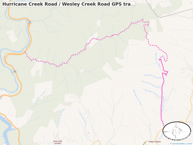
Hurricane Creek Road / Wesley Creek Road GPS track
Starts at I-40, west end. Single track linking the two roads for download as a .GPX file.
This mapped route is done west to east making the climb. The large water crossing is a little easier this way, the steep rocky spots at the top a little more difficult. Riding it the other direction, east to west, the downhill may make the steep parts easier and the water challenge a little tougher. Either way Hurricane Creek Road is quite a ride for those who like a challenge.
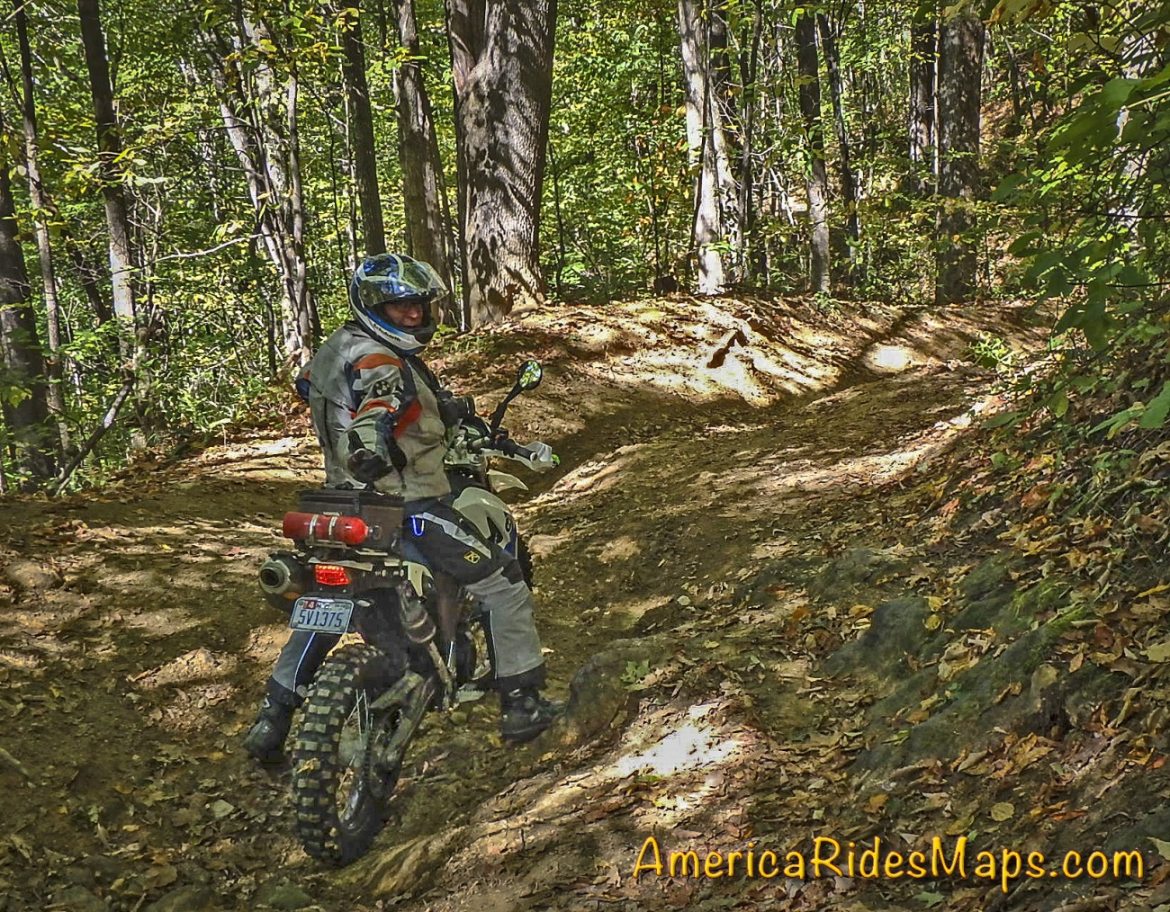
Hurricane / Wesley Creek Rds Group Dec 2 17
A group ride on Hurricane Creek Road to Wesley Creek Road with a talented bunch of adventure riders. Wet, rocky, steep near the end.
These Unpaved Roads and many other Great Rides are found on Map OR1 - The Best Unpaved Roads EAST of Smoky Park
You'll find the wealth of fabulous Paved Roads in this area on maps -
Map #6 - The Best Motorcycle Rides Near Smoky Mountains Park - EAST
Map - 100 Great Motorcycle Rides in the Smoky Mountains
Waterproof, durable, easy to read, Motorcycle Ride Maps done right!
More than 1000 Motorcycle Riders and Sports Car Enthusiasts Flock to The Dragon every day during the peak season -
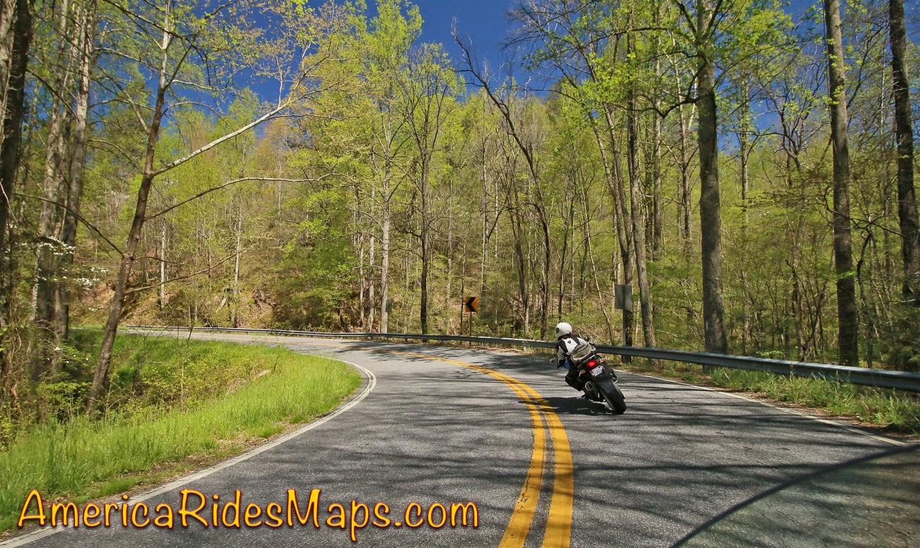
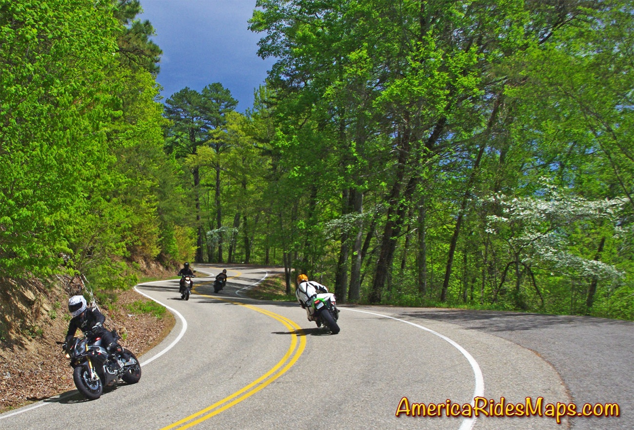
The Dragon (a.k.a Tail of the Dragon ®) is famous for it's 318 curves in 11 miles; it's America's number one motorcycle and sports car road.
The Cherohala Skyway, designated a National Scenic Byway, is essentially a supersized version of the Dragon. It's almost 50 miles long with nearly non-stop sweeping curves the entire way running along the highest ridges of remote mountains in Tennessee and North Carolina. The views from the overlooks are spectacular.
This is the classic loop ride which combines them both.
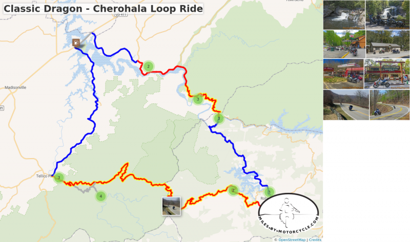
Classic Dragon - Cherohala Loop Ride
120+ miles.
Meet at The Hub Restaurant in Robbinsville, NC.
Ride north on US 129 to the NC start of The Dragon at Deals Gap, NC.
Break stop at Deals Gap Motorcycle Resort for swag.
Ride through the Dragon.
Break stop at the Calderwood Overlook.
Follow US 129 along the lake to Punkin Center.
Turn onto TN 72, follow through to US 411.
Cross the lake on US 411 to Vonore.
Break stop at gas station corner of US 411 and TN 360.
Follow TN 360 south to Ballplay. Turn left at stop sign to continue to Tellico Plains.
Turn on to the Cherohala Skyway. Lunch stop at Tellico Kats Deli.
After lunch follow the Cherohala Skyway to River Road and ride out to Blad River Falls and Baby Falls. Break at Baby Falls.
Follow River road back to Whiteoak Road then out to the Cherohala Skyway.
Ride the Cherohala Skyway then turn onto Snowbird Road and follow into Robbinsville.
These and many other Great Roads are found on maps -
Map #7 - The Best Motorcycle Rides Near Smoky Park - SOUTH
Map #8 - Best Rides NORTH of Smoky Park
Map - 12 Classic Deals Gap Motorcycle Rides
April views of motorcycle rides near the Smoky Mountains
By mid April spring is coming on strong in the Blue Ridge Mountains. The electric green leaf shoots are exploding on the trees. The first purple and white flowers are showing on the wild dogwood and cherry trees along the roadsides.
While you can expect chilly weather early in the month, you'll also start getting days that reach the 70's. It's still jacket and gloves weather for the most part, especially in the morning. By afternoon it can be quite comfortable.
Motorcycle friendly businesses are open by April and eager to see you. Events and rallys have started. It's early in the tourist season, easy to find rooms, lodging , and campsites.
While things are greening up at the lower elevations, the trees at the mountain tops will still be bare. The high country lags several weeks behind the valleys.
Come on up to the Smoky Mountains and enjoy the early riding. It's a relaxing easy time for motorcycle touring and exploring some new roads.
A good set of maps will help you find the hundreds of great roads waiting for you!
Order now!
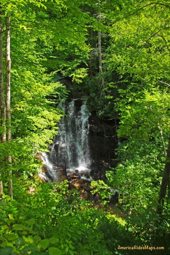
The Easy Waterfall Ride
Tour a dozen roadside waterfalls on this scenic day ride.
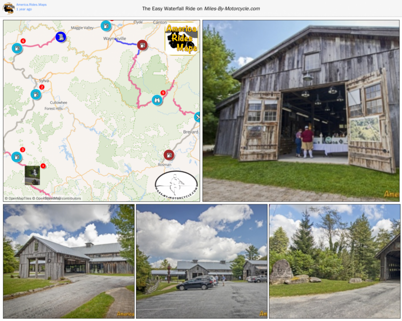
The Easy Waterfall Ride
This is a nice 165 mile loop ride that will take you to a dozen roadside waterfalls in a day. I suggest you run it counter-clockwise as the section between Franklin and Highlands can get busy later in the day and you'll get the 4 lane riding out of the way early. You'll ride some very curvy roads, hit some nice scenery, and take in one section of the Blue Ridge Parkway. Bring the camera!
Distance: 165 miles
Ride Time: All day ride
Start: Maggie Valley
Ride: Maggie Valley to Franklin
-
Follow US 19 - Soco Road west and climb to Soco Gap. Pass under the Blue Ridge Parkway and start dropping from the heights on US 19 - Wolfetown Road. Ride through a long passing lane then hook around a curve. The unpaved parking area for Soco Falls is located on the next sharp turn.
- Leaving Soco Falls wind down to Cherokee on US 19 - Wolfetown Road. When you get to Harrah's Cherokee Casino, turn left onto Casino Road to cut to US 441-S. Turn left onto US 441-S and follow to Exit 74 EAST onto US 74 / 441. Follow to Dillsboro Exit 81 south to Franklin. From Dillsboro, ride south 18 miles on US 23 / 441 - Sylva Road to NC 28 / US 64 - Highlands Road in Franklin.
Ride: Franklin to Brevard
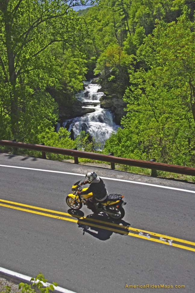
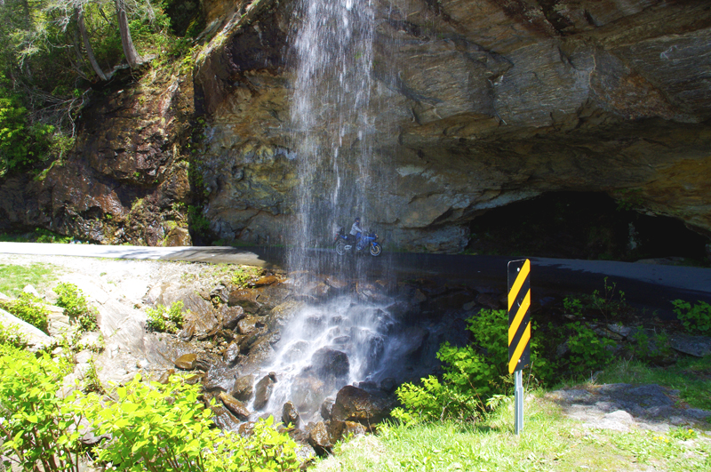
- NC 28 / US 64 - Highlands Road rolls out from Franklin along the Cullasja River through gentle country then quickly turns sharp when reaching the Cullasaja River Gorge. You'll encounter four nice roadside waterfalls as NC 28 twists into Highlands. Turn north on US 64 - Rosman Highway inHighlands and follow to Cashiers. You'll pass Toxaway Falls as the road continues to Rosman. US Highway 64 run seast from Rosman through buslting Brevard. Follow through to the intersection with US 276 - Pisgah Highway.
Ride: Brevard to Maggie Valley
-
US 276 - Pisgah Highway leads north along the Davidson River into a very popular area of thePisgah Forest. It's a pretty ride but expect congestion on nice weekends. Looking Glass Falls is the noteable attraction here, worth a stop for a closer look and a photo. Soon after you'll pass Sliding Rock. The road gently climbs higher and higher through pleasant twists. The higher you get the steeper the grade and the turnns grow progressively sharper. Arrive at the Blue Ridge Parkway junction at Wagon Road Gap at the top of the climb. The Cold Mountain Overlook is a good rest stop.
-
Ride the Blue Ridge Parkway south towards Cherokee. You'll pass the Graveyard Feilds Overlook with it's large and busy parking area. Second Falls is located here. Exit the Blue Ridge Parkway atBeech Gap onto NC 215 - Lake Logan Road.
- NC 215 - Lake Logan Road drops from the Parkway passing Bubbling Springs Falls and then Sunburst Falls. It winds and twists down to Bethel where it meets US 276 - Pigeon Road. US 276 - Pigeon Road takes you through Pigeon Gap into downtown Waynesville. Follow Main Street then US 276 - Russ Avenue to the junction with US 19. Follow US 19 - Dellwood Road back to Maggie Valley.
List of waterfalls -
- Soco Falls
- Cullasja Falls
- Bust-Your-Butt-Falls (Quarry Falls)
- Dry Falls
- Bridal Veil Falls
- Sequoyah Falls
- Toxaway Falls
- Looking Glass Falls
- Sliding Rock
- Second Falls
- Upper Falls
- Bubbling Spring Falls
- Sunburst Falls
These and many other Great Roads are found on America Rides Maps -
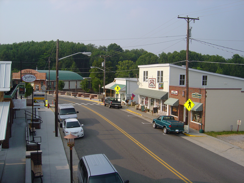
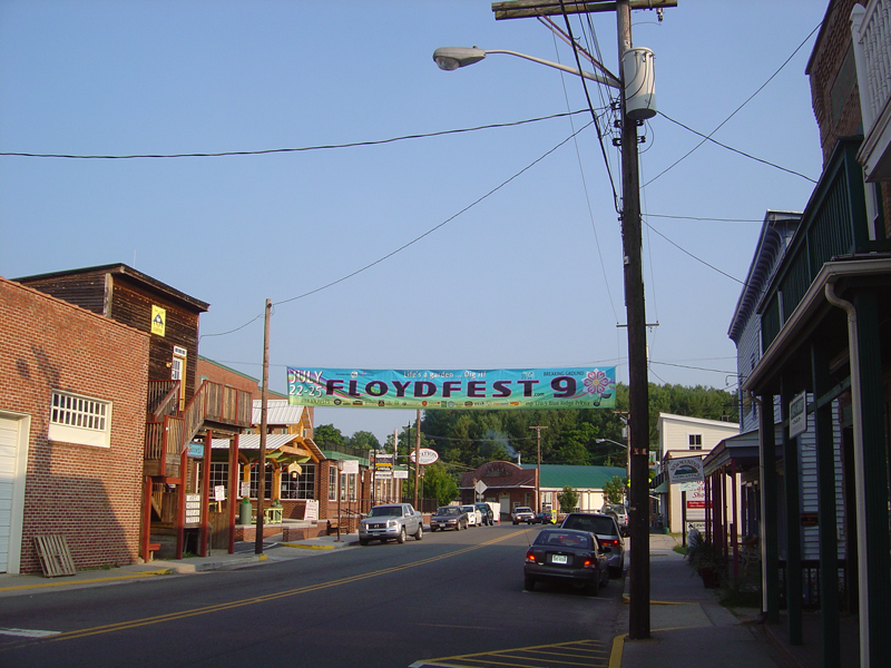
The Best Curvy Roads Near Floyd, VA
Floyd, Virginia sits just 6 miles from the Blue Ridge Parkway not far from the border with North Carolina. It's a favorite place to stay as it's such a fun town with good food, nice shops, lots of live music and great roads to ride all around. This is a nice loop ride from town that takes you on some fun roads.
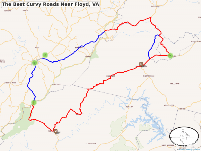
The Best Curvy Roads Near Floyd, VA
This 59 mile loop south of Floyd, VA takes you on a nice romp through some of the best twisty sections of the road near town. It crosses the Blue Ridge Parkway twice, and runs through the campus of historic Ferrum College. Sawmill road can be used to bypass the school.
START: Floyd
RIDE: Floyd to Ferrum
- Take VA 8 south from town towards the Blue Ridge Parkway. It's an easy ride, nice and curvy, that soon leaves town behind rolling out into the woods and farms. You'll reach the parkway at Tuggles Gap.
- Pass under the Parkway and continue on VA 8. Tuggle's Gap Restaurant and Motel are just off the parkway exit. Beyond, VA 8 makes a twisty plunge through a series of nice switchbacks before it relaxes again on the way to Woolwine.
- Turn onto VA 40 - Charity Highway to start the ride east. You'll soon hit the first twisty section. It's a mostly wooded run, surrounded by hills with a few homes here and there. The road remains full of curves for several enjoyable miles. It doesn't relax until you get near Ferrum.
- The valley opens up as you near Ferrum. You can use Sawmill Road to bypass Ferrum College, though it's a nice ride through the historic campus and there are some curves just over the hill you'll miss. When you reach the college turn onto Ferrum Mountain Road.
RIDE: Ferrum to Floyd
- Pass through the campus on Ferrum Mountain Road then wind down the back side of the mountain. It's wooded, tight and twisty until you reach some broad open feilds. When you pass them and reenter the woods, watch for the turn onto 5 Mile Mountain Road.
- 5 Mile Mountain Road is a tiny paved road which rolls through homes and open fields for a bit then gets twisty as it climbs up onto the mountain. There are several unpaved pull-offs along the road where you can get views back down the valley. You'll emerge from the trees into some small farms and arrive at a stop sign at the Blue Ridge Parkway.
- Cross the Blue Ridge Parkway onto Franklin Pike SE. It meanders through wooded spots and farms as it makes it's way back towards Floyd. You'll arrive at US 221.
- A short section of US 221 brings you back to the heart of town.
END: Floyd
These and many other Great Roads are found on maps -
Map #2 - The Roads Of Roanoke and Beyond
Map #3 - North Carolina / Virginia Border Rides
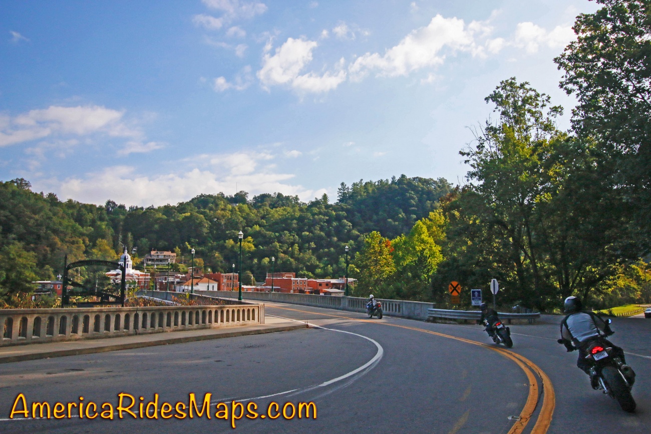
The Classic Rattler Loop Ride
Long popular with locals, NC 209 takes you on a wonderful scenic and challenging ride north to Hot Springs. Continue through Hot Springs on US 25, pass through Marshall, then follow Meadows Town Rd to NC 63. NC 63 leads you back to NC 209. 98 miles in all, it's 1/2 day ride.
START: Junaulska
Ride: Junaluska to Hot Springs
-
NC 209 - "The Rattler" starts at Exit 104 on US 19 / 74. A Lowes Store is the landmark at this exit. NC 209 - Crabtree Road winds north through the valleys near the Pigeon River, crosses over I-40 at Exit 24 then becomes NC 209 - Rush Fork Road once it leaves the river valleys. Sweeping curves flow through mountain farmland, climb to Rush Fork Gap then drop to the Fines Creek community.
-
NC 209 then shoots east as Betsy's Creek Road rolling into another farm valley for several miles. The landmark at this turn is Ferguson's Supply Store. Just beyond you'll find the "Rattler" sign and a chance to buy t-shirts and swag at the roadside. The road hooks around and climbs Lab Mountain to enter the first section of tight twists through rocky cuts. Cresting Besty's Gap it descends along Spring Creek. The curves relax and you'll pass historic Pink Plemmon's Store as you roll into the tiny settlement of Trust.
- The Trust General Store is the landmark here. Note the junction with NC 63 - you will return from here to Junaluska to complete the loop ride.
-
NC 209 soon makes a long straight shot across broad Spring Creek Valley then follows the banks of the creek for several more miles of nice curvy road.
- A sharp hook marks the start of the climb above the creek as you enter the National Forest. Challenging tight curves cut through the rocky bluffs high above the river. As you near Hot Springs a couple nice overlooks offer good stops for photos.
- NC 209 then drops and draws near the river again becoming Lance Avenue as you enter Hot Springs.

Ride: Hot Springs to Marshall
- Passing through Hot Springs, Lance Avenue becomes US 25 / 70 once you cross the French Broad River. It climbs from the river through sweeping curves then makes a long slow descent to a stop sign at Big Laurel Creek.
- Turn right to continue south on US 25 / 70. The road winds along for several miles to reach the well marked turn onto North Main Street into Marshall. Continue to the stop light in the center of town.
Ride: Mashall to Junaluska
- Turn at the traffic light in Marshall and cross the French Broad River to reach Baily Branch Road. It winds through hilly terrain south of the river to become Meadows Town Road. You'll reach a stop sign at NC 63 - New Leicester Highway.
- Turn right and follow NC 63 - New Leicester Highway carving up and over Doggett Mountain then down through the switchbacks to return to NC 209 in Trust.
- Turn left and follow NC 209 back to Junaluska.
END: Junaluska
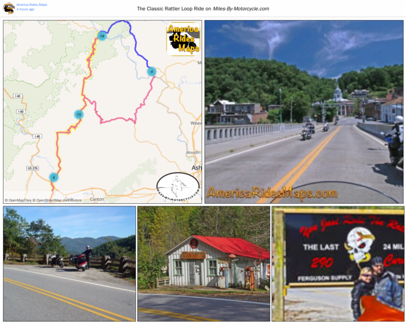
The Classic Rattler Loop Ride
This is the most common loop ride done with "The Rattler" - NC 209. It starts and ends at Junaluska covering about 100 miles. This is one of the best Blue Ridge Mountain riding experiences with mountain climbs, beautiful valleys, a nice mix of easy and challenging terrain, historic places and sights, lots of stops, and great scenery.
It all started with a cup of coffee on a motorcycle ride to Hot Springs, NC, May 21, 2015.....
Yermo and I had become friends on Facebook. When he came south to the Smoky Mountains we arranged to meet for a ride. It was a warm day in May and he had a friend tagging along. We ripped along through the mountains stopping in Hot Springs for coffee. We talked about maps and his Miles-By-Motorcycle site. It was a good day, a good ride, and we parted ways.
I next met Yermo on October 16, 2016. He was taking a long route home after crossing the country on the Trans America Trail. I looked forward to hearing tales of his adventure. I did not suspect he was bringing an idea that would bring us together from then on.
I'd been looking for a way to move my printed maps into digital format. I couldn't figure out how to prevent them from being too easily shared. With 10 years of work into them I wanted to grow my business, not give it away.
Yermo had a solution, but said he needed my help to make it work. Over the next few days we rode, we talked into the night, we agreed to work together.
Motorcycles on Horse Pasture Road
A minute riding 650 ADV bikes on a fun section of this unpaved road in South Carolina.
18 months later we've made tremendous progress. I've digitized more than 1000 roads. We've been building the features, testing the components, and using the system to make our own trip plans and rides. It's been 7 days a week, all hours of the day, every spare moment spent working on this project and it's close to being ready for a first release.
So that's how this all got started and where we are today. There has been some riding along the way (the videos) but it's mostly been driving a keyboard. It's now time to get ready for release and start bringing some people like you on board. Things will get better, there's yet a lot to be done, but the ball is rolling downhill now.
America Rides Maps
Maps of Great Motorcycle Rides in the Blue Ridge Mountains. Blue Ridge Parkway, Tail of the Dragon, hundreds of great biker roads for motorcycle touring. Tennessee, North and South Carolina, Virginia, Georgia motorcycle ride maps,
http://AmericaRidesMaps.com
America Rides Maps makes the most detailed and comprehensive maps of the Blue Ridge Mountains. A series of easy-to-use pocket maps cover the mountains from Virginia to Georgia showing all the best roads and good roads to link them together.
100 Great Motorcycle Rides in the Smoky Mountains | America Rides Maps
100+ Great roads surrounding the Smoky Mountains
https://americaridesmaps.com/produc...
Southeast Blue Ridge Map Package | America Rides Maps
Full Southeast Package, motorcycle maps, motorcycle touring, touring the blue ridge, ride the Blue Ridge Parkway, best motorcycle rides
https://americaridesmaps.com/produc...
Motorcycle Rides surrounding Great Smoky Mountains National Park | America Rides Maps
Motorcycle Rides surrounding Great Smoky Mountains National Park maps, motorcycle smoky mountains, great rides near Great Smoky Mountains, Best motorcycle rides
https://americaridesmaps.com/produc...
3 Map Smoky Park Unpaved Set | America Rides Maps
The unpaved roads in and surrounding Great Smoky Mountains National Park
https://americaridesmaps.com/produc...
#6 The Best Motorcycle Rides Near Smoky Mountains Park - EAST | America Rides Maps
East and south of the Smoky Mountains, the land of the Waterfalls.
https://americaridesmaps.com/produc...
#7 The Best Motorcycle Rides Near Smoky Park - SOUTH | America Rides Maps
South and west of the Smoky Mountains, Waterfalls, The Dragon, and some of the best riding.
https://americaridesmaps.com/produc...
Best Rides NORTH of Smoky Park | America Rides Maps
Rides on the North side of the Smoky Mountains around Gatlinburg, Pigeon Forge, an the surroundings.
https://americaridesmaps.com/produc...
Tags
- 5 americaridesmaps
- 4 north_carolina
- 4 map100smokies
- 3 map6
- 3 scenic
- 3 Map12ClassicRides
- 2 vlogging
- 2 overlook
- 2 historic
- 2 tennessee
- 2 video
- 2 attraction
- 2 MapOR2
- 1 Virginia
- 1 classic
- 1 GoPro
- 1 named
- 1 map2
- 1 MapOR1
- 1 map7
- 1 map8
- 1 mapor1
- 1 Roanoke
- 1 Map100SouthernRides
- 1 Connects_To_Parkway
- 1 Blue_Ridge_Parkway
- 1 view
- 1 map9
- 1 Georgia
- 1 books
- 1 west_virginia
- 1 swag
- 1 store
- 1 Good_Rest_stop
- 1 TN
- 1 coveredbridge
- 1 gopro
- 1 mapOR3