
Ford Routes and Western Maryland Ride

The original plan had been to lead Duncan and Bruce down to the area where I had accompanied Wayne, of America Rides Maps, as he scouted routes for his new Virginia and West Virginia maps. Those roads were nuts. But due to circumstances well out of our collective control, a multi-day trip this year isn't in the cards.
We had gone on a short-ish ride in the damp and cold on Saturday. I hadn't slept the night before so was absolutely stupid tired. Nevertheless, it was a good ride but the weather forecast for Monday was looking really good. Bruce and I had discussed going on a ride. "I feel bad Duncan has to work and won't be able to join us. It feels wrong." I said. When we mentioned it to Duncan, to our surprise the stars aligned and Duncan declared he'd take the day off to join us. This is to my recollection unprecedented. Awesome!
The plan was to attempt an early start and do a properly long day ride like we haven't been able to manage all year. One of the downsides was that despite my best intentions and to Duncan's chagrin, I have not yet gotten the Beloved Blue Oil Burner reassembled. That project is ongoing.
The Great BMW K100RS 16V Engine Swap Project of 2019
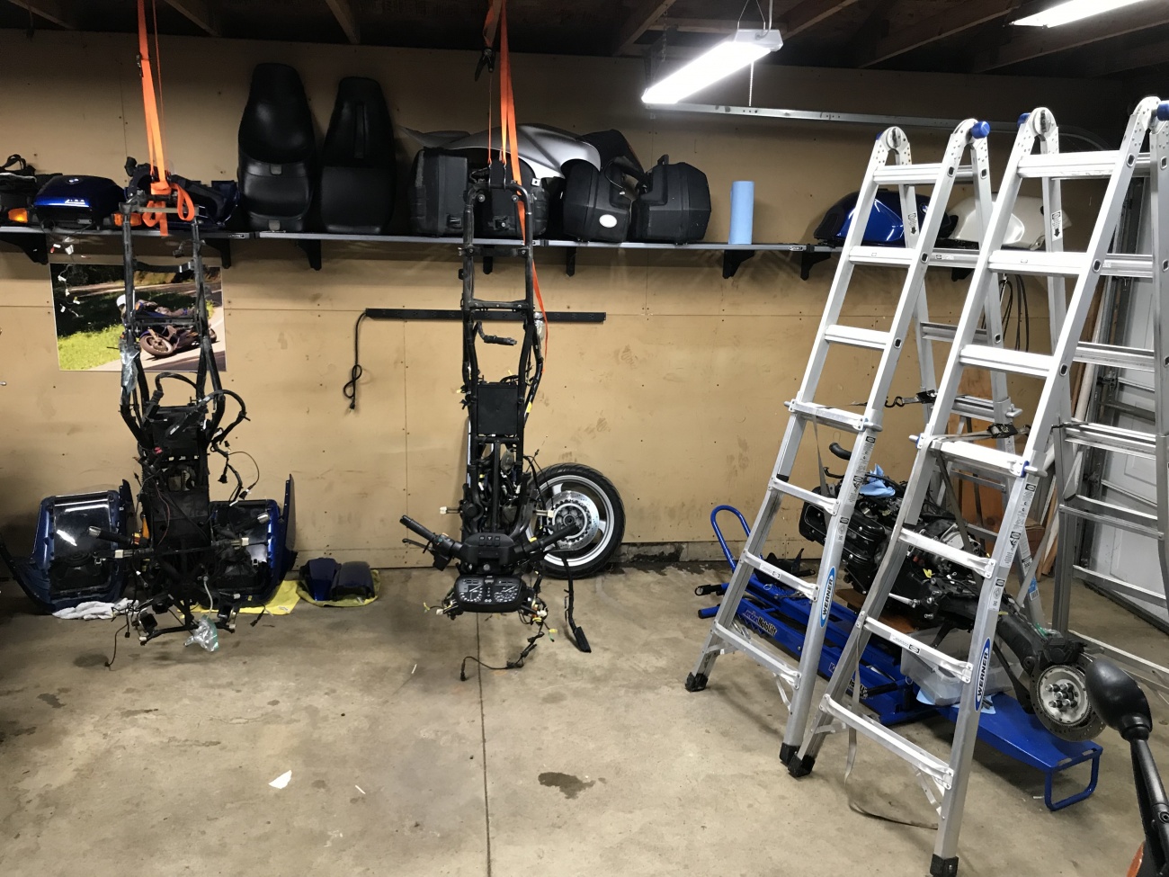
My '92 K100RS 16V with 123,000+ miles on it started significantly consuming oil and fouling plugs. It started smoking dramatically on deceleration as reported by Duncan. A compression test and leakdown showed a variance of more than 20% between the cylinders. My best guess is that two things failed in concert: the thermostat stuck open and the temperature gauge did not read accurately. As a result, the theory goes, I ran the bike too cold for probably too long and that caused it to fail.
I had picked up a spare identical bike because I wanted to swap out the fairing since mine had started looking pretty rough. The donor bike is actually in much better shape and a saner man would just have attempted to transfer parts from my bike over. But as it turns out the donor bike also needed the water pump rebuild, the rear main seal, and other work including cleaning up evidence of some monkeying by previous owners.
As a result, I made the decision to disassemble both bikes and create one decent machine from the best parts of both bikes. We made short work of the disassembly but then with distractions the project has lingered. Time is getting tight as Bruce is going to be flying into town and the three of us hope to go on a multi-day ride. If need be I'll ride my DR650SE but ideally I'd like to have my Beloved Blue Oil burner back in service before then.
To make the job of coordinating parts, tasks, information, and documentation, I've taken a few days away from banging my head against the mobile app development wall, and built out a project/build feature which months ago I had discussed with Mike. It's super rough at the moment but it presents the beginning of a place to thoroughly document one of these big projects along with all the associated rich media that goes with it. My hope is that it's going to be useful.
This means I would have to ride my Suzuki DR650SE which isn't ideal for lots of street miles, especially considering we would likely be superslabbing it back home. My neck, back, and hips have a tendency to lock up painfully on that bike especially in the cold at highway speeds. But I've done 575 miles on it in a day, so I know it's doable. It'll just hurt.
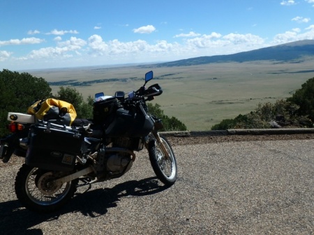
2009 Suzuki DR650SE
The Mule
This is a bike that I bought specifically for the purpose of riding the Trans Am Trail. I did eventually, in 2016, ride it through about 2/3 of the trail.
Given that we only had one day, we wanted to increase our chances that it would be a good ride. The problem is all of the best roads I could think of off the top of my head are an hour or more away and on a Monday traffic around DC would suck.
After some discussion, I mentioned that maybe we could retrace some of the roads Jim Ford, of the RIder's Workshop, had taken us on some years ago. They were much closer and we could avoid the Beltway to get there. We remembered them to be particularly good. "But it was a pretty short ride." Duncan reminded me. "Maybe I can cobble something together from some of our other rides further out West." I replied. Duncan mentioned a road with a view over the Potomac that had been particularly good with lot's of elevation changes. I picked up the phone and searched the map for some of our old rides. "Savage River Road?" I asked. "Maybe." (We would realize much later that Savage River Road had little to do with the Potomac.) It was agreed to try to cobble together a route based on the best parts of our previous rides to create a route out to the panhandle to finish up on Savage River Road.
Since creating the initial mapping features on the site, I've religiously uploaded tracks from my GPS after each ride and often annotate them to remind myself what was good. (Soon I'll be able to do this from the mobile app.)
Searching over past rides, I came across the entries for these three, each of which was pretty good.
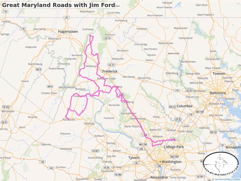
Great Maryland Roads with Jim Ford
I had the pleasure of going for a day long ride with Jim Ford, the guy behind the Riders Workshop.
http://www.ridersworkshop.com/
I have a gift for finding good roads, but I cannot touch the talent that Jim has. This was an incredible ride that ran through areas that I thought I knew well.
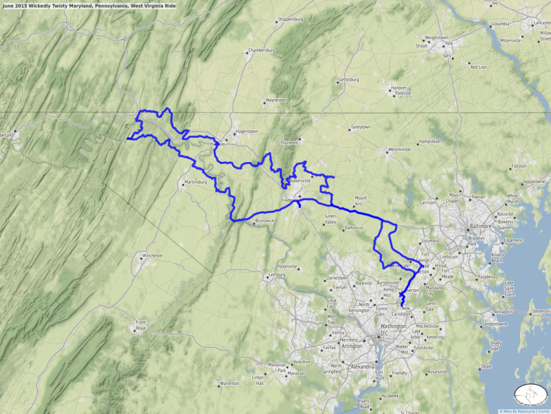
June 2015 Wickedly Twisty Maryland, Pennsylvania, West Virginia Ride
 buffalo and I went on a 305 mile loop ride with a group of riders led by Jim Ford of the Riders Workshop ( http://ridersworkshop.com ).
Jim's ability to stitch together small sections of twisty roads into a cohesive tour is truly impressive. It's hard to believe there are all these small gnarly roads so close to DC.
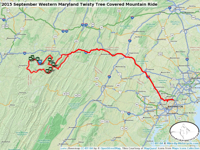
2015 September Western Maryland Twisty Tree Covered Mountain Ride
Why didn't anyone ever tell me the roads in the Western Maryland Panhandle were so good?
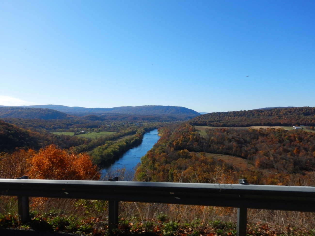
buffaloare I took our sport touring bikes (he on his 2009 BMW K1300S and me on my 1992 BMW K100RS) and rode out from the DC area to exit 34 on route 68 just past Cumberland Maryland. I had see Savage River Road on a map another member here posted and wanted to check it out. I thought it might turn into gravel but it turned out to be just a wonderful little twisty hilly tree covered mountain road that went on for a good ways along a mountain stream. In higher elevations the leaves were already starting to turn so some corners appeared treacherous.
This went on for quite some time and that road is worth the trip out there alone. It just a stunningly beautiful area. Duncan had never seen Deep Creek Lake before so we made our way out there and had lunch at the Pine Lodge Steakhouse. I had been there last year.
From there we took Sang Run Road to White Rock Road and once again found ourselves in just wonderfully hilly tree covered mountainous terrain. This trend continued to the Westernmost border of Maryland and through West Virginia as we made our way South.
We took Route 7 east. This was a bigger less interesting road which eventually turned into 39 and then 135. Once we turned off on 38 the roads got good again and this trend continued on until we reached 220 at which point it was time to head back home.
All told our loop was just under 420 miles and we hardly noticed the distance. Over the last few weeks we've just had the best luck finding great roads, but this area around the Western Panhandle will need to be explored a little more thoroughly.
So I picked what looked to be the best parts of each ride and showed Bruce how I could copy them to a new map and trace a single coherent route over them. I knew the roads Jim had taken us on were really good. Looking at the map the one ride went close to Berkeley Springs, WV. Route 9 from there is awesome up and over the mountain and there's this incredible overlook there. It would be a good place to stop.
Then I remembered a road Katy Clark, of Katy Clark Art and Design, had mentioned, Detour Road, just off of WV 9 a few miles past the overlook. (If you check out her Lino Prints, the one of the K100RS is my Beloved Blue Oil Burner. :) )
I had really wanted to check out that road, so I added it to the plan. I improvised a bit to connect the sections by picking the squiggliest roads I could find that weren't too close to towns. I had no way of knowing whether these would be any good. I connected those to the roads that led to Savage River Road and at that point, about 40 minutes later, I had what looked to be a pretty decent ride assembled with 80 waypoints. (Why do all other mapping solutions out there limit the number of waypoints on a map? Google allows you 10. Others limit it to 25. When I plan a longer trip I'll often have over 100. So I don't impose a limit here. Maybe that'll come back to bite me if we ever get a lot of users here.)
On screen it looked good. Starting at I270 and MD 80 not far from Frederick, the route wended it's way through 190 miles of back roads to end up in the Maryland pandhandle. That's a lot of back roads.
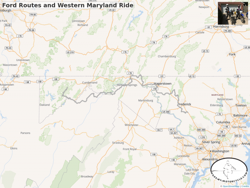
I exported the route to a GPX file and showed Bruce how I could load it on my Zumo 550 GPS.
We were good to go.
To my absolute shock and horror, Duncan was exactly on time at my house at 10AM. 30 minutes later we were under way.
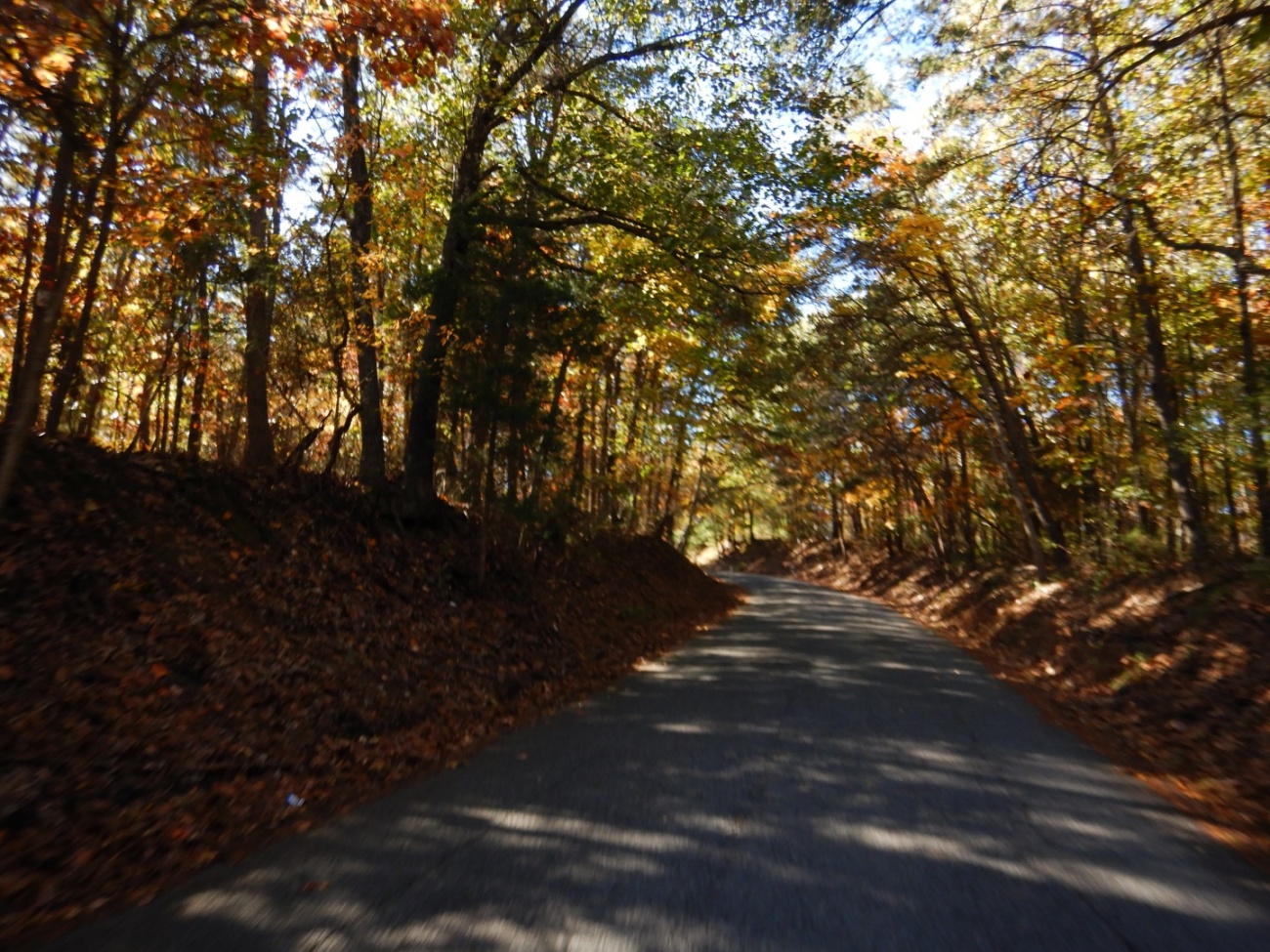
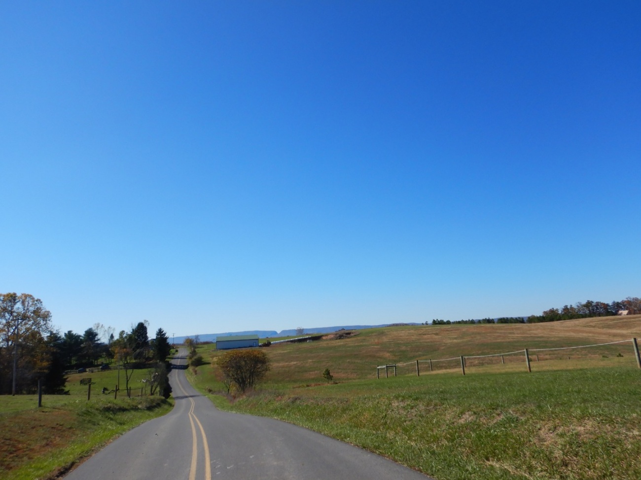
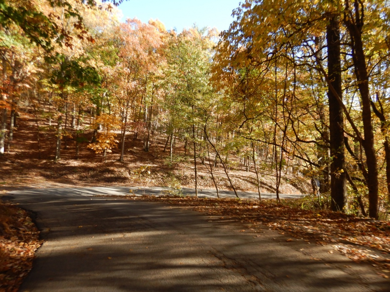
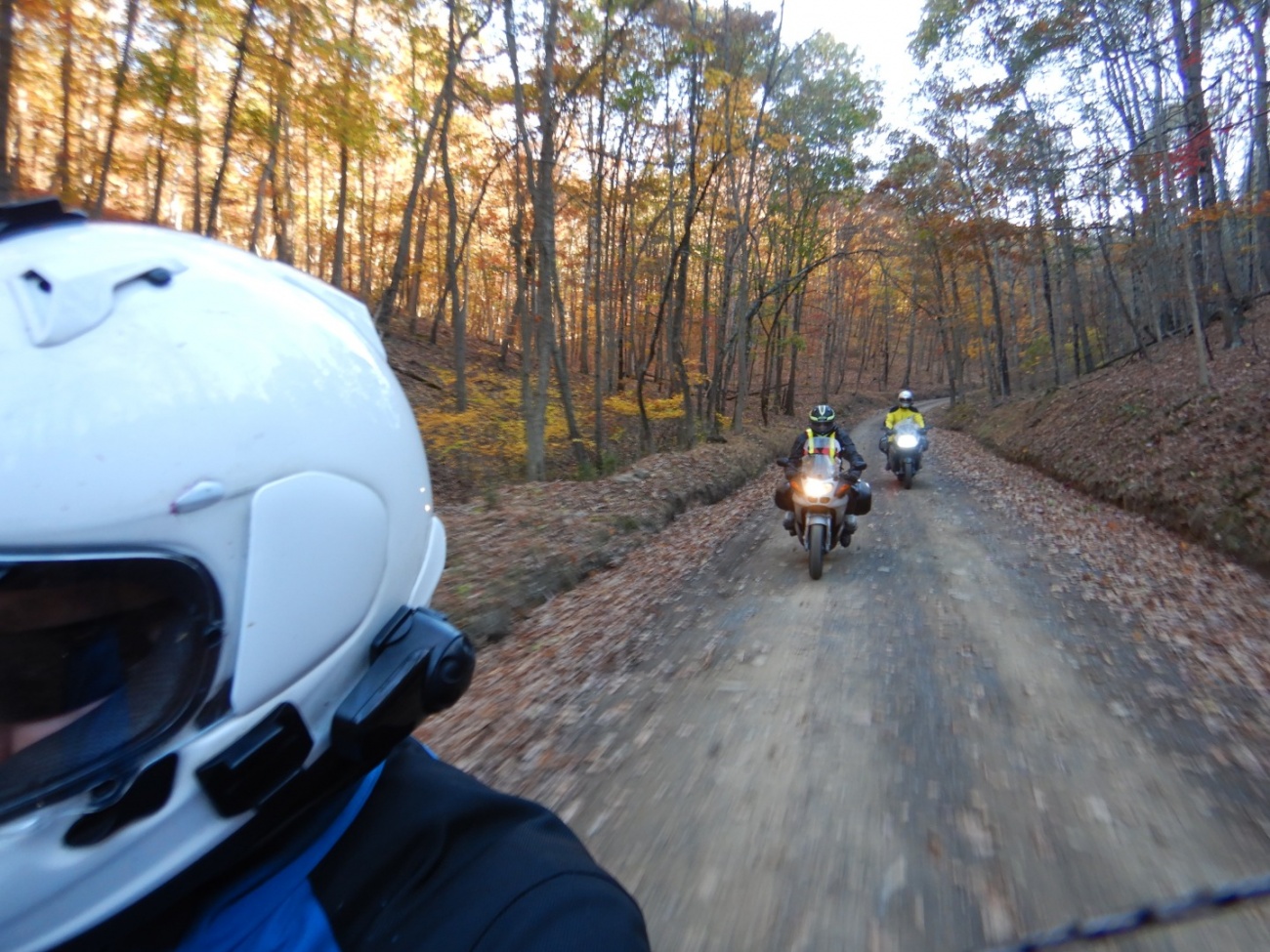
40 or so minutes after that, despite it being a Monday morning, we were on Route 80 heading West. The weather was cool but sunny and near perfect. The trees had all started to turn dramatically. I had remembered these roads being good and scenic but this quickly turned nuts. Deep valley twisty red and orange covered tree tunnel roads, lit by an angled sun, that opened up into expansive views of distant mountains. There were sections where there were leaves on the road but not excessively so. It just went on and on for hours on end through open land, mountains, small towns and more tree tunnels.
It must have been something about the time of year and the company because I didn't remember this being so much fun or so striking.
Photos never do it justice.

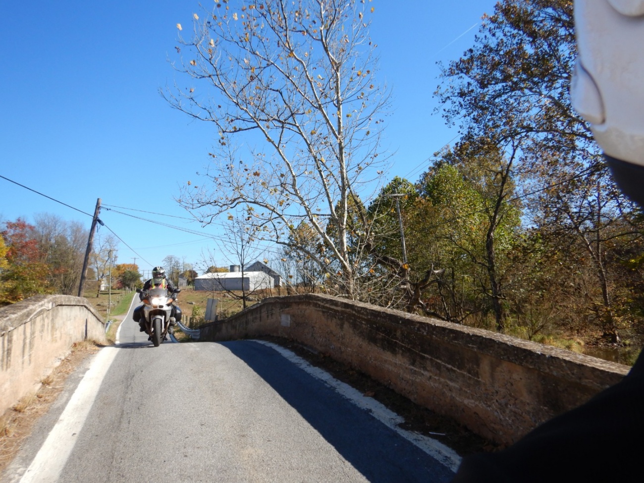

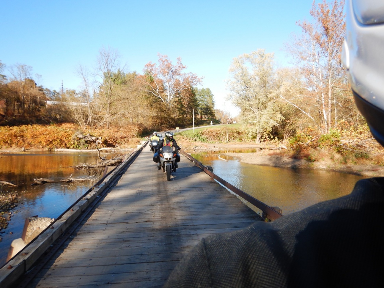
And what's up with all the one laned bridges? We must have crossed dozens, at times two in a row.
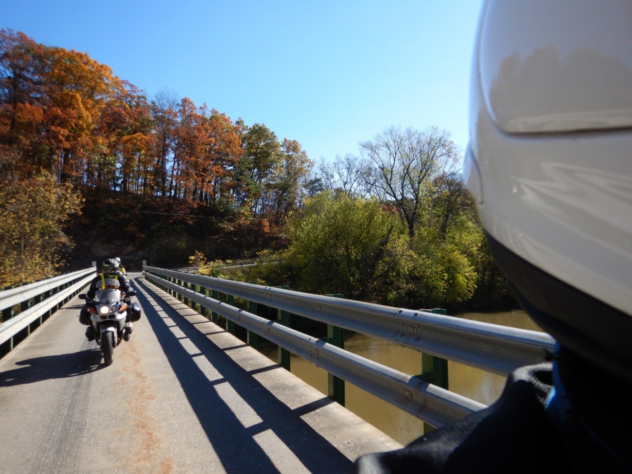
One particularly crazy wooden one lane bridge we came across on Green Spring Valley Road was a toll bridge. $1.50 later and we were experiencing the sketchiness.
There were no bad roads. We did go through a few small towns each with either interesting vehicles or architecture to see, but encountered almost no traffic. Bruce could be heard calling out whatever 60's vintage muscle cars were to be seen which would, like clockwork, start a conversation between he and Duncan about the relative merits of this vs that muscle car and what options and upgrades were available. "If I had the money, I could see getting ...." is one of Duncan's standard comments.
We all run these Bluetooth noise cancelling communicators, called the Sena SMH-10.

Sena SMH-10 Bluetooth Headset Dual Pack - RevZilla
Purchase the Sena SMH-10 Bluetooth Headset Dual Pack at RevZilla Motorsports. Get the best free shipping & exchange deal anywhere, no restock fees and the lowest prices -- guaranteed.
http://www.revzilla.com/motorcycle/...
I had initially been very skeptical of them but after a few rides we were all sold. They allow us to have clear conversations at speed. It has also turned into a safety thing. We find the lead rider rarely notices deer and other side hazards, presumably because he's paying so much attention to the road. Riders in the rear, however, having a bit of attention saved by having a rider to follow, will often notice deer before the lead rider does. The Sena's allow the lead rider to be alerted.
But it goes beyond safety. There's a unique quality to conversations on the bike.
Duncan presciently once said, "I know my life depends on focusing on what I'm doing here so there's just enough attention left over for a conversation. The typical noise that goes on just gets quiet. No todo lists. No troubles. Just the ride, and this conversation." He's onto something.
We often have our best conversations and insights while riding. It's brought us all closer together somehow, if you can believe that friends can become closer even after decades of riding together. Riding is about so much more than enjoyment. It brings with it a strange calming effect, especially on twisty mountain roads. We have our theories as to why this might be the case, but I can definitely report that I just feel better when I ride.
It's been a very long time now since I've felt better.
"I need to ride with you both more often, not less." Bruce declared.
"Agreed." Duncan and I replied simultaneously.
There were quite a few one lane construction sections, but none that cost us all that much time.
The miles passed by seemingly unnoticed; one gorgeous road after another. If it weren't for the GPS there would have been no memorizing this route and doing it by paper map would have involved a lot of stopping to check the map.
"This is a fantastic route." we all commented like a broken record throughout the day. There were crazy 90 degree turns with moguls, something I had not previously experienced. Extreme hills climbing up and then dropping so quickly that it's hard not to catch air.
"I'm always so down about how poor a job I've done on the software and how many problems there are, but if it hadn't been for all this klunky software I've written, there would have been no way to come up with this route and today would not have happened."
"... and especially not planned in 40 minutes." Duncan replied.
It's too easy to focus on the bad, the lacking.
There's a recurring theme in our "Street Rides".
"Eventually, all pavement ends."
Historically, we've been pretty cavalier about unpaved roads. But a while ago, we realized that Duncan's K1300S has the problem that the radiator is very low and gets clogged with debris pretty easily. Since then, we've started being a bit more cautious about it. To my surprise and Duncan's relief, we only came across one unpaved road, Mineral Country Connection Road, which we opted to follow as it was in great shape. Poor Duncan taking up the rear is always covered in a good layer of dust when we do this. I feel bad.
It's marked as a dashed line on the Trip Map (See the Trip Map tab at the top)
Most of what we rode was indeed awesome but four roads stood out for me, marked in Yellow on the Trip Map.
Keadle Road near Mount Pleasant.
Indian Springs Road near Indian Springs, which i think may have been our favorite road of the day.
Detour Road we found to be quite rough but where it connects to Magnolia it gets really good. Wickedly twisty rough pavement with some dramatic views and dangerous off camber corners. On the DR650 it was quite good but as Duncan reported on his BMW K1300S less so. I've marked it as one of my favorites because I was on the DR. But man, that was a fun road. (I'm developing a feature on the site where I can keep track of what roads I like best on which bike. What's fun on a DR650 is not necessarily as fun on a big sport touring rig and visa versa.)
And of course, Savage River Road is wonderful and long. It looked like it had been recently repaved.
After a full day of riding, sunset approached. We headed North to catch I68. Back roads in the dark at this time of years is ill advised because of large forest rats who conspire to ruin your day. So we decided to super slab it. In deference to my typically aching back, shoulders, and the general rest of me, Bruce repeatedly offered to suffer the interstate on the DR. However, I had been doing pretty well and was hardly in any pain at all. I opted to stay on the DR and see if I could do the 165 miles of slab.
I thanked my former self for wiring a BMW style power connector to my DR so I could plug in my electric vest. I had also installed heated grips and a voltage meter since the alternator is pretty anemic. To my surprise, the voltage at highway speed was about normal.
"Probably because of that LED headlight you installed which draws so little." Duncan would say.
I kept the speed down a bit from our usual highway pace. The inverse square law being what it is, 10 mph reduction makes a huge difference.
Thanks to the Sena's , conversation made the miles melt away with us hardly noticing it.
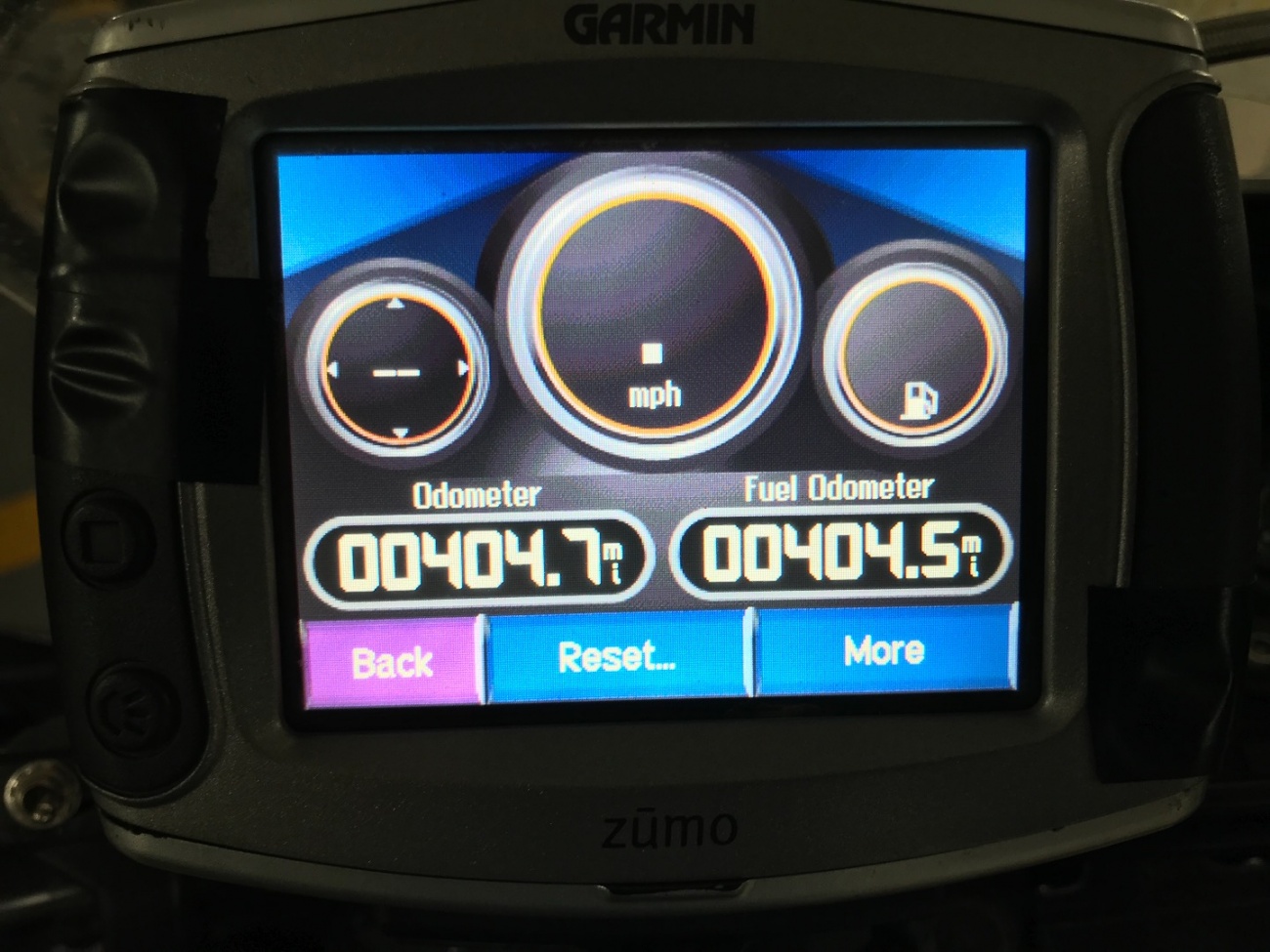
A bit over a couple hours and 165 miles later we arrived at what has become a traditional post ride stop for me, McGinty's Pub in Silver Spring. That made for a total of 404.7 miles with 190 of those being on back country twisty roads on a DR650.
This was a very good day. I need more days like this.

I rarely take substantive breaks. There are always endless reasons not to do things. I get so caught up by the fact that I'm so far behind on all this software development and deadlines pass more often than not. The site isn't what it needs to be. The mobile app, which is coming along, it taking absolutely forever with endless just gut wrenching major setbacks.
So I grind myself down and spend endless hours in front of the computer trying to build this place where I, and eventually we all, can plan and share these motorcycle travel stories.
But it's coming along. Days like this day help to keep me motivated to continue down this road.
I've taken a short few week break from the mobile app slog to focus on rebuilding the map/ride planner here. The focus of this effort is to make something production ready for general use. I've already made good progress and I think it's going to represent a massive improvement over the early version of the tools I've built here.
More on that later.
In the mean time, you can check out the Trip Map tab at the top of the page here which has the full track of the ride with too many photos and the best sections annotated. Give it a few seconds to load. It's a big map.
Tags
- 1 dayride
- 1 ridereports
Archives
- 1 2019