
Mapping Suches - Unpaved

My challenge is mapping a section of unpaved roads in the north Georgia mountains. It's fall, a great time to be in the woods on a motorcycle. I've already done maps of the east, south, and west sides of Great Smoky Mountains National Park. This next map will encompass the unpaved roads in the north Georgia Blue Ridge.
October 7 - Terra Incognita
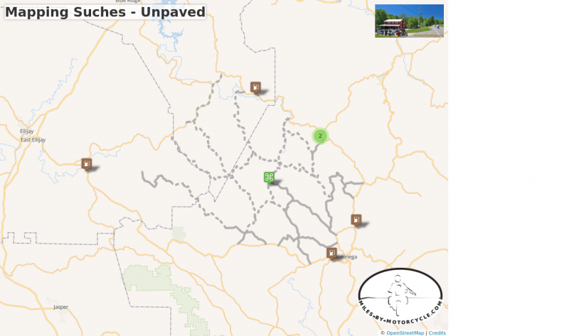
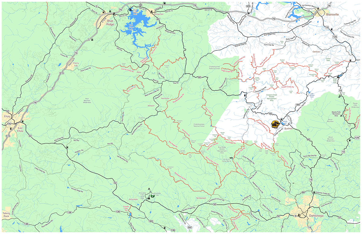
Large areas of National Forest mean there are a good selection of unpaved forest roads in north Georgia. I chose Suches as the area to map as it is such a popular motorcycling destination due to the superb roads in the surroundings. While I've ridden a few of the gravel roads, there are many more to explore.
It took several days to scan for roads around the small town of Suches, GA. Searching for unpaved roads and trails is challenging. I found some US Forest Service maps online which helped. I did google seaches of the roads for info on whether they were open to motorcycles. I used Google satelite imagery to zoom in on the roads enough to guess if they were paved or not. The resolution is not very high and you'd be surprised how hard it is to tell. It takes a long time to be thorough, but it's worth it to take the time now and eliminate roads which are not accessible. Time is precious when it comes to riding them.
One by one I identified likely unpaved roads, then I located all the paved connecting roads which lead to them and connect them together. I laid all these roads out on a digital map.
Suches is surrounded by potential rides, more than can be done in a day. The largest collections were north and south of GA 60. The south side is more dense and the roads longer, probably more than can be done in a short fall day. It's a good place to start.
The best way to map this area would be to plan a stay at Two Wheels of Suches Motorcycle Resort. It would add hours of riding to the days by eliminating the commute to the area. Instead we'll be making this ride in a day.
While there are several ways to get from my home in Waynesville, NC to Suches, they all take around 2 hours. That's 4 hours of the day gone just to get there and back. We'll need gas stops, a bite to eat, and there will be break stops for photos. At minimum we should have 3 solid hours of exploring.
There are at least 75 miles worth of unpaved riding I've already identified. Some of those will turn out to be roads closed to travel or private roads. Based on my earlier research there are likely to be 4WD roads or motorcycle specific trails as well.
My plan for this first visit is to hit the long roads and see the general layout of the area. As we go I'll make note of the side roads that connect and any trails or new roads. It's an initial scouting to get the lay of the land and what to expect on return visits.
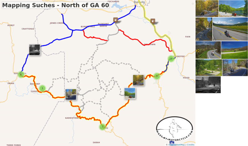
I decided to take a look at the roads north of Suches to see if it made better sense to visit this area first. Both north and south of GA 60 are full of potential. To get to the south section we have to ride past some of these roads. Is it a better strategy to start here?
There are still roughly 50 miles of unpaved roads to explore. Things to ponder.
Almost ready to move back to this project. The weather turned bad, then it was time for our trip out to Snowbird Lodge.
Overnight to Snowbird Lodge - Oct 12 - 13
This adventure took place on 'Thursday October 12th, 2017'
Jackie's going to knock off early on Thursday. We'll leave for the Snowbird Lodge in the afternoon. The more time we have, the more varied the ride out as it's only 1.5 hours to the lodge. There's time to meander and enjoy some twists. The lodge provides dinner, usually 3 entrees to choose from, and the bar is well stocked with good wines. We'll spend a warm night on the porches or a cold one by the fireplace. The lodge provides breakfast, and will pack you a picnic lunch. The next day is for riding back east to home sampling any number of roads in TN, GA, SC, and NC. I'll be laying out that section shortly. Arrival home in Waynesville late afternoon.
I spent the next several days working and riding with Yermo. We got a lot done and hit some extreme roads. Since, I've been mining a new set of maps to scout for additional roads and tweaking the exisiting roads on our maps. I'm just wrapping that up.
Weather fronts have dropped a lot of rain and I'm currently looking for the best bubble of nice air to get things started.
Wednesday, June 6 - arrive Copperhead Lodge, start riding at 10 AM. Return to the lodge for the night.
- Work across the trails north of Suches then onto the roads near Blue Ridge. Come back on roads south of Suches.
Thursday, June 7 - Start Riding after breakfast, 9 AM? Return to the lodge for the night.
- Finish riding the roads south of Suches. Move on to Helen area. From Helen work towards Clayton.
Friday, June 8 - Start Riding after breakfast, 9 AM? Return to the lodge, depart at end of day.
- Ride roads near Clayton and pick up any peripheral roads.
Suches side of the map
This unpaved motorcycle road map of north Georgia has taken much longer than expected. It's been a wet winter and a wet spring, lately to the extreme. Sitting on a back burner but not ignored, I've constantly searched my sources for info and added it to the map, but it's long overdue time to ride the routes.
The only way to know if my maps are accurate is to ride the routes. Some roads are crap and shouldn't be included. With the unpaved stuff you too often run into private land, gates, or closed roads and dead end runs to trail heads. Sometimes the track of the road is very different from the source info. I often get surprises when I get home and review the GPS tracks.The plan of attack is to go to Blairsville and spend 3 days riding as much of the maps as possible. Working west to east any unexplored roads will be closer for a follow up visit. I'll stay at the Copperhead Lodge as it's well located and has food and a bar on site. The commute is too long and it would eat up my tires.
If you find yourself in the area and want to ride along for a while you're welcome to join me.
It's looking like my hesitation to get the right weather should pay off. After a week of drenching from a tropical storm, a cold front has come through with some drier air. I should find conditions in much better shape. The mud holes will be prime, but at least the rivers won't be flooding.
I'm also getting in just before The Hooch Ride. With the ground this soft a large number of bikes going through could make places sloppy. Glad I won't be dealing with the leftovers.
I'm picking up a spare trailer wheel tomorrow as the current tires are so old. The bike just needs a chain lube and it's ready. Now it's just matter of choosing which electronics to bring and charging batteries.
Ready to go
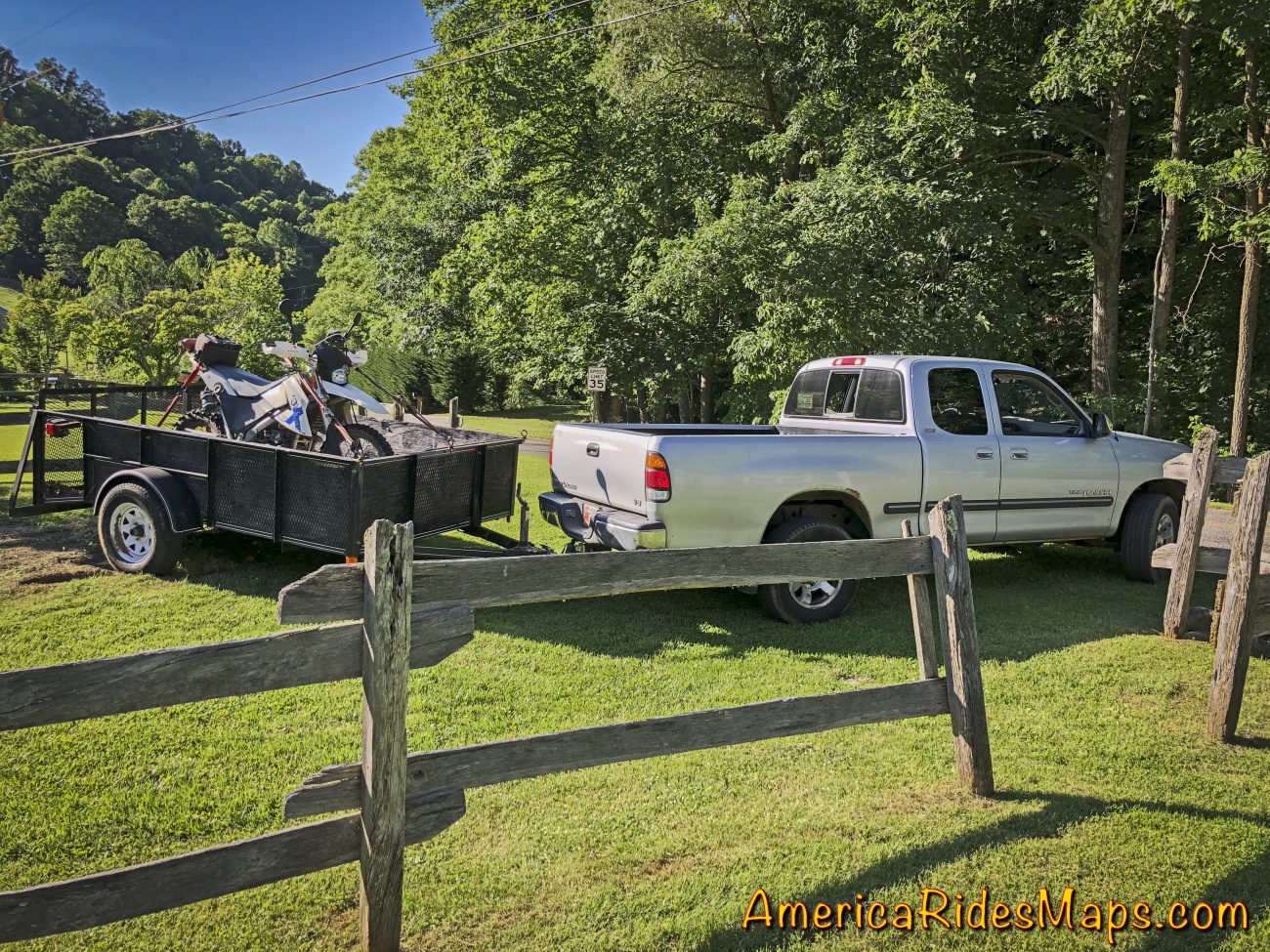
It's been a long time since I've trailered, I prefer to ride to where I'm going. It's 2 hours from Waynesville, NC to the area I'm basing out of in Blairsville, GA. Commuting will just eat up the knobby tires I want for the unpaved roads. Knobby tires go fast.
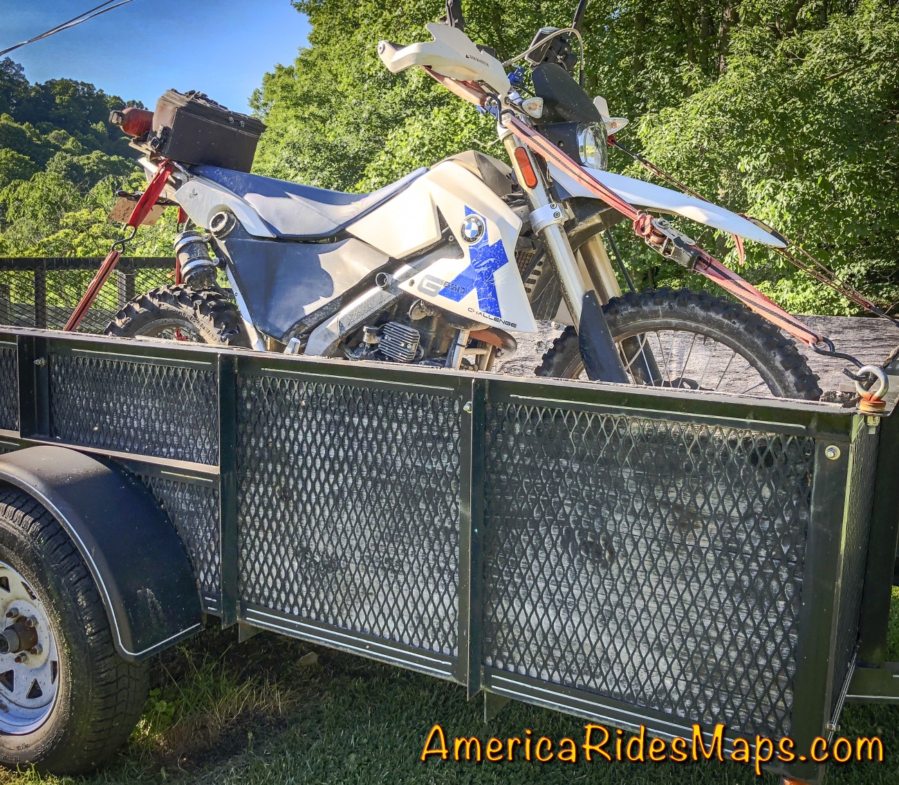
Trailers save tires
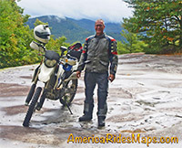
The BMW GS XChallenge is proving to be a damned good bike for the purpose. It takes a beating and has the scars to show for it. Hope I haven't jinxed it for saying that.
Things I've learned mapping off-road rides through Georgia.
Lesson 1 - You do NOT have tubeless tires.
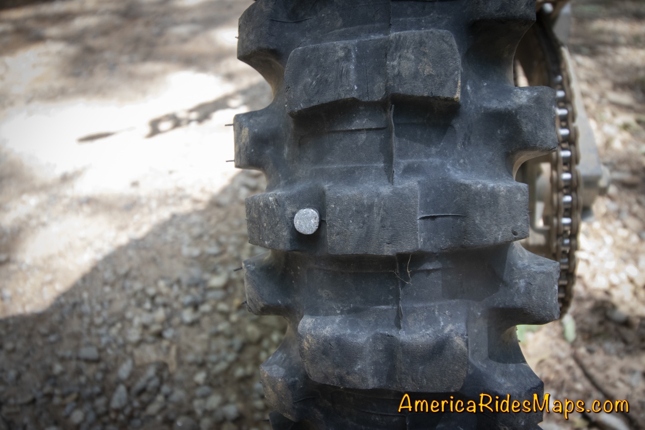
2 inch roofing nail
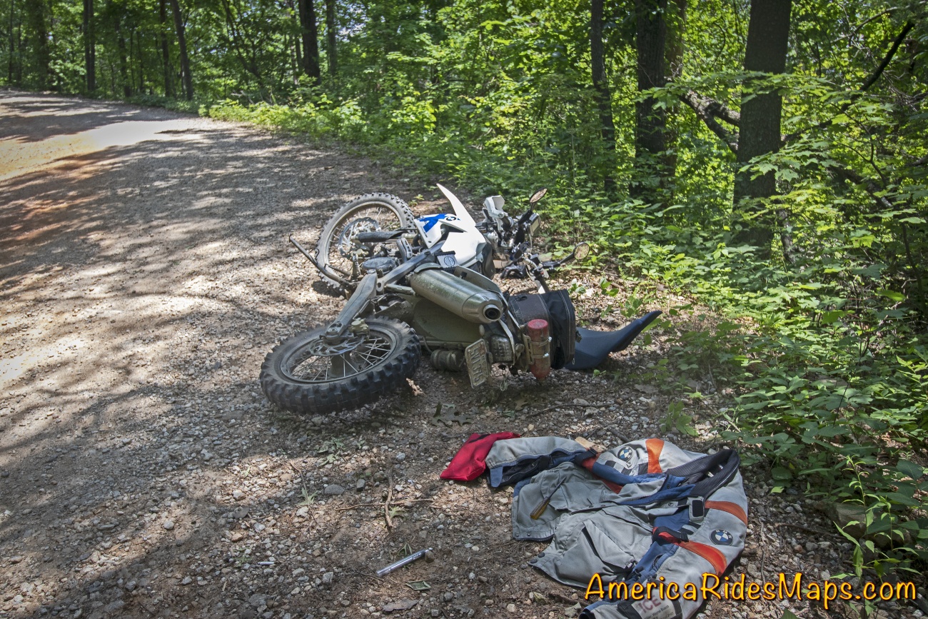
I was wrapping up the third day mapping the unpaved roads surrounding Suches, GA when the rear end went all googly with a flat. I had one last section of road to explore then I was to retrace my earlier path out to pavement and then back to the Copperhead Lodge then home. Pretty much in the center of the large wilderness area, I stopped and found the offending nail in the rear tire.
I've got this!
I've got this, shouldn't take long.
I took out my pump and plug kit. Following the instructions I meticulously inserted a very pretty plug patching that nail hole. I attached the tire pump and waited.
Nothing. The bead wasn't set. I spun the tire, kicked at it, the pump just got hotter and hotter.
Then I saw imprinted on the Pirelli tire - "Tube Type".
Slowly the fog cleared and I recognized the new tires I just had installed were tubed tires. I brought the kit for the old tubeless tires. I just did an excellent plug job and made the problem worse.
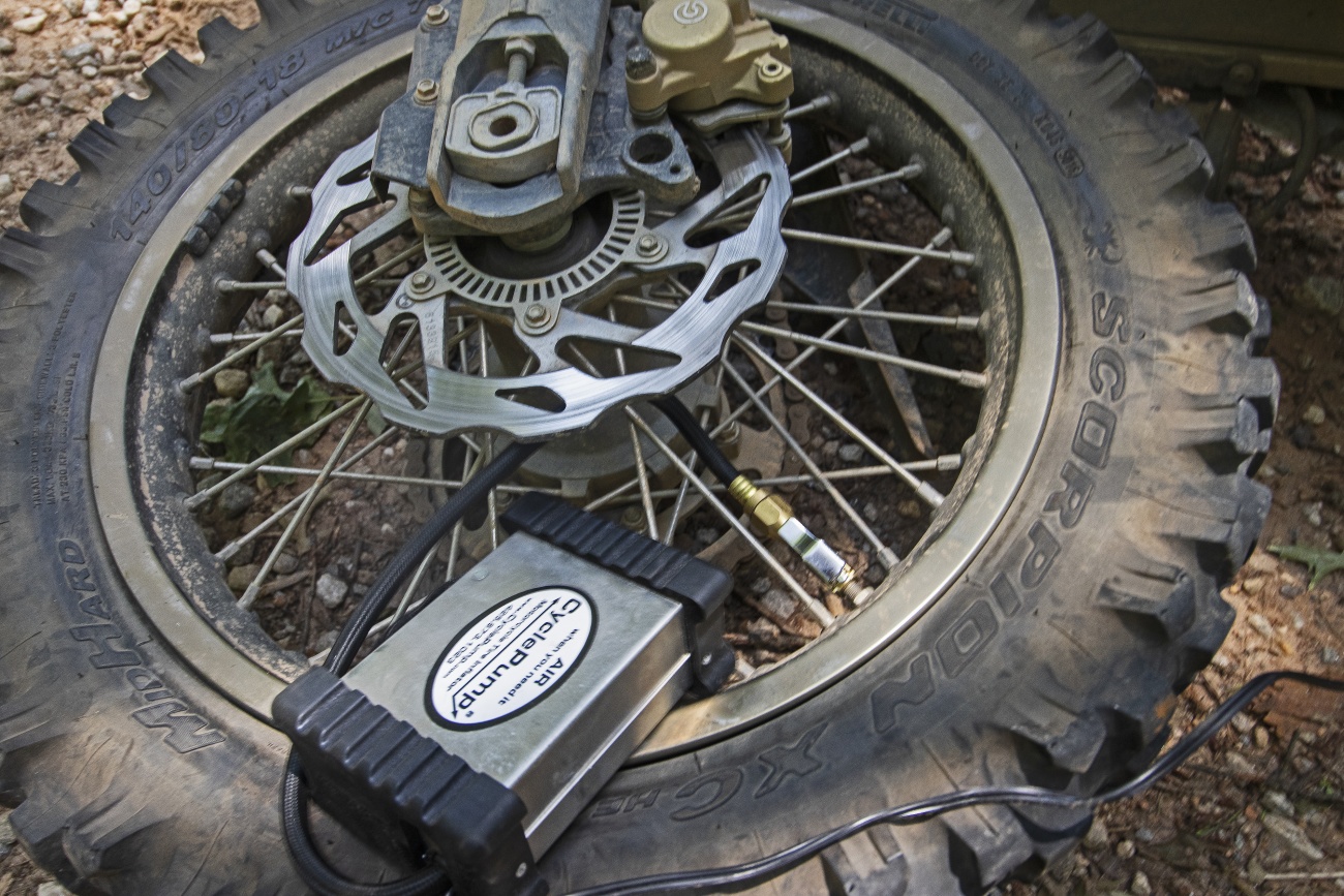
Cyclepump - recommended
PLAN B
Is it a rideable flat? Will it last the distance. Miles to go.....
The BMW 650 GS XChallenge is a very light bike and the tire carcass on the Pirelli is stiff. A short test at idle speed kept the tire on the rim, there was hope.
Plan B is go as slow as needed to keep the tire on the rim.
I set off at 8-10 mph, about as slow as was comfortable without slipping the clutch and just fast enough to maintain steerage in the gravel patches. The rear end wallowed but followed. I took short breaks every 10 minutes to let the tire cool down so it wouldn't come apart. About an hour in I stopped to find the tube had been expelled and was wrapping around the hub. I cut it away and continued on the empty tire carcass ever more gently now.
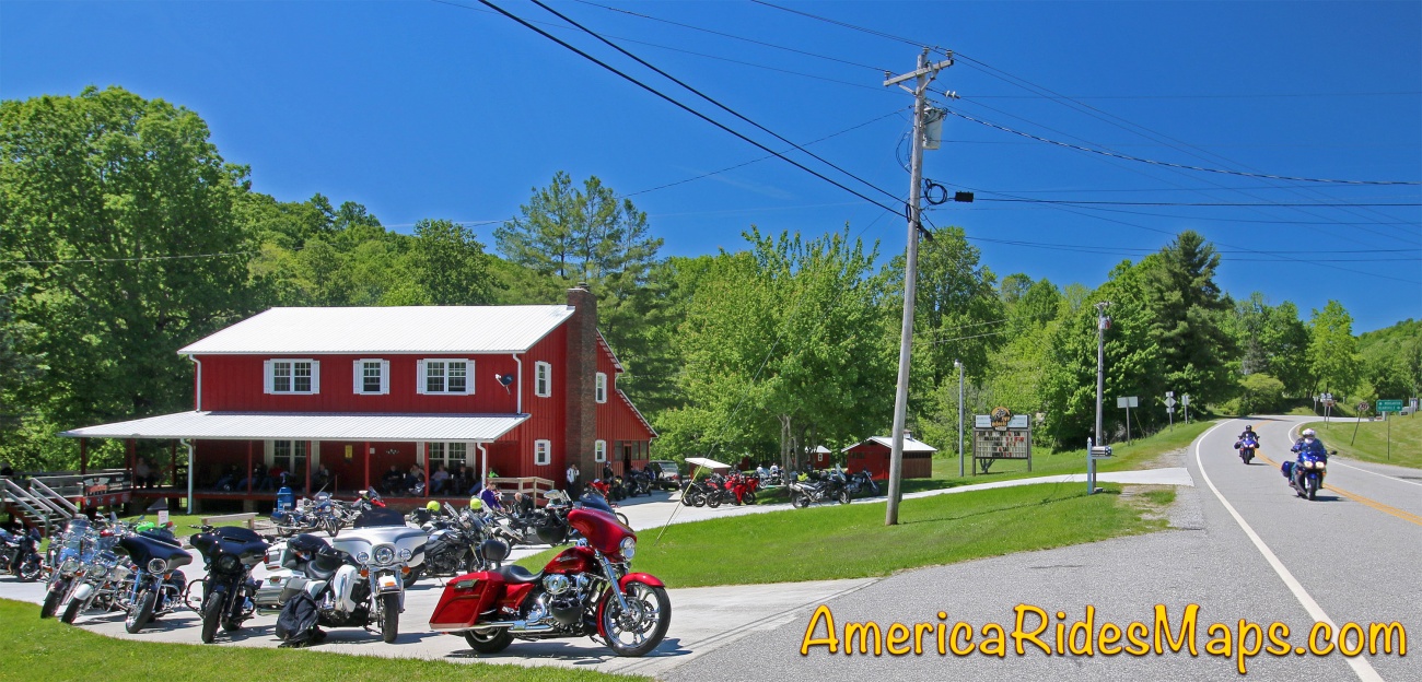
I had an entire section of Coopers Gap Road to ride, then the run north to pavement, miles more on pavement, then onto GA 60 to Two Wheels of Suches, the nearest spot to seek help. While I thought "That's it, the tire is coming off"way too often on the 2 hour ride to pavement, then out to Two Wheels of Suches.

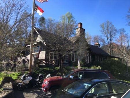
Two Wheels of Suches, GA
Two Wheels of Suches was a carnival, bikes swarming about, people arriving with them in tow. The HOOCH rally was just getting started.
I meet an angel.
I went to the porch and started bartering $20 for a ride to the Copperhead Lodge in Blairsville to get my truck and trailer so I could tow the bike home. The skies were getting dark and my requests were first met with laughter. Then I man appeared and said "I'll take you".
We rode 2 up through the rain on GA 60 then Skeenah Gap Rd, then on to the Copperhead Lodge. He would not take payment.
He appeared when needed, gave a charitable service, then vanished. Be thankful for angels, be one if you can.
Lesson Learned?
Doh! Pretty dumb mistake. I'm going to need to come up with a way to carry the extra tools and tubes. It's not the only issue to deal with, the next issue is fuel.
The first lesson I learned was I am not prepared for a flat tire.
The second issue finding a better way to carry spare fuel.
It didn't last
My BMW GS 650 XChallenge has a 2.5 gallon tank. Off road I get 50 - 60 miles to the gallon. I try to fill up at 100 miles. Current record - I coasted into a gas station dry at 136 miles.
The XChallenge also has no gas gauge. At each fill I reset the odometer to track how many miles on the current tank. The odometer counts the miles to empty. If I see triple digits I'd better be on my way to a pump.
That limited range is starting to frustrate me. When I'm out mapping, there is the expected route and frequently unexpected routes to explore. Plans change on the fly.
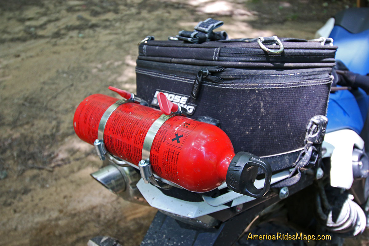
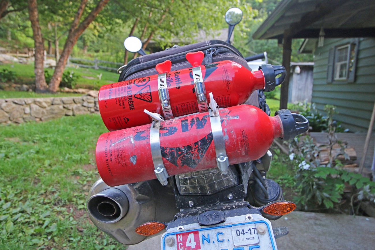
When 2 Bottles failed, i went back to 1
I Have Spare Fuel Now -
Camper fuel bottles have been my solution up to now. Each carries 15 -20 miles worth of fuel. They are cheap, available, and seemed pretty solid. Experience has proved otherwise.
I used to carry two 30 oz. bottles strapped to my tail rack with hose clamps. I reduced to one bottle when the hose clamps punched a hole in one of the bottles. Riding out on a flat this last trip I found the single fuel bottle falling out of the clamps and deeply creased and the cap leaking. That single fuel bottle is little more than moral support, barely adequate. It's time to re-evaluate this system.

Bad crease in one, hole in the other
Lesson Learned - I need to find a better solution
Step 1
I need to add a siphon hose to my kit. If someone comes by when I'm out of gas, and is willing to donate, I should carry the hose to make it easy.
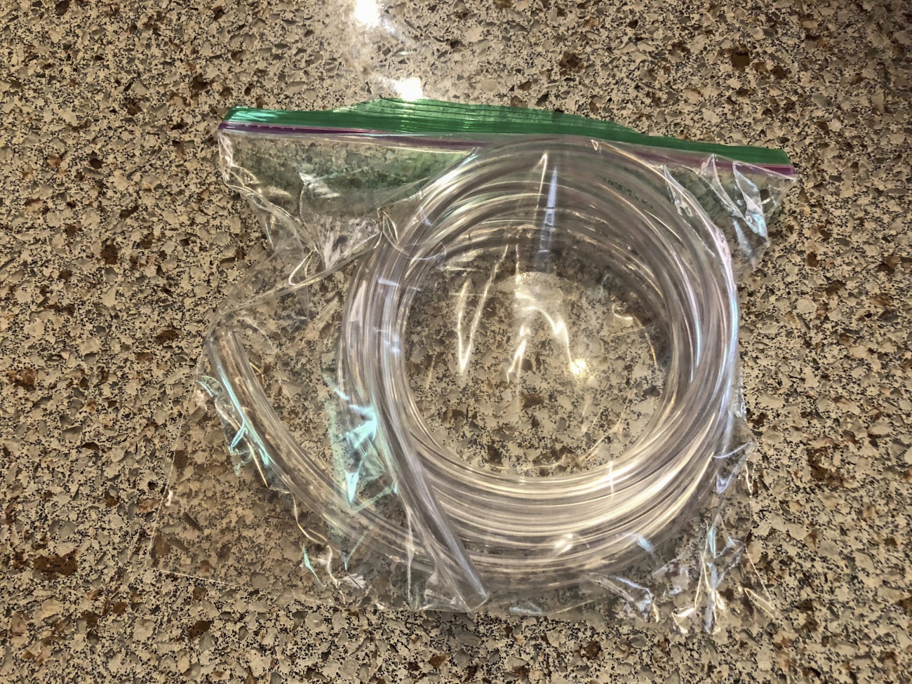
Siphon hose added to kit
Step 2
Suggestions welcome. I'm currently drawn to the RotopaX Gasoline Packs. Even the smallest 1 gallon tank adds 50-60 miles of range and that's enough, but then I need to adapt how I carry things on top of it. The handle protrudes from the gas tank and my current top bag won't sit on it. Ideas?
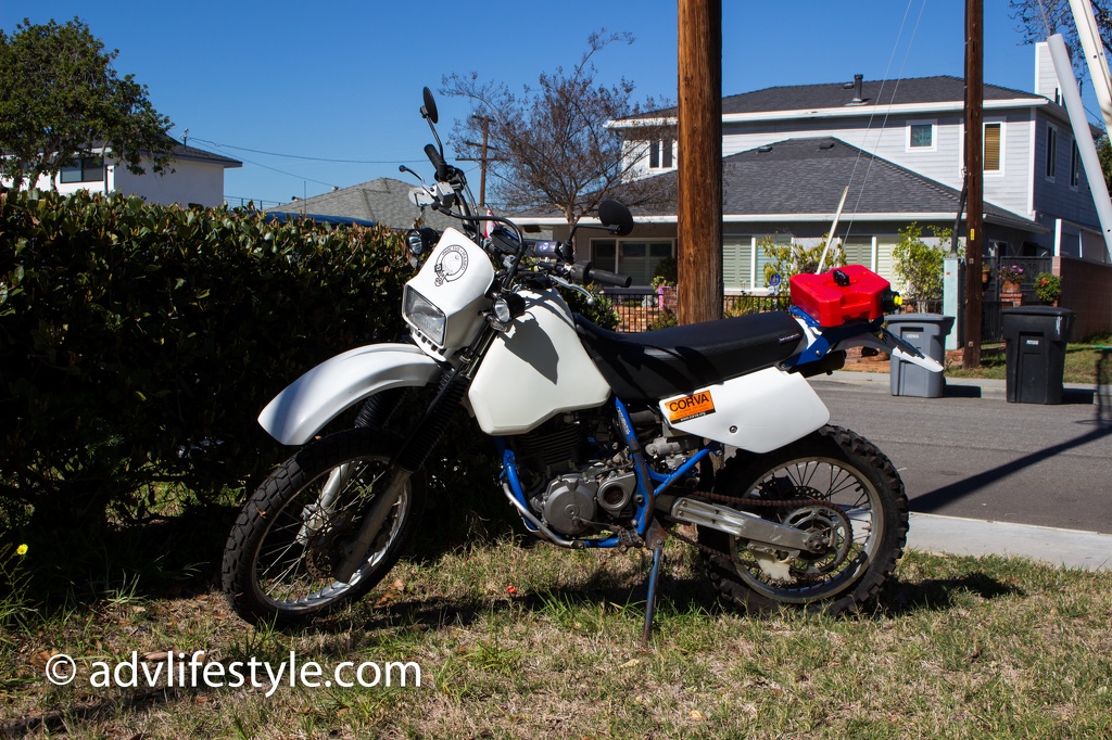
Rotopax fuel tank
Photo shared from advlifestyle.com, link to article here - http://www.advlifestyle.com/2016/02/10/rotopax-fuel-container-for-the-dr350
Lesson learned - if you don't actively need it, stow it more securely.
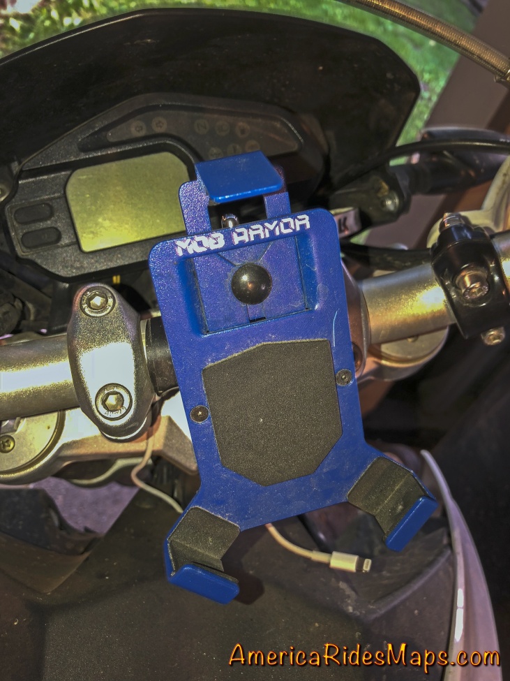
Phone gone....
I lost my cellphone. Near the end of Nimbelwill Road, a deeply eroded and rocky forest road in Georgia, I looked down to see an empty cradle where my new iPhone used to be.
With the sun getting lower and the shadows growing I circled back to look for it. I retraced the whole of Nimblewell Gap Road then back again, but it was gone. All my mapping notes and all the photos I'd taken were on that phone.

Winding Stair Gap - To Nimblewill Rd
There was no need for the phone to be exposed. There was no signal, I was not using it for navigation. I keep it mounted out of habit and to have it handy for snapping photos.
While the Mob Armor cradle has been reliable and secure for many years, the new iPhones are larger. Add a thick protective phone case and it's at the mounts limits. It could be my failure to tighten the lock enough or get the phone squarely in the cradle. I'm pondering modifying the cradle.
Lesson 3 - If You Don't Actively Need It, Stow It Securely.
The obvious answer is don't leave the phone in the cradle unless it's necessary. If it's being used I'll be paying more attention to it.
When not needed, stow it in a pocket. I may find it's quicker to use when I don't have to unscrew the mount for each photo.