

The Miles By Motorcycle Blog
Meanderings and musing by fellow motorcycle travelers.

I know there has not been much activity here in quite some time. As time permits, I've still been chewing away at improving the site and trying very hard to craft a reliable cross platform mobile app which has proven much more challenging than I ever imagined.
However, some progress has been made and we have our first early alpha testers busily finding all kinds of bugs and shortcomings which keeps my life interesting.
Interestingly, many of the first people who have expressed any interest in helping test the app have not been motorcyclists. One is a long distance bicyclist who has used it on a couple trips.
bikepack C&O/GAP Wash -> Pitt
Scheduled to Start on: 'Wednesday May 17th, 2023 0:00'
bikepacking westbound Washington DC -> Pittsburgh, PA via C&O Canal Trail and Great Allegheny Passage
I've had people in the 4x4 overlanding community ask to test it. I have hikers who want to use it to plan and document their hikes.
And over the last couple of years, my own interests have expanded outside of long distance motorcycling as I've been pulled somewhat reluctantly into long distance open ocean sailing.
It just felt natural to use this platform to document those adventures here as well.
Sailing Adventure Aboard AraVilla (No Motorcycles Involved)
This adventure took place on 'Wednesday November 3rd, 2021'
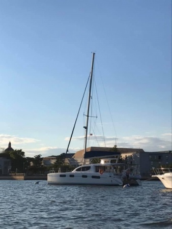
The trip that got me into sailing. I've been invited to crew on a 46' catamaran sailboat leaving from Annapolis, Maryland to St Martin. I am tempted to stand up another site just for this trip, so as to not dilute Miles By Motorcycle, but I am stretched pretty thin these days so I don't know if I'll get that done before I leave. I just find having a place where I can keep all the things around a trip in one place is just too useful, so this "ride" is where I am planning and will document my upcoming sailing adventure. Feel free to join the site and "watch" this "ride" to get notifications when I post updates. There will be a number of days when I won't have any signal so updates will be intermittent.
In the last two and a half years, I've spent a solid three or more months aboard a number of boats and during one crossing it dawned on me, somewhat late, that despite believing I'd been developing a platform for motorcycle travels, I realized that in fact I've been building an adventure travel site that could be used to plan, track, and share all kinds of different styles of adventure travels whether by motorcycle, car, bicycle, by boat, or on foot.
The domain name Adv-Traveler.com was available so I jumped at the chance to register it.
My good friend, Stacie, a wonderful graphic designer, came up with a gorgeous logo that I think embodies what we are now trying to do here:
![]()
I had pondered launching a separate site for Adv-Traveler and keeping Miles-By-Motorcycle as is, but running two instances of all this stuff is a bit much for this skeleton crew, so I opted just to keep everything the same and just change the name. No features have been taken away. Miles-By-Motorcycle is now just one "channel" under a bigger Adv-Traveler umbrella. It is still a great place to plan and track motorcycle adventures.
You'll notice notifications now come from no_reply@adv-traveler.com instead of miles-by-motorcycle.com.
The one downside is that you will have to log in again if you'd like to use the site. Just use your same login and password as before.
As always, if you notice any of the persistent inevitable problems or have any suggestions, please let me know. You can comment on this article or use the contact link at the top to get in touch with me.
I've been riding motorcycles for quite a while as have a number of my friends. In our little circle, I'm often known as the "one who knows the good roads." As soon as I got my license as a teenager, I would wander off in search of good roads to ride. I would stumble across them here and there. Once I found one, I would always return to it especially if I was guiding friends. Who wants to take the risk and lead your friends into heavy traffic, a stoplight nightmare, or some suburban hell or dead end?
Back in 2001, I think it was, Ian suggested we go on a trip down to the area near Ashville to stay with a friend of his and then go tour the scenic waterfalls that area is known for. At this point I had been riding for decades and, believe it or not, had never thought about riding the Blue Ridge Parkway. I had always assumed it would just be more of Skyline Drive. I was very wrong, but this fact didn't cause me to pause and consider the larger error that I was making.
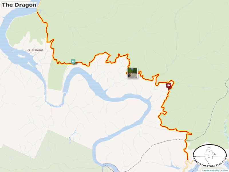
The evening of our arrival, Tom, our host, as an aside mentioned, "Oh, Deal's Gap is only about 100 miles from here."
"Deal's Gap?? The Dragon? That place actually exists?" I replied. I had heard mention of the Gap years earlier in an internet news group called "The Denizens of Doom" or DOD for short. I had always disregarded it as fantasy.
Tom assured me it existed and then in a move very uncharacteristic for me, I implored Ian that we skip the waterfalls and instead ride out to this mythical place. I, of course, feared it might be a tourist trap or not nearly as good as people said.
But I needed to go find out. We rode out to US129 and not knowing exactly which section the Dragon was we just kept going eventually passing a run down looking motel and gas stations on the right. "Was that it?" we wondered. We decided it must be further ahead. And then we hit that first hairpin. By the time we reached the far end 11 miles later, Ian said to me, "We don't need to see anything else. We've arrived." We spent the rest of the day just riding back and forth.
That fateful decision started me down a path that has fundamentally altered the course of my life. In many ways, I often think of the Dragon as the "road that made me".
After riding the Dragon that first time, I would go on to make a yearly pilgrimage down there to ride it again along with the occasional surrounding road for a week straight. Eventually, I talked my buddies Duncan and Bruce into joining me and we've made the trip down there more years than not over the last 9. The first year, we went down the Blue Ridge Parkway, which is a road I never tire of. In subsequent years, we would barrel down the I81 super slab so we could get to our target area quicker.
"There are no better roads than the ones you'll find in the Smokies. I know. I've been all across the country a number of times." I would confidently say completely unaware, as is true of most humans, of the gaps in my knowledge.
As a result of my recurring trips, I've gotten to know a number of people down there. The motorcycling world is, after all, very small. Some that I met had told me of a rider who made his living by finding the best roads around, riding them, and then producing motorcycle maps from that knowledge. These maps covered the Smokies and Blueridge. You could find these pocket maps for sale just about everywhere down there. I bought a few one year at the Deal's Gap Resort. Duncan, Bruce, and I then followed some of the routes. That was the first hint that maybe there was much more to know, but I again didn't ponder the right questions.
Years later, through the persistent efforts of Darryl at Bob's BMW, I was introduced to a man named Jim Ford who runs the Riders Workshop. At the time, Darryl had been hearing me talk repeatedly about the social motorcycle mapping site I was trying to build and he thought I should meet Jim. "Jim knows good roads." he said. Jim takes people on two day mountain riding training tours. He invited me to join him on a ride and we and some other riders spent a day in Northwestern Maryland riding great twisty little roads that were better than any I knew of in the area.
"So close to home. I've ridden past here hundreds of times. How did I not know these roads were here?" I thought.
Foreshadowing.
I told him about my trips to the Gap. "You should meet Wayne down there who runs America Rides Maps." he said.
Small small world. This was the rider I had heard about.
"I'll introduce you. But you should know, he's a very fast rider and he doesn't ride with just anyone."
On our next trip down to the Gap area, Bruce and I met up with Wayne. Our bikes were fully loaded. Wayne was on an unloaded Tiger 800. "We're not fast riders and our bikes are loaded." I said to him. "I'll keep it at a moderate pace." he assured us. He guided us along a road we had not previously encountered that the locals call "The Rattler".
Unable to embed shared object. Sharing permissions error?It was a wonderfully twisty challenging mountain road. We kept up but it was effort.
"If this is him keeping things at a moderate pace, I don't want to know what an aggressive pace might be like." I remember thinking. His riding was disciplined and never out of control and he had clearly been riding these kinds of roads for a very long time.
We reached the far end and Wayne was all smiles. "I know I said I was going to keep it a moderate pace ... but you guys looked like you were keeping up ok."
A friendship was born.
In subsequent years, we would sometimes visit Wayne and he would take us tours of the area. One year, he gave us a route home based on one of his maps that avoided a good chunk of Interstate and that involved so many corners, literally hundreds of miles of them, that the sides of my tires wore out before the center line did. By the end of that day I was screaming into my helmet, "Make it stop!". So many corners! Such views! The roads were fantastic, and once again we had been riding past them on boring super slab for years just not knowing they were there.
Wayne would say, "If I haven't ridden it, it doesn't go on the map. You can look at a squiggly line on Google Maps and you'll know nothing about the road. You have to go take a look. You have to ride it."
This philosophy appealed to me as it matched in complimentary ways what I've been trying to do here. There are those who advocate "machine learning" and algorithmic approaches to laying out motorcycle routes, but I think the human element is preferable. A rider needs to ride the road and report back about the experience because twisty by itself is meaningless. More over, you need to know something about the rider who has gone out to look at the road. Having a system for qualifying good roads is a key element here. Wayne has a system.
"For a road to go on the map, it also has to be useful. It has to go somewhere, it has to have minimal traffic, and it has to have something special about it."
Beyond this, Wayne considers his diverse target audience when laying out routes. There are roads that are wonderful for the big cruisers with long sweepers and dramatic scenic vistas. There are super twisty little technical roads for the more sport oriented riders. And there's much in between.
As part of the map making process, Wayne will travel out on his bike for several days straight scouting roads for inclusion on the maps. He typically does this alone because its grueling and "most people want to take breaks". He prepares for these trips for weeks in advance, pouring over endless sources of information culling it down to a target list of routes to scout. It's real work. Then, once underway, the work continues as the days are long, exhausting, and he has a set schedule to keep. It's not only about the roads but also about the places to eat and stay. So as part of it he will not recommend a place he has not tried himself. This makes the trips quite a bit more expensive to undertake. "Ride hard, rest easy." is his refrain.
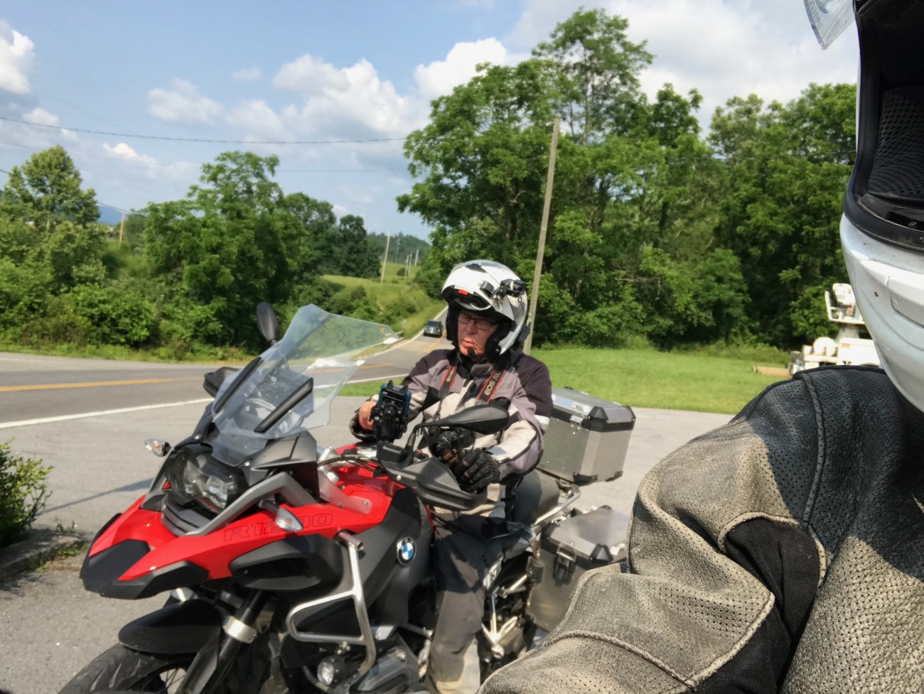
As surprising as it is, Wayne has invited me to join him on the last few scouting trips.
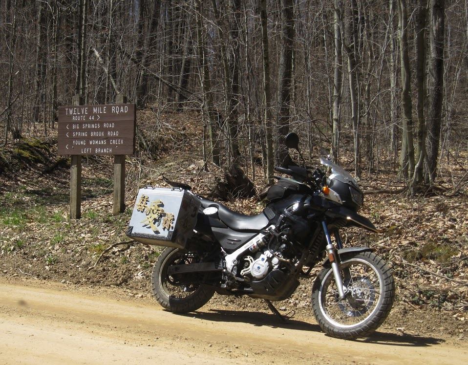
Motorcycling as work. I got back last night and I am sore from head to toe.
This photo pretty much sums up what it's like.
But now multiply that by hundreds and hundreds of miles. We rode nearly 1000 miles of twisty mountain country roads and the more we scouted the clearer it became that there were added dimensions to these maps that were not immediately apparent to me. Many of the roads would start out small and twisty but would suddenly turn to gravel. These are excluded from the street maps. If you're on a big Harley or some BMW K1600GTL you are more likely than not to want to avoid gravel.
While none of the gravel roads we encountered were all that challenging some were a number of miles long. It's disappointing when a good road goes to gravel as it can't be put on the map.
There were other roads that were /fantastic/. They met the criteria of being useful, going somewhere, and having something special about them, but were excluded because ... truck traffic.
Some roads are quite good but are too close to industrial areas so have a steady flow of tractor trailers with the resultant pavement damage and gravel in corners. As a result, these roads are excluded as well.
But to know any of this, you have to go ride the roads.
The days started at 7AM at the latest and I think this was largely in deference to me since I am not a morning person.
Shower. Quick breakfast. Back to the room.
From the time we got back to the room to the time Wayne was ready to go was so short as to be nearly unbelievable. I have never before encountered such an efficient traveler.
Then it was game on for the rest of the day with military like discipline.
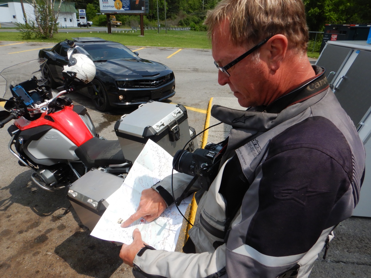
The list of roads to scout for each day of the trip had been laid out on the site here using the map editor. I would export the routes for each day and load them onto my Garmin GPS.
There was very little talking. Most of our ride was in silence. Wayne would call out when we approached a "new road". After just a few in a row they would blend together to the point where I wouldn't remember which road had what characteristics. It just became one big blur.
"What was your favorite road today, Yermo?" he would ask. "Ummmmmm. The twistier one?"
Wayne, on the other hand, even at the end of the day after 400 miles of seemingly countless little roads could vividly and accurately remember the characteristics of each individual road. He did take notes at the end of each road but it was very quick. Usually there was just enough time for me to pull a glove off and take a single photo with the phone.
I have heard that taxi drivers in London have to learn something called "The Knowledge". At the end of their careers, all the memorization alters the structure of their brains in detectable ways. I found myself wondering if Wayne's brain has altered in similar ways. His sense of routing, road quality, and how these pieces fit together is impressive.
Over these days following Wayne on roads that were so much closer to home than Deal's Gap a theme started to develop that filled me a bit with a sense of sadness.
Some of these roads in Virginia and West Virginia are as good if not better than the ones in North Carolina and Tennessee that I so confidently called "The Best in the Country". It's stunningly beautiful. Duncan, particularly, likes green tree tunnel roads. There were so many of these on this trip.
What saddened me is to realize how close all these roads are. Duncan, Bruce, and I would stay in Wytheville, Va on our way down to the Gap. We were so close. There are roads hidden in those hills that are crazy good. Both Bruce and Duncan have very limited vacation times. Getting away from family and obligations is a major undertaking.
How much of that precious time did we waste sitting in traffic on the I81? We could have opted to ride roads closer to home that are just as good. More riding less travelling.
But we didn't know. So for years, we just rode right by them going for what we knew and having no way to finding what we did not. I would often look to the West and think, "I should go exploring." and at one point I did. I found a few good roads but missed the fantastic ones that Wayne has found. I guess we could have trolled internet forums or poured over maps but which recommendations do you trust? There's so much bad advice.
But now having gotten to know Wayne and seen up close and personally the system he has for putting together his motorcycle maps, we can now see the areas with the best roads and what useful connector roads there are that avoid traffic and lights and development. We have a source of information at our disposal that let's us ride good roads in an area all day long.
I build mapping software, amongst other things. I've pondered trying to build my own maps of the area here that I know. But it's hard. Look at an area with good roads. Try to figure out the best routes to and from that area. Then find the best roads in the area and how to link them together. Then add to that where to stay, where to eat. Then go out and ride all those roads to make sure none of them are duds. Remember all those details. Then translate that all into a useful format that you can use to make the best out of a 7 day vacation ride.
It's surprisingly not easy.
So when I ride to North Carolina, I just take Wayne's maps:
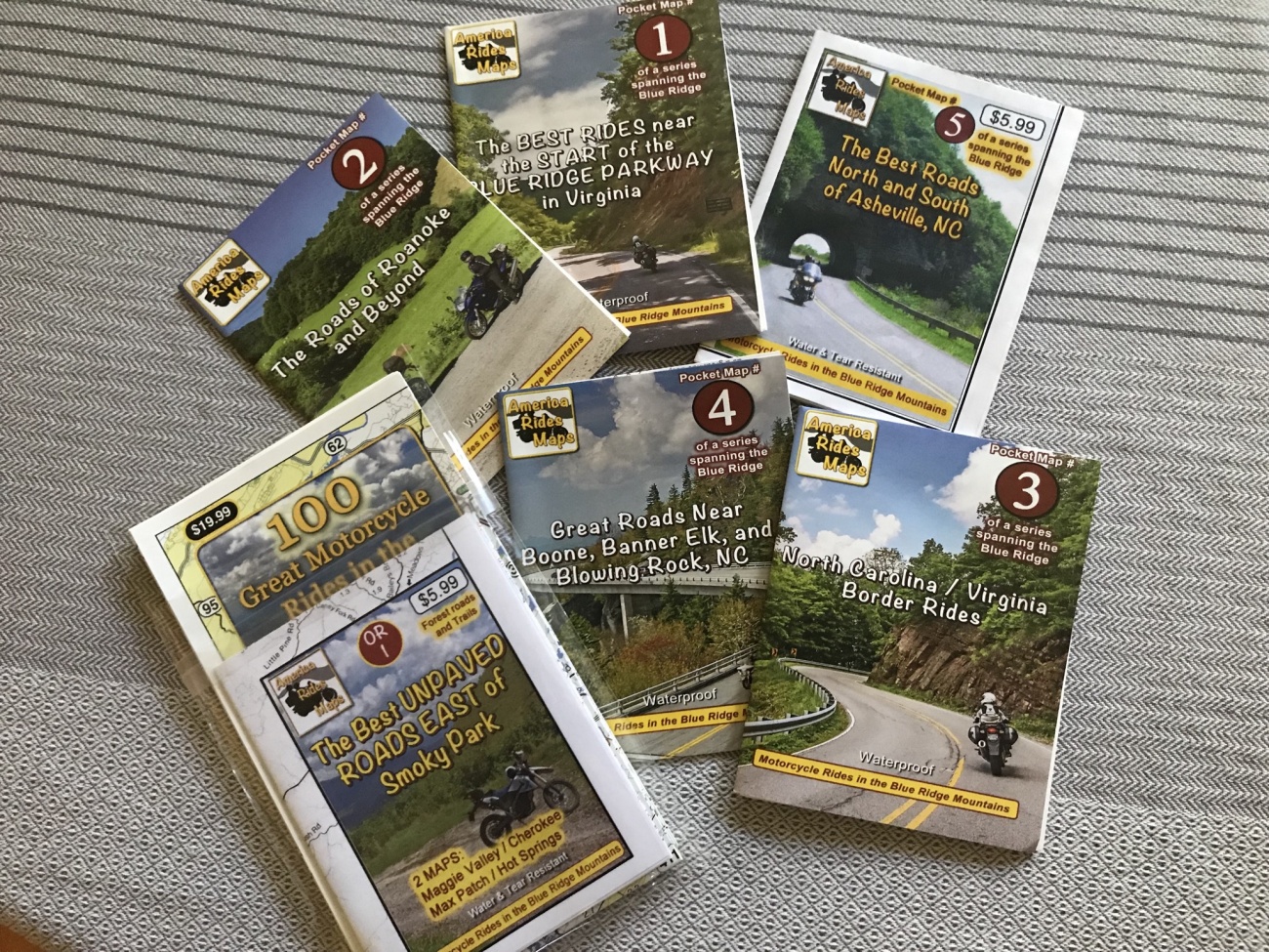
They have completely changed how I ride in the areas they cover. Interestingly, they have also changed the wear profile on my tires. ;)
Wayne is currently working on the updating his existing maps and adding new ones to cover sections of Southern Virginia and West Virginia. My hope is to lure him up further North at some point in the future.
For more information or to purchase his maps visit his site:
America Rides Maps
Maps of Great Motorcycle Rides in the Blue Ridge Mountains. Blue Ridge Parkway, Tail of the Dragon, hundreds of great biker roads for motorcycle touring. Tennessee, North and South Carolina, Virginia, Georgia motorcycle ride maps,
https://americaridesmaps.com/
I first became aware of Gary a number of years ago when, to my surprise, he lifted some photos of my Beloved Blue Oil Burner from my Facebook page and reposted them to the BMW MOA Group. It turns out he also had had a blue K' bike. I was a bit taken a back at first but I figured it didn't hurt anything. Over the years, he would do this a number of times.
It didn't take long for me to realize he had a big footprint in the BMW world and knew well many of the motorcycle people I had met in passing. I found myself thinking, "He's someone I should meet one of these days."
At some point, I became aware that he was following my writing here. From time to time, he would tag me in posts or bring me into conversations or reference some article or photo of mine.
Gary struck me as a colorful strong character who was very different from myself. It would be challenging to find two more divergent people, or at least that's the impression he left me with. He would post a stream of seemingly inappropriate content intermixed with some truly profound insights and beatiful photography.
For example, on November 10th he posted:
"No siren did ever so charm the ear of the listener as the listening ear has charmed the soul of the siren."
Oftentimes, he would prefix his posts with "Lord Moto:" as in "Lord Moto says." I got the impression he was liked by many.
On rare occasions, we would have brief chats on Facebook. "We need to get together and ride sometime."
As Duncan can attest, I had every intention to.
Over the years, there were many opportunities.
Every time that Duncan and I would ride deep into Pennsylvania not far from Williamsport where Gary lived I would comment, "We really need to go riding with him one of these days."
There was the time, coming back from one of my excusions North of the Wall to spend time with my favorite Canadians, that I was stuck in traffic in Williamsport when I saw Gary, who I instantly recognized, on his Helix. I tried to get his attention but he sped off before I could. When I got home I messaged him saying,
"Yea, I'll come up again soon and we can go ride."
There was the time he mailed me a number of paper maps of areas we could go explore. I still have them here next to my desk.
It seemed like our paths would often cross online, no matter where I went.
Last year or so, there was the big kerfuffle in the BMW MOA group that motivated him to create his own private group on Facebook. To say that "political correctness" was not Lord Moto approved would be an understatement. Before I knew it, he slammed me into his group. Among the 193 other members, there were many names I recognized.
Not too long ago, the conversation started there about moving "off-Facebook". He was getting tired of Facebook. After some soul searching and conversations with Duncan, I offered to host his group privately here on Miles By Motorcycle. He explored some other options then decided to give it a try. I created a private group for him and made him an admin. As a test, he invited about 29 people over to kick the tires. Among the people he invited were some truly notable names that I had heard about for years. Much to my chagrin, because the programmer I use needs to be taken out back and shot repeatedly, there were many more problems than I had anticipated. I (ahem, I mean that worthless programmer) worked like a fiend to fix them. Gary took it all in stride and explored every feature I had built always being constructive at every step. He asked about the map and route archive. He started posting like mad, like he did everywhere, and got some others involved.
"I'm going to move the entire group over beginning in 2018." he told me.
Whew. That meant I had some time to fix things and add the some new features that would make things easier for them. I could easily get everything solid by then.
As one of this test posts in his group on MBYMC, he posted about the 2018 BMW RA Rally happening in Wellsboro, PA.
"Ok, this time I'll ride up. I'll see you at the rally if not before." I told him over messenger.
I confinued working like mad fixing bugs and adding some features. To help him with his archive of GPX files, I started writing the long overdue article that months ago I had promised Mike Austin about how to use the mapping system here.
He would report new bugs and in the same breath mention people in the motorcycling world he thought I should get to know.
"You interested in riding Japan? I know people in Japan and Mexico almost a free trip" he asked in early November.
As is the case so often with software projects, things happen on other people's schedules. I was working like mad thinking I had time when Gary on a Friday not too long ago said,
"I'm moving everyone over on Monday."
"What happened to 2018?!?" I thought but I knew I had to roll with it.
He had posted a few things in the group. I still had work to do so I worked late into the night trying to make sure as much was ready for the next day.
On Monday, there was no sound. There were no messages. Gary was no where to be found.
"Had I done something wrong?" I thought. It wouldn't have been the first time that someone's had a change of heart at the last moment or found a better arrangement. The hours ticked by and still I heard nothing.
This was supposed to be a ride report. This was supposed to be an article about how we launched his group. It was supposed to be about how I did a cold weather ride up to Williamsport on my oil burner to meet him person. It was supposed to be about chance encounters with interesting souls that one would never have had the chance to meet if it hadn't been for the motorcycle. It was supposed to be about how the motorcycle brings together radically different people from ridiculously divergent backgrounds, perspectives, personalities, and beliefs. It was supposed to about how, once the helmets are on, it all doesn't matter because we're all just motorcyclists.
But, sadly, this is not that article.
This is an article about how someday never comes.
Late in evening on that quiet Monday there was a post in Gary's facebook group by Gary's friend Jim Davis:
"Folks, it's with a heavy heart that I inform you that our fearless leader has had a stroke. I'm afraid it's bad, very bad. Gary Weaver was my soulmate and best friend for the last 20 years. Gary lived a great life til the end and slid into home with his body nearly completely worn out. RIP my buddy."
A few days later:
"Gary was brain dead from complications arising from a blod clot. He was an organ donor so they kept him on life support for a while. "
Lord Moto was dead.
I never got to meet him. It's strange how the passing of a man who I have never met would hit me as hard as it did. The wind was taken out of my sails and I've been walking around in a daze finding it very difficult to get any work done since. I suspect this is bringing back demons from a time when I was confronted with a sudden surprise loss that I have never recovered from.
I hadn't realized how much I had grown to enjoy Gary's posts and commentary. There was a gruff and unrefined kindness to the man; a generosity, a helpful, supportive, encouraging spirit.
Some days ago, now too many since it's taken me quite some time to muster up the presence to write, a mutual online friend who I have also never met in person, Mike Austin, put me in touch with Gary's daughter Elizabeth. Further reminding me of the horrors that took place for me in 2008, adding insult to deep injury the aftershocks of Gary's passing are taking their toll on his surviving family. Gary had an 80/20 insurance plan and his wife has been left with more debt than she can handle.
Elizabeth reached out to me on Messenger:
"Hello I am Gary Weaver’s oldest daughter. Mike Austin had recently reached out to me about getting my dads info for donations to help defray medical/ funeral expenses. I have access to his PayPal account so contributions can be made to that either by his email
Drxbmw@aol.com
(on PayPal)
paypal.me/DRxBMW
I don’t know how well you knew my dad but he has made such a impact on so many peoples lives. It is truly amazing how a love of motorcycles created this very kind and supportive community.
Thank you for your help in this matter."

Gary Weaver Donations PayPal.Me
Help defray medical and funeral costs for the Weaver family.
https://www.paypal.me/DRxBMW
I contributed $100.00usd and confirmed with her that she got it.
While I never met him in person, Gary was kind to me and I deeply value kindness in whatever form I find it. I feel for his family and know all too well what it is like to be them. I remember it like a moment frozen in time.
There is so much need in this world. There is so much pain and loss.
If you knew Gary and haven't done so, maybe you'd consider doing a small thing to help his family.

Background
Miles By Motorcycle originally grew out of my desire to have a better place for my friends and I to discuss, plan, and document our motorcycle travels.
There's quite a bit of of knowledge involved in travelling long distance by motorcycle. There are bikes to consider for differents kinds of trips. There are awesome roads hidden between seemingly endless superslab and conjested towns. There are hidden gem places only locals know. There are shops, restaurants, cool old hotels, campgrounds, and sites to see. There are techniques to learn and skills to hone. There's good equipment and bad. The farkles never end and what parts to buy are a constant topic. Peruse advrider.com or any other motorcycle travel forums and you'll see they contain a wealth of knowledge, insights, and recommendations that are often hard to find as they are drowned out by a cacophony of other posts. And, if you're like me, finding those great posts when you need them again later is a constant challenge.
ADVrider and forums like it are a great resource but I wanted something different. I wanted to build a place where our normal everyday conversations would turn into a kind of "actionable" geographic library that we could use to start dreaming about trips. Then with all those potential trip ideas neatly organized in one place, turn them into concrete plans and then into action. And once we've returned from our travels Out There, tell our story so that others can start building their dreams off of them.
You could think of it as "closing the loop". Read stories of travel to far away places to fuel your imagination. Plan. Go ride. Come back and tell your story. Start the process over again.
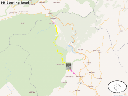
For example, I recently took a trip down to the Smoky Mountains on my Suzuki DR650SE to go explore unpaved roads with Wayne Busch who runs America Rides Maps. It was a great trip filled with good company, fantastic roads, and unbelievable views.
During my return trip, I happend upon what is now one of my favorite roads. Mt Sterling road runs through the Smokey Mountains National Park and is a simply awesome road that I intend to ride again the next time I'm down there. If you like unpaved mountain roads that turn into wickedly twisty smooth pavement I strongly suggest it. It's a blast.
Now, what do you do with this information?
- Where do you put it?
- How, years from now when you finally take that ADV trip through that area, do you find it?
- How do you use it to navigate to it's start or end?
What if you could just click on it and save it on some map for later?
What if you could do the same with any photo?
Unable to embed shared object. Sharing permissions error?On Facebook, I've often been frustrated when photos of great roads are posted and I have no way to find out where they are. I want to be able to click on it, add it to a list or a map, and then, when I have the time or am in that general area, ask the question, "Remind me again, what roads in this area did I mean to ride? Where was that waterfall or overlook?"
Having that kind of capability would change my trips for the better. However, to turn this idea into a reality, I needed to build my own mapping system, search engine, and site software that organizes all the elements of mapping differently than I've seen done.
This then answers the question I have been asked so often, "Dude, are you nuts? Why are you building all this instead of using something like Wordpress?"
It has turned out to be quite the insanely large project for just one developer (little 'ol me all by my lonesome) but, while still actively in development, it is now near the stage where it can be successfully used to plan trips, mark great new roads, and document rides. There are a number of other things in the works as well.
As a side-effect, it's also a turned into pretty good way of building motorcycle maps, planning routes, editing tracks, and working with GPX files.
Features
The Miles By Motorcycle mapping system allows you to :
-
GPX FILE UPLOAD/DOWNLOAD/SHARING:
- upload a GPX files generated by your GPS or another site containing favorites, routes, and tracks and display it on a map.
- cut sections or remove tracks
- edit or remove favorite markers
- add, edit, or remove routes, waypoints, and points of interest.
- export the edited GPX file for use on your GPS or other device.
- make the GPX file available for download by others members of the site.
-
GEOLOCATION
- find locations on the map by address or city and state.
- find locations on the map by address or city and state.
-
TAGGING
-
add tags (a.la. Twitter hash tags) to all maps, routes, tracks, pois, photos, videos, links, comments, posts, and articles (whether your own or by others) and use those tags in the site search bars to find those items later.
-
-
ROUTES
- plan routes consisting of many waypoints.
- plan multiple routes per map.
- drag, add, insert, and remove route waypoints.
- title, describe, and tag each route individually.
- split routes
-
TRACKS:
- title, describe, and tag tracks individually.
- pare down tracks by cutting out sections.
- remove route sections
-
CURATE ROUTES AND TRACKS
- add photos, videos, points of interest, and links and associate them with routes or tracks.
- mark paved vs unpaved and best vs normal roads.
- mark technical vs easy roads.
-
SAVING AND SEARCHING
- save all items in a map individually.
- using the advanced search button at the top, search for individual parts of a map. (Search for routes, POIs, tracks, etc).
- search by keyword, tag, and member.
- use the 'mentions' button on an item to see on what maps (or elsewhere) it's been mentioned.
-
EDITING
-
edit maps, routes, and tracks
-
-
POINTS OF INTEREST
- add points of interest to the map to mark notable locations such as scenic views, campsites, restaurants, gas stations, motels, notable cross roads
- title, describe, and add tags to each points of interest.
- add photos, videos, and links to add more context to the point of interest.
-
PHOTOS
- upload photos which can be displayed on the map.
- optionally place photos using the photo's geotagged location.
- add titles, descriptions, and tags.
-
YOUTUBE/VIMEO VIDEOS
- add youtube or vimeo videos directly to the map.
- add titles, descriptions, and tags.
-
SHARING
- share static screenshots that are created whenever you save a map.
- embed the map in blog posts, forum posts, or comments on the site.
- share links to the map off-site.
-
CONVERSATIONS:
- have conversations directly on tracks, routes, POIs, photo, videos, maps, rides, etc.
- have conversations directly on tracks, routes, POIs, photo, videos, maps, rides, etc.
-
RIDE PLANS
- click on any geotagged photo, point of interest, track, or route anywhere on the site to add them to "ride plans".
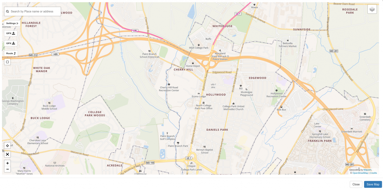
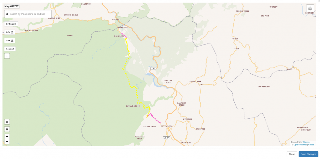
For example, you can see many of the basic mapping features in action if you click on the following map which documents one of my favorite Greater Washington DC area rides:
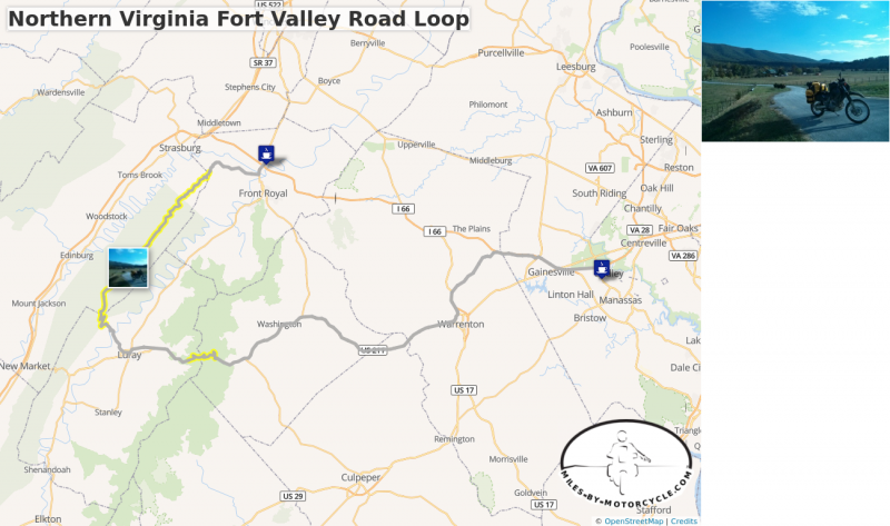
Northern Virginia Fort Valley Road Loop
This is one of our favorite routes through Northern Virginia. We typically start out at 55 where it meets 15 and take side roads down to 17 until it connects to 211.
There's a wonderful section of tight technical but well graded switchbacks on 211 as you approach and cross Skyline Drive.
We usually have lunch in Luray and from there head up to Route 675 which is a series of switchbacks the carves it's way up the side of the mountain. There are wonderful vistas as you go up. Very pretty.
From there you catch Fort Valley Road which goes on seemingly forever as it winds it's way through this magical looking valley of pristine farms and old buildings. It eventually narrows to a tight state park road that follows a roaring creek bordered by steep canyon walls in a deep wood.
We typically make our way to the Starbucks in Front Royal before taking the Superslab back home. Sometimes we'll take 55 for some local color as it winds it's way seemingly through towns that time forgot.
The best sections are tagged in yellow.
Creating Maps
Maps can be created in two places on the site:
- in your personal profile
- in a group that you belong to.
At this time, the only difference between the two locations is who can see the map:
- Maps created in your personal profile may be viewed by anyone logged into the site but, as of this writing, cannot be shared off-site. (This will be improved as I rework how privacy works on the site.)
- Maps created in a members-only group may be viewed by any member of the group but no one else and cannot be shared off-site.
- Maps created in a public group may be viewed by anyone on the site in addition to any anonymous visitors coming in from the net. (For sharing maps off-site for example to Facebook or Twitter, posting them to the MBYMC Public Group is your best bet at the present moment.)
NOTE: As of this writing, creating maps is best done on a computer with a mouse. While maps can be created on a mobile phone or tablet, using touches to mark fine locations on the map remains a challenge. I typically create and edit my maps on a computer and then view them on a phone when I'm out on a ride. I also often export the map to a GPX file that I load onto my GPS. (I have Garmin Zumo 550.)
To create a new map in your personal profile, click on your username in the upper right corner of the site then click the Maps tab then the "New Map" button.
To create a new map in a group, select the group from the Groups dropdown menu at the top, select the Maps tab, and then click the "New Map" button.
Working with the Map
When you click the New Map button, a window will appear populated with a map. If your location can be determined (that is, if you allow geolocation) the map will be centered roughly at your location or it may be zoomed out to a world view.
There are a number of buttons. The image below lists out their meanings. (You can click any image in this article for a larger view).
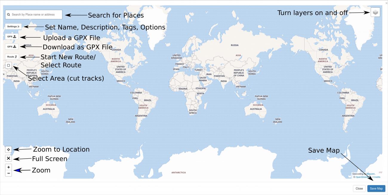
You can zoom the map in and out using the zoom buttons or the mouse wheel. You can also drag the map around.
Finding Locations
To find some specific location in the world, use the search bar at the top. The address lookup is provided by a company called MapZen and is based on free and open data. Unfortunately for those of us spoiled by Google address lookups, it leaves something to be desired. City and state name lookups (e.g. College Park, Maryland) seem to work pretty reliably. Complete addresses in populated areas also seem to work pretty well. Outside of major metropolitan areas, however, address lookup seems less reliable. When it can't find a given address, I find it's easiest to search for the nearest town and then zoom into the map and find what I'm looking for. (If we ever get the money to afford a more robust commercial address lookup service, I'll improve this. In the mean time, I am constantly on the lookout for better free options. MapZen is, at least, significantly better than the previous service I was using. Unfortunately, Google's and Bing's terms of service prevent me from using their lookups here.)
The steps are:
- enter an address or a town, state in the search box.
- press ENTER to reduce the number of matches.
- click on the correct match from the list.
- (ignore the bug that places the buttons over the results. I will fix it.)
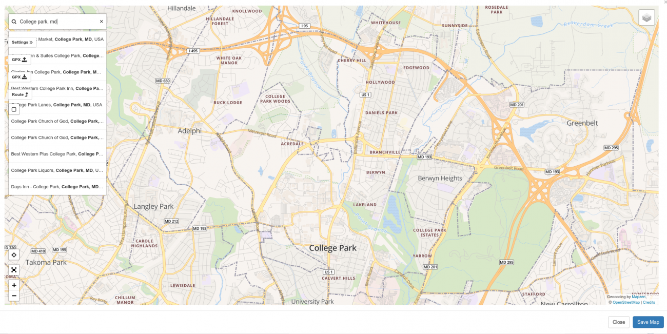
When you select a name from the search list, the map will pan and zoom to that location, drop a pin, and present you with the Map Click Popup.
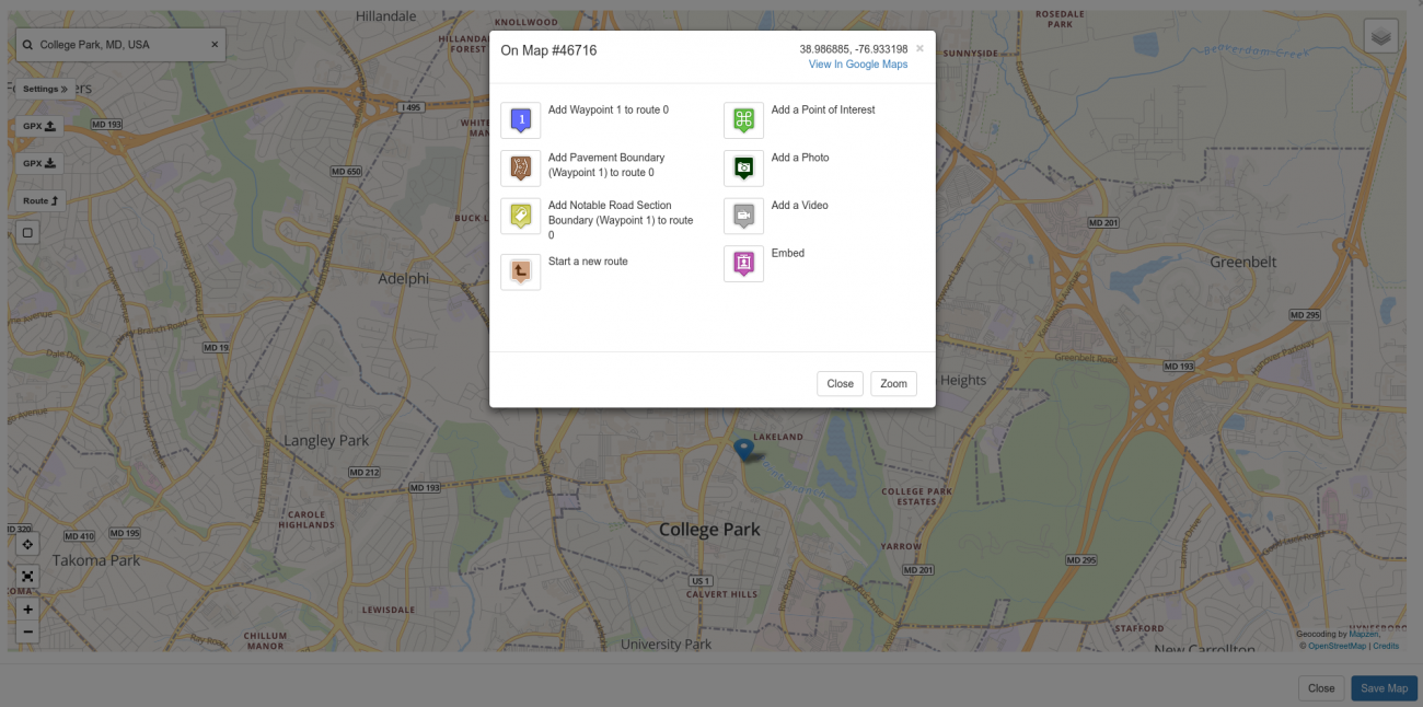
Notice the latitude and longitude of the point on the map in decimal notation is listed in the upper right. I often use this when I'm out on a ride to enter the coordinates for a given place into my GPS.
There is also a link to the same spot in Google Maps if you prefer a Google. (If you can't beat 'em, join 'em.)
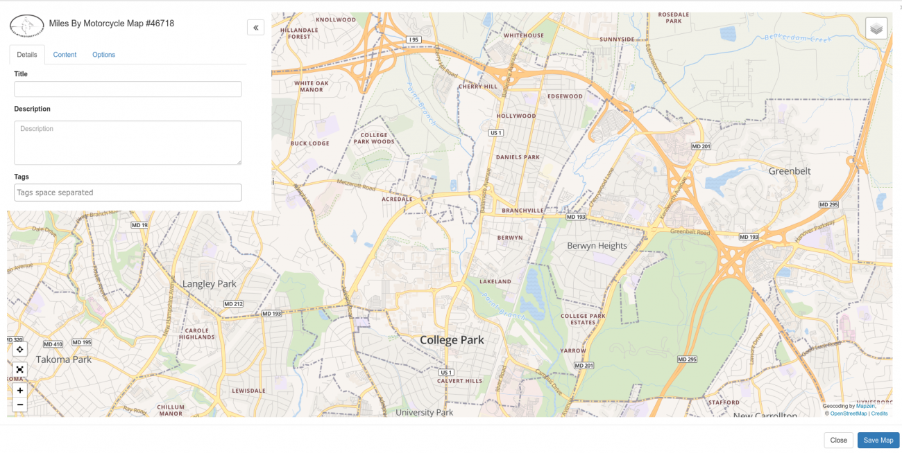
Map Settings: Title and Description
A big part of the mapping solution here is to be able to organize maps and all the elements on them in such a fashion that they are easy to find again later.
There is a settings button in the upper left which when clicked will open up a slide out panel.
Here you can add a title for your map. You should choose something descriptive the captures the point of the map so you can find it later.
There is also a description box where you can describe your map in more detail.
The keywords present in the title and description are used when searching the site.
Tagging
Tagging is a central theme on Miles By Motorcycle. Tags on Miles by Motorcycle work much in the same way that tags on Twitter and Facebook do. Tags can be thought of as categories you add to a post that help you find that post again. Tags take the form of single words and are displayed below the map when you view it. Virtually anything you post on the site supports being tagged. This includes maps, routes, tracks, points of interest, links, photos, videos, posts, comments, articles, etc.
There's no "correct" way to use tags. They are there for you to organize your maps and other things you post so you can find them again.
Some examples of tags I've used on my routes and tracks are:
- twisty - for twisty roads
- goodroad - for roads I particularly liked
- technical - for technical roads (will also cause the road to be rendered in red)
- easy - for easy crusing roads (will also cause the road to be rendered in blue)
- seattletrip2013 - for the maps, routes, and posts I put together around my 2013 cross country trip
- todo - for roads I'd like to ride or places I'd like to visit
- scenic - for particulary pretty places
Tags can be applied to other things on the site as well including forum posts, photos, and links. For example, I frequently use these tags:
- k100rs - for anything related to my street bike
- tech - technical subjects
The tags can then be used to search the site. Simply type a # followed by the first few letters of the tag in the site search bar at the top of the site and then select the item from the drop down list. For example, I tagged the Fort Valley Road Loop map above with "local_favorite", "scenic", and "twisty".
You can also just click on any displayed tag to see all the other items on the site with the same tag.
You can also add your own tags to anything else on the site, not just things you post. There is a small tag icon at the bottom of most posts, maps, routes, etc. By clicking it you can add your own tags. I typically do this when I find some interesting on the site that I want to remember. I also do this with interesting discussions in the forums and with photos and links people post. Sometimes I use tags instead of a ride plan if I think others might be interested. For example, when people mention unpaved roads and don't add the adv, offroad, or pavement_ends tags, I'll often go in and add them.
You then have quite a few options for narrowing down your searches to find what you have tagged. See the section on Searching below.
Uploading a GPX File
GPX stands for GPS Exchange Format and is a standard file format for exchanging route, track, and point information between GPS devices and GPS software. Every GPS I have come across can both import and export GPX files. For a bit more information on GPX files see this article I recently wrote.
If you have a Garmin GPS, when you plug it into your computer, look in the Garmin/GPX directory (folder) on the device. In there you should see a Current.gpx file. That will contain any routes and favorites you've added in addition to a track of any of your recent travels. You can use this to create a map of your rides which, these days, is something I do for virtually every ride I take.
You can also get GPX files from other sources. For example. RoadRunner makes a bunch of their routes available as GPX files. There are sites dedicated to the exchange of GPX tracks. GPX tracks are often mentioned on AdvRider. (You can enter #gpx in the search bar here, select gpx from the dropdown and hit search to see the links I've tagged with GPX.)
Once you have a GPX file, uploading it to a map is just a matter of clicking the GPX Upload button (first button under the location search bar on the left of the map.)
Select the file and click upload.
You should then see the contents of your GPX file rendered on the map. Depending on how big the GPX file is it may take a few moments for the map to render.
A Note About GPS Favorites
On Garmin GPSes you can mark places as "favorites" which you can then use as destinations when getting directions. For example, one special favorite is the "Home" favorite which marks your home location.
When the GPS generates the GPX file, it includes ALL the favorites, routes, and tracks that have been entered into the GPS.
So chances are you're going to want to remove some things before you save the map.
For example, here's a map that was created from a GPX that came directly off my GPS on my last ride up through Dover, PA. You'll note the blue marker.
You can click on the blue marker to get more information about it.
Clearly that marker needs to go.
Removing Unwanted Markers and Track Segments
Removing markers is as simple as clicking on them to bring up the marker popup and selecting Remove.
GPSes tend to break tracks into segments. Sometimes you may want to just delete a whole segment. You can just click on the track and select Remove to remove the entire track segment from the map.
You may also want to just cut out small sections of a tack. For example, you may not want a track you post to start and end exactly at your front driveway. The GPS starts recording as soon as you turn it on. If you're like me and turn the thing on in the garage and turn it off again in the garage, you may want the ability to cut out a section of the track so as not to show the exact location of your house or the location of friends you visit. (This has been a frequent request when I visit friends.)
The fifth button, a square, under the location search bar lets your select regions on the map to delete.
Just click the button. Then click and drag to draw a box around the area you want removed. Then click the scissors button.
After that, you should see the track cut out.
You can also use the scissor tool to cut a track into two separate sections which is sometimes useful especially if you're building a library of good roads or offroad sections.
Routes
There are two central concepts to GPS navigation which often confuse people.
There are "routes" and there are "tracks". The two are different and how you interact with them, because of they way they are represented, is different. As I mentioned, I wrote an article that describes the differences between routes and tracks.
Typically, you'll start out by creating routes. Routes are created by clicking on the map to add waypoints at various places through which you want the route to go and then asking the routing engine to plot a route along known roads that includes those waypoints as closely as is possible.
You can also upload routes contained in GPX files however you should be aware as explained in the article linked above that different GPS units and routing engines may choose different routes for a given set of waypoints.
Tracks typically come from GPX files and are record of your actual travels. During the planning phase you create routes. During the ride you record tracks of the actual path you took. In the story/ride report phase you upload the recorded tracks from your GPS onto a map. This doesn't cover every possible use but it's a way to conceptualize the difference.
So one way of thinking about the difference between routes and tracks could be:
- routes - the best laid plans of mice and men
- tracks - documentation of your misadventures
I also use routes to:
- keep track of roads I'd eventually like to ride (which I tag with #todo).
- keep a library of my favorite roads.
- recommend roads to others.
- plan my rides.
Planning a route is straightforward. It consists of:
- clicking on the map and dropping waypoints at the points you want the route to travel through.
- adding, moving, or deleting waypoints if the route the routing engine has chosen isn't to your liking.
- describing and tagging the route
Then, if you want to provide even more information about the route especially if you're documenting a truly great road you'd like to share with others, you can curate it by adding photos, videos, points of interest, and links to it.
Creating a Route
To create a new route on a blank map, find the starting location for your route. For example, let's say I want to plot a route from the Starbucks in College Park to Michaux State Forest in Pennsylania.
If you don't have a map open (in another tab in your browser), click on Groups at the top, select Miles-By-Motorcycle Public Group. Select the Maps Tab. Click "New Map".
Find the Starbucks in College Park, Maryland by typing in 'starbucks, college park, md' in the search bar and press Enter.
Select the "Starbucks, College Park, Md" entry.
A marker will be placed on the map and the "map click popup" will be displayed.
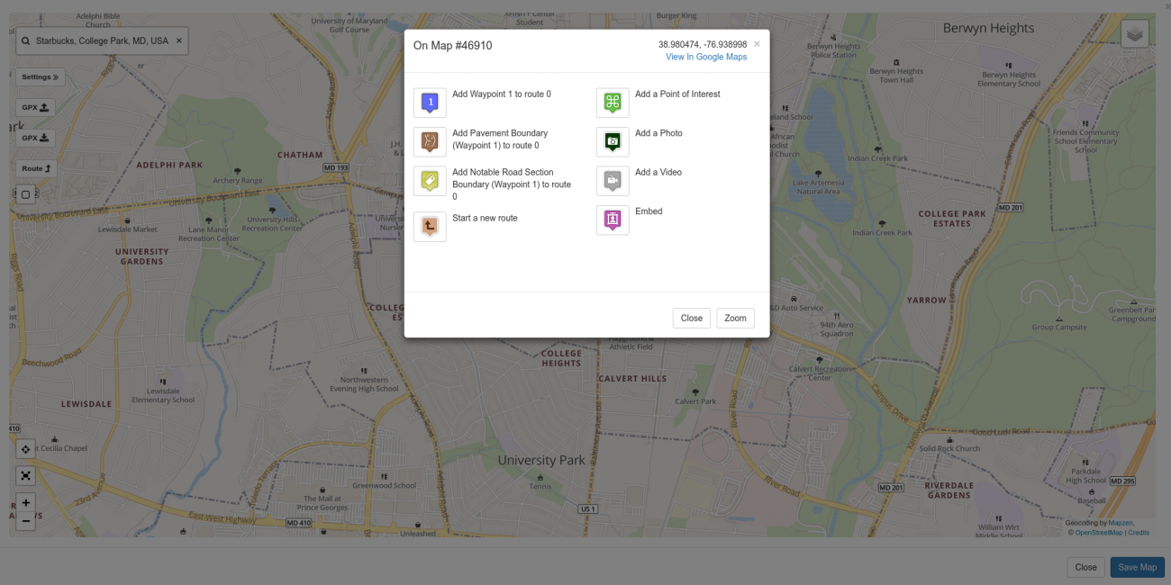
Click on the "1" icon in the upper left labelled "Add Waypoint 1 to Route 0". A waypoint marker will be dropped on the map.
Now type in "Michaux State Forest, Menallen, PA" into the location search bar, press enter, and select it from the list.
A marker will be dropped in the middle of the forest and the same "map click popup" will be displayed.
For this example, there's a road called Dead Woman Hollow Road, which if memory serves is unpaved, just North and West of where the marker is dropped. Close the popup. Zoom in and then drag the map over until you see where Dead Woman Hollow Road and Route 233 intersect.
Sometimes you can use the satellite view to see if a road is paved or not. There is a satellite view available in the map editor. You can display it by clicking on the box in the upper right corner of the map (called the Map Layers Box) and selecting "satellite view".
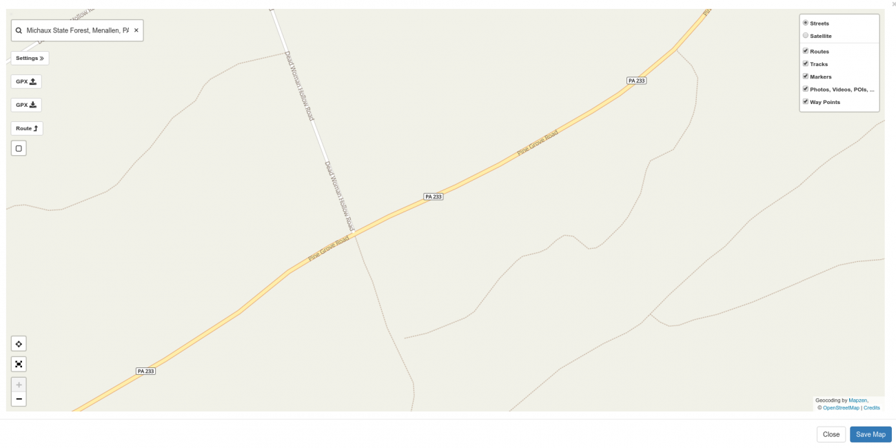
Satellite imagery is provided by Mapbox.
Later, once the map is populated with routes, tracks, POIs, photos, etc you can also use the Map Layer box to show and hide types of items which is sometimes useful if you're trying to get the name of a road under a rendered route.
To continue with the example for our route, click on the map where Dead Woman Hollow Road meets Route 233 to open up on the "Map Click Popup" at that location.
Note that the latitude and longitude of the point where you clicked is listed in the upper right of the popup. In addition, there's a convenient link to Google Maps in case you want to compare and contrast between the Openstreetmap data we use here and Google's data. Oftentimes, Google's satellite imagery is better than what I have access to.
Now to calculate a route from the Starbucks in College Park to this location on Route 233, click the "2" icon in the upper left labelled "Add Waypoint 2 to Route 0". A waypoint will be dropped on the map and there will be a slight delay as the route engine calculates a route. If you zoom out slightly, this is what the calculated route should look like:
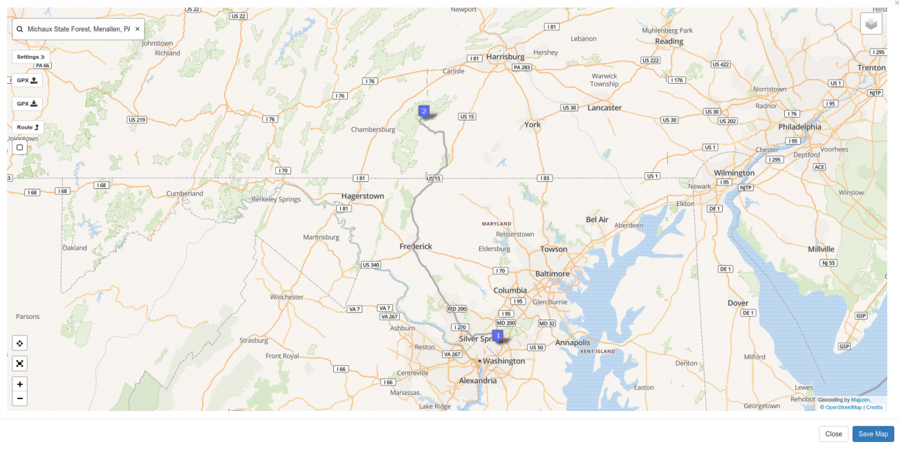
You can click on the route to bring up the Route Properties Popup.
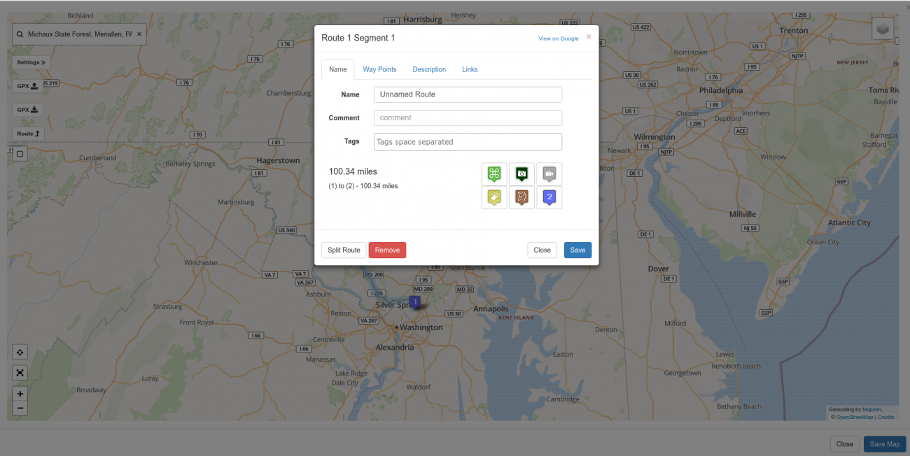
Here you can see that the calculated route is 100.34 miles long.
On this popup, you can name your route, provide a short descriptive comment suitable for display on a GPS, and a set of tags (as discussed above) to make finding this route easier later on. (As is discussed later in this article, when the map is saved, the route will be saved separately as its own 'element' in the database which is what enables someone to click on it later and add it to a ride plan. This is also why it's a good idea to not only describe the map but also each element on the map individually.)
(It should also be noted, the "comment" feature is here solely because some GPSes have the ability to display the comment along with the route. It is NOT used in searching the site and, frankly, may be removed in a future release.)
When laying out routes, if you want to find them again later, it's best to come up with some descriptive title that will be easy to remember. If it's a particularly notable road (which frankly route 233 in PA is) you can describe it further on the Description tab and add some tags.
Inserting and Dragging Waypoints
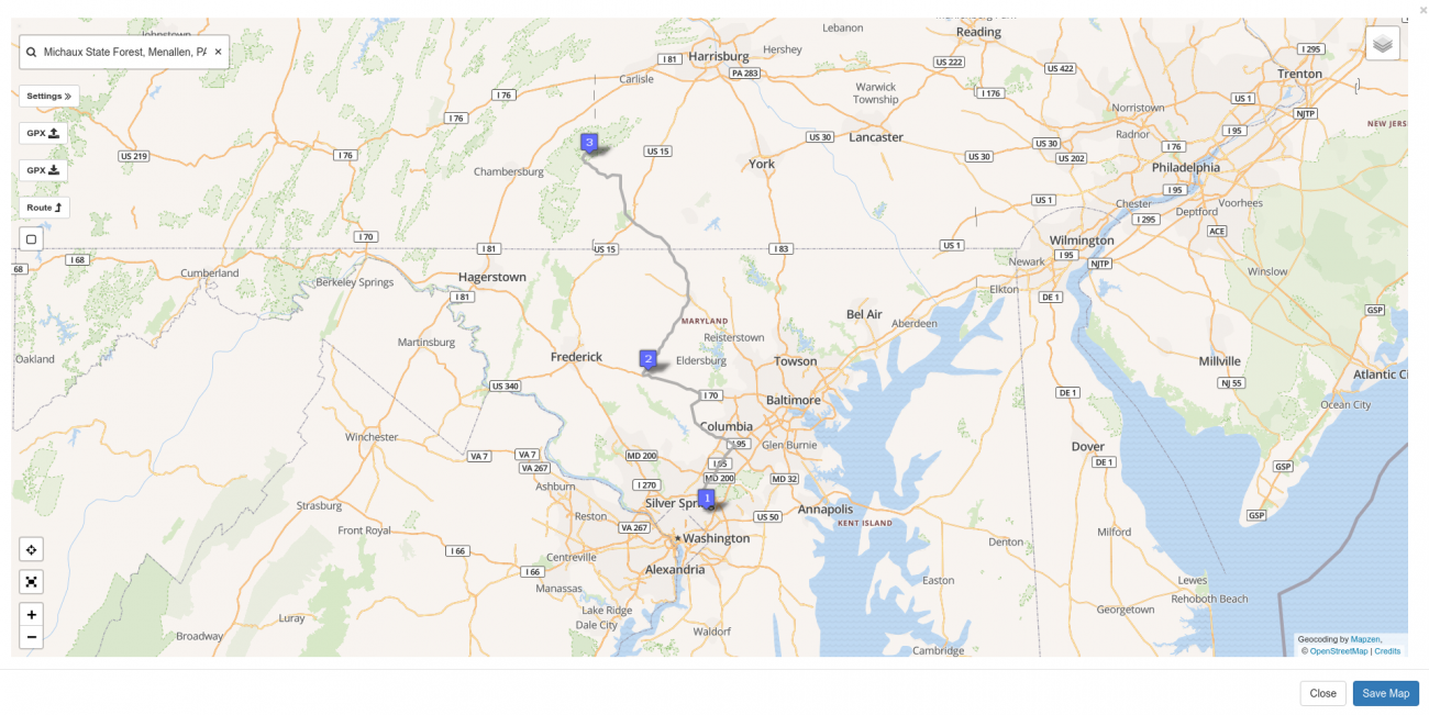
We may find that we want to refine our route. Let's stay that before we go to Michaux we want to go through Mount Airy.
To force a route through a certain location, "insert" a route point along the route and then drag it to the new point.
Click on the route to bring up the Route Properties Popup.
Note the "2" icon in the lower right of the popup. (See photo above). If you hover over this icon you will see it says "Insert Waypoint 2".
Click the "2" icon.
You will now see a "2" waypoint on the route and you'll notice the previous waypoint 2 at Michaux is now 3. Drag waypoint 2 over to Mount Airy (or where ever).
Once you've dragged the marker you will see that the route is recalculated to take the new waypoint into account.
If you click on the route now, you will see the distance has updated. You will also note that it now shows you the distance for the route segment you clicked on in addition to the total distance.
If you click on the WayPoints tab you can see the distance of each segment. From the waypoints tab you can also reorder the waypoints. Let's say you wanted to head to Michaux first and then to Mount Airy. Just drag and drop the waypoints into the order you want.
If you want to add points to a route you can just click on the map and select the waypoint icon in the Map Click Popup to add a waypoint at that location.
You can drag any waypoint and the route will be recalculated.
You can insert waypoints to force the route engine to choose a particular route. This is often necessary if you're trying to get it to route across gravel, forest, or small country roads.
You can remove waypoints by clicking on them and selecting "Remove".
Unlike Google, there is no set limit on the number of waypoints you can have in a route but practically speaking if you have more than 100 waypoints it can get quite slow.
Adding Multple Routes to the Same Map
You can have multiple routes on a single map. I find this useful if I'm trying to group together a bunch of road recommendations for a trip. For example, in 2013 I was planning a cross country trip and posted a question in the BMW MOA group asking for recommendations of good roads and places to see. For each road that was recommended I would create a new route and place it on my planning map:
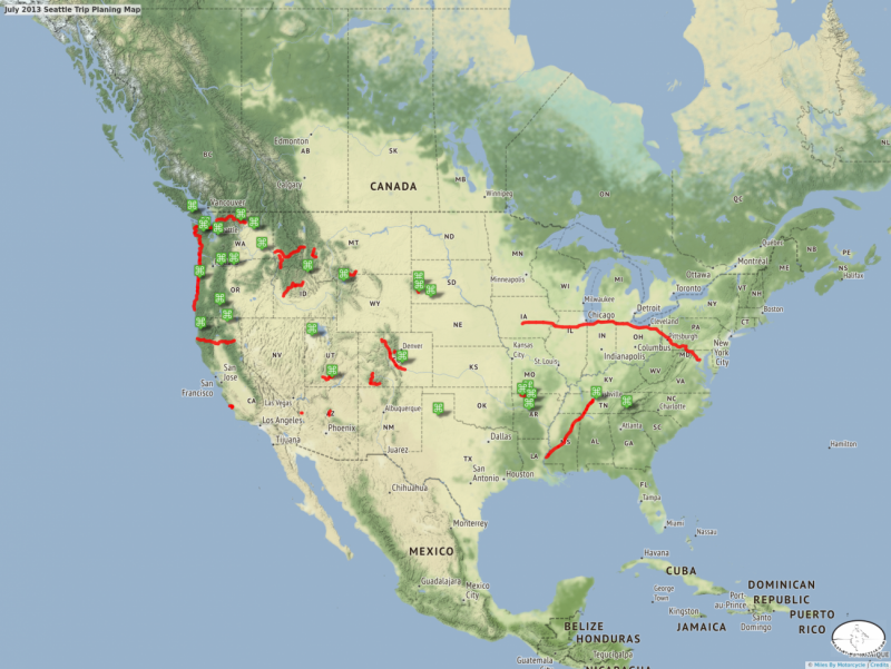
July 2013 Seattle Trip Planing Map
A little bit of route and sight planning for the upcoming 2013 Seattle Trip.
To add a new route to a map, click on the map where you want to start the new route and then click the "Start a New Route" icon. A new differently colored waypoint 1 will be added to the map.
Now when you click on the next location on the map, the next waypoint in the series for that route will be added.
If you decide you want to add a waypoint or make some change to one of the other routes, just click on that route. That'll set the "current route" to that one.
You can also use the Route icon on the left of the map to switch between working on different routes or starting a new one.
Splitting Routes
Sometimes the situation arises, especially when trying to create a curated library of the best roads, where you might want to split a route in two.
To split a route into two routes, simply click on the route where you would like to split it and click the Split Route button in the route popup.
Both routes will share the title, description, and tags. However, the second one will add "(from split)" to the title and automatically add the tag "revisit_split". This is done because if you are curating a thousand or so roads, it's easy to lose track of routes you've split and failed to go back and edit.
Deleting Routes
You can delete sections of routes by removing waypoints. You can remove an entire route by clicking on the route and clicking the Remove button.
Oftentimes, when uploading a GPX files it'll include routes that you don't want on your map. (I ran into this problem endlessly while on the Trans Am Trail trip as I had Sam's routes on my GPS but since they are commercial and proprietary I did not want to upload them.)
Curating Tracks and Routes
There are plenty of sites where you can download simple tracks and routes. However, I find most of these lacking because when I look at a given track there's no mention of why I might want to ride that section.
A big part of the mapping system on Miles By Motorcycle is to create an organized and curated library of roads and destinations, each adequately answering the question "why would I, a motorcyclist, want to ride this?", that I can use to create ride plans.
I want to know more than just that there's some road. I want to get some insight into why I might want to add it to my plan and ride it. To enable this, tracks and routes can be "annotated" to provide much more context for the motorcycle traveller.
If you click on a track or a route, the properties popup will appear. For example the track properties popup looks like this:
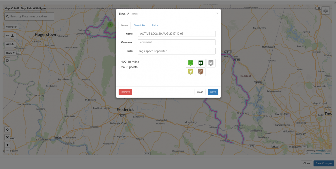
Similar to the map settings slideout, the properties popup lets you add a title, a comment, a set of tags, a description, and some related links. If you have a notable track or route that you'd like to be able to easily find again or share with others you should give it a descriptive title.
The comment is intended to be a short line of text that some GPSes can display. (As of this writing, the comment line is not used when searching on the site. See the description tab.)
As mentioned above, tags are a central theme on the site useful for helping you organize your tracks and routes so you can find them more easily in the future.
The description tab allows you to add a longer more descriptive block of text intended to include more detail about the track or route and why one might want to ride it. The description field is also used when searching the site.
Highlighting the Best Sections
One thing I have always wanted to be able to do is to mark the best roads that I've ridden. Most often, these best roads are just sections of bigger rides.
Highlighting the best sections works for both tracks and routes.
If you have a route or maybe track from your GPX file that includes a truly awesome section, click on the point where the best section starts.
Then click the yellow tag icon:
Once you click the icon, the track from the point where you clicked until the end will be highlighted in yellow.
Now click on the point where the best section ends and once again click the yellow best section icon.
You will now notice that the best section is of your route is clearly highlighted in yellow. In this way, when looking at a route or a track, the best sections of the road are immediately visible. In the above example, Mt Sterling Road through the park is a truly fantastic road. However, much of it is unpaved.
Highlighting Unpaved Sections
Another thing I wanted to accomplish with Miles By Motorcycle was to create a library of legal unpaved roads that I and my buddy Duncan could ride our Suzuki DR650SE's on.
Marking an unpaved section of road works just like marking a best section.
Click on a route or track where pavement ends and then click on the brown Gravel Road icon in the popup. You will notice the line of the route or track change to dashes from that point until the end.
Then click on the point where the pavement starts again.
You'll notice that it's possible to combine "Best Road" with "Unpaved Road" making a "Best Unpaved Road" which this route through the park definitely represents.
Some Notes on Best Sections and Pavement Boundaries
The way Best Sections and Pavement Boundaries work in routes is slightly different than in tracks.
In routes, the best section and pavement boundary markers are actually waypoint markers. This means that you have the flexibility drag them, delete them, insert them, etc.
As of this writing the support for annotating best sections in tracks is incomplete because there is currently no way to change the boundaries on a track once they have been set. The only option is to delete it, upload the track again, and place the markers again.
The way best sections and pavement boundaries are handled will be dramatically improved in an upcoming release which should be availabe in the first quarter of 2018.
Adding Points of Interest (POI)
In any motorcycle trip, there will be points along the way that are notable. The Deal's Gap Resort. An overlook off the Blueridge Parkway. Waterfalls. Good restaurants. Camp Grounds. The Grand Canyon. Atigen Pass. Endless others.
The Miles By Motorcycle mapping system includes the concept of a Point of Interest which is a way to represent these notable points on a map. Each point of interest is marked with an icon.
Points of interest can be "free floating" on the map or associated with a track or a route. If associated with a track or route, that POI will be displayed along with the track or route whenever the track or route is mentioned. (See the sections on Saving and Searching below).
To add a point of interest, click on a point on the map or on a track or route and then click on the Point of Interest icon.
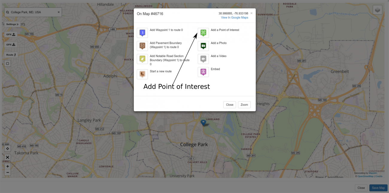
When you click on the icon, first the Miles by Motorcycle database is searched to see if there have been any POIs added close to the location where you clicked. In this way, I hope that duplication of points of interest will be reduced.
For example, if I click on the Starbucks across the street, which to my surprise I have not yet added I get:
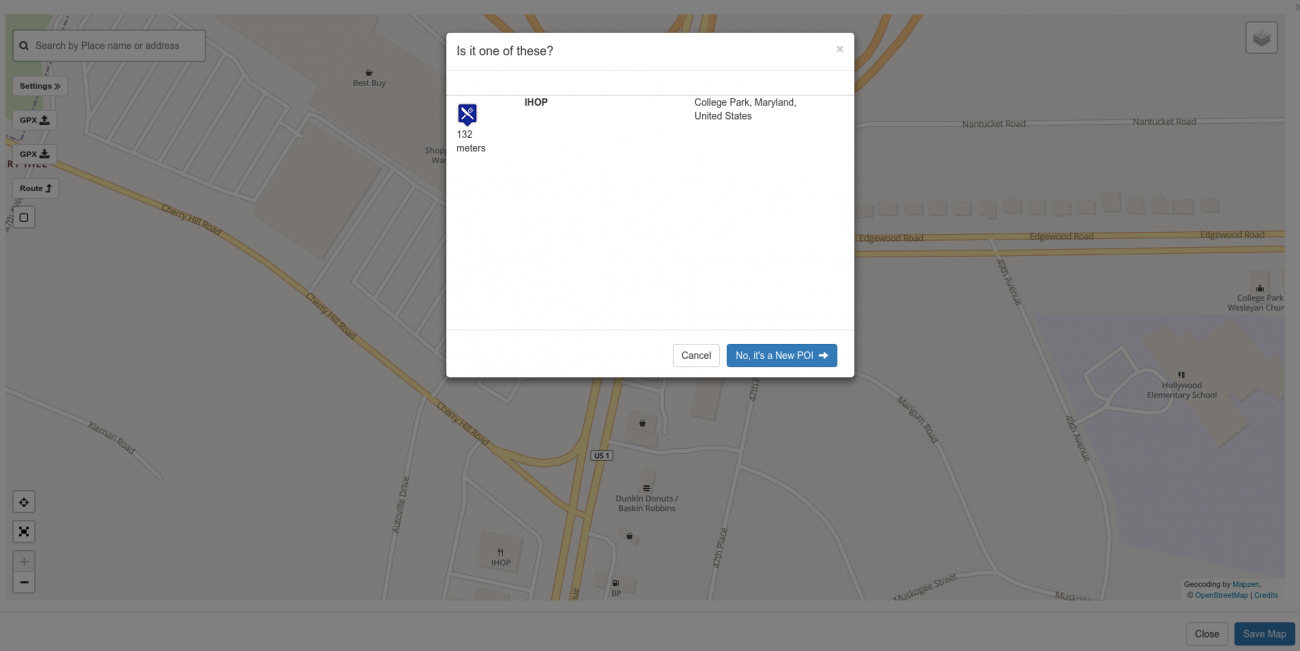
There's an iHop across from the Starbucks. In this case, it's not the POI I want so I click "No, it's a new POI" which leads me to the next screen:
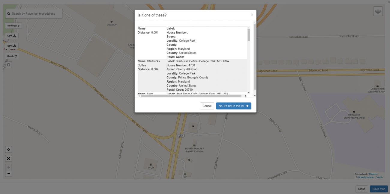
The address for the Starbucks is listed in the second position, so I click on the second item in the list. If it was not in the list, I'd click the "No, it's not in the list" button. In either case I am then presented with the Point of Interest type popup.
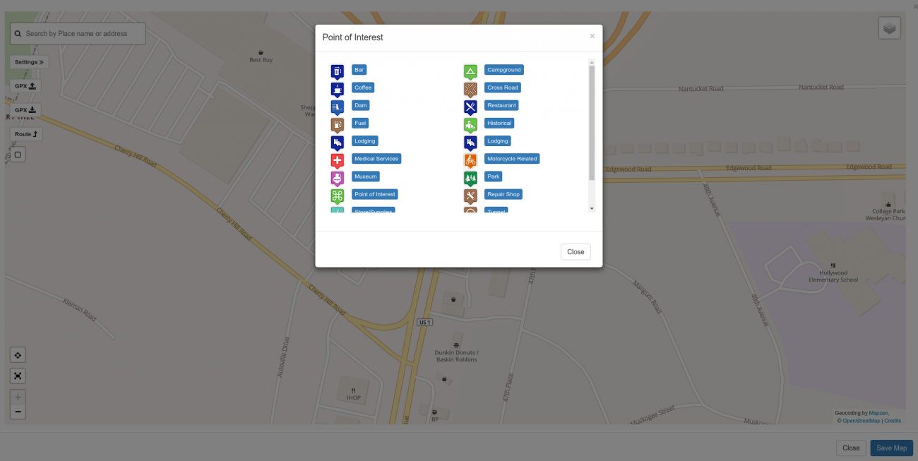
There are currently 20 different kinds of Points of Interest you can choose from. In this case, being Starbucks, I choose the Coffee icon. In the case where there's no appropriate icon just select the generic Point of Interest icon in the left list.
Once you click on one of the icons in the list, the point of interest is put on the map at that location. You can drag the POI to change it's position.
Once it's on the map, you can click on it to bring up the POI Properties Popup where you can add some information about the POI in a fashion simllar to others items discussed earlier.
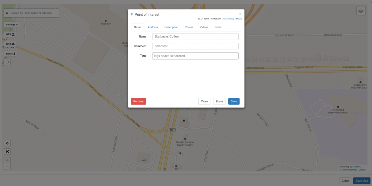
Similar to everything else in the system, here you can edit the title, comment, tags, and description of the POI. You can also elect to remove it from the map.
POI Extra Information
You will notice that on the Point of Interest Properties popup there are three additionals tabs:
- Photos
- Videos
- Links
In the case where you're adding a point of interest that represents a place you think others might want to go, offering additional information about that place to let the rider know why they might want to go there can make the POI entry much more compelling and useful. To this end, you can add photos of the place, videos from Youtube or Vimeo, or related links from the Web.
Adding a Photo to a POI
You may add any number of photos to a POI. Select the Photo tab and then click Add Photo.
From there click "Add Files" and select the photo from your computer or phone to add to the Point of Interest Entry.
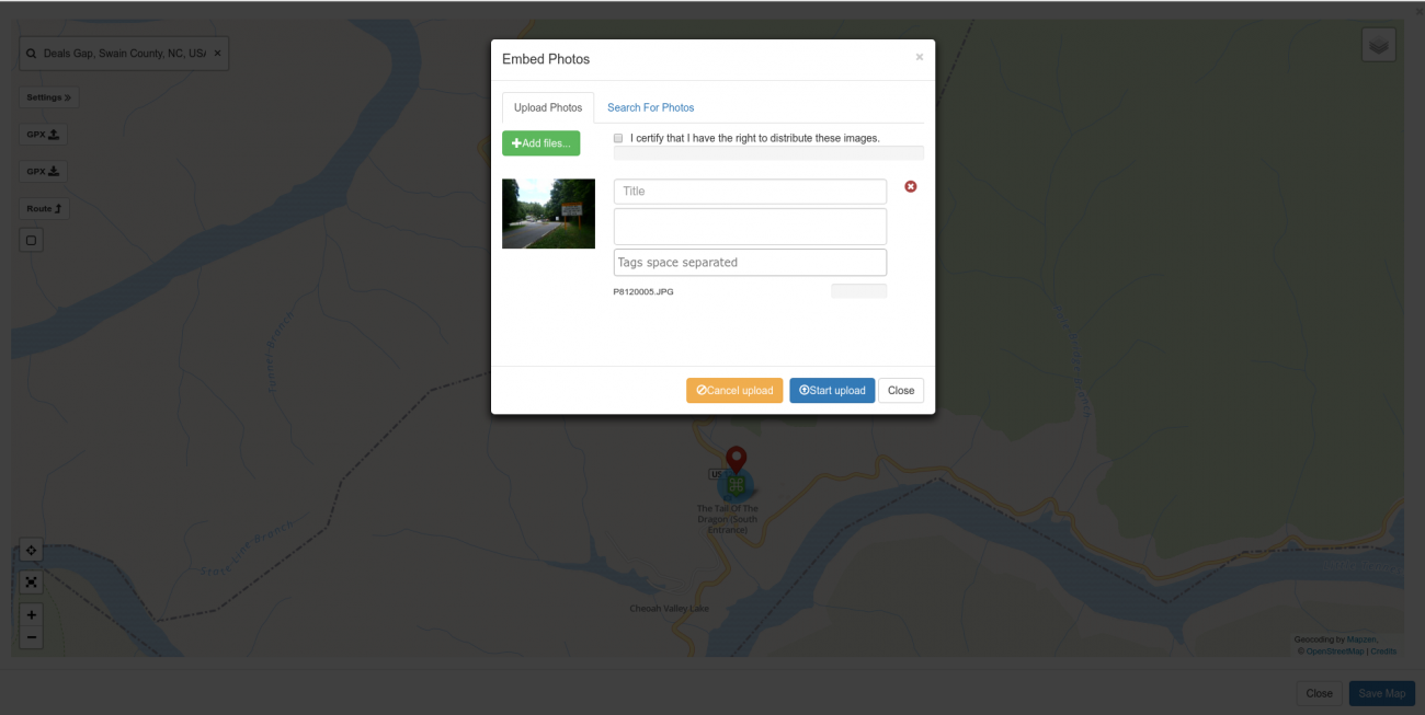
Once selected, you have the opportunity to add a title, description, and some tags to the photo. Once you're done, click "Start Upload".
The progress bars will move as the photos are uploaded. Once uploaded, each photo will be displayed with an "Add" button next to it. Click each add button to add it to the post. (NOTE: I hope to improve this.)
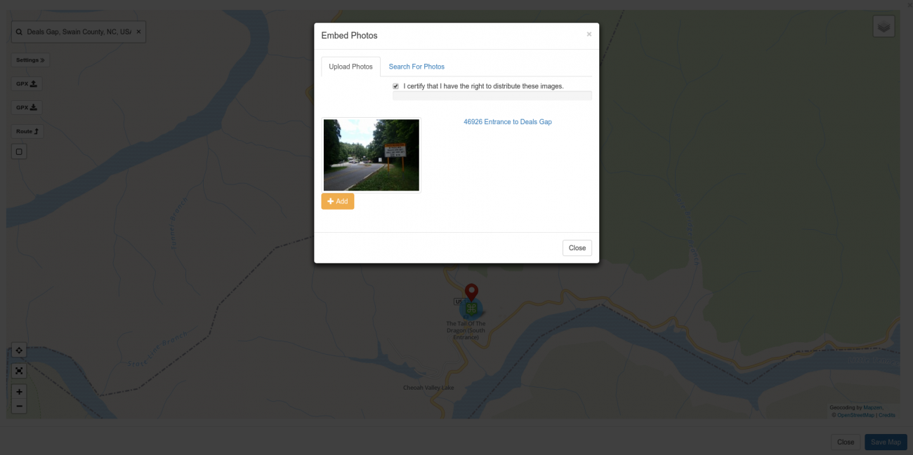
Once you click add, the photo will appear in the POI Properties Photo tab.
(NOTE: There is a bug here in that when you click the Add button there is no feedback. I will fix it. Click the Add button for each photo then click close.)
Click Save on the POI properties popup.
NOTE: See Saving and Searching below. At this point the photo has been uploaded and an entry for it created in the database (meaning it will be available in the Photos tab in the group or in your personal photos if you're creating the map under your profile). However, it will not get associated with the Point of Interest until you save the map.
Adding a Video to a POI
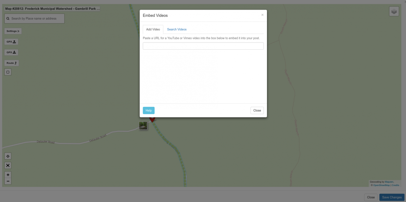
If you select the Videos tab on the POI properties popup, you can add YouTube and Vimeo videos to the Point of Interest.
You have to first upload the video to YouTube or Vimeo. Once you've uploaded it and have the URL for it you can elect the Videos tab and then click the "Add Video" button.
Paste the URL of the YouTube or Vimeo video into the box. The site will fetch the details for the video.
A carousel of images pulled from the video entry will be presented on the left. Title, description, and tags on the right. Edit and tag as you see fit and then click the "Add" button. Note that if you're working on a map in a group, the video will be saved in the group videos list as well.
Adding a Link to a POI
Adding links to POIs is the same process as adding videos. Click on the POI "Links" tab and click add link. Paste the URL for the link into the box and wait for the site details to be pulled. Pick a photo and edit the title, description, and tags to your liking and the click the Add button.
Links added to POI's will also be listed in the Links tab if the map is being added to a group.
Adding Photos to the Map, Routes, or Tracks
In a fashion similar to POI's, you can add photos "free floating" on a map or you can add them to a track or route. In either case the process is essentially the same.
Click on the map or on a route or track. Then in the resulting popup, click on the camera icon.
You'll be presented with a popup with an "Add Files" button. Click that to select photos from your computer or photo to upload.
As is the case with other things you can post to Miles By Motorcycle, you can add a title, a description, and some tags to your photo. Once you're ready check the "certify right" checkbox and then click Start Upload.
You must click that you certify that you're allowed to share these photos.
Once uploaded you'll be shown the embed screen.
ADV Harleys. Gotta love it.
It should be noted that there are, for our purposes here, two kinds of photos:
- photos that include GPS location information (GeoTagged Photos)
- photos that do not include GPS locaiton information.
Your cellphone and many cameras on the market today have the option of embedding the location where the photos was taken directly into the photo. This is often referred to as "geotagging". If you want to put your photos on maps, it's a setting that you'll want to make sure is turned on in your phone or camera. When you upload a photo to the map it'll determine whether or not the photo has been geotagged. If it has you will have two options:
- place the photos at the geotagged location where it was taken
- place the photo where you clicked.
You can force the photo to be placed where you clicked by clicking the "Add at Marker" button. Or if you want to place the photo where it was taken, you can click the "Add GeoTagged" button.
Sometimes the GPS does not correctly identify where a photo was taken. I've had it happen that photos get placed miles away from where they were taken. Mountains, tree cover, and other factors affect how accurate the GPS coordinates are.
Once you click one of the add buttons, your photo will be added to the map. If you originally clicked on a route or track the photo will be associated with that route or track. This means if you search the site and bring up this one track or route the photo will be displayed along with it. See Searching below.
Another way I use photos on tracks and routes is to mark where interesting things are. For example, the photo I added to Mt Sterling Road above clearly shows the unpaved section started at a point before I marked it .
So oftentimes I find it's best to upload photos first and use them to guide where I mark good or unpaved sections.
If you want to remove the photo you can cilck on it and select "Remove". (Note that removing a photo from the map DOES NOT delete it from the server. It just removes it from the map.)
Adding YouTube and Vimeo Videos to the Map, Routes, or Tracks
You can also add Youtube and Vimeo videos to the map or to track and routes.
The process is similar to adding photos however you must first sign up for a YouTube or Vimeo account, upload the video, and get the link. (We don't have the bandwidth to host videos ourself at this time I'm afraid.)
Once you have a video uploaded to your service of choice get the URL of the video. On YouTube select the Share button under the video and click Copy.
Then click on the map, track, or route where you want to place your video. Click on the Video Camera icon in the track popup.
Adding video works just like adding links. Once you paste the location of the video into the box, the details of the video will be fetched and you'll have the opportunity to edit the title and description in addition to adding some tags. You can also select the cover photo from the caroursel.
Just like with links, when you post a video to a map in a group, the video will be added to the group videos tab.
Once placed, the video will be represented by a camera icon.
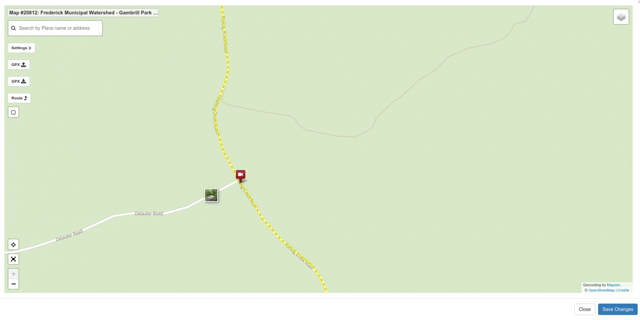
Here's the map with the video:
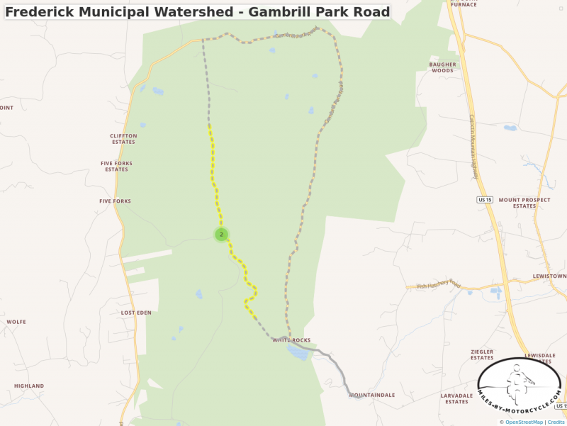
Frederick Municipal Watershed - Gambrill Park Road
Part of the dirt roads/trails in the Frederick Municipal Watershed
Adding Links to Routes or Tracks
Oftentimes, there are useful links out on the World Wide Web which provide additional information about an area or a road. I'm always trying to find good places to put links that related to places I've been or places I may go.
Miles by Motorcycle supports the idea of adding links all over the place. Links can be added to tracks, routes, and points of interest. They can also be embedded into posts and comments or added directly to the links tab in a group.
The link system here is roughly inspired by Facebook. When you add a link, the site does it's best to pull details from the linked page. It then opens a popup with whatever details it was able to find about the site filled in. If there are images on the page, it'll give you a carousel where you can select the image from the site to associate with the link. There's also a place to add a title, description, and tags.
For example, Mt Sterling Road through Smoky Mountains National Park is on American Rides Map's OR1 map. So I might want to add that link to that map directly on that track:
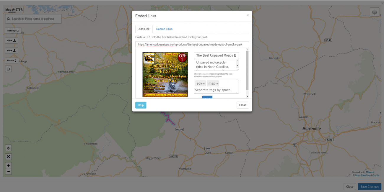
Just click the Links tab then select Add Link. Paste the full link into the box. If the link has not already been added to the site, you'll see a "Getting Site Details" message. Once the site has been fetched, you'll have the opportunity to describe the link, add some tags, a description, and select one of the photos from the site to include with the saved link.
Once you have the details of the link set the way you like, you have to click the "Add" button below the details (you may need to to scroll to see the add button.)
Then click Save to save the link to the track.
If the link has already been added to the site, it'll show you the entry and give you the option to add the link to your track.
IMPORTANT: Nothing is saved to the server until you click the SAVE button down at the bottom right corner of the map window.
In summary, to add a link to a track:
- click on a track or a route to bring up the properties popup.
- select the Links tab.
- click add Link
- paste the link into the box or you can use the search tab to search for links that have already been added to the site.
- edit the title, description, and add some tags.
- scroll down a bit to click the "Add" button.
- click the save button on the track popup to save all your edits to the track.
- once you're done with everything you want to change on the map click SAVE in the lower right corner of the map to save everything to the server.
If you're saving your map in a group and you include any links in the map, the link itself will show up in the links tab in the group. For example, to see the list of links that have been saved in the MBYMC Public Group click here.
Exporting to GPX
Maps can be exported to GPX files. This is useful if you want to load routes, tracks, or points of interest from your maps onto your GPS.
For maps that you have created, you always have the option to export it to a GPX file yourself. Simply edit the map and you will notice a download GPX button on the left.
If you want others to be able to download your map as a GPX file, you can edit the map and open the settings slideout. Click the Options tab and then select the checkbox next to the "Allow GPX Download" and then save it. Now any member of the site who is allowed to see your map will see a button to download it as a GPX file.
Saving
No changes are saved to your map on the server until you press the "Save Map" button. This means you can cancel your work at any time. However, it also means that any changes you make to routes, track waypoints, points of interest, and annotated sections will be lost unless you remember to save the map.
There are some exceptions to this, however. At the time of this writing links, photos, and videos are added to the server immediately when you enter them but they are not associated with the map until the map is saved. This means if you add a photo, link, or video to a map but then cancel the map without saving it, the photo, links, or videos will still be present and available on the server. They just won't be associated with any map. You can see this in action by creating a map in a group, adding a photo to the map, and then closing the map without saving it. The photo you added will be listed under the Photos tab in the group. (It's easier to simply do an advanced search to find the photos you've just added. See below.)
As a result, if you decide that you do not want the photos, links, or videos that you added to the map on the site, you will need to do a quick search to find them and delete them.
This leads us to to what makes the Miles by Motorcycle mapping system different from any others I've come across. It has also been the source of some confusion.
When you save a map, all the items on the map are saved to the database individually. Each route, track, point of interest, photo, link, video, etc gets its own entry in the database and can be searched for indivdually. (See Searching below.) The map itself is then just a "container" that "mentions" all of these various items.
While it adds some complexity it is what enables perusing the site and adding whatever you see to "Ride Plans" which you can use to quickly plan rides consisting of routes, tracks, pois, photos, etc that you or anyone else on the site has shared.
Editing
You can edit any map that you have created. To edit a map, find it (see Searching below), click on the down arrow in the upper right, and then select Edit.
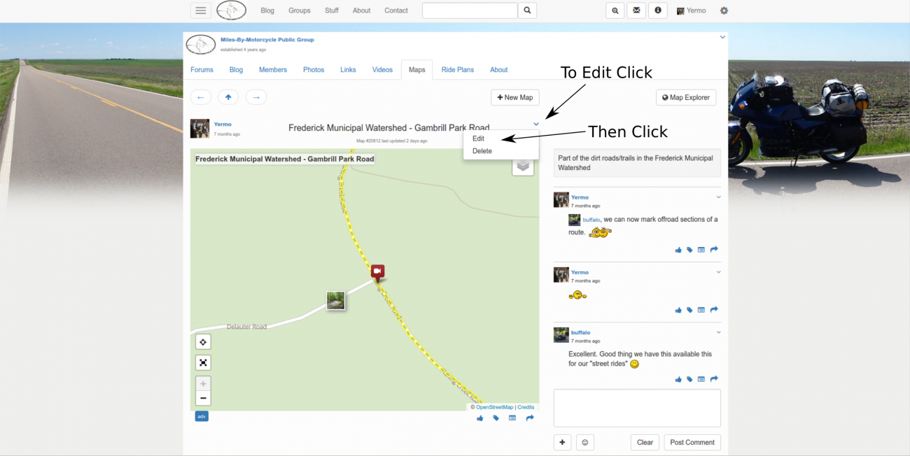
You can then work with the map just as if you had just created it.
One thing to note is that since every element on the map was saved separately if you elect to "Remove" something from the map all it does is break the association between that element and the map. It doesn't actually delete the element from the database.
So, if you click on a route and remove it for the map, you can still find the route by searching for it. So if you want to completely delete something from the server you have to find that thing separately and delete it individually.
This, however, has a side effect in the reverse. If you delete something from the server such as a route, a POI, a photo, etc that element will be deleted from any ride plans, posts, comments, etc that mention it anywhere on the site.
(NOTE: on my TODO list is to add a warning about how many places a given element is mentioned before deleting it in addition to offering a way to delete an item from the database directly from the map editor. Searching for the thing separately to delete it is cumbersome.)
Deleting Items
To permanently delete an item from the server (and every place it is mentioned), search for the item (see below), click on the down arrow in the upper right of the item and select "Delete".
Once something is deleted it cannot be recovered so please be careful. (Strictly speaking, items that are deleted may be present in the last backup but please don't ask me to go in and try to recover them for you as it's quite a lot of work.)
Searching
One of my primary design goals with Miles By Motorcycle was to be able to find things later. On Facebook and other social media sites, there is a wealth of information in the discussions that happen every day but there doesn't seem to be any easy way to go back and find them again. They are all drowned out by the noise.
On this site, I wanted to somehow capture all the valuable information that's posted and turn everything that members share into a kind of collective knowledge base on the subject of motorcycle travel. I looked at the way that I usually try to find things and designed my own search engine around it.
Searching on Miles By Motorcycle you can search by:
- keywords present in the title and description. For example, "Frederick Watershed" which, if you type it into the search box at the top of the site yields 30 results including a couple videos, some photos, a bunch of tracks, a few maps, a ride, a link, a thread, a post, etc.
- tags applied ot the post. For example, typing in "#adv", clicking on adv in the dropdown, and then clicking search yields 91 results as of this writing.
- who posted it (or tagged or liked it)? You can search for things posted (or interacted with) by a given member or members. For example to search for everything I've posted, tagged, or liked on Miles By Motorcycle, in the search box type the @ charater followed by yer and then select "yermo" from the dropdown and click search.
- when it was posted. You can narrow the search results by time range. For example, you can select the advanced search box (the magnifying glass with a plus in it), scroll to the bottom of the popup, and select "today" to see everything posted on the site today.
- what was posted. You can narrow the search results down by type of element that was posted. For example, you can select the advanced search box, and then click the checkbox next to "Video" to get a list of all videos posted to the site.
The results returned by the searches above may be different for you depending on which groups you belong to and what level of access you have.
It's possible to combine all of these features simultaneously into a single search. For example you might want to search for all videos that I posted with the word "Witt" in the title of description, tagged with #transamiltrail, this year.
To do this, click the advanced search icon on the top bar. (Magnifying glass with a plus in it).
Type in "witt" followed by #trans (select Transamtrail from the list) followed by @yer and select Yermo from the list.
Click the checkbox next to "Video"
Select "Year To Date" from the date range dropdown.
If you remember the example of embedding videos, links, and photos on the map, routes, tracks, or points of interest, there was a "Search the Site" tab on each one of those. The search in those popups works the same way the main search does. You can search by member (it's often useful to search for things you yourself have posted by searching on your own username), tags, etc just like in the main search box.
Finding Things By Following Mentions
Sometimes I'm searching for something but I can only remember something about what was posted. For example, I was just thinking about a guy I met on the Trans America Trail who drove his Land Rover along the entire trail. He has a website.
I can't remember his name.
I don't remember the website.
I don't remember exactly where I met him.
But I do remember, I had a photo of him and his land rover that I took last year.
So maybe I can search for photos last year tagged with #transamtrail shared by me.
Enter #transamtrail @yermo click photo and last year.
The results should look something like:
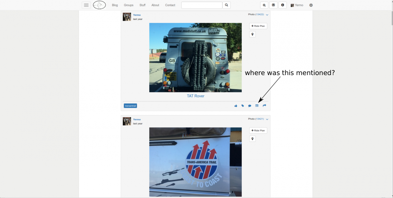
There it is. Now you can click the "mentions" icon to see where on the site this photo has been mentioned.
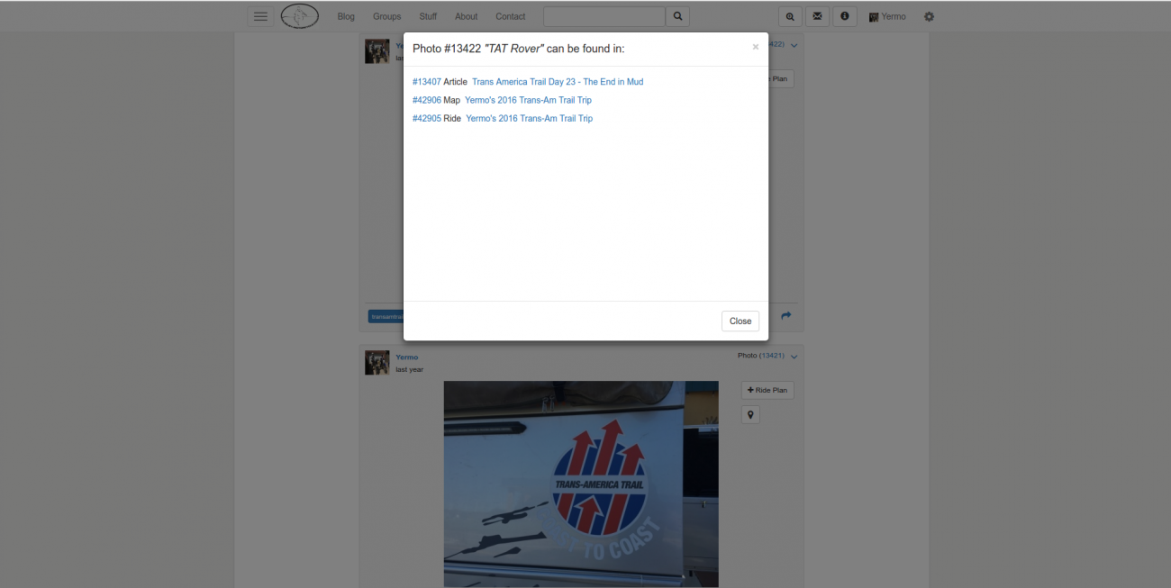
And you can see this same photos was mentioned in a blog article, a map, and in a ride. (More on the "ride" feature in a follow on article.)
Everything on the site is linked in this fashion. So if you can't remember exactly what you're looking for but can remember something that's related to it you can often search for the related thing and then bounce along the mentions unitl you get to what you were looking for.
Searching By Area Using the Map Explorer
A recent addition to Miles By Motorcycle is the Map Explorer. It's in it's early stages at the moment but it is now possible to search over an area for any photos, videos, tracks, routes, or points of interest posted in that area by keyword, tag, and/or member.
The map explorer is available from the top left dropdown menu:
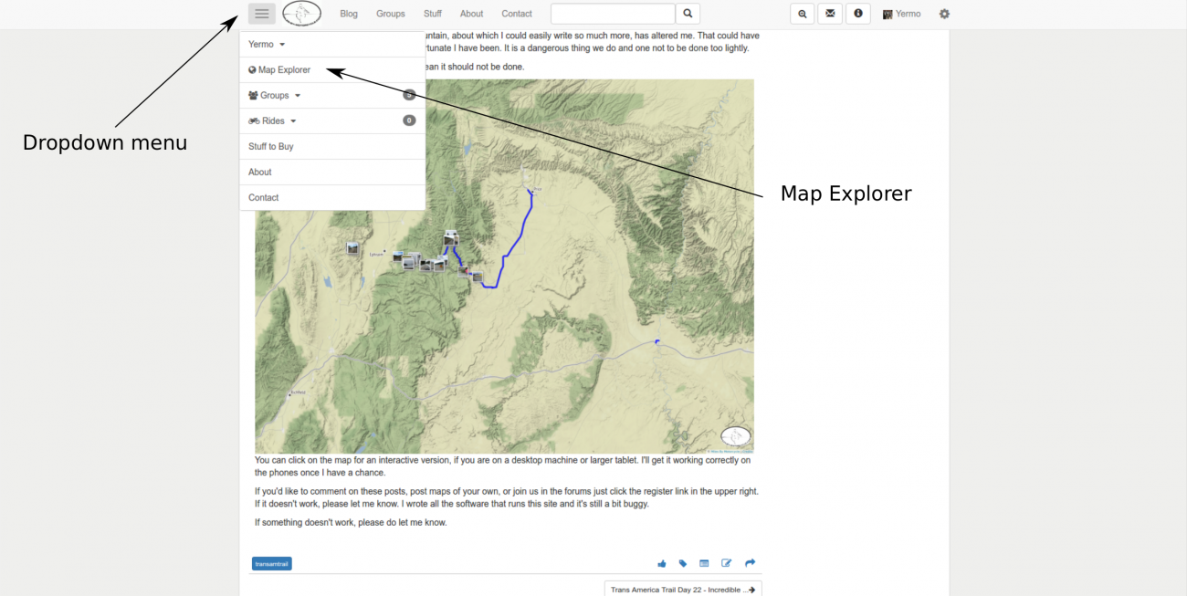
The map explorer will bring up a map with a search box. The search box on the Map Explorer however (as of this writing) only lets you search the Miles By Motorcycle database. It does not let you search by geographic location (yet).
The search box works the same way the main search box works. You can search by keyword, #tag, or @username. As of this writing, however, you cannot (yet) search by element type or date range but that is coming in an upcoming version.
To see all the things you've posted in an area, zoom and pan to the area of interest and then type @ followed by the first few characters of your username, select it from the list and click the search button. For me searching around my local area yields:
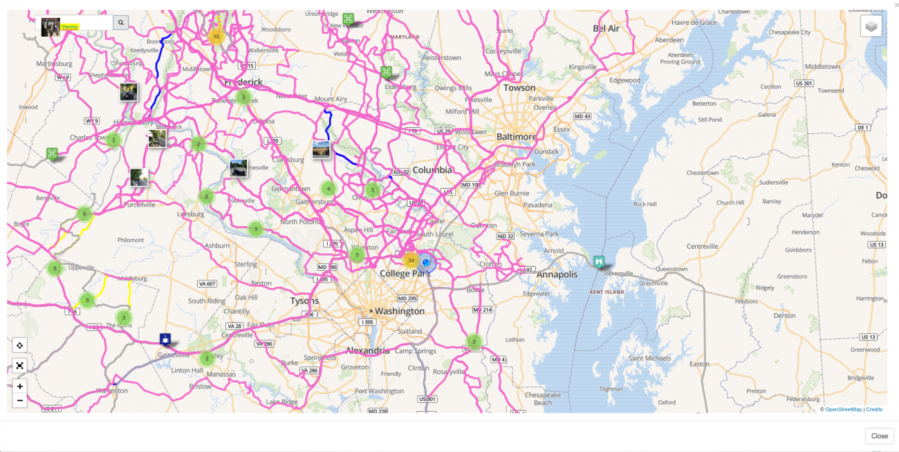
Depending on how large an area you are searching and how many items are returned it can take QUITE a long time for the map to render. So in general it's best to be very specific about searches and keep the areas small.
I find the Map Explorer to be quite useful as I travel. If you have been tagging routes or places with #todo, you could search over the area you're in with @ your username and #todo to see them. This is a great way of seeing all those roads you intended to ride in a given area. It's often easier just to add a #todo tag to places and search in the map explorer than it is to create ride plans but your mileage may vary. I tend to do a combination of both.
Once you have some results, you can then click on each track, route, photo, POI, etc to get details about it.
When you click on an item in the map explorer a properties popup will be displayed. It's because the Map Explorer can return an overwhelming number of results that adding good titles, descriptions, and tags to tracks and routes is a good idea.
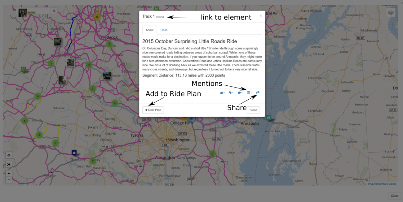
You can click on any track, route, point of interest, or photo from the map explorer to get a similar popup.
Each element (a.k.a. "object") on Miles By Motorcycle gets its own unique number that is used to reference that element. It's listed at the top of the popup. (You'll also notice that for each photo, map, route, and POI in this article the object ids are also listed.) You can click on the number to jump to a view of that item by itself. From there, if it's something you shared, you can edit it.
Along the bottom right of the popup are a list of icon buttons which are:
- like
- tag
- comment
- mentions
- share
You can let the poster know you liked their post by clicking on the like button. If you however over it you can see what other members have liked the item.
You can add your own tags to the item. For example, if you wanted to remember this particular track you might tag it as I do with "#todo". Just click on the tag icon and add your own tags. (Then later you can search the site for tracks tagged by you with #todo).
You can also start discussion right here about this track. Click the comment icon to leave a comment for the poster. They will get a notification that you left a comment. In this way you can have discussions directly in items on a map.
The mentions button, as described above, will show you all the places where this item has been mentioned.
Finally, for items that are posted in public groups you have the ability to share the item to Facebook, Twitter, or to copy a permalink for sharing in email or other sites.
Lastly, if this is a place you might like to visit or you think you might want to organize a ride to include this thing, you can click the +Ride Plan button to add it to a ride plan of yours.
Sharing
Lastly, once you have maps or ride plans built, you can embed them directly into your posts around the site.
For instance, in the forum, you can embed maps into your posts by clicking the Map Marker icon at the bottom of the post entry box:
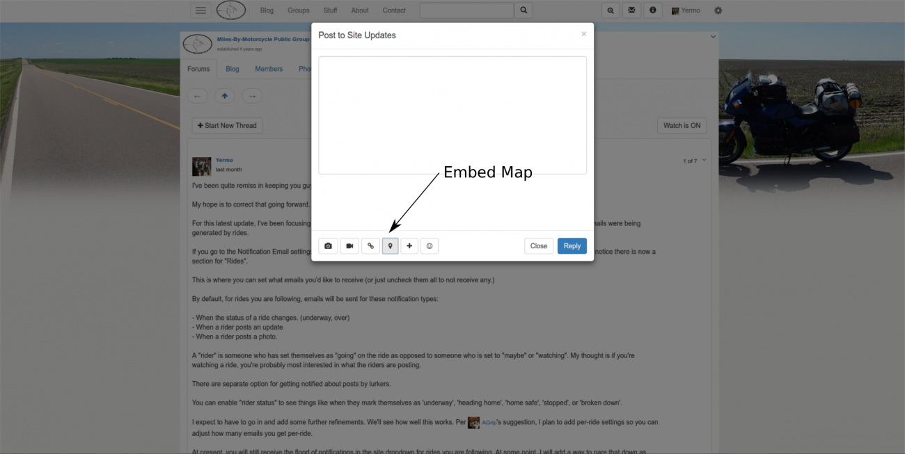
Click the map marker icon and then click the Search For Maps tab. Enter @ followed by the first few letters of your username and select it from the dropdown then search. Click "Embed" new to the map you want to embed in your post.
Static Maps
Each time you save a map, a static screenshot is generated. It sometimes takes a few seconds to generate. Static maps are useful for sharing as photos in ADVRider photos and for posting to Facebook and Twitter.
To find the static version of any map, search for a map. A link to the static version is included.
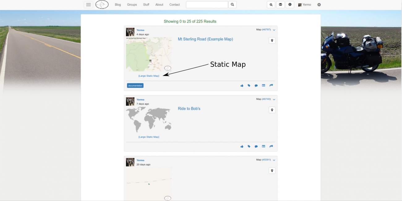
To use a static map in an ADVRider post right click on the "Large Static Map" link and select Copy Link Address.
Then over at ADVRider you can use click the Image button and paste the link. For example here's an example in a thread on the subject of creating image files from GPX files.
You can also upload the image to Facebook or Twitter. You have to first download it to your computer. Click on the Large Static Map link to open a page with just the map image then right click and save the image to your computer. Then upload the image to Facebook or Twitter
I often post map images to the Miles By Motorcycle Facebook page for example.
You can also share links to maps here on Facebook and Twitter using the share icon. Just hover over the share icon. From there you can:
- share to Facebook
- share to Twitter
- right click and copy the link address to the map for sharing in email or elsewhere.
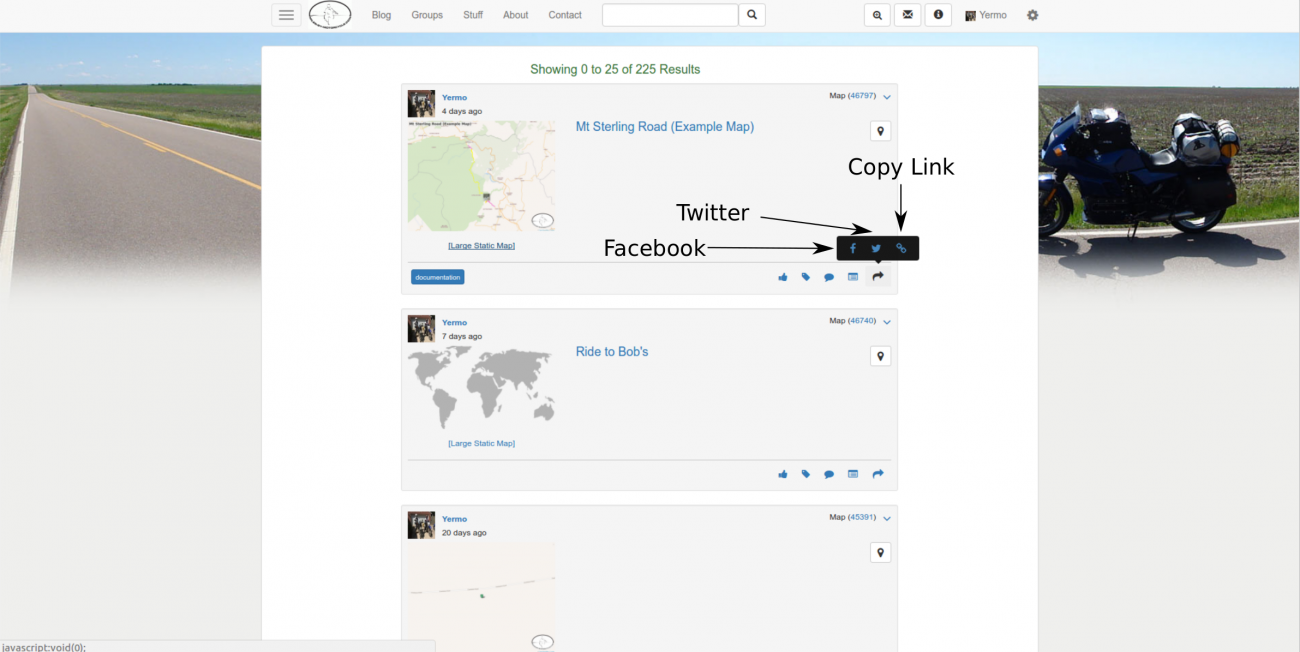
When Things Go Wrong
The software is still in a relatively early stage and there are still a number of bugs that I am tracking down. Sometimes maps refuse to save. You'll click the button and nothing happens. If this happens please let me know by posting in the Public MBYMC Group or using the contact link.
There are a number of other glitches and gotchas. I'm actively tracking them down and fixing them. Letting me know when things don't work as you expect or if there are features you'd like to have is a great way of influencing how things get done here. You wouldn't believe how reluctant people are to tell me what's broken.
If I don't know it's broken for you, I can't know to fix it.
The Future
There is more to the site than has been discussed in this article. Over the coming months it's expected that many improvements and refinements will be implemented to make the site easier to use and navigate. I have quite a number of features planned and hope to be in a position to make some announcements about the future of the site come the first quarter of 2018.
There are still a number of bugs and many features are still a bit awkward to use, but it's all coming along and over the coming months we should see dramatic improvement.
I know it's been a very long article that has covered quite a bit. If you have made it this far, I thank you.
If you have any questions or comments feel free to comment below or reach out to me via the contact link or post in the forum. I can also be reached on Facebook.
And most importantly ,if you try it and run into problems I would greatly appreciate any feedback you can give. I can only fix it if I know it's broken.
Thank you.
As I continue to make progress on the Miles By Motorcycle mapping tools, I've been asked a number of times recently to explain the difference between the concepts of "Tracks" and "Routes" as they occur on GPSs, the maps here on the site, and in GPX files.
My hope is that this answers some of those questions.
First, a little background:
Latitude and Longitude
The foundation concept for all navigation is the geographic coordinate system.
For simplicity's sake, the Earth can be considered a sphere. Every point on the face of the Earth can be represented by two values. These are latitude and longitude expressed as angles from a reference slice of the planet.
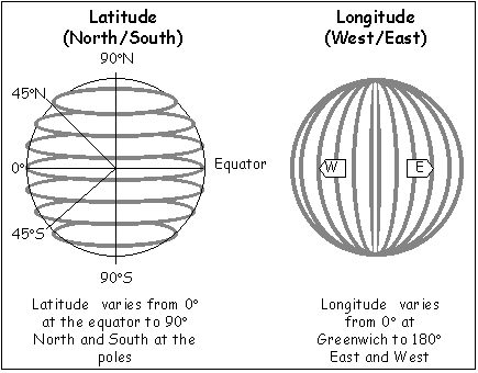
Latitude angles range from 0 to 90. You will sometimes see them listed as two positive numbers with an N or S prefix meaning North or South of the equator or as positive or negative numbers where positive numbers represent North and negative ones South.
Longitude angles range from 0 to 180 from Greenwich. Similar to latitude, they are either listed as signed numbers where East is negative and West is positive or prefixed with E or W.
To make matters even more confusing, there are seemingly endless different ways that the angles themselves can be represented. In Engish speaking contexts, the most familiar seems to be degrees, minutes, and seconds but for digital uses a representation called decimal degrees is the most common. This is the one I've standardized on here.
You should make sure to set your GPS to use decimal degrees when entering coordinates from the site. For example, on my Garmin Zumo 550 there's a Format screen off of Where To -> Coordinates:
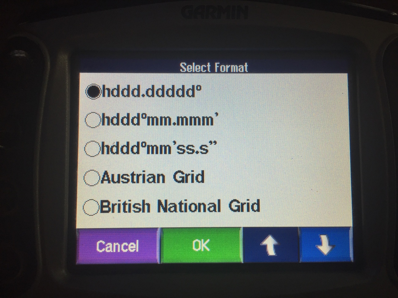
For example, the coordinates of the Starbucks near my house are 39.015374,-76.928335. (Or 39.015374 N, 76.928335 E)
The Garmin uses the N and E notation. I use the positive and negative notation.
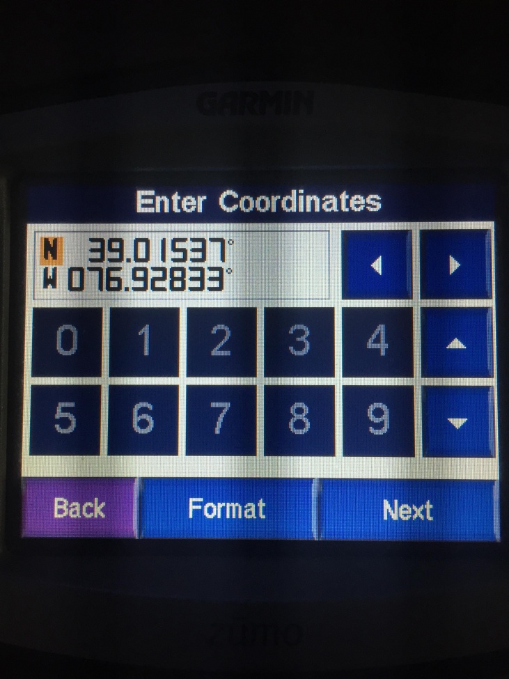
Be aware that some projects, notably European ones, reverse the numbers and prefer to list longitude first. A classic symptom of entering your coordinates in the wrong order is that your points end up displaying on the other side of the planet.
So now we can represent any single point on the planet with two numbers.
Tracks
A track is just a list of latitude longitude pairs. You can think of a track as a breadcrumb trail that gets dropped as you move. Tracks are typically generated by your GPS automatically where every so and so many seconds it adds your location at that time to a list. You could also create a track by hand simply by listing out a set of lat/lngs. For example, here is a track from the Starbucks near my house to the Best Buy across the parking lot:
39.015370,-76.928442
39.015954,-76.928211
39.016491,-76.929241
39.016779,-76.929751
Most GPSes will also draw a line on the map connecting the points of your track together. It's important to note that the track is not the line. The track is the just points. The line is drawn by your GPS to connect the dots and is for display only. Depending on how fast you are going, there can be quite some distance between the points in your track. For example, here's a track from a recent ride as recorded by my Garmin Zumo 550. If you click on it and then zoom in far enough in you can actually see where the line kinks showing where the points are. This is especially visible in tight corners.
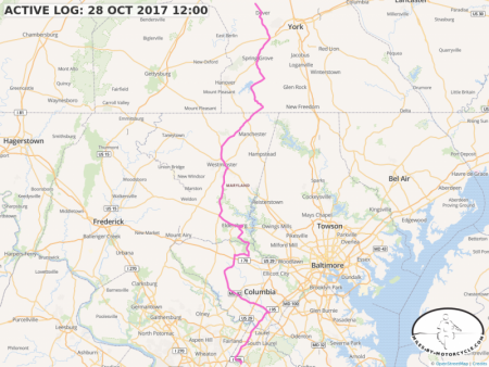
You will notice that so far there has been no mention of maps. Tracks are just a list of points. Aside from being points on the Earth, there is no relationship between a track and any map. There's nothing preventing you from creating a track over the neighbors yard, through that building across the street, or into Area 51. As a matter of fact, you don't need a map to create a track at all. It's just a list of points.
I'm often asked, "But I want to change this track to follow this other path or extend the endpoints."
Tracks are just independent free floating sets of latitude longitude pairs. If you have a track and you want to change it you have to have some mechanism to manually add, remove, or maybe drag the individual points that make up the track. Think of track points as "yours". You provided all of them so only you know where they need to be.
I built a proof of concept track editor to let you drag individual points, at some, remove other, and cut out sections. Finishing it up is on my todo list. Right now, you can upload a track to the site and cut out sections of it. I will add the other features hopefully in the near future, time permitting.
However, because there's no relationship between a track and a map, there's no way to say, "I want to change this track and make it follow this other road." To a track, "There is no road.".
That is, unless you turn it into a "Route".
Routes
Because routes and tracks look identical on most map systems, people are often not able to tell the two apart.
Just like tracks, a route is a set of latitude longitude pairs. However, unlike tracks, routes have an underlying map and a software system called a "router" or "route engine" implied.
A track includes every point between the start and end point. A track can have many thousands of points especially if you record a long trip. They all come from you (or your GPS).
Routes typically have very few points. The latitude longitude pairs that make up the route are called waypoints. On Google Maps, most routes you use probably consist of only two waypoints, your current location and your destination. If drawn as a track, you would see a straight line from the start point to the end point, which is not terribly useful.
As I mentioned above, routes imply an underlying map and a router. You give the router your waypoints and then it, using the underlying map data, attempts to calculate a set of latitude longitude pairs that include your waypoints as best as it can by following along established roads that are present in the map data it has. The latitude longitude pairs the router returns look very much like a track. You can inspect the points as well and if you zoom in far enough you'll see that the route returned by the router also has kinks in it where each individual point is placed. Again, just like tracks, it's the points that matter. The GPS simply draws straight lines between the points in the route.
However, how the route is represented is different from a track. In a track each point comes from you. In a route, only the waypoints come from you. The points in between the waypoints come from the particular router you use. Roughly, the data for a route after it's been calculated looks like:
your first waypoint (lat/lng)
router latlng 1
router latlng 2
router latlng 3
...
your second waypoint (lat/lng)
router latlng 1
router latlng 2
....
etc.
your end waypoint (lat/lng)
In order to figure out how to route between your waypoints, the router queries its map database. It finds the closest spot on a road in the database to the point where you've placed your waypoint. From there it begins to search through the database trying to find a path along the roads in the data to get as close to the target waypoint as it can.
Given any set of waypoints, there are often many different routes that can be generated between them. For example, on my Garmin Zumo 500, the routing engine has some settings that influence how it calculates the route:
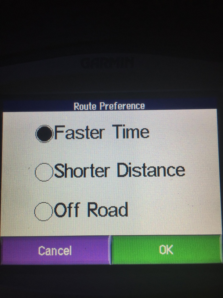
You can further tweak the choices made by the router by selecting the "avoidances":
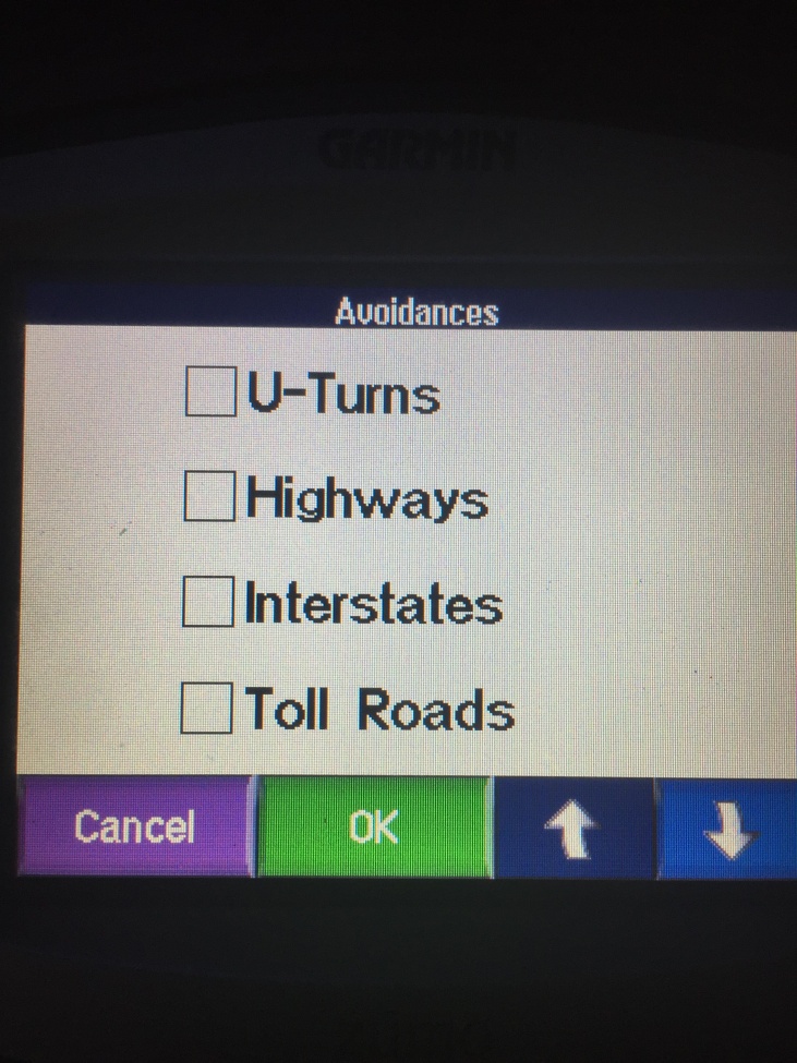
Which router you use, what data it's relying on, what settings have been set, and even what version of the software it uses can affect the routes it returns. For example, given the same two end points, my Zumo 550 and Duncan's BMW Navigator 5 often return different routes. Google Maps and Waze have access to real-time traffic data and are thus able to return routes that take current conditions into account and can return radically different routes depending on road conditions. (I wish I had access to data like that.)
There are some motorcycle oriented routers that can add a preference for "twisty" roads.
What this all means is that when you share routes (instead of sharing tracks) the route the receiving person is going to see may be very different from what you intended. So oftentimes it's better to share a track than a route.
Conversions
It is possible to convert between tracks and routes. For example, on my Zumo 550 if I import a track (see below), it will ask to convert the track into a route. So if I have a track of a thousand points, it'll attempt to turn it into a route of a thousand waypoints. This is all fine and good until the track goes off into some area that the Zumo has no map data for or where there are no roads. I learned this the hard way on last year's Trans Am Trail Trip. The symptom is that the GPS goes insane. Also, apparently there is a limit on the number of waypoints a route can have. At least this seems to be the case with my Zumo.
Some civilized GPSes have the ability to to display a track on the screen and just show you your current location relative to that. This is what I do with the maps here on Miles By Motorcycle. When you get into off the beaten path adventure riding I find that's much more useful.
You can also convert a route into a track. This is just the process of taking all the waypoints and calculated lat/lng pairs and putting them into one list. When downloading data from the Miles By Motorcycle maps, I've added an option to convert routes to tracks. This way I know the person I'm sending the track to is getting what I intended.
GPX Files
There are countless ways for vendors to store and organized geographic data. Each GPS vendor in addition to each online application stores their data internally in different and incompatible formats. Years ago, the need to easily exchange GPS data between devices, software packages, and online sources became apparent.
Enter the GPS Exchange Format, or GPX for short. GPX has evolved as the de-facto standard for exchanging routes, tracks, and waypoints. Pretty much everyone supports importing and exporting GPX files.
For the technically inclined:

GPX files are actually just specially fomatted text files. The latitude and longitude of each point in a track or route is included long hand in the file. You could, in a pinch, edit the files by hand in a text editor if you needed to.
For the curious, a track represented in GPX format looks like:
<trk>
<name>ACTIVE LOG: 28 OCT 2017 15:10</name>
<trkseg>
<trkpt lat="40.029065" lon="-76.876805">
<ele>212.11</ele>
<time>2017-10-28T19:10:57Z</time>
</trkpt>
<trkpt lat="40.031709" lon="-76.878686">
<ele>200.09</ele>
<time>2017-10-28T19:11:10Z</time>
</trkpt>
<trkpt lat="40.033318" lon="-76.880222">
<ele>183.75</ele>
<time>2017-10-28T19:11:19Z</time>
</trkpt>
<trkpt lat="40.034856" lon="-76.882431">
<ele>169.33</ele>
<time>2017-10-28T19:11:29Z</time>
</trkpt>
You can see the latitude and longitude of each point. My Zumo also records the time and the elevation.
In contrast a route in GPX format looks like:
<rte>
<name>Unnamed Route</name>
<rtept lat="38.993605412718" lon="-76.883354187012">
<extensions>
<gpxx:RoutepointExtension>
<gpxx:rpt lat="-76.883377" lon="38.993644"/>
<gpxx:rpt lat="-76.884017" lon="38.99327"/>
<gpxx:rpt lat="-76.885017" lon="38.992633"/>
<gpxx:rpt lat="-76.885757" lon="38.992126"/>
<gpxx:rpt lat="-76.885833" lon="38.992069"/>
<gpxx:rpt lat="-76.886405" lon="38.991664"/>
The rtept is my waypoint. The part under RoutepointExtension is what the router, in this case the router I use on the site, calculated.
When I plug my Zumo 550 into a computer it creates a file called Current.gpx in the Garmin/GPX folder on the device. This file contains all the routes and tracks that I have on the GPS. It's then a matter of just copying the file and saving it somewhere.
You can then upload the GPX file to this site (or to any number of sites out there) and have the data displayed on a map.
To upload a GPX file on this site, just go to your profile. Go to the "Maps" tab. Click New Map. On the left click on the upload GPX icon (second from the top on the left under the search box on the map).
There are endless numbers of sites where GPX files are shared. It's common on ADVRider. Roadrunner magazine makes many of their rides available as GPX. There's advtracks.eu among others.
Sam Correro sells GPX tracks for his Trans Am Trail route.
TransAmTrail.com is the exclusive source for Maps Roll-Charts, and GPS Tracks for navigating the Trans-America Trail - an exciting, off-road, dual-sport motorcycle adventure across the United States
TransAmTrail.com is the exclusive source for Maps Roll-Charts, and GPS Tracks for navigating the Trans-America Trail - an exciting, off-road, dual-sport motorcycle adventure across the United States
http://www.transamtrail.com/
Other Formats
It should be noted that GPX is not the only cross device format that exists. Google likes their KML format which can represent more than just tracks and routes. There's something called GeoJSON that I use extensively on the site. There's GeoRSS and others. However, GPX is the most common format for exchanging route and track data and because that's what's primarily of interest to motorcyclists it's what I focus on here. Time permitting I hope to expand support for KML so we can easily transfer data between Miles By Motorcycle and Google Maps/Earth.
Conclusion
My hope is that this answers some of the questions that have been asked. If something is not clear or you have any questions please feel free to contact me here or you can find me on Facebook.
Last year, I met Tom Seymour on the Cannonball Centennial Ride. He's the founder of Saddlemen Seats. After seeing a number of seats from that company on the ride and being very impressed, I asked Tom if I could get one made for my bike. "Just contact me and I'll hook you up." he said.
When I got home I contacted him to see who in his company I should talk to about having a seat made for my beloved Blue Oil Burner and asked him what the price range would be. "I really don't want to take your money. How about we make you one for review?" he said. I was humbled and honored.
Unfortunately, shortly after I received the seat, a series of Very Bad Things(tm) happened which have conspired to stop me in my tracks for almost a year. Because I was so late in getting anything written, I reached out to Tom to offer to pay full price for the seat on two occasions. To say I dislike disappointing people, especially ones who have been so kind to me, is an understatement. He assured me it wasn't a problem and looked forward to what I had to say when I finally got around to saying it.
So after many thousands of miles in all kinds of different conditions, much internal agonizing, and some key insights I've finally come up with something to say on the subject of Custom Seats By Saddlemen.
Executive Summary:
- The ordering and build process is trouble free. You send them a seat pan. You describe what you want and how you ride. They build a seat. If you then find it's not exactly what you wanted, you can send it back once and they will alter it.
- The degree to which they achieved what I specified is nothing short of impressive. My directions were, "Understated. Clean. Oriented towards two up brisk mountain riding." That is exactly what I got.
- Is this the best most comfortable seat I have ever owned? Yes.
- The quality, craftsmanship, design, and durability is top notch. The seat speaks quality and does not feel "custom".
- Surprisingly, I take much longer rides since getting this seat. It took me a while to recognize that parts of my body that you would think are completely unrelated to the seat hurt much less. This included my legs, knees, feet, hips, and back. The net effect is my shorter day rides have been hovering around 350 miles up from 200 miles and by the time I get home I am much less beat up. This was not something I expected.
- Contrary to what I would have thought, water drains out of the central channel quickly.
- Unlike showroom seats, these seats are designed to be sat on for extended periods. Initially I was skeptical about how comfortable the seat would be for extended periods as the seat was quite firm, but after spending time with it I began to understand the wisdom of the design.
- When you have something custom made to your specifications, it's easy to get caught up in what you hope to do as opposed to what you actually do and this can result in you getting what you ask for but not what you need. In my case, I ordered a seat for sport touring that was easy to move around on. What did I actually do? I spend many hours on the Interstate not moving around and wondering why I hurt more than I had hoped for.
- When left in direct sunlight, the gel in the seat seems to soak up quite a bit of heat which if you are wearing textile gear can be quite uncomfortable until the seat cools down.
- Because the seat was made accurately to my specifications, it's more rounded allowing me to move more easily on twisties but that means the edges of the pan tend to cut in my legs a bit when I sit still. On days I spend on back roads I pretty much experience no seat related pain, which I think is amazing. On days when I spend all day tank to tank sitting in the same position, it still hurts. However, it hurts much less than any other seat I spend extended time on. I suspect if I remember to move around just a bit while doing highway miles it would be less painful. I could also have the seat tweaked to bias it more towards long distance riding but I suspect that will compromise it's sport touring nature.
- Having some more resources available to help the first time novice custom seat purchaser narrow down their requirements would be helpful. A Revzilla style video explaining the options and the typical gotchas would have been very helpful.
- Is this the most comportable seat I have ever sat on? No. Another Saddlemen Seat is. (see below) I go back and forth as to whether I want to send the seat back to have it tweaked slightly altered to see if it can be made to more closely resemble the GSXR seat I saw. I would also make the passenger portion of the seat flatter and include a slight ridge to prevent the passenger from sliding forward so easily. Sadly, I no longer ride with a passenger so getting a thorough passenger review is something I am unable to provide.
- I am sold on these seats. I will be buying ones for the guest bike and, if it's possible, also for the DR650SE dual sport.
Last year as I was traveling across country with the Cannonball Centennial Ride, I metTom Seymourat breakfast one day. Heis the chairman of Saddlemen Seats. Over the next few days, I had the pleasure of talking to him a number of times.
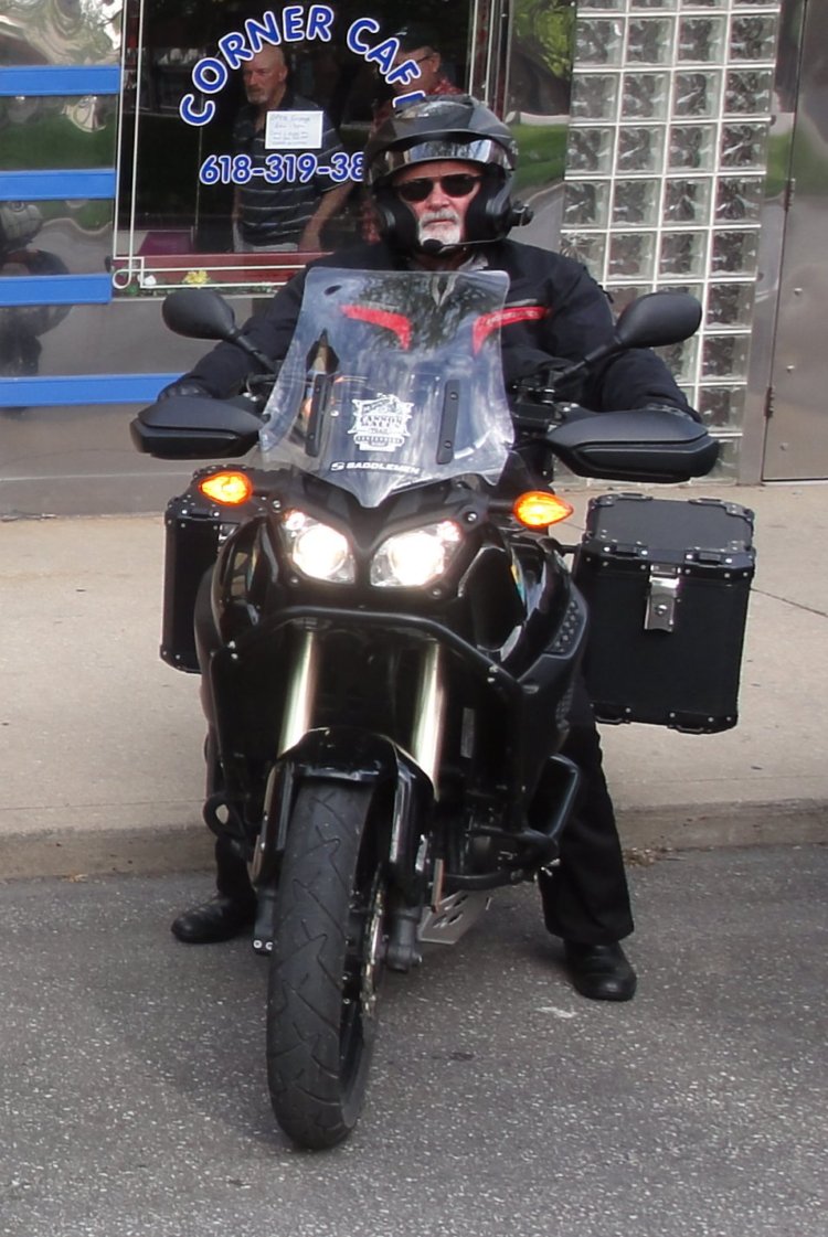
I live in somewhat of an abstract world and details often fail me. I had noticed in passing that the seats on many bikes looked a bit unusual in that they had a channel running down the middle, but I did not initially pay much attention to them. My focus was on the ride. After talking to Tom however I did take a much closer look at the various kinds of Saddlemen made seats present on these bikes. I looked closely at the design and craftsmanship. The quality and design made quite an impression. They certainly seemed better made and "much more serious" than any seats I have encountered before.
I talked to a few of the riders who raved about their Saddlemen seats. It was around this time that I started to become aware of just how much I hated the seat on my bike. It was more pain maximizing torture device than cradle and had quickly gotten to the point where it felt more like brick than cushion. The Airhawk Seat Pad I had picked up before the ride turned out to be a big help but it left a great deal to be desired. With the Airhawk it's hard to lean off or feel all that connected to the bike. Fortunately, for the kind of long distance straight road riding I had mostly been doing on this trip, the pad wasn't that much of a hindrance. However, on twisty back roads I find it often gets in the way and if it's particularly hot out I also find it tends to make the ride a bit hotter.
I approached Tom and asked how I might be able to get a seat for my bike. Since it's such an old and relatively unpopular bike, Saddlemen didn't have an off the shelf seat for it but Tom said I could ship my existing seat in and they would be able to craft something for me. "Just contact me when you're ready and I'll hook you up." he had said.
So when I got back home I did contact Tom, as I mentioned above. I was fully willing to pay for the seat but he suggested I do a review instead. I agreed. Tom mentioned that the April June timeframe was their silly season and wondered if I could wait until July. Of course, I could wait. They were doing me a favor and not the other way around.
July arrived and I contacted him. He said, "I need your seat. Include your address, phone number and a sketch of what you think you would like (higher, lower, wider, narrow at nose, flat seating platform to prevent sliding - that sort of thing.). Our service techs do a verbal interview, but a sketch adds to the process (but not always necessary) - it's the starting point. With a seat and a sketch, or your comments, in front of them it is easy to go through the custom build sheet. We sell 100 "off the shelf" seats for every 1 custom, so most customers select a seat from our customers catalogs (like Parts Unlimited or Drag Specialties who sell to 10,000 dealers in the US) or from our website. We do customs for bikes where we don't offer an off the shelf selection (like your BMW.) "
I did as I was instructed, but the problem I faced is that I had no experience to determine what features I might like in a seat. I focused on the times where I really noticed my current bucket style seat's limitations. It was hard as a board and had these ridges along the edge that always cut into my legs. So I took a photo of my existing seat and a photo of a seat that I saw on the Cannonball Ride. "Clean. Simple. Sport Touring Functional." I wrote along with the photos. I shipped a spare stock BMW K100RS seat I had from a parts bike to them and shortly afterwards received an email from one of their service techs.
"I have your seat here at Saddlemen. We are going to customize it for you and I have a few notes in front of me. But If you could please call me or leave a phone number where you can be reached at, I would like to go into greater detail of what you will like in your seat and give you more options. Im looking forward to hearing from you and getting a custom Saddlemen seat on your bike."
I got in touch with the service tech. He mentioned that most of the seats he builds are for cruisers and wanted to get a much better idea of how I was going to be using the seat. He asked if I wanted to have anything special done with the styling and rattled off a number of options. I replied that I just wanted something in vinyl that was clean and simple, nothing fancy, but that since it was a review if they wanted to plaster a large Saddlemen logo on it that would be fine. We talked for a bit longer and from the conversation I got the impression that he didn't understand the kind of riding I do. "Does that bike of yours lean?" he had asked.
So I showed him this photo.
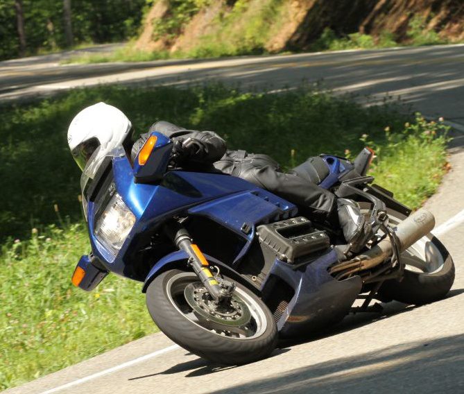
We talked some more when I mentioned that I also do a tremendous amount of riding with a passenger and showed him this photo.
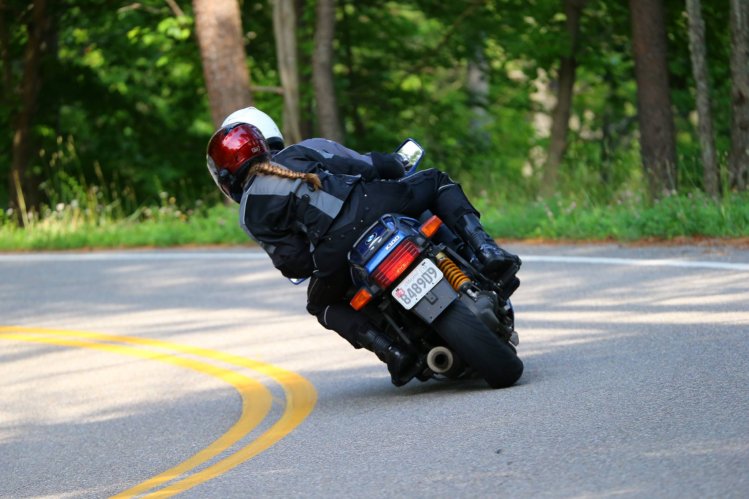
I heard a bit of conversation on the other end of the phone. "Oh, I just called over the other guys to show them this photo. That's pretty cool!" he said. "Yea, she's the best passenger I've ever had." We chatted some more and after a little while I got the feeling he really understood what I thought I was looking for.
There was a little snafu which caused the build to take a few weeks longer than expected but that was not a problem. The seat arrived almost exactly one year ago today.
The seat was professionally packaged and insulated against damage which was good since the shipper had clearly impacted the box.
When I pulled the seat out I had a "Whoa." moment. The degree to which the service tech nailed the "Simple. Clean. Sport Touring Functional." was immediately apparent.
I don't know what I had expected. When I think 'custom builds' I guess my thoughts go towards 'prototype'. Looking at this seat though I thought, "This doesn't look 'custom' to me at all. This looks like a production seat that's already been through countless revisions." The build quality is simply fantastic. It feels very "solid". It also feels much more like "quality" than even the stock BMW seat did.
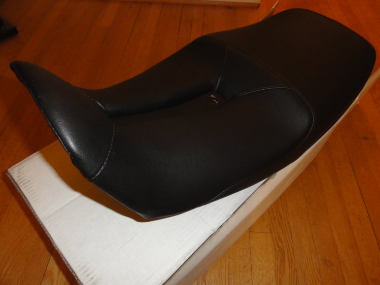
I flipped it over and one could see who solidly the vinyl is secured to the seat pan. I suspect this is not going to come loose any time soon.
Clearly the Corbin seat I had, which had quickly turned into a brick, is more oriented towards straight up riding. The edges always cut into my thighs and in general the seat just hurt.
I mounted the Saddlemen seat and I noticed another thing I hadn't expected. Not that I pay a great deal of attention to looks but this seat significantly, at least to my eyes, improves the looks of the bike.
The plan had been to start putting miles on the seat so I could write a review before winter hit in earnest. As I mentioned above, Very Bad Things(tm) happened in succession and then Winter hit the DC area with a vengeance. I draw the line at ice. All this conspired to prevent me from doing any significant riding until spring time. I only put maybe 50 miles two up on the bike before the season was over.
My initial impression riding the bike was that the seat at first feels much firmer than one would expect. I had anticipated a softer "initial feel" but after putting some miles on it I realized that "initial feel" is what sells bikes in a showroom but not what works after extended time on road. The seat material is a multi-layer affair including some gel. It feels to me like it "breaks in" a bit as the miles pile on. It is quite amazingly comfortable.
The pillion position is sloped downward a bit more than I like which causes a passenger, especially if she's wearing textile gear, to slide forward too easily. If I find myself doing significant miles with a passenger again, I'll likely send the seat in to have the pillion leveled out a bit and possibly include a slight ridge to further mitigate the sliding forward issue.
Spring rolled around and the maelstrom that was my life had not settled down much. I did manage to do a two thousand mile Deal's Gap and Smoky Mountains trip where I met Wayne Busch of America Rides Maps. He showed us an endless array of just wickedly twisty roads.
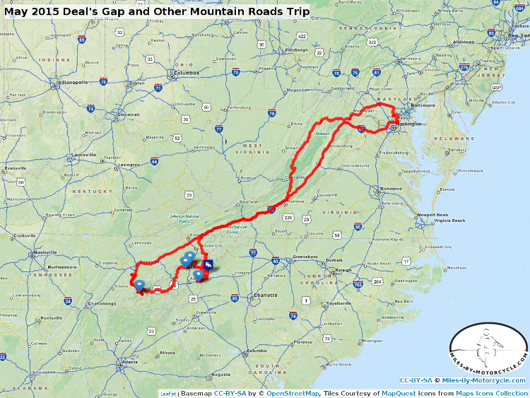
Interestingly, I failed to notice the seat on this trip despite the fact that I was trying to pay attention. A seat is something that is typically, at least after a few hours, first and foremost on my mind. I also failed to notice that I wasn't getting nearly as tired after 90 miles as I normally do. I instituted the "take a break every 90 miles" rule years ago because after about 90 miles everything starts to hurt and if I don't take a break I'll hurt so much that my days get cut short.
I did notice, however, that riding my bike on these twisty roads was easier. Having less of a ridge on the sides of the seat also made it much easier when flatfooting the bike.
It was fairly hot on this ride and one time having left the bike out to bake in the sun I noticed the seat got quite hot. I suspect the gel in the seat soaked up the heat. Having textile gear on allowed alot of that heat to transfer to me and it took some time for it to cool down. I think riding through a desert or in other hot climates, I might keep a towel or something to drape over the seat if I leave it in the sun for long.
One thing I had been concerned about looking at the design of the seat was the water would accumulate in the center channel as I could see no visible drains. To my surprise less water pools in that center channel than would accumulate on my previous seat. If you let it sit for just a little while all the water drains out. Impressive.
While down at the Gap, John came down to meet us on his GSXR 750. I immediately recognized that the seat was also made by Saddlemen.
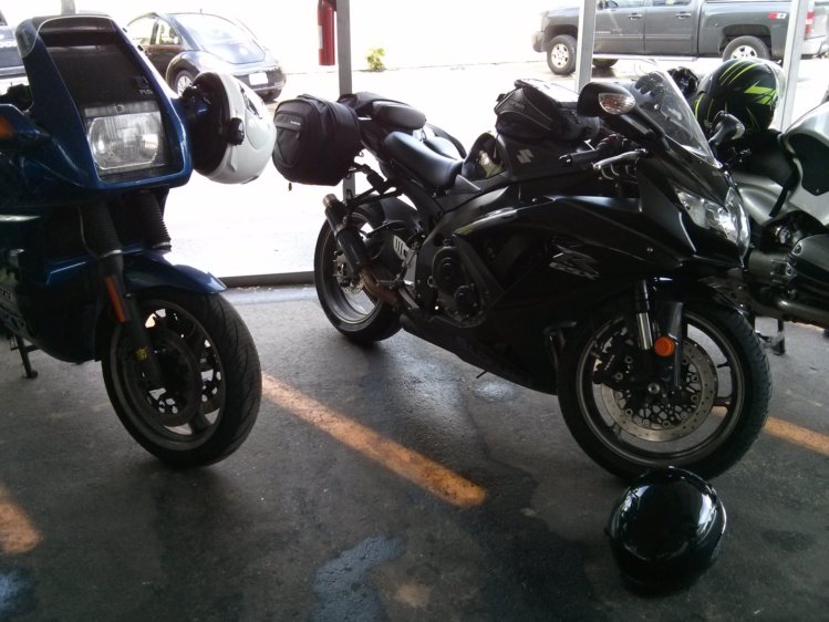
Compared to the seat on my bike this one has a much more aggressive channel and much more padding. John let me take his bike through the Gap which was tremendous fun. The seat on his bike, at least for the 45 minutes that I was on it is wicked comfortable. (Just last night I was chided on the use of the word "wicked" which from a New Englanders perspective has a specific meaning. I do mean this seat was "wicked comfortable." You may, however, disagree.)
If you look very closely at my seat you'll notice where the padding gets very thin towards the forward edge of the pan. I find that on extended Interstate travel that edge does cut into my legs a little bit. If I were to have the seat tweaked, aside from the passenger modifications I discussed, I'd likely have the profile adjust ever so slightly to more resemble this seat. I fear however that would raise the height a bit. Everything is a tradeoff.
I had intended on writing this post after getting back from the Gap trip but something was nagging at me. I just didn't feel like I had enough insight to write anything meaningful. In July and then again in August, I took the Superslab up to Ontario, Canada. Contrary to how I like to travel, these were trips on a Schedule(tm). I decided to do the 500+ miles in a day but on both trips I got late starts so had to make up time.
It was on these trips that I noticed several things:
- My knees, legs, hips, and back hardly hurt at all where as after about 100 miles all would previously hurt. Correlation does not imply causation but as far as the bike goes the seat is the only change I've made. While I do not know for certain, my suspicion is that the center channel is largerly responsible for this improvement. Now when I get on a normal seat, I'm immediately very aware that the center channel is missing and things are getting pressed on.
- While it was not pain free, I was able to without going into agony ride through two full tanks of gas stopping only to get gas. In all the years I've been riding, I've never done that without the help of a tremendous amount of Advil and that was back 20 years ago. I should note that this seat might be pain free for someone without an autoimmune disease that expresses itself in joint pain.
- I find it's much easier to shift around on the seat sliding forward or backwards and that after a few moments if I happened to be experiencing any pain it would dissipate as long as I moved. The key seems to be not to stay in any one spot for any length of time.
- The pain I did feel was mostly the narrow contact points where ass meets seat. Sometimes being in significantly less pain gets you, irrationally, to overfocus on the small remaining pain. Slightly more padding with a flatter profile might help in this long haul context.
On these longish superslab trips, I found myself troubled that this seat that I regarded so highly was not "Ironbutt Ready". As I keep reminding myself, context is key. Change the context ever so slightly and you have to reexamine all your assumptions.
I had only talked about Deal's Gap and cornering with the service tech. I talked about leaning, moving around on the seat, and riding in a spirited fashion. At no point did I think to mention that I only do that for maybe one or two weeks a year and that at times I might sit for endless hours on Superslab. I had described to him the riding that I like to do but not the riding that I actually do.
It was on the second Ontario trip that I realized I had, in fact, gotten exactly what I had asked for. I had asked for a sport touring seat molded for the purpose of carving mountain roads and this is exactly what I received. It was around this time that I also began to understand that a "review" would not be appropriate. A "review" is relevant for a commodity. I buy a thing and review it so that you can read the review and gain some understanding of what you might experience with whatever is being reviewed.
This however, is a custom seat created according to my specificiations. Telling you that I have a 4.5 out of 5 star seat is in large part just telling you about how I view my design decisions and where I did not think clearly. So this is more a description of an experience.
Professionally, I write largeish one off custom software systems. There are quite a few parallels between what I do and the buiding of a custom seat. My customers typically are not experienced 'custom software purchasers' so there is an education step. There's a great deal of communication involved where I try to understand not only what they are trying to convey but also what they are not telling me. I have to use imagination and experience to anticipate that unspoken needs my customers have. Inevitably, it's a trial and error process as we get to know one another. As I build versions of software, they get a better understanding of what's possible and their requirements then get adjusted. So we iterate against a moving target. This is how it always is.
So, to view a custom seat as a "product" where a company magically "get's it right the first time" is not a constructive model. It's probably more constructive to think of a custom seat builder as a provider of a professional service. They service tech takes your requirements as you describe them and their experience in an attempt to deliver something that meets your spoken and unspoken needs within the constraints of the stock seat pan you send them.
Given how little experience I have with ordering custom work and how little I described, it's amazing to me how well they hit this target. Is this seat an Iron Butt seat? No. But I did not ask for an Iron Butt ready seat. I think if I had the resulting seat would have compromized on it's sport touring character. Any choice involves a tradeoff between competing requirements, in this case long haul comfort versus sporting usability.
So as I was logging all those Interstate miles wondering why it was not completely pain free I realized that I need to take responsibility for my own choices and understand the tradeoffs I had asked for. I also believe this is where the wisdom of "one free alteration" comes from. Customers, myself included, rarely know what they actually want. You have to give them something that helps them frame what they want. I do it in software. Saddlemen does it with seats.
Towards the end of July Duncan and I restarted our weekend day rides. We had remarked a number of times on these rides that I was able to go much further before complaining that I was tired or hurting too much. While before we used to do 200 miles we were now regularly clicking off 300+ and I was hardly feeling like I had spent any time on the bike. On this last ride, we did 430 miles of hill and mountain roads and by the time I got home I was in no pain. Of course, on these roads I am moving around a fair bit.
"This seat is perfect for the mountain road context." I found myself thinking, and it is.
In conclusion, this is the best seat I've owned. For the purpose I asked it to perform, Saddlemen has executed to near perfection. Just like the myth of the four seasons riding suit, a seat for all purposes is likely also unattainable. Make something sportier it's going to compromise it's long haul use. I may just need to have two seats for my bike and switch them.
If I had it to do over again I would:
- pay more attention to the full range of riding I do. For a single seat, I would probably compromise and decide to go with a slightly more touring oriented seat and then complain about how it isn't perfect down at Deal's Gap.
- research more existing seats. If I had encountered the GSXR seat prior to having my seat made, it would have influenced what I asked for. Additional research may have also provided me a better vocabulary to use.
- be more willing to go through the alteration experience. It might be interesting to see whether or not there's a better compromise to be made for my use case.
In conslusion, do I like the seat? Yes.
Do I think it rocks? Yes.
Do I think it's perfect? It perfectly matches what I asked for.
Would I buy one? Yes.
Will I buy one for my other bikes? Hell Yes.
This guest post is contributed by long term Miles By Motorcycle member and frequent contributor,John St. John,who we met down at Deal's Gap along?with his son Joel some years ago.
Adventures in Learning
This spring, I finally bought an Adventure Bike. What ensued was a learning experience about many previously ignored aspects of motorcycling, and a great need to learn how to more fully use the Garmin Zumo 550 GPS, that came with the bike. The following is my meager attempt to explain my personal quest to learn the basics of plotting a course, uploading files to the GPS, and following a pre-planned Route.
Now, to anyone that knows how to do all this already, I say: shame on you, for not sharing this secret knowledge. Internet browsing, I found only snip-its of information and hints as to what others could do. Where is that global sharing of rider insights and information, when the topic is using a GPS? Is it really so obvious to everyone else? Am I really getting that far behind the technology curve? The answers to my questions are a resounding YES, but, still.someone needs to break the silence. This is both a call for help, and my small contribution to the web content on the subject of using a GPS.
Background: The event that created a need.
On a recent charity, Big Bike Rally for Cystic Fibrosis, the sponsors handed out Rally Sheets and had GPS tracks available for uploading the Route to a GPS. We were to follow a course they had carefully planned out for us, which included many scenic back roads, a lot of which were dirt, and some Hero Sections that were truly challenging to ride on a big adventure bike. (Think: Long Way Round, in Mongolia.) The planned route, included a free lunch stop: a real incentive to make at least one check-point.
The Big Bike Rally consisted of about 30 riders that self sorted themselves into smaller, more manageable groups, based upon luck, timing, and a process that reminded me kids picking their softball teams. Now, the guys with GPSs either did not have a cable to upload the files, or wouldnt admit that they didnt know how to do it, anyway. I suspected both to be true when a fellow asked me if I had a BMW Cable. Regardless, no one had the route on their GPS.
Being Big Bike riders on large adventure bikes, no one in our group had any experience with what dirt bike riders use on these sorts of organized events: Rally Sheets. (Think: adding machine roll tapes with tiny fonts, on a tiny roman scroll, mounted to your handlebar.) We could look at the scroll, or look at the roadso we all got hopelessly lost.
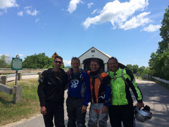
We did manage to find the lunch stop, but missed a large portion of what must have been a great ride. We found the lunch stop by imputing the address of the restaurant into the GPS, and subsequently followed its directions through some awful urban blight and congested highway, to reach our Destination. The GPS not only was useless to follow a nice pre-planed route, but it gave terrible advice on how to recover from getting lost. I was so miserable. Here we were, a group of adventure riders in full armor, sitting in downtown traffic. The avoid highways option does not mean find me a nice pleasant twisty route down back roads. I wish it did.
So, the next morning, I awoke with a conviction to figure out how to use my GPS. And in part two, Ill tell the rest of the story. Right now, its time to ride.
Part 2:
Entering the story: Neighbor Dave (as he likes to be called) is an enigma. Hes one of those rare individuals whos hitch hiked all around the world, several times, hiked every trail youve ever heard of, and some you havent, and in general seems to have a depth of knowledge, on any topic, that few possess.
So, you got an Adventure bike?, he says. Then, he proceeds to tell me about all of these adventure bike rides with memorable names like the Puppy Dog Ride in Vermont, http://www.vtbmwmov.org/rides/ the Trans-Mass tail in Mass, and the Hampster Trail that runs the length of New Hampshire, on mostly dirt roads.
More than a little intrigued, I looked up the Hampster Trail on the internet; nothing. Then Hampster Trail adventure ride: Bingo! http://www.advrider.com/forums/showthread.php?t=981534
In this post on the Advrider forum, the author offers several links: the first is to a drop box file. Not having a Dropbox account I shied away from there, besides, I didnt know what I would do with the file if I downloaded it, anyway.
Next: theres a link to a site called Rally Navigator https://www.rallynavigator.com/routes/6153#.U-KRwfldX9k
Here, I could see the route, its way points, and see that the site allowed the user to create his or her own routes. Now, were getting somewhere! Although, I could tell that a major emphasis of the site was to create the Rally scrolls that I hated, I could also see that it might provide the missing link I needed to make my GPS really useful.
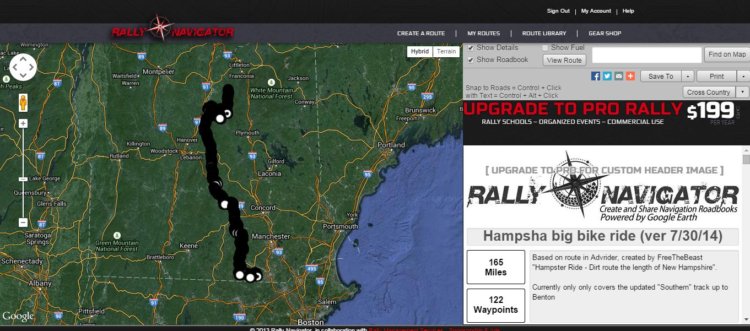
So, after creating a free account, I was able to save some pre-made routes to my own personal routes library, and even make and save a route of my own. Now, to get these files onto my GPS. I hit the button to My Routes and was able to see the files I had saved to there (wherever there is).
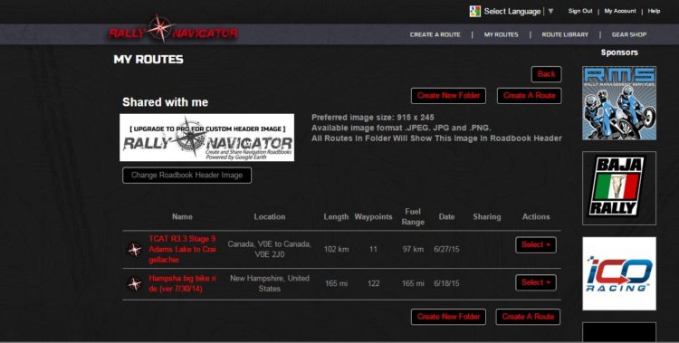
Not being terribly computer savy, I clicked on the name, which took me back to the map view, with no new functionality. So, back around to My Routes, again. Under the Actions column, you can select the only option that there is for action, which is to download the GPX file. So far, so good.
With the GPX file on my local computer, I plugged in my Garmin Zumo 550, which immediately caused it to prepare for USB mass storage by backing up all my the GPX waypoints, routes and trip log information in GPX format. Files that I didnt even know I had. Next, I downloaded the Garmin Express software, which configured itself to work with the found device. (I must really be boring some of you, but Im trying to be thorough here.) The tools, vehicles and voices features in the Garmin Express software all seemed pretty useless, to me.
Using Windows explorer, I walked down through the file folders on the device and found the GPX folder, and copied the saved GPX files into there. Oddly, as long as the GPS was connected to the computer, or powered by the USB cable, I could not access the menus, but only had this screen.
As luck would have it, when I went out to the bike to use the new routes Id downloaded, the GPS would not load the maps. It tried for a few seconds, then quit; again, and again. After a second attempt to load the files, and a little searching on the internet, I found some chatter about the batteries on these units often go bad. And, when they go bad, the GPS wont work, even when plugged into power on the bike. The test for whether you need a new battery, or if you just need a new GPS, is to take the battery out of the GPS and plug it in. If it powers up, you need a new battery. (Sorry, I digress).
After loosing the battery, I just walked through the menus on the Garmin: Where to; Routes; Selected the Hampster Ride; and hit Go! Whala! And, so I did.
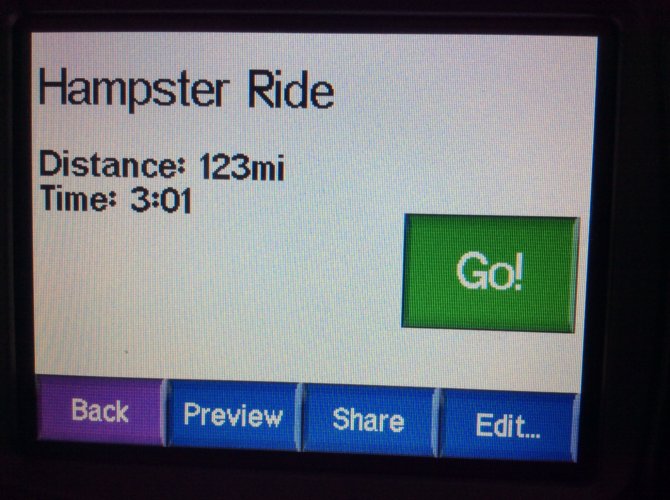
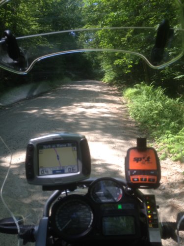
Part 3: Retrospective
It seems that once I knew enough to start looking for GPX files, and my searches included the term GPX, the subject of mapping and routes with a GPS just started to unfold, easily. Once I understood how the pieces of the GPS puzzle fit together, (so to speak) the Miles-By-Motorcycle mapping function suddenly started working great! (For years, I thought that only Yermo could get it to work;-)
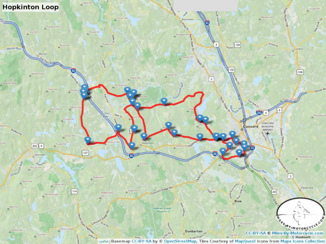
Conclusion:
Learning anything new is a lot like riding a motorcycle. Once youve gotten some traction, and enough momentum to keep from stalling, you just start rolling along. Fear and frustration is replaced by excitement, and then matures to a deep and lasting joy.
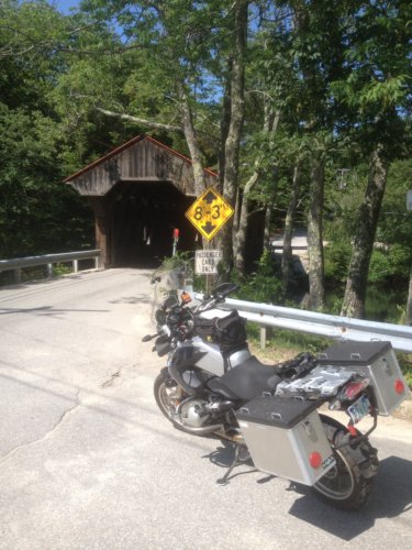
This is a guest post by Miles By Motorcycle member, Lisa Hallwhich was originally posted to theforum here.
In Lisa's own words, "I'm a passionate motorcyclist. If I'm not riding I'm reading about riding. I've been riding for over 21 years and have logged over 275,000 miles. I'm getting close to 300,00. My husband and I began riding at the same time and we have loved each and every mile. We've been involved with group riding since 96 and have led thousands of rides and trips. I do all of the ride planning which is really something I enjoy. i get the most satisfaction when people comment on how much they've enjoyed the ride. I've been across the country and to New Foundland and Nova Scotia. I've have had many diffirent motorcycles Hondas Kawasaki BMW Harley. My favorites were the Gold Wing. The K1600 and my current bike A 2013 HD Road Glide."
Read on for her review.
I promised I would give a review of the new Sena 20S Bluetooth headset. I purchased the 2 pack from Revzilla and as usual with Revzilla It was delivered in 2 days. I couldn't wait to start playing. In the box comes two headsets already paired, 2 mounts, 2 boom mics, 2 wired mics, 2 car chargers, 2 usb chargers, 8 mic socks. I was quite impressed with all the goodies that came in the package. Mounting the headsets was easy (I've installed lots of headsets on helmets so it was a snap). The only thing I thought was odd was the screws that secure the mount to the helmet face the inside of the helmet making screwing them in slightly more difficult but no big deal. I mounted my headset to my 3/4 helmet and mounted my husbands headset to his half helmet (I made pockets for the speakers to sit in the half helmet).
Sena has a smartphone app for this unit so I downloaded that and quickly paired my iPhone using the app. The app also allows you to set some basic functions on the headset. Next I paired my GPS and again everyone paired easily
Today was the first time using the headsets. I was so excited this morning but as we were ready to pull out my unit says "battery Low" and shuts off. Well it turns out I had left the unit on after playing with it during the week. No problem my husband has a 12volt charger in his trunk so I got one of the car chargers and plugged it in for our ride to the meeting location today. It got a 40 min charge and that was good enough.
Now it's finally time to see how these work. I was really impressed with the sound quality and the volume. As I said my husband was using a half helmet and I was worried about wind noise being transmitted, but that was never a problem. I heard him loud and clear. Even on the highway I could hear him well.
I was able to play music through my iPhone and the quality of the music was pretty good for helmet speakers. Probably better than others I have used. The music would play and if either one of us spoke the music would be lowered to a background level that you can adjust.
These units can pair with other non Sena Bluetooth headsets as my friends have the scala g9. I wasn't able to try that out today but will give a report when I do.
Overall I am completely happy with this purchase and grateful to have a decent communication system
Update from 12/6/2014:
As an update on the performance of the 20s one of our units kept shutting off randomly throughout the day. I contacted Sena they asked me to try a couple of resets. I did that but still the unit would shut off. Now they are sending me a replacement under warranty and paying for the return of the defective unit.Im very pleased with how Sena responded.
The other unit works perfectly.
The Sena 20S is available for purchase from Revzilla.
* Please note that Miles By Motorcycle is a RevZilla affiliate.
On July 26, I was invited to give a talk at Bobs BMW Motorcycles in Jessup, Md about my time on the Cannon Ball Centennial Ride which I took part in from Dodge City, Kansas to Battery Park, New York, New York. A long time family friend, Dr. Garret Hyde, offered to record it.
I feel terribly self conscious about this. Now, gritting my teeth with trepidation, I am making the videos of the presentation available.
It's a one hour presentation divided into 5 parts.
I worked on the presentation until nearly 2AM the previous night and as a result did not have a chance to give it a dry run through. So this was done cold-turkey.
After the fact, I realized there were so many themes I wanted to tie together which weren't tied together to the degree I would really have preferred.
During the ride, talking to Gary McKechnie who created a wonderful series of blog entries about the ride along with companion videos (my bike can be seen in a couple), I mentioned that I thought that what actually happens on a ride, during an event, or a time in life, is far less important than what it means. What can we learn from what we are seeing?
I pre-occupied myself with this thought as I rode across the country with a diverse group of people from backgrounds so different than my own.
Of course, any ride involves thoughts of risk. The risk of falling. The risk of injury. But there are other risks and how we respond to those risks will determine if what we have is just another ride or maybe a great adventure.
The focus of the ride for most was the story of Cannon Ball Baker and what he accomplished 100 years ago in taking a 7 hp Indian motorcycle, which at that time was little more than an over-glorified bicycle with a motor, across the country on a record breaking run. It was a great accomplishment if one considers the hardships he had to endure covering so much distance across a largely unimproved country. There's the old saying that, "Those who don't learn from history are doomed to repeat it." But there is also another perspective that makes history even more personally relevant. As times change and "new normals" arise we have found ourselves in an era where it's often considered "too dangerous" to take any risks let alone ride a motorcycle across the country, even given all the safety equipment and other gear we now have available to us. We live in an age ruled by fear. "Motorcycles are too dangerous." many say. There are those who would like to see the driver removed from cars "for safety". Looking back and hearing these stories of so long ago reminds us of what we were once capable of, of how we used to dream much bigger dreams, and how we did not shy away from those dreams for fear of the risks involved. There was a time when people looked to the moon and dreamed of going there.
There were also the stories of these riders 100 years later, which for me were in many ways more inspiring. Their stories are worthy of a good telling as well. There were champion racers. There were adventurers who had ridden motorcycles on every contintent. There were those from industry. Listening to a few stories, I was amazed to hear the kinds of challenges and adversity these men have endured and overcome. Accidents, pain, or life threatening injuries did not dampen their spirit. At each point, when they fell, they got up again and continued on. After listening to some of these stories, I felt a little self-conscious thinking about the little challenges I've faced and the toll they've taken on me.
There was also the theme of age. At 46 years old, I was one of the youngest members of the ride. Watching these riders, one a grandmother on a GSXR 750 no less, was an inspiration. I have often commented about how old I feel. I've always felt old. I've listened to 21 year olds tell me they feel old. I've even wondered how many more times I would be able to go cross country. Then I join these riders across the country and see what they can do and suddenly I don't feel so old. I feel embarrassed.
Why do we feel old? It dawned on me that we cannot imagine how we are going to feel tomorrow. We only know how we felt yesterday, what we used to be able to do, and compare it to today. Tomorrow is an unknown so of course we feel "older" than we ever have. A big theme for me from this trip was not to fall into the trap that dreams die with age. As long as we are breathing we can still strive and seek as long as we do not yield to the inconvenience of age.
And finally, "There's something about motorcycle people." she said early in the trip and that observation became a theme of its own. Once the helmets are on and the kickstands are up, we are all just motorcyclists and there's something about that regardless of whether you are famous race winner, a titan of motorcycle industry, or just a random stranger, the motorcycle and what it means to us all brings us together in a way that few things in life do.
For more information please see:
For more stories of motorcycling, check out the Miles By Motorcycle Facebook page. You can also follow me on twitter.?
There are many ways to travel. Most people like to book reservations and know exactly where they are going to end up when. For me that feels too much like day to day life. I learned a long time ago when I was in a very different place, that being flexible and open on the road can unlock doors that from the start you would not have imagined possible.
I've tried to share this view, but in practice it's harder than in theory.
I had parted company with John and Lucy and headed out from Canon City to the Big and Flat that is the midwest. Despite having started late in the day, I was making good time and by early afternoon I was just outside of Dodge City. I had been second guessing my decision to leave. John and Lucy's kids are flying out on Friday to ride around Colorado. It would have been fun to spend some time with them.
However, I was feeling the pressure to get home. There's much that I need to do and funds are getting low. My plan was to push through another few hundred mles and then have an easy few days to arrive home on Saturday in time for Mothers Day on Sunday.
I ran through nearly a tank of gas breaking my 90 mile rule, and suffering appropriately for it when I stopped at a gas station to fill up. I noticed a couple of bikes. A custom Harley and a bike that I first thought was an old Indian frame with a new engine in it. It looked like something Duncan would like, so I asked the rider if I could snap a photo.
"Sure." he replied so I did. Strangely, this Indian really appealed to me. It was clean and it had dirt on it. I liked the rough and used look.
"Is that an old Beemer?" he asked.
"1992" I replied.
"So not old." he replied. "Where are you headed?"
"Back home to Maryland."
"How far did you go?"
"Out West to Los Alamos to visit a buddy and then tooling around New Mexico. A few thousand miles."
The he said, "Hey, we're meeting a bunch of bikers over at a hotel in Dodge City. You should join us. I'm sure we can get you a room at the hotel."
I guess I must have given him a tentative look as I was pondering what I might encounter. I had visions of feeling really out of place in some rowdy biker bar scene.
"Oh, most of the bikes there are like yours. That and lots of adventure bikes." he said betraying a strange perceptiveness and willingness to put me at ease.
"Oh, ok. I'm in."
I hold on to my wants loosely. I had wanted to do a few hundred more miles that evening but this was an opportunity to meet another group of riders.
"Who knows what might happen?" I thought innocently enough.
So I followed them towards Dodge City.
As we rode along I found myself thinking about taking chances. I had no idea what I was getting myself into or what kind of people I might encounter. Was it going to be ok? I've traveled with people who were closed to these kinds of things. "We don't know these guys from Adam, why would we trust them? They're going to trick us. I can feel it." I can remember them saying. don't enjoy traveling with those who are not open on the road.
"There's something about motorcycle people." Debbie had said. Her friend Andy had been concerned about her traveling alone and meeting up with random strangers. "But that's the best part." I think I replied.
So here I was riding behind a custom Harley and in front of some strange Indian. Both riders had clearly been riding for quite some time as we all stayed in a perfect staggered formation without a word having been spoken about it. "These guys have been riding a long long time. They get it." I thought. Normally, you don't see Indians, Harleys (especially custom ones), and BMW's riding in perfect staggered formation. The 17 miles passed quickly.
We rolled up to the hotel they had mentioned and I saw that there were nearly 30 bikes of all makes and models. There were guys about futzing with their bikes.
"This might be ok." I thought.
Someone mentioned something about a centennial ride related to someone named Erwin that had done some cross country trip in 1914. "Ok, so this is a group ride across the country." I thought.
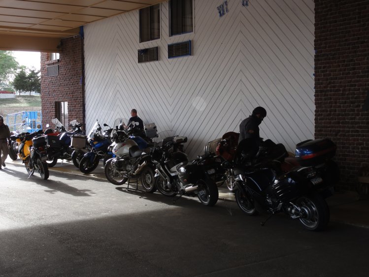
I got off my bike and walked in to see if I could get a room. "If there's no room for you, you can take mine and I'll share one." my new companion said. I thought that was amazingly generous especially for a complete stranger. "By the way, my name is Robert." he said.
As it turned out, there was a room available. The pretty young woman behind the counter asked, "Are you with the riding group?" and before I could respond, Robert said "Yes."
I didn't give it much thought.
I walked back outside to take a look at this strange Indian.
I put my stuff away and then walked back outside. The initial plan had been to go some place else but it was then decided to eat in the hotel Saloon. I wandered in and saw Robert sitting with a group of people chatting away.
Walking into groups of people I don't know always makes me feel awkward and off balance. At first glance, I got the feeling these guys were not at all what I had initially thought. They were professionals of some sort and clearly were into riding. I listened and awkwardly tried to join in the conversation. There was the typical guy banter and storytelling. I didn't have much to contribute. Robert explained the trip he was on. It was to retrace the route of Erwin "Cannonball" Baker who in 1914 smashed the cross country record of 20 days. He did it in 11 on a 7 horse power Indian in an era where the road system was, let's say, challenging.
There's also a website Cannonballproject.com.
I had never heard of Cannonball, but someone mentioned that it's where the "Cannonball Run" comes from. It turns out it's an industry invite-only event that's been in the planning for 3 years.
I asked Robert about his Indian figuring it was some custom.
"It's a prototype that's likely going to be scrapped but I talked them into letting me take it on this trip." I think he called it and "Indian Adventure Bike". I believe he also mentioned that the guy who built the Spirit of Monroe streamliner fabricated the bash plate protecting the engine.
(It turns out that Indian Motorcycles has anarticle about it. So doesCycle World.)
"Really? How is it that you were able to secure yourself an Indian pre-production prototype?" I asked wondering how someone might be able to make that happen.
"I'm the PR Manager for Indian Motorcycles." he replied. "Barry, to your right, shoots and writes for Cycle World and is covering our ride. Ken writes for RoadRunner and Motorcycle Consumer News." He went on to name more people than I could remember, all industry insiders either famous for their racing or movie roles or deeply involved in the media or business side of things. There's Keith Mashburn who was in the movie "On Any Sunday" with Steve McQueen. It's being organized by AMA Hall of Famer Don Emde.
"Holy Sh*t." I thought. You just never know who you are going to meet.
I listened and between jokes and stories were comments about how much press the ride was getting. Apparently, it had made the New York Times.
We sat at dinner and I tried to participate but didn't have much to contribute. I felt terribly awkward. There was "Mucho Bill" who said he owns a Frank Loyd Wright house. There was Ken Freund who talked about riding in places all over the world. (So did Bill.)
I sheepishly raised my hand and said, "My photo is in the Aerostitch catalog. Yea, I got nothing."
We stayed up fairly late and I listened to all kinds of motorcycle stories. More than I remember. At the end of the evening, they asked, "So are you going to join us for the ride tomorrow?"
I thought about it for about a half second and said, "Yes."
I can make it a long day Friday and Saturday I thought and still get home.
To my dismay this meant getting up at 5:45AM because the ride started promptly at 7:30. It was far easier to get up than I had imagined.
At breakfast I foundNancy Emde-Steward stamping the leather bound journals given to all the riders. "I'm just some random guy the Indian rider met at a gas station."
She didn't seem to mind.
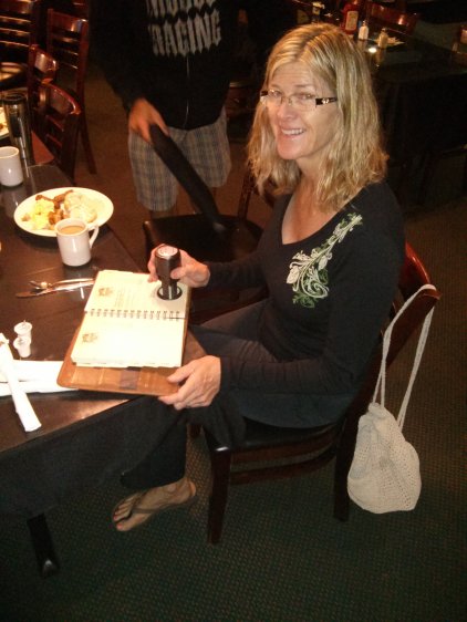
Eventually, Don Emde, the organizer showed up and asked me who I was. He was concerned that I might expect to tag along for the entire ride. "You can't attend any of the events we have planned. These people have paid in good money and it would be unfair to them. I can't stop you from following us on the road, but you have to pay your own way."
"Of course!" I said explaining how I had ended up there and by no means wanted to be an imposition and was only planning on tagging along for the day today and then I would be off.
Shortly there after, off we went.
I still had no idea what I was getting myself into.
This is the largest group of riders I have ever ridden with.
And these people can ride.
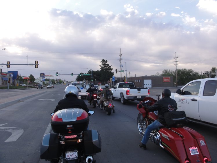
We did about 300 miles that day from Dodge City to Kansas City. I met a number of the riders and the story of the "random gas station k-bike guy" had made the rounds through the group. "So are you joining us all the way to New York?" a number of them had asked. "No, I don't want to impose. I'm just here for the day."
After maybe the 10th person asked, I began to think, "I wonder if I paid my way in would they let me join them? I'm not sure when I'll get an opportunity like this again."
So at the hotel that evening, before going to dinner, I approached Don and asked if I might be allowed to join them if I paid for the half of the trip I was on. I figured the answer would be "no".
"The last thing I want to do is be a freeloader. I see how much work, planning, and effort has gone into making this ride happen. I know that costs money and I'd like to contribute."
"I'm really glad you see that." he said, his demeanor having changed. He went to to talk about the trip some more and then explained I just needed to talk to Nancy.
And with that I was an official member of this ride. I still had no idea quite what I was getting into.
So here I sit, a few days later, in Indianapolis in a swanky hotel not far from the speedway. I have my own leather bound log book. There's a Canonball sticker on my bike. My photo has been taken dozens of times and embarassingly enough people occasionally ask for my autograph. There have been receptions. There was a dinner and drinks the night I joined. There was a police and firetruck escort through the town of Greenville. As we rode into town the whole town was out waving as we went by. A ceremony followed.
I've ridden hundreds of miles with journalists. Watching Barry work has been fascinating. We rode in a small group today. He would stop from time to time to shoot photos of various things along the way using this huge camera he had strung around his neck. There's one shot he staged where five of us rode through a small covered bridge each of us just inches from the other. These people can ride.
There are too many stories, too many insights and there's always something happening. In 45 minutes, I have to be downstairs. It does not look like I'm going to be able to have dinner with them at St. Elmo's because they are booked to capacity. "Of course, I understand." I told them. I'm trying to be as flexible and non-problematic as I can possibly be. I'm not sure, but I get the impression many have asked to have the opportunity that I have but have been told no.
I have no idea why I've been allowed to be included in this event, but I'm "rolling with it."
Because there's been so much going on, I haven't had a chance to write much. I look at my own writing now, with it's typos and half baked thoughts, and I'm self-conscious. There are professionals who are going to see this stuff ... since some of them are friends with me on Facebook now. I'm going to have to step up my game.
I leave you with some photos.
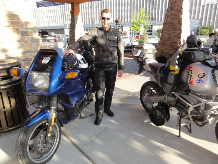
Group photo at Donelson Cycles and Museum
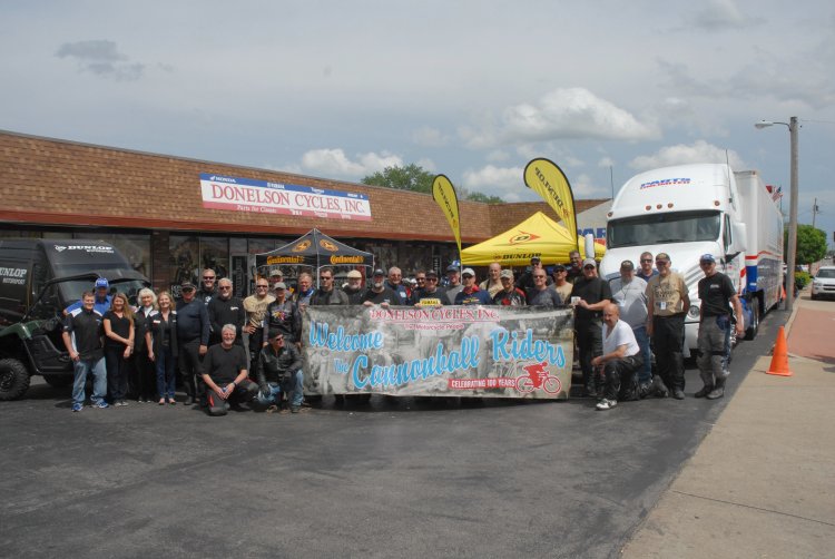
Keith Mashburn eating lunch in the museum. Duncan would have loved this place.
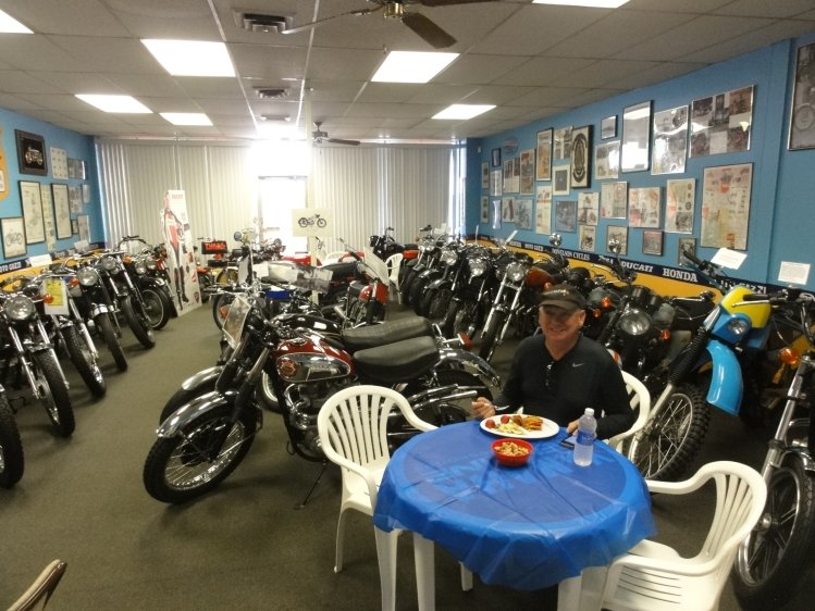
Assembling for the escort through Greenville. Of all the stops, Greenville is the only one that still has the original post office where Erwin Baker got his log book stamped to prove his times. It's a small friendly town.
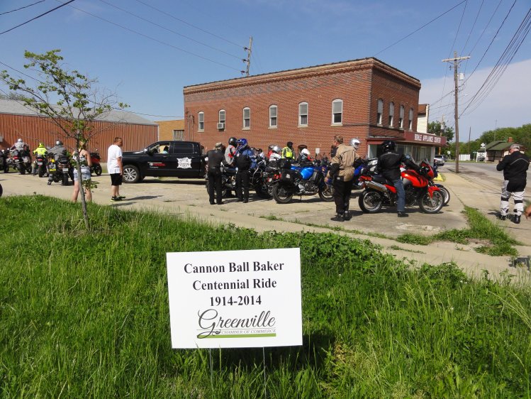
The police and fire escort. My radiator cooked me pretty good here.
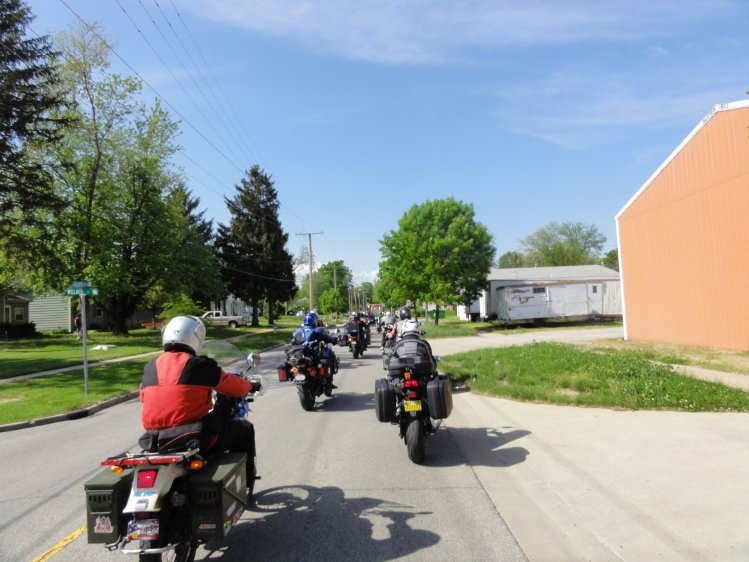
The mayor making a declaration and giving Don the key to the town.
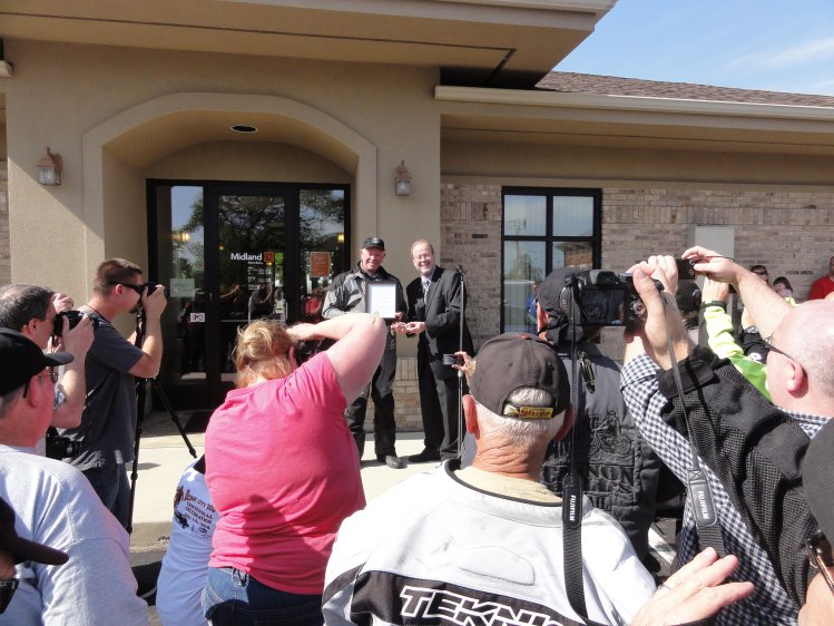
There was a "cruising night" going on that same night with all kinds of old cars and people in the streets. I think Bruce would have liked this GTO.
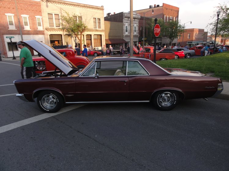
Breakfast the next day.
The town had given us shirts. Randy, who was on the Harley riding with Robert when we first met at the gas station, wore the shirt the next day as did I.
Barry, shooting a motorcycle mailbox.
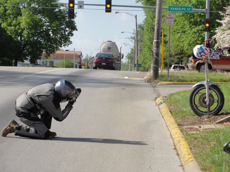
Swanky hotel in Indianapolis. Note there is Starbucks right here in the lobby!
My room with a view.
There are so many stories to tell and so much to write. This has been an eye opening experience.
I have to say, one of my favorite moments riding has been following five of these guys around a 25mph off-ramp at speed each of us riding exactly the same line falling into the corner light WWII fighter jets. That's the one moment on this trip that I really wish I had had the gopro camera mounted. This is the best collection of riders I have ever ridden with.
"They're mostly industry people." Tom, the founder of Saddlemen seats said to me as we were pulling away.
Another said, "We're surrounded by living motorcycle legends."
That does seem to be true.
I'm going to be riding with these guys until Thursday. I suspect I will be back home by Friday if all goes well.