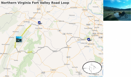
Northern Virginia Fort Valley Road Loop
This is one of our favorite routes through Northern Virginia. We typically start out at 55 where it meets 15 and take side roads down to 17 until it connects to 211.
There's a wonderful section of tight technical but well graded switchbacks on 211 as you approach and cross Skyline Drive.
We usually have lunch in Luray and from there head up to Route 675 which is a series of switchbacks the carves it's way up the side of the mountain. There are wonderful vistas as you go up. Very pretty.
From there you catch Fort Valley Road which goes on seemingly forever as it winds it's way through this magical looking valley of pristine farms and old buildings. It eventually narrows to a tight state park road that follows a roaring creek bordered by steep canyon walls in a deep wood.
We typically make our way to the Starbucks in Front Royal before taking the Superslab back home. Sometimes we'll take 55 for some local color as it winds it's way seemingly through towns that time forgot.
The best sections are tagged in yellow.

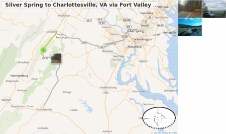
Silver Spring to Charlottesville, VA via Fort Valley Road and Route 211
This is, IMHO, a much nicer albeit longer way to go to Charlottesville from Silver Spring. It's a very pretty, twisty, and mountainous route.
I66 out to Front Royal.
Left on 55.
Follow over the river and then right.
Left on Fort Valley Road. It starts to get good here.
Continue on to Camp Roosevelt Road, route 675. (If you end up on a dirt road you've missed a turn.)
There's a wonderful overlook you can stop at at one of the switchbacks.
Left on 211 business in downtown Luray.
Continue East on 211 up over the mountains. Great curves.
Then make your way via side roads down to Route 29 South and Charlottesville.
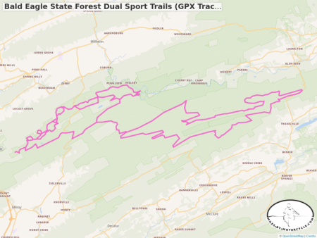
Bald Eagle State Forest Dual Sport Trails (GPX Track from Advrider.com)
This map is generated from a GPX file shared on AdvRider and covers some of the dual sport trails in Bald Eagle State Forest in Pennsylvania. See comments for link to the thread over at AdvRider.
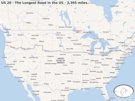
US 20 - The Longest Road in the US - 3,365 miles.
I came across this road in a post on Facebook today. US 20 is known as the longest road in the country at 3,365 miles. I've linked some articles on the right.
I thought I'd try to map out the route. Because I have a 50 waypoint limit, I've created two routes that total 3321 miles. Clearly, there are a few errors that I'll have to track down time permitting.
If you notice where I've made errors please let me know in the comments below.
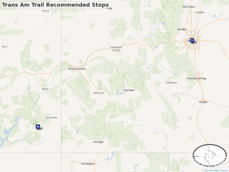
Trans Am Trail Recommended Stops
In the TAT Group on Facebook the recommendation was made to create a list of places to stop, eat, camp, etc along the Trans America Trail. My thought is to create a map here where all the spots can be downloaded via GPX and imported into a GPS or any app supporting GPX import.
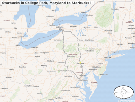
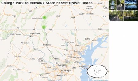
Starbucks in College Park, Maryland to Starbucks in Burlington, Ontario, Canada and back again
This is a travelling route primarily consisting of highways and interstates. There are some nice sections through the mountains in Pennsylvania and New York. The small section, marked in yellow, that goes through Harrisburg, PA along the waterfront is especially nice.
The trip up is on the left and the way back down is on the right. On the way back, there's a really nice Pennsylvania Welcome Center at an overlook that's worth the stop.
If you want the GPX file for this route, log in and you'll see a GPX button on the map.
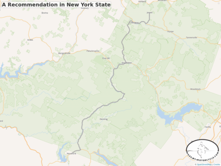
A Recommendation in New York State
Neversink, NY up W. Branch Rd thru Olivea to Shandaken then up NY 42 to Jewett, NY.
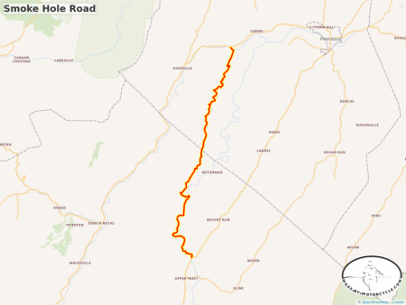
Smoke Hole Road
An awesome very twisty lane and a half wide little paved road that carves it's way along a stream in between canyon walls. This is one of my favorite roads in the area and is, IMHO, worth the trip from the DC area to ride.
If I'm not mistaken it's part of the MA BDR (Mid-Atlantic Back Country Discovery Route).
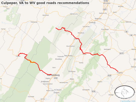
Culpeper, VA to WV good roads recommendations
I put this together in response to a question on Advrider.