
now
 Ian13 years ago
Yermo, I'm impressed that you're taking the time to write so much. Thanks for the posts - and I'll look forward to your updates.
Sounds like this is a very meaningful trip for you. And why not? This is a proper long-distance, long-duration trip. It will, no doubt, be good for your soul. And I suspect that at the end of it all you will in fact retain some of the uplifting aspects of it in your daily grind.
Ride on! buffalo13 years ago
As with everything, "hard core" is relative. Relative to many people you know, riding in soaking wet gear after camping in the rain *is* pretty hard core

BTW, there's a reason why you find so many bars in the north. The winters more or less demand it. If your route takes you through Minneapolis/St Paul, you'll find that they have skyways between buildings in the downtown so that they don't have to walk outside in the dead of winter.
I was there once in January and it was so cold that we couldn't get the windows cleared on the car, despite running the heat and the defrost at full tilt for quite some time...- Ian13 years ago
Yes, hard core is relative, a state of mind. You can get used to that stuff - riding in the rain all day, camping in the rain (good gear helps a lot for these), fixing your bike on the side of the road in grizzly territory, etc. It's like starting a new exercise regimen and the more you do it the more normal it feels.
You might want to check the long-term forecast before heading north from Fairbanks, though. If it's supposed to be wet, then it might be wise to reconsider the Arctic Ocean run.  mothman13 years ago
you have an adult haircut & don't look like Charles Manson as in your first cross country trip. plus being out of DC people are different.
 Yermo13 years ago
@Buffalo I passed right by there but was making time trying to get close to Dancing Rabbit. I'm about 100 miles outside of DR now.
@Ian I hear ya. The beginning of July is when it's supposed to get wet. Tom did it on an ST1300 in the wet and muck. If he can do it I imagine I can.- Yermo13 years ago
I think it's more than that. More people are walking up to the bike and looking at it. More people are approaching me while I still have the helmet on. I think times may have changed ...
 Anatoly13 years ago
I wonder if some of it is curiosity. Until I met you, I didn't even know that BMW made motorcycles. I figure many people haven't seen anything except Harleys and Hondas.
- Yermo13 years ago
I think that may be part of it but in '92 hardly anyone approached me at all or looked at the bike ... it's weird. I have been getting alot of attention on this trip. All kinds of people walking up to me, talking, asking questions, wanting to follow the facebook posts and read the blog.
It's been nice in a way ... and so unexpected. - mothman13 years ago
"So in this context, where it's been done before, what's the point? It's a silly destination to some arbitrary far away point that contains no significance other than it's the farthest I can go to get a sense of "away"
you could go much further the other way south to the Pan American highway and ride to Ushuaia, Argentina.
just giving you options... - mothman13 years ago
"When I was a kid, I had a Harley AMF two stroke my old man had bought for me, somewhat against my wishes. It was always breaking down, making funny noises and otherwise misbehaving."
so your telling us it was working normal for a Harley... - Yermo13 years ago
@mothman Yea, I was thinking about Tierra Del Fuego but I just don't feel comfortable enough travelling through South America. That guy Tom I met had done that trip ... too hard core for my taste.
- Anatoly13 years ago
"I just don't feel comfortable enough travelling through South America"
Yeah, and we don't make enough to pay your ransom.
- mothman13 years ago
you have a point since they are killing people in Guatemala & leaving their heads on the steps in front of their congress - I can see why you don't want to do that trip.
Four severed heads found in Guatemala City
http://news.bbc.co.uk/2/hi/world/latin_america/10290246... - mothman13 years ago
watch out for those low stops camping
- looks like your having a fun time sorry for all the doom & gloom back here in DC.
you may have heard the news "Flash flood sweeps away Arkansas campers"
At Least 16 Campers Killed in Arkansas Flash Flood
http://abcnews.go.com/WN/Media/campers-killed-arkansas-...
‎ - buffalo13 years ago
Interesting take on communal living--I think this is the attraction of group houses as well. There's always someone around doing something, and you're rarely alone for long.
Sorry about the false leads on the various dead end roads; I suspect the MO DMV/DOT is passing bad info to Garmin  Todd13 years ago
You might want to consider picking up a hydration pack or bladder bag for the tank bag. For the last two years I tour with a Camelback 3L bag on my back and find I am not as tired at the end of the day and can push through those realy hot slab sections. My last trip, where I did nearly 600mi in one day, I consumed 6L of water. When I rolled into the garage, I felt I could have ticked another 100 easily. Water, its the ticket.
I am really digging the blog.- mothman13 years ago
you're probably find that gas mileage will be normal on paved highway but you are chewing up more on dirt or gravel. something to think about if you decide to go all the way to deadhorse which would mean you need to carry more gas than first calculated.
- mothman13 years ago
your old riding gear arrived by fedex yesterday the box is in your living room
in front of the TV - mothman13 years ago
I've been watching the news the mid part of the country has been getting some epic rain, flash floods, etc
don't over load on the endorphins, you may be actually enjoying your trip.
did you actually say side roads and kansas in the same sentence?
escape while you still can. - buffalo13 years ago
The ramps that turn to dirt are actually truck escape ramps. If you lose your brakes, you aim your truck down that ramp and the dirt brings you to a safe stop.
We passed several of those in the Tennessee hills on the way back from Deal's Gap last month. - Yermo13 years ago
@Duncan. Nope. These aren't truck ramps. They are full on 360 offramps that are crazy tight. I went by by one and thought to myself "no way!". I should have taken a photo. They led to farm roads but were full on offramps directly off the interstate.
- Yermo13 years ago
@Lance yea, according to the news there was tremendous flooding in Kansas City. Where we were the roads were covered in a few inches of water but nothing dangerous.
- mothman13 years ago
"I figured some of my friends would give me a hard time about the last two posts, and as expected that happened."
hard time no way, my comments are all in fun you know - you should know this after almost 20 years.
after the past couple years it's good to see you having a good time and enjoying it.
FYI: you are getting into open range country beware of cows or other slow moving large critters stepping out in traffic - last time I was out there I almost hit a cow coming around a mountain curve. - they are slow & dumb even if you honk your horn the only thing they may do is look at you as if your stupid. - mothman13 years ago
rational thought rant "wow' if that is what Kansas does to your mind I would have suggested I29 leaving Kansas city
I29 follows the Missouri river and some hills and the road actually has some curves in it to keep you awake
up to I90 through the "bad lands" into Wyoming (which is where yellow stone is) then drop down into Colorado to avoid Kansas.
I know your meeting people and plan on camping with friends out there but whats a couple hundred miles?
"a mind is a terrible thing to leave in Kansas"  pobatra13 years ago
Yermo, seriously it's been great to see the gentler side. Not giving you a hard time at all. Ok, maybe giving you a little bit of a hard time, but in a good way. Didn't mean to offend.
Those are some great pictures of of flat Kansas (and Colorado). I think you really captured it. And the cosmological myth is wonderful.- Yermo13 years ago
@pobatra Thanks.
No offense. I figured I'd catch a bit, but it's ok and probably necessary. The flatness was really oppressive. I mean completely nuts.
I'm glad you liked my myth. I thought about ways to expand it quite a bit ... but it would have gotten too long. - Anatoly13 years ago
You know, if you called your trip the Starbucks Cross-Country Tour, you could have gotten sponsorship! (Or maybe at least some free coffee.)
- Yermo13 years ago
It dawns on me that I forgot to include the section where I was going to tell Mike "you know, it's only a days ride out here ... you see what you're missing. What's a few days off of work after all?"
- mothman13 years ago
I'd suggest a set of plugs till you have a chance to get it serviced it may help if they are being fouled
high altitude can cause some issues (fuel/air mixture) but if this is intermittent you'll probably will need to have it looked at.
more pics...
the views are great. - Yermo13 years ago
@Mothman It may also just be bad gas. Some of the only place to get gas out here are a bit sketchy.
- mothman13 years ago
missing report 13: - lost connectivity ok not eaten by bears or anything
good to hear the bike is running better.
how many times have we told you - children are just like dogs they won't notice you if you don't move or make eye contact.
you obvious moved or made eye contact. - it's all over then.
good more pics - Yermo13 years ago
I stood very still, motionless even, when one of the little noise makers said "we see you". I was a goner.
- dchakrab13 years ago
You have to start telling them that they're almost old enough to ride a motorcycle, and it's cool to go fast without gear. Then maybe their parents will take them off our hands?
- mothman13 years ago
cool pics and the bear spray must work because you haven't mentioned seeing any bears
- mothman13 years ago
the mountains make their own weather patterns some spots just never get water.
some of those personal boundaries you come to live with so long there is a strange comfort zone, the known vs the unknown.
your cage door is open, you have to figure it out for yourself. - buffalo13 years ago
What Lance said about the mountains--they can affect weather, depending on which direction moisture bearing air flows predominantly.
Don't freeze, glad the grips are helping - Yermo13 years ago
@Buffalo In yellowstone right now. Barely getting a signal. Caldera hasn't exploded yet. It's bloody cold up here at night. Heated grips are working great.
Got stared down by a buffalo in the road, then by another one in a parking lot. They're everywhere up here.
Haven't seen a bear yet. - buffalo13 years ago
Wow, excellent pictures. Very glad you noticed the idiot in the cage at just the right moment. Be careful...
- mothman13 years ago
"How Did the Tetons Get Their Name?
French fur traders came to the region in the early Nineteenth Century. Focusing mainly on three of the largest peaks--Grand, South and Middle--they referred to the range as "les Trois Tétons" or "the Three Breasts." That is the origin of the current name, Grand Tetons." http://www.ehow.com/facts_4927640_did-grand-tetons-thei...
if your looking at mountains as breast you've been out in the woods too long...
no head to head combat with cars sorry but not allowed - there is scotch back here to drink - Yermo13 years ago
@Mothman <laugh!> I did not know that. But maybe I have been out on the road too long.
@Buffalo Yea, I found myself thinking of the last cross country trip, Hells Canyon, you on the OldWing. - mothman13 years ago
the dead trees you were seeing,
depending where you were in the park may have been due to fire.
Arnica fire that burned 10,700 acres September 2009
LeHardy fire 10,361 acres July 2008
Columbine 1 - 18,500 acres August 2007
East - 18,050 acres August 2003
the really big fire was 1988 793,000 acres burned, 1.2 million acres was scorched out of the park’s 2,221,800 acres.
http://www.nps.gov/yell/parkmgmt/firemanagement.htm - drdave13 years ago
It is a pleasure to follow along and share in your experience. Happy for your journey, Scared when evil closes in. Remember your sister. and share in the uncommon beauty of the journey.
Its quite the journey here, getting radiation treatments and hiding from the sun. I cannot begin to tell you how my spirit rides with you. for me, life right now is a roller coaster but im riding in the car instead of being tied to the tracks.
May all the spirits of the road keep you safe on your journey. We want you back ! We are with you..... our hearts and minds. Have fun and Be safe - Yermo13 years ago
@drdave thanks, dude. Kind words. I've been thinking about you during my trip. I don't know what else to do but keep my fingers crossed for you. Sorry I didn't have a chance to set that software up for you before I left.
- TomL13 years ago
I've really been enjoying reading your blog posts. It's an epic trip and it sounds like it's been good for your soul.
It's also a bit like reading Zen and the Art of Motorcycle Maintenance, one of my all-time faves. Except it's more Yermo and the Art of Motorcycle Maintenance. Nicely done. - Yermo13 years ago
@TomL Thank you for the encouraging words. These things are terribly difficult to write ... I have to admit I've been floored by the responses I've gotten. It makes it so much easier to write ...
- buffalo13 years ago
So you finally got a cup holder
I'll have to thank Ian for his part in that
How's that line go? Oh yeah--"My work here is done"
That ferry brings back memories--I remember trying to lash the bikes down properly back in '92 as we were heading back down to Washington from Victoria on our way back south... - Yermo13 years ago
@Duncan this ferry ride was glass water smooth. The bikes could just be left on center or side stands without issue. We were also given preferential treatment. We were a band of about 6 BMW's and one Ducati (along with a couple of scooters).
- mothman13 years ago
talking about messy garages, your once organized garage we've disorganized it with micro's diesel truck in your garage replacing the injectors,injection pump & glow plugs
that truck seeps the goo
don't know if your own bike will fit in the "club" when you get back  Stacie13 years ago
Yermo, that's almost a smile you're wearing in the coffee/ferry pic... a testament to your caffeine lust.
Love the balloon/bikes photo!- Yermo13 years ago
@shorty Good to hear from you! you're right, nothing seems to make me happier than release from caffeine withdrawal.
@mothman How'd that project go? Are the starting issues with that truck resolved now? - mothman13 years ago
we're not finished with the truck, project ate the weekend, then monday and tuesday evenings after work we are going on day 5.
these 6.5 GM diesels are a pain to work on I've never seen something so poorly engineered. every part you want to unbolt
has something in the way it's almost like GM intentionally planned it that way.
you know me I have flex head ratchets, sockets with knuckles built into them, extensions with swivel ends, and offset wrenches, metric & SAE you name it and they don't help on this thing
then to top it off it's a mix of SAE & metric with the occasional WTF nothing fits - I could understand if the bolt head is rusted or stripped but they're not.
to top the strange fasteners on this thing we resorted in borrowing one of the super thin 13 metrics from the factory BMW "S" tool kit to get the valve covers off - yes the bike will need to be burned to cleansed it from touching a GM
sorry but sacrifices needed to be made. - mothman13 years ago
"that walking into an Easy Thing, like a resort, a cruise, some far away island beach, makes me more internally uncomfortable than any Hard Thing I've ever done." - what some view as the hard thing may not be - it is one's perspective
you enjoy riding, you don't mind camping out and you check yourself and the gear before going. you don't just jump on your bike expecting to make it to some far off destination. - yes there can be problems & usually are in any long trip.
you may not be prepared for everything but have yourself mentally prepared to handle the situations.
so far every part of your trip from what I have seen has been worth it. - there are parts of your trip I wish I could have been there - (but not having time off from work, not having the correct bike that could do the trip and far less riding experience would just be fool hardy at this time).
I'm sure you'll enjoy riding up through Canada & Alaska to Fairbanks and meet more interesting people.
now Deadhorse just seams like some point on the map 400 miles from nowhere, I could be wrong there might be something to see (end of land at the Arctic ocean) other than a oil field at the end of some road.
-you can always turn the bike around because doing doughnuts are fun... - pobatra13 years ago
Just catching up finally. Was without internet for a few days.
Nice post. Great pictures, and thought provoking at the end. Didn't realize how bad your ulcerative colitis was. Glad you made it through. - pobatra13 years ago
I think your incipient cannibalism is a good sign. A sign of life. You'll make it to Deadhorse no problem.
- buffalo13 years ago
Sounds like things are progressing well. The ferry pictures certainly bring back memories. I recall a series of ropes tying the Goldwing's frame and crash bars to various parts of the boat to help it stay upright on the center stand.
Thanks for putting up pics of Fraser Canyon--I've ventured back into memories of that place many a time as you're well aware, despite my NDE while headed northbound to PG
Let us know if serendipity throws another "Canadian Toll Booth Girl(tm)" in your path.
Do you think you'll pass by Lac La Hache (Crystal Lake) again on your way north to PG, or the way back? You probably remember camping there 18 years ago.
Funny to think you can take the man out of PG, and he'll just find another PG to go to thousands of miles away - Yermo13 years ago
@Duncan laugh. Yea, ain't in the truth. I've been riding on Route 1 for a couple of days now.
- Ian13 years ago
Quote: "I honestly don't know if I'll make it. Maybe it'll be too hard ..."
If you don't make it do Deadhorse, it won't be because it is too hard; you don't shy away from things that are difficult. If so, it will be because the conditions dictate that it is not sensible to try. I think you know the difference between difficult and foolhardy. With any luck, the road will be dry enough and you'll be able to give it a go. - Yermo13 years ago
I talked to two guys today. The Englishman who said "It's 'orrible! Simply 'orrible!".
The later I talked to a guy who said "It's no problem. Don't let him discourage you. People take Goldwings up there. Just choose your weather carefully." - buffalo13 years ago
If we didn't stay at the Ramada last time, we at least pulled up in front of it briefly. I remember realizing (too late) that the parking slot I pulled into was at a slight forward incline. This made it very challenging to back the goldwing out of it without assistance.
Don't worry about the pictures, we're "getting" it just fine from afar.
Seems to me our last oh <expletive>! moment was about 1/3 of the way out of PG on the highway toward Prince Rupert, not long after (or right before?) you had a flat on the K bike, when a black bear cub walked out on the road in front of us.
BTW, the yellow flowers look alot like Canola (aka rapeseed), which are used to extract the oil of the same name. We saw a lot of that in the UK back in '06.
Now that you're on the Alcan and heading north, any chance of picking up some enduro tires, like the Metzler Enduro 3's before you attack the Dalton? - mothman13 years ago
I'd figure Duncan would be all over that bike with the trailer
Black Bear & out of dodge - good move they can be more temper mental than grizzly's - nice pic
watch out for young bears or moose because the mothers will go crazy if you get between them and their young - worse mistake you could ever make. - pobatra13 years ago
I think being brave is knowing you are afraid and going ahead and doing it anyway.
I'm curious about those crystals too. - mothman13 years ago
wile e coyote super genus - associating people with food or as food?
no rocket skates? darn
I guess if bear is in the road who waits who out?
cardboard police cruiser and a camera is all it takes any way to cut the budget.  MikeS13 years ago
Congratulations on making it to Deadhorse. You're halfway home.
The difficulty of the journey is relative to your experience. The fact the you found the road to be oversold also shows how well you did in preparing yourself (and you gear) for the trip.- Yermo13 years ago
Thanks. I think a big part of it is also that I didn't impose any preconceptions on the road. A big part of this is mental. How much patience can one bring to bear. It's an easy road, but it is dangerous and can surprise you.
- Ian13 years ago
Halfway home? Yermo, have you considered continuing west? Get a ride over the water and ride west to, say..., Germany.
- Ian13 years ago
Seriously, though - I'm happy for you that you made it to Deadhorse. It may have been for No Reason At All and didn't mean everything, but it means something. Come back through Victoria and I'll buy you a celebratory drink.
- pobatra13 years ago
Cute coyote. Yermo, for my own selfish reasons I think you should definitely keep writing!
- pobatra13 years ago
A bit harrowing there with the clutch. This is the best post of all. Congratulations!
- Anatoly13 years ago
"It makes it so that I want to continue trying to write."
You always said that you were not a good writer. Maybe it was just the topic, because I think you're actually a very good writer. You should definitely keep writing after this trip. - Yermo13 years ago
@Anatoly Coming from you, that means a tremendous amount. I didn't realize you were reading the road reports. Thanks!
- Yermo13 years ago
@Ian don't tempt me. Points far further away have started calling to me. I've met and further heard of a number of people who have done the Prudhoe, pronouned Proodhoo, Bay to Argentina Tierra Del Fuego run ....
@pobata Thanks! Yea, the clutch thing was kind of a pain, but it was foreshadowing. More on that in the next post once I have a chance to write it.
@Ian I will definitely stop by on my way back down. It was suggested that I got to Valdez so I'm strongly considering heading out that way. You're supposed to be able to see a glacier from the road .. and there's a reportedly a boat tour that goes out to a glacier on the water. - Yermo13 years ago
Yea. I especially like British Columbia. I was surprised. The last time I was there the people didn't make as strong an impression on me. I have really liked almost all the Canadians I've encountered. You know when I have a positive impression of a law enforcement officer things a Different(tm).
- Yermo13 years ago
I doubt Ludwig reads this, but his son, who I am much closer do, probably sees them. His wife would translate, I think. I was torn about whether or not to tell that story. I never admitted to anyone what a toll it took on me or let anyone know how much other stuff was going on at the same time.
There are so many other stories to tell ... Duncan knows them all. A few select few know most of them ... - buffalo13 years ago
Uh Oh. Time to watch "The Long Way Down"
"Thomas and Andrea did it--how hard could it be?" - mothman13 years ago
it's your trip. write when you can all of us back here are just on the virtual trip
- Yermo13 years ago
@Duncan well Thomas and Andrea had their bikes shipped to Santiago. Interestingly, I was just talking to the woman at the front desk about South America and she was telling me how terrible Mexico has gotten. How terribly dangerous it is. "They cut people's heads off now". There are always reasons not to do a thing. But it's starting to sound like maybe it's something I might have to do ...
- Ian13 years ago
Talk about an unusual coincidence - my motorcycle's headlight failed the same day as yours!
Good luck with the bear search. - buffalo13 years ago
Hope the boat trip goes/went well. Remember to zip up your suit pockets!
98F here yesterday, 95F projected for today--enjoy (dryly if possible!) the cool weather... - Yermo13 years ago
@Ian There were grizzlies! 4 of them. A mother with three cubs. There were also countless eagles and a sea lion. More on critters on the next post.
@Duncan Heading out on a boat today to tour the icepack. It's supposed to be around freezing out there. There's a chance I might see whales. It's a long cruise, lasting over 7 hours. I'll stay here in Valdez one more day and head back out onto the road tomorrow. - Yermo13 years ago
@Micro LAUGH. I remember that episode. I don't want to spoil the blog update but I met a guy who was coming down from Alaska who had not gone up to Alaska, he had come through Magadan, Russia. He was doing his own Long Way Round ...
- Ian13 years ago
This is your punishment for not returning to Victoria to visit us! 'least, that's how I see it...
 Flashlight13 years ago
Yermo! Susan here. Beautiful countryside. I particularly enjoyed the photo of you preparing to swim in the lake with your full leathers doubling as a swim suit. ....As well as photos of you and Ian from a few weeks ago...
While you have been away we indeed experienced the first ever "tornado warning" for "southeastern Montgomery County" which sent me huddling in the bathroom for 15 minutes... as well as our first earthquake which had me texting Mimi at 5 am and reaching for some proper pants to put on as what else does one do to react to such a thing? Not to mention day upon day of 100 degree weather. Unsettling indeed. Perhaps these acts of mother nature are NOT directed at you as we have long suspected! Then again, there is the felled tree in your yard. Hm.
While you are away, watch out for the chupacabra; the creature is on the increase. Also note this story about aliens targeting this poor man with meteorites and take heed:
http://www.metro.co.uk/weird/835482-man-hit-by-six-mete...
-Sister Susie- buffalo13 years ago
Excellent. All the best theoretical concepts in the world are of little value until one is ready to accept and apply them.
Once one is ready, it's nearly as simple as a 1 second internal "click", and suddenly the world has shifted about a foot to the left--permanently.
Well done; this was/is/will be the entire point of the whole operation (at least as it appears from the outside). *Lots* of external work/effort/labor for a (seemingly but not really at all) "small" internal shift... - buffalo13 years ago
...can suck at times.
I envy you the boating--that looks like fun despite the work factor.
It may be that your FI (does it have an O2 sensor? Lance and I couldn't decide if it did while discussing this last night) needs a slight tweak with the new pipe, but that's an easy/quick fix at some point.
Hope the trip to PA goes smoothly... - Yermo13 years ago
Strangely the running warm problem seems to be correcting itself. The 16V K100RS does not have an oxygen sensor according to techs at Bob's despite what the fiche says.
I'm wondering if it has a mass airflow sensor which it might use to detect a freer flowing exhaust. I'm keeping an eye on the temperature. - mothman13 years ago
Road stench: - The beyond BO funk that builds up on a rider after 60+ days on the inside of the transit suit.
so can the suit stand on it's own yet? - Todd13 years ago
I didnt expect Rt 55 to have that traffic, sorry for the bad lead. Those bendy bits and vistas are what I recall.
If you do make it to the Eastern Grand Canyon, Rt 15 south is a pretty fast road aside from the bits through Williamsport and the like. I was on it two weeks ago and was surprised to see a four lane that lacked the infamous PA construction with no one working. It is becoming I-99 in sections.
The transit suit is stalking it because you are going to eat and not inviting it, demonstrating some sort of passive-aggressive behavior? - Ian13 years ago
Hey, getting back home won't be so bad.
There'll be clean clothes and a shower
You can sleep in without worrying about checkout time
No more twitching every time the credit card comes out
Air conditioning!
The satisfaction knowing that you Did It and are better for it; What you do next is entirely up to you
Phil's right - many would never get a chance to pop out of their hellhole, ever. You're luckier than you think. - mothman13 years ago
you think civilization is still waiting back hear in DC - indoor plumbing, electricity, AC and Scotch - it's gone
just a big hole where the house was but the garage is OK. - Ian13 years ago
Have you read Siddhartha lately?
As you ponder your things you could ask yourself, "will this thing make it more likely or less likely that I will eventually be able to run my business from:
a ) the back of my motorcycle
b ) a boat
c ) a distant land
?" - Yermo13 years ago
It's been many many years since I've read Siddhartha, but maybe I should re-read it. Herman Hesse was my favorite author for many years.
- buffalo13 years ago
Of course there's a long term stable place between "too much stuff" and "no stuff" that one can eventually settle to.
It also stands to reason that for most folks, a lot of oscillation between the poles has to occur before that can happen, and one reachs a more stable "stuff state".
IMO, like the physical place one is at any given moment, things are an external reflection or echo of intents, motivations and aspirations--the the locus of what they refect.
Follow this line of thought to the end though, and internal state is internal state; one can move to Tahiti, sell all posessions, assume a new identity and so forth--in search of internal change. But ultimately, internal state is (and must be) independent of the external things that people so often (and sometimes unwittingly) attempt to modify their internal state with.
The trick is to get to that place where one can knowingly and effortlessly direct and maintain one's internal state in the desired focus and mindset at any given moment, regardless of external posessions/environment/people and location. - Yermo13 years ago
yes, but each external thing takes up a bit of life. How many hours do I have to work to make money to buy the parts and supplies to keep the boat going? The bikes? The car? The house? All the things in it?
It's ok to say that the internal state shouldn't be affected, but the fact is it is simply through the practical expenditure of time and effort.
We lead stuff over-filled lives. Excess abundance. - Yermo13 years ago
This is just a test comment to see if I've fixed yet another bug from having moved the database over from yml.com and edited it by hand.
 Phil13 years ago
some stuff makes life more conveant, more comfortable, easier.
some stuff makes life fun, more enjoyable, entertaining
for most people, if you want that kinda stuff
you have to work!
to make money,
to buy the stuff.
how much you have to work and how much stuff you want
is all personal choice
for me
I could not go to deal's gap in oct cuz I had to work
if I didn't work, I could still could not go,
if I didn't work, I could not afford to go
I could not afford to have a new bike, with new tires, hotel rooms, fuel, food
one might be happy with out stuff.
I would not.
so I work, almost every day- mothman13 years ago
Quality of life & personal happiness.
If you base it on work, money & stuff, I don't think your going to find it.
there is more to life... - Ian13 years ago
I know people who have to plan their vacations around their pets, because the pets either need to go along or go to a dog hotel.
If you own a bunch of old bikes and spend much of your free time maintaining and rebuilding them, then that's fine if that's how you want to spend your time. If you'd rather spend your time riding one good bike than working on old ones, get rid of the old ones. Same goes for computers and the services they provide. - Yermo13 years ago
@Phil I hear ya. I've spent more of my life doing 7 day a week 100+ hours than not. Along the way I accumulated more stuff than I realized. I'm not advocating complete stufflessness. For me, it's a matter of trying to decide, for each thing I own, does this add or detract from the things I want to be doing? Many of the things I have accumulated are related to work and are actually just silly in my current context. Servers. Routers. Switches. Modems. UPS's. I manage the kind of infrastructure that a local ISP would have. It's alot of work and ties me to this place and places me on call 24x7. I've been doing that for 16 years now. These days it no longer makes sense for me to do that. We just don't make the kind of money off of it anymore. Eventually these machines will get shut down and all of it will be moved onto some virtual server somewhere. Then there will be peace in my house.
And before too long reality will strike again and I will likely have to go back to the grind, but for this brief moment I get to reflect and decide what my next move will be ... or have life decide it for me if I wait too long.
@Ian I agree.  SprintKS13 years ago
I like Jay Leno's way of handling stuff...buy all the stuff you want, buy the perfect garage to keep your stuff, hire a staff to maintain your stuff and you just drive/ride your stuff whenever you want.
Unfortunately I’m confident I will not have this reality.
I believe strongly in finding balance and really living life vs. surviving it. This balance is not the same for anyone and I know from my own experience, may not be easy to identify. I also understand that ‘things’ don’t ultimately make you happy; however they are augmentations to it.- Yermo13 years ago
@SprintKS The Jay Leno approach had always been my plan.
I agree, there is a fine balance. Recently I've been more focused on how life changes context and how the things that made sense in a previous context no longer do. I'm hoping that tonight, for the first time since I moved into this house 15 years ago, the noise of servers will finally be quieted. My hope is I'll be able to think then .. it's strange how the noise of these machines affects my ability to think. - Ian13 years ago
Tara was our next-door neighbor when we first met her, so I don't think there were any introductions. And she had a coffee maker.
- Yermo13 years ago
Oh that's right! The day my original espresso maker met it's untimely demise due to an unexpected rain shower.
- Yermo13 years ago
And, for the record, I still don't believe a DR650 on knobby tires can be leaned over that far. That's just nuts.
- Phil13 years ago
see if Tara wants to come back in may, I do my best to MAN UP and defend the honor of Man-kind ,lol
I can even bring the KTM as well and she can pick her poison.
glad you guys are having a good time  JohnnyDanger13 years ago
Sweet! That's exactly the review I've been looking for. Good work putting together a comprehensive and truly tested gear review. Now I want one more than ever... I've had my old leather jacket for over 100k miles and while it looks awesome and is super comfy it is NOT waterproof. My Darien is the go to wet weather/touring gear, but it's not as styling and it's a pain having to be all or nothing with your gear. Having a 'jack of all trades' suit would be great.
Thanks for putting in the time, I'm sure others will find it quite useful as well.
Cheers.- Yermo13 years ago
Cool! I'm glad you liked it. I had been meaning to write that for some time. Thanks for giving me the nudge I needed to get it done.
- Yermo13 years ago
It was mentioned to me today that maybe the suits are actually made in Vietnam and not China. I had thought they had said China, but I could certainly be mistaken. If someone knows for certain please let me know.
I was also asked, over at advrider.com, about sizing options, but aside from what's listed in the catalog I don't know. The jacket seems "big" to me for a 42. The pants seem to fit just like comparable jeans do.  Micro13 years ago
Warning. South Africa was amazing. Of course, looking at a pride of lions lazing in the shade 30 feet from the road might be a different experience on a bike...
- Yermo13 years ago
@Micro You gonna post pics? Strangely, Allan didn't mention any problems he had in Africa. I plan on reading his road reports. But of course, I'll never do a trip like that.
And I'll check out that commenting bug you reported. I think I know what's causing it. - Yermo13 years ago
@Micro when you have a chance could you post another comment and let me know if you still get the error?
- Micro13 years ago
I'll probably post a few pics, but there are 2,400 - including a few movies. There is something about seeing wildlife up close that makes it impossible to stop clicking the shutter button. Also, there are some awesome motorcycle roads along the ridge line between central and eastern SA. I didn't see a ton of bikes, but I know there had to be a few...
- Yermo13 years ago
I came across an interesting article that touches on some of these subjects today at the NYTimes: http://www.nytimes.com/2010/12/01/world/europe/01iht-le...
- pang513 years ago
I'm just impressed by the angles of your shots. You have a certain je ne sais Steve Martin going on there.
- Yermo13 years ago
@Pang5 yea there's been some laughing about that shot online for some time now, especially over at ADV. I thought about changing it but thought better of it. It's a very unfortunate angle. It's not an arrow but a ceremonial blow-dart-gun that my sister brought back for me from Borneo that has been hanging in my living room for years.
- pang513 years ago
All the better, youngun.
And changing things now would be silly. I mean, the pics are essentially meant to assist folks interested in buying a suit, right? Those folks might be momentarily amused by the angle but they'll surely be concentrating on your informed review.
Oh, and seriously, only meant I like your writing, eh. That's not meant to be pressure for more writing.
x - Yermo13 years ago
No worries. That's quite alright. I've been feeling the pressure internally all on my own quite a bit of late.
- Yermo12 years ago
These articles take so much time to write and there are so many things I forgot to include because I ran out of time.
. John, Joel's dad bought us a very nice bottle of scotch as a thank you for being a "Road Scholar" for Joel.
. "Manifest smoothness. Grace under power" in response to questions about my riding style and how I wear out tires.
. Dinner with Chad and his wife and how Chad took over Josh's roll to continue the epic wrongness.
. More conversations with James, the push boat captain.
and so much more.
Despite rain and cold it was a great trip. - Yermo12 years ago
Oops.
Some corrections.
1. I completely forgot that we did do a practice lap single file and slowly around the track to familiarize us with the track.
2. On track sessions were timed at 20 minutes, not the five laps they way I had remembered.
The article has been edited to reflect these corrections.  Moira Lee12 years ago
"Ulcerative Colitis and Crohns disease are not curable, unless you chop out the affected sections of intestine."
Not true. UC has been reversed with fecal transplants:
Treatment of ulcerative colitis using fecal bacteriotherapy.
http://www.ncbi.nlm.nih.gov/pubmed/12811208
Fecal bacteriotherapy for ulcerative colitis: Patients are ready, are we?
http://www.ncbi.nlm.nih.gov/pubmed/21618362- Yermo12 years ago
Interesting. I did not know that, obviously. I stand corrected. Luckily for me, based on diet discipline I've been (nearly) symptom free for years.
Thanks for the links! - Moira Lee12 years ago
Just sayin. With a little offbeat medical treatment you could be a Guinness man again.
- Yermo12 years ago
I contacted the manufacturer and they suggested that we were having a more difficult time than we should have been and further suggested that we should watch these videos for the proper technique. They say it's easily a one man job. I will give this a try once I get my changer bolted down:
http://www.youtube.com/user/nomartirechanger - Yermo12 years ago
I forgot to include a link to Ryan's Biker Peeps: http://www.bikerpeeps.com/biker_peeps/clip.html
 Jen Raffensperger11 years ago
If you figure out how to do it, how to look past the stumbling blocks of fear, please share. Everyone has their own fears and ways around them; I feel like some leftover from when I was a kid and had no faith in myself to move past them at all have hovered around for way, way too long.
At least you can do the work in one way. One way is better than no ways. Any fear faced is better than none at all.
Thanks again for writing this. AGrip11 years ago
Yes, easily a job for one person, once you get the hang of it. I think I've gotten the whole thing down to a fairly quick procedure. Just have to remember the little things, like letting the air out of the tires.
- Yermo11 years ago
I wrote this while I was ridiculously tired. Track Day took it out of me to a degree I haven't felt in a while. Even today, I'm still hurting. I plan on making a bit of an editing pass through it and will try to refine my points a bit.
Clearly, having services available and having a more controlled environment makes the track a much "safer" place to explore the limits of speed and control but I don't believe it makes accidents any less likely. Given the speeds and the difference in skill levels especially in the beginners group I feel "get-offs" are much more likely on a track day than on a typical day through the Gap. People are by the very nature of the track riding much closer to the limits of their ability. I certainly was riding much harder than I /ever/ have on a street by such a wide margin as to not be comparable.
I was really conscious of the fact that I had a the slowest bike and getting blown by a bit too close like I was standing still while doing 120+ takes some getting used to. I've talked to so many guys who are missing internal organs from having been rear-ended on a track. Actually, the organizer was telling a story of the last track day where exactly that happened. One guy on the straight mis-shifted, slowed down abruptly and was rear ended at serious speed. Scary.
The way I see it it's like ABS and air-bags. These devices save lives. Unfortunately, as has been found by safety statistics, the devices also lead to a false sense of security so drivers tend to feel invulnerable leading to riskier behavior. The same can be said for top safety gear on a bike. Undisciplined riders, unaware riders, feel safer in full gear so tend to take risks they would not take if they were not wearing any gear at all.
So that's how I see it on the track. If you're going to wreck somewhere, you're going to want to wreck on a track because of all the help available there. You don't want to wreck at the Gap. Wrecking there really sucks. So, psychologically, you're more careful at the Gap because the dangers are more in front of you.
Which is why I said, if you are a disciplined rider and do not exceed your limits, it's probably not safer. To your point, it's just different.
But if I had a to choose a place to have a "get off" I would certainly choose the track and never the road. Nor would I ever explore anything close to the limits of my riding on a public road or suggest that anyone do. It's not the place for that. "Take it on the track" is solid advice for anyone who wants to go fast.
But I continue to believe Deal's Gap teaches things to riders you cannot learn on the track. To some degree, and I need to update the article to reflect this, the lessons I learned at Track Day do not translate as well to street riding as even the Keith Code school did. You simply don't do those kinds of speeds on a public road, if you're sane. So in this way, Deal's Gap, with it's unpredictable corners and surprises, is much more of a "street" education and in many ways, I believe, is a better practicing ground to become a better safer street rider assuming you are self disciplined and do not ride beyond your ability there, regardless of what that is.
Also I need to update it to say, if someone has never taken Total Control or similar riding course they really should before getting on the Track. There were several riders who clearly had no riding education. Personally, I think Bob's BMW should get together with the Total Control guys to offer a Total Control package to Bob's customers. - Moira Lee11 years ago
"If you have an accident we'll come up and we'll ask you your name."
Does this mean people don't wear earplugs on the track? - Yermo11 years ago
I wondered about that as well. It seemed like I was the only one wearing ear plugs. It's crazy loud out there so I don't understand how people can go without.
- AGrip11 years ago
I don't know about other people, but I can certainly hear when people near me are talking, while wearing ear plugs. I have not been to a track, so I don't know if it would still be true in that case.
In emergent situations, such as a car crash, I've found that things get very quiet until the safety of the situation, and the condition of the people involved, have been assessed. I'm not sure if that lull in activity would occur on a track in the same way. - Yermo11 years ago
Re-reading my safety comment above I realize that I missed a bit of context. I suspect once one gets to the more advanced levels where riders are on equivalent hardware with roughly equivalent skill levels that things even out considerably.
My observations and the context I was commenting on was from a beginners point of view where most of the beginners had no training at all.  rshaug11 years ago
I had to laugh a little reading about Yermo's apprehension. If he was feeling a bit nervous and stressed about there being a new guy along for the ride...imagine being "the new guy". Some background is important here. This was the first multi-day trip I had taken in 20 years that was not a family vacation. So, I'm tagging along with a group of guys who have been hanging out and riding together (that second bit is important as Yermo mentioned) basically forever. I know and trust Josh and he had said this was a good group of guys, which made it a little easier. A little. I was INCREDIBLY NERVOUS LoL. I was terribly concerned that if it didn't go well I was ruining my first guys trip in 20 years but even worse, I was going to ruin a trip of friends who don't get to see each other often - which in my book would have been much worse. I wasn't really worried too much about the riding aspect. I've been on road bikes since the mid 1980's and always loved riding with others. I also am a believer in "riding your own ride" and am not a big fan of folks who ride like a jackass. I'm also a pretty easy going rider who doesn't care where in the line-up I am or if I'm better or worse than anyone else at anything. It was clear after a very short amount of time that it probably wasn't going to suck. After three days I was kind of upset. Why? Because I hadn't met these guys twenty years ago, seriously. These guys are the best. ALL of them are incredibly smart, incredibly well rounded, super funny, and fully engaged. The whole time on the trip I felt included, not just also there. I also came to find out that I have way too much in common with Yermo, that we share too many of the same views, and no two people should ever independantly come up with "catnip" as a description for a motorcycle blog's appeal to its readership. How absolutely awesome is that. Bruce and Duncan are quite different from each other in a number of ways, but have that easy rapport of long time friends. And both are a riot. Bruce has a wonderful dry wit and sneaky humor. He also can totally be the devil, in the best way possible. Costco tequilla - enough said :-). Duncan is super easy going, is the only person I've ever actually witnessed fall asleep with a full smile, and actually does seem to know everything. I don't in any way mean that he is a know-it-all - Duncan is remarkably modest - I mean he knows a shocking amount of information. I don't ever want to play Trivial Pursuit against him. I don't want to leave Josh out as he is responsible for inviting me along on this trip. I've known Josh for a while now and already knew that it was going to be a lot of fun hanging out with him for a few days.
In summary: I couldn't believe what a good time I had and it was all because of the people. Yes, the Tail of the Dragon is a great road. Yes, the Skyway and Parkway are incredibly beautiful. But they are just roads to drive on; amazing roads but still only roads. People make the event and this group made the event fantastic.
Josh, Thank You for inviting me.
Yermo, Bruce and Duncan, Thank You for letting me be a part of your world. I truly believe I've made new old friends (hopefully that makes sense).
Cheers!- Yermo11 years ago
Thank you for the kind words, Rob. We're all looking forward to you joining us next year. New old friends. I like that.
- Ian11 years ago
I never did get to go check out those waterfalls!
One of these years I'll make it out for another trip, have a good ride down the BRP, meet some new old friends and have a grand ol' time.
Yermo, don't forget that we still owe Francois a dinner. As if we needed an excuse to head out that way. - Ian11 years ago
When I lose my mind and run screaming from my daily life, I'll make sure to grab my helmet and boots on the way out the door.
 Dave Stafford11 years ago
Awesome read so far, loved the parts about the ferry, I've ridden that one out as far as Friday Harbor but my daily commute is on the same system, yep, first on first off, except those masochistic cyclists ahead of us, bout fell out of my chair laughing when i read that, too true, it's crazy up in here with the peddlers
- Yermo11 years ago
laugh. Good memories. I can't wait to make my way back up that way again. Thanks for joining the site!
- Dave Stafford11 years ago
Fairbanks, 10pm, sun
we used to drive up from just outside of Anchorage on June 21st to watch the sun -not- go down, it wasn't a whole lot different than 500 miles south but it was a fun trip, I used to start my daily run at about 11pm when it finally cooled off enough, I could run til 3am on the highway just fine, plenty of light
The flowers that you got great shots of, they do grow quite well on fresh burns and with some irony they are called "Fireweed" however they get that name from their usually large numbers, surprised you found some solo like that, when they are in large numbers covering a whole hillside and there is a good wind the waves that pass through them not unlike wheat fields make it look like the hill is on fire and flames are lapping across the land, thus "fireweed"
College Park Maryland. yea, the great white north is like that, I say I'm from AK because I grew up there but I was born at Georgetown Univ. a few years back I lived in Germantown, Md and then Leesburg,VA for about 3 years, family up in PA so a drive through college park was not uncommon, come back the long way to hit IKEA.
small small world - Yermo11 years ago
Wicked small world. Met a bartender in Whitehorse, Yukon. He asked me where I was from. I told him he's probably never heard for College Park, Md.
"College Park?", I go there all the time.
Wicked small world. - Dave Stafford11 years ago
wow, the memories of Alaska this brings flooding back are just endless, never went to valdez but many places much the same (lived on Kodiak island for a few years, you should check it out), feel bad that you never got right up on a glacier, its something else, they have receded massively since I was a kid, I worked at one (tourist cruise like the one you went on) when i was 19 and one night heading back to college in the city I snagged an ice burg, probably 3x2x2 feet but 150lbs, deep dark almost turquoise blue, threw it in the trunk of the car and took it to the dorms to have ice that hadn't been water in millions of years for our vodka. thought of that when you put up a couple "you know you are in alaska when.." pics
I'm really savoring the perspective you offer, so much i could not help but take for granted, never in a million years would have thought anything of the clouds in valdez. wow. dear friend of mine i grew up with, rode dogsled after school with (yes, really), happens to live near you (more small world)... once said to me when i was getting wound up in my own trappings much like you describe about your nightmare time and sort of corrected me like only a friend of 30+ years can, set me straight a bit on my complaint, so i thanked him and apologized and then he said some of the wisest words I've ever heard: "thats ok, it is easy to lose perspective, even easier than losing money"
thank you for so much perspective, awesome. - buffalo11 years ago
That was pretty silly. But I did some reading--looks like we all need to pair with everyone for the multichat stuff to work right.
- buffalo11 years ago
Factoid: these ATCs were featured in the James Bond movie: "Diamonds Are Forever".
- buffalo11 years ago
These are early Yamaha JT-1 mini enduros. I learned to ride on one of these many moons ago
- buffalo11 years ago
You know, with fuel injection, decent tires, and real suspension, this could have been a totally different bike...
- Yermo11 years ago
yea, I don't have the rich_textarea box enabled for photo descriptions so @ mentions and # tagging doesn't work there ... but I hope to find some time to build that in. I'll add it as a bug/todo list item. #bug (Note how you can tag anything ... so even though this isn't in the bug thread when I search on # bug I'll be able to find this comment thread. Pretty cool, no?
) - rshaug11 years ago
This was just before the real-life inspirations for every "toothless cannibal hill people" movie came tearing around the dirt road in their questionably legal truck. We saw them on the way out drinking on the porch of their log cabin. Booze+speed+dumbass=
LOL - rshaug11 years ago
It's kind of sad just how many pictures show all of us with our faces in our phones. Hmmm.... going to start putting an effort to leaving it in the pocket more.
- buffalo11 years ago
Yeah, me too. Maximum biking focus, minimum phone focus. But there are always going to be those days that when you want to ride, you'll have to check to make it possible.
- Yermo11 years ago
Yea, there-in lies the conundrum for M-BY-MC. It'll be an app who's reason for being is to get people out on the bikes and not using the app.
- rshaug11 years ago
From my perspective I was actually thinking more "friend focus" and less "phone focus". Other than family the reason for being on these rides is for the people much more than for anything else. I love riding, and the bike, and all that goes with it. But if I want to focus on that, or focus on the bike I'll just ride alone or maybe with one other person (after all it's always safer to have a ride buddy). But, when on these M-by-M rides I'm really there for the people. I struggle sometimes attaining a good life/work balance and have been trying to tilt the scale more towards life.
- AGrip11 years ago
I've been trying to set my phone down a bit more, as well. It is difficult on rides, since it's also my camera.
- AGrip11 years ago
 Yun Lung Yangread up on it, as well. It seems we can only connect with three other SENA units, on one channel, at a time. The day after this picture was taken we seemed to get the initial pairing down, and it all worked well. There were only 4 of us, and we didn't have any problems. I think that adding a fifth would start causing people to be dropped.
 - buffalo11 years ago
Or needing to be paired differently. It looks to me like we ought to be able to daisy chain a significant number of riders if we all:1) have the latest firmwareand 2) pair everyone up right.
- Yermo11 years agoYun Lung Yangremember this? Looking forward to doing the Blueridge again this summer.
- Ian11 years ago
That was a truly great place to camp. Indeed, I would love to camp there again this summer if I can make it happen. We will discuss...
- buffalo11 years ago
Hmm. This looks a bit like last year (or the year before's?) first ride up around Union Bridge, MD
- Yermo11 years ago
I intend to base it on this jquery calendar plugin
http://arshaw.com/fullcalendar/ ; - Yermo11 years ago
Turned out to be a nasty event handler binding bug. Dialogs with buttons the invoked nested dialogs were binding events to all dialog buttons in the entire window rather than just binding to the buttons in the loaded dialog. oops.
- buffalo10 years ago
As Rob astutely pointed out, the 144.95 run was likely due to tire slip on the first attempt. The second run was better, at 148.65.
- Yermo10 years ago
This should be fixed now. Please let me know if there are any further problems logging in using MSIE.
- Yermo10 years ago
It would help if I could write SQL correctly. Partial improvement had to do with the NextPrevious query handler in fv_sharedobjectManager. It was in advertently examining too many rows.
- Yermo10 years ago
So apparently this level of shavings is not considered out of norm. This is something I am surprised by.
- Yermo10 years ago
This turned out to be a nasty session bug in the way the Facebook API handles sessions. For some reason the API was losing the current access token.
- Yermo10 years ago
Oops. Failed to notice that it calculate a route off the ridge around Asheville. I still have to finish up editing of maps which I'll do after this trip.
- Yermo10 years ago
Will try! When I'm done with these maps you'll be able to put that directly on the map with a date/time, spaces available, etc. I'm going to build a full-on motorcycle trip planner/organizer.
- rshaug10 years ago
I think, my opinion, that this is very much ready for prime time. Excellent execution of the concept @yermo
- lukejmorrison10 years ago
Kingman to Oatman Arizona is a great ride over the Black Mountains. You get to hang out with the wild donkey's and see a gun fight at noon. It's part of route I did. This summer I'd like to ride up near Bryce Canyon.. I'll be heading down from Vancouver Island at some point to do some of this route. http://goo.gl/maps/K7t8O
- Yermo10 years ago
We might be able to do part of that on this trip but much of it is too far south for the amount of time we have.
- Yermo10 years ago
Added it to the map and tagged it. (Tagging members on pages with maps loaded is not working at the moment. Tracking that one down. )
- Yermo10 years ago
Excellent! (It ended up being a stupid oversight on my part.)
It's getting closer. Being able to tag people (and tags) directly in map descriptions and on map comments is key.  Gabe10 years ago
Correct. Reply message shows the inline form. However I could have sworn that when I used a browser last week for the multi-message spam I sent that it was a popup or didn't close properly and thus I ended up sending multiple replies. I can't remember which computer / browser I used but I will try and experiment later with some test messages across my devices.
I do know that behavior seems to differ on my Win7 desktop in Firefox, IE9 and Google Chrome somewhat dramatically when composing and replying to standard forum posts. But I will have to experiment this week to document the bugs / behavior differences.- Yermo10 years ago
So I'm wondering, is that The Camp David? I do remember seeing these restricted/do not enter signs and thinking that was odd.
- Gabe10 years ago
Side Note: Think I just figured out how I sent you mutiple messages. Once the message shows posted (like here), if you click the browser "refresh/reload" it will actually want to submit the form again. I must have ignored this somehow or missed the dialog box to re-submit the form, but it's interesting that it wants to the submit the form again even when it shows posted with nothing queued or typed in the box.
- Yermo10 years ago
Cool. Thanks for letting me know. I'll fix it. I was messing with the dialog box code recently and clearly broke something.
- Gabe10 years ago
Yep, works fine for me now on iOS (iPad Safari). I get a small "your message as been sent" new box now with a close button. Much better!
- Yermo10 years ago
Strange that it was only manifesting under Safari. This should be fixed now. Please test it out.
- Yermo10 years ago
Very cool. The maps system I've built here is still "early-alpha" so so still has a bunch of bugs. If you run into trouble please let me know. If you have a GPS and you do that run, uploading the GPX track works well.
- Yermo10 years ago I'm thinking I should write a parser for Google's KML so we can import them here. The big advantage to what I'm trying to build with maps has to do with making them shareable, taggable and searchable. I always hate going on a ride and then, months or years later, not remembering what the ride was, or what happens more often, is that a buddy of mine, like buffalo, might tell me about a ride he did somewhere but by the time I get around to that area I've long since forgotten.
The other aspect of what I'm building, to be released "soon" is a multi-user rider planner. Imagine laying out a route with pre-agreed upon meeting points over the duration of the ride (or big trip) and then being able to invite people on the ride like a facebook event, but with multiple places/times/etc which can then be updated as the ride happens. Status updates, photos, etc from everyone will get stored along with the map/ride which is then a resource for people later.
I do wish I could have built all this stuff on top of google maps (actually the first version was) but they changed their terms of service basically preventing me from using them so I had to fall back and punt to using Open Street Maps. Extremely cool, but limited when compared to Google. - Yermo10 years ago
I would like to point out you are the very first person to successfully create a map on the site other than myself.
I'd like to say thank you. Would you like an M-BY-MC sticker? a cap? t-shirt? mug? If you private message me your address I'd be happy to send you one.
Check out this map where I've compiled a bunch of roads and points of interest that people have suggested forYun Lung Yang's and my trip in a couple of weeks.
July 2013 Seattle Trip Planing Map
A little bit of route and sight planning for the upcoming 2013 Seattle Trip.
If you haven't been there, check out Crater Lake, in the vicinity of 5.
From there head to Highway 101 on the coast:
Soon, I'll add the ability for people to mark suggestions directly on the map.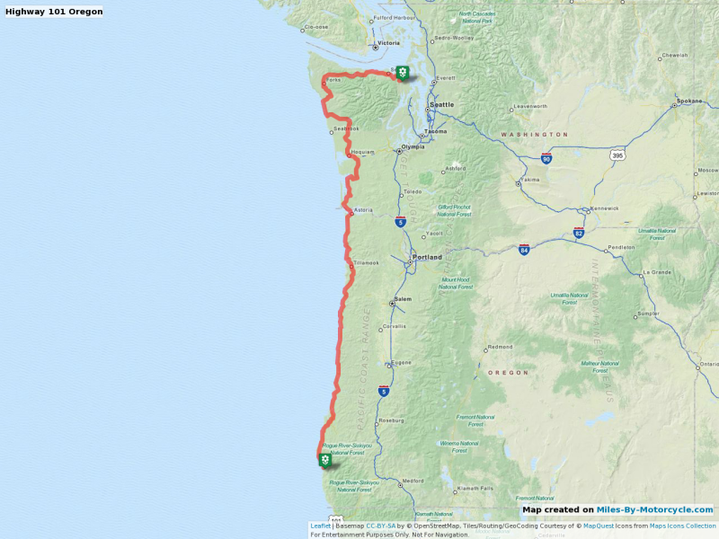
Highway 101 Oregon
Recommended by BMW MOA Facebook Group Member Kris Jacobson
(Download Screenshot)
I see you've highlighted Crater Lake. After stopping there, if time allows, you should really go back out to Hwy 101, and proceed north along the Oregon coast. Probably one of the most scenic coastlines in the US. - Yermo10 years ago
Very cool! I'm glad that worked. Are any of your photos Geo-tagged? If so you can edit the map and upload some photos which will get placed on the map.
- Yermo10 years ago
ah, bummer. I'm going to have to add the ability to manually place photos on a map.
- buffalo10 years ago
Interesting--I see you wound up taking the ferry from St John, I assume because the Bar Harbor CAT <--> Nova Scotia CAT is defunct?
- Yermo10 years ago
Interesting bug uncovered. The most recent forum post is missing. I'll have to see if I can reproduce that one.
- rshaug10 years ago
I deleted it after I messed the map up. I'm working on a proposed map for Friday and should repost it later this morning.
- Yermo10 years ago
That's a fantastic photo. I didn't think you could capture the height of this thing in a photo but I think you've nailed it.
- Yermo10 years ago
It seems that many of the markers lost their descriptions. Not sure what happened there.
- buffalo10 years ago
Yeah, good trials riders can do some seriously nutty stuff that would likely kill the rest of us...
- Yermo10 years ago

Wow, what a road! | | Gary S France
Skyline drive on a motorcycle. Drop-offs on both sides at the same time!
http://www.garysfrance.com/motorcyc...
- Yermo10 years ago

Lois on the Loose - the books, adventures and general escapades of Lois Pryce
Welcome to Lois on the Loose, the official website for UK adventurer and author, Lois Pryce. Here you will find information about her books, adventures, public speaking, writing, all-women motorcycle tours and lots of other exciting adventure-related shenanigans.
http://www.loisontheloose.com/
- Yermo10 years ago
It's a great place, no? I didn't get enough time to spend there so I'd like to go back and spend a few days in that area exploring.
- DaFish10 years ago
I belong to another forum that met there last year over Memorial Day Weekend.
They plan on doing it again this year same time, same place.
They are a Harley bunch and a little rude and crude but, nice folks all the same. - Yermo10 years ago
Doh. I came across this new thing called Google. Amazing to think I found the answer to my question there. :)
- Yermo10 years ago
Here are the photos
DaFish shared about this place.
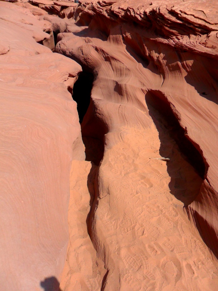
Antelope Canyon
Yeah we went down into the ground through that crack into a "drainage ditch"! - Yermo10 years ago
So I added this to the places I would like to see.
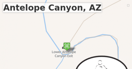
 Point of Interest
Antelope Canyon, AZ
I think this place might need to be visited on the next cross country tour.
I think this place might need to be visited on the next cross country tour.
Lower Antelope Canyon Exit, State Highway 98, Page, Coconino County, Arizona, 86040, United States of America
- Yermo10 years ago
Gary S France who did a 20K mile trip across the US was here and wrote up a blog post about it with more amazing photos:
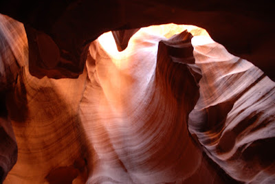
Flies in your Teeth: Can a Man Love Rock?
About Antelope Canyon, AZ
http://garysusatour.blogspot.co.uk/...
- Yermo10 years ago
Recommended by
 Matt:
Matt:

Barber Vintage Motorsports Museum
Home to the world s best motorcycle collection, the museum now has over 1200 vintage and modern motorcycles and racecars and the largest collection of Lotus cars as well as other significant makes. The collection is the largest of its kind in the world. There are approximately 600 of the 1200 motorcycles on display at any given time. These bikes range from 1902 to current-year production. The common street bikes represented, as well as rare one-off Gran Prix race machinery.
http://www.barbermuseum.org/
- DaFish10 years ago
It's right outside of (Southeast) Page, AZ.
They have two canyons. The north and south Antelope Canyons - Yermo10 years ago
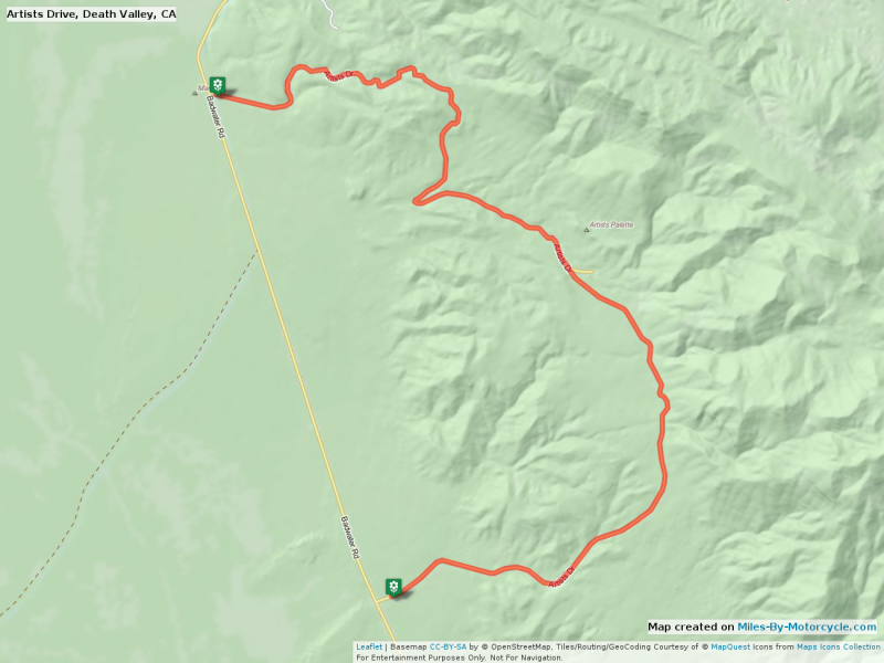
Artists Drive, Death Valley, CA
Photos show it to be a gorgeous small desert road.
(Download Screenshot) - Glenn Jaffas10 years ago
Good for you. If I end up at RevZilla it will be because of Miles-by-Motorcycles, as I am a huge advocate of supporting the local dealer. Best wishes for success.
- Yermo10 years ago
Thanks! If you go there, tell them that please. They are great folks and the selection of gear they have is truly impressive.
- Yermo10 years ago
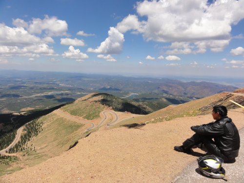
Road Report : 2013 Gap to Seattle Trip : Days 7 & 8 : Twin Peaks
Pikes Peak and Mount St Evans Road
http://miles-by-motorcycle.com/fv-b...
- Yermo10 years ago
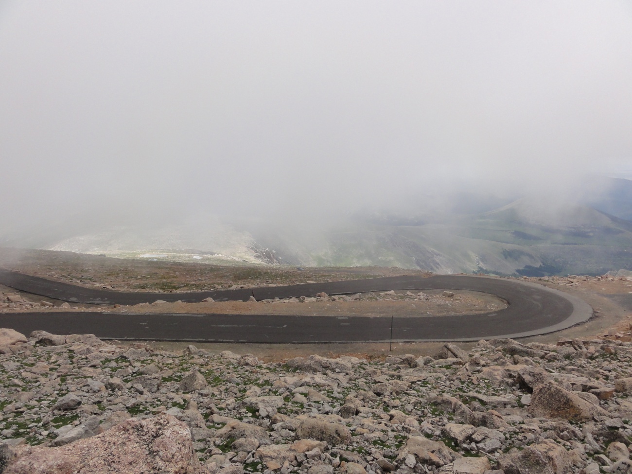
Switchbacks
The road up was wet, cold and had some intense switchbacks over the highest section. It's a very slow road.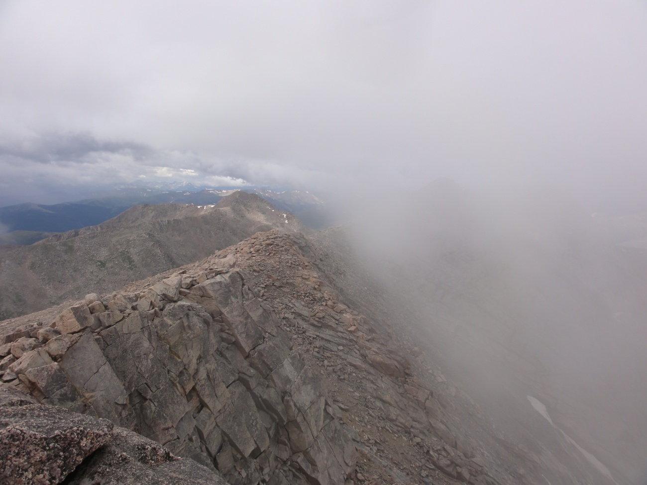
Clouds colliding with Mountain
Clouds would hit the mountain and sweep over.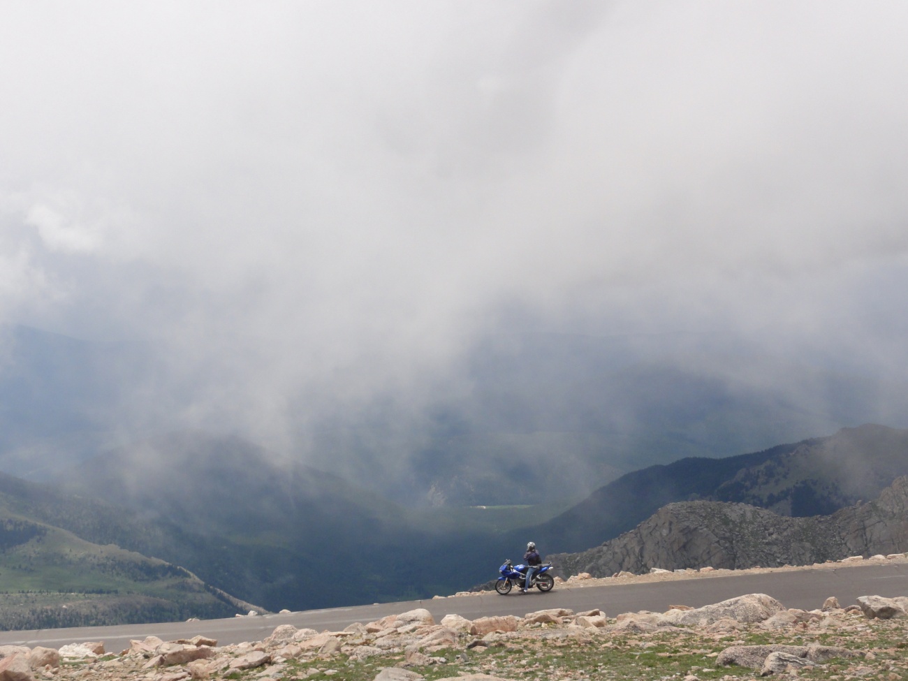
SV650 in the distance
We met an SV650 rider who later stopped on his way down. I caught this photos just at the right moment as the clouds opened. - Yermo10 years ago
Thanks! This is surprisingly close to RevZilla. I think a short road trip might be in order. Adding it to my todo list.
- Lisa Epifano Hall10 years ago
You will definitely enjoy this ride. 82 is a cool road. Narrow, blind curves. Occasional gravel. It's one of the roads I'm trying to master.
- Lisa Epifano Hall10 years ago
I do not have a picture of this bridge but now I'm on a mission. Next time I'm out there I will take one.
- Yermo10 years ago
While this helmet is not to my personal taste, I find it much more interesting when a given thing has an interesting story behind it.

Bell Bullitt TT Helmet - RevZilla
Purchase the Bell Bullitt TT Helmet at RevZilla Motorsports. Get the best free shipping & exchange deal anywhere, no restock fees and the lowest prices -- guaranteed.
http://www.revzilla.com/motorcycle/...
- Yermo10 years ago

Chad Hodge (Storehouse)
Photos behind the scenes of the Bell Bulit
https://www.storehouse.co/stories/a...
- AGrip10 years ago
I didn't even notice that we had gotten a wheel off the ground. I was just trying not to slip of the back. :)
- AGrip10 years ago
It was nice, but as you can probably see in the picture, my legs don't quite fit comfortably.
- Yermo10 years ago

Mount Magazine, highest point in Arkansas State Parks
mount magazine lodge, arkansas state parks, mount magazine arkansas, highest point in arkansas
http://www.mountainstateparks.com/m...
- Yermo10 years ago

Beaver Bridge - Little Golden Gate - Beaver - Reviews of Beaver Bridge - Little Golden Gate - TripAdvisor
Beaver Bridge - Little Golden Gate, Beaver: See 8 reviews, articles, and 6 photos of Beaver Bridge - Little Golden Gate on TripAdvisor.
http://www.tripadvisor.com/Attracti...
 JerryUncaged10 years ago
Balance it across a socket extension or other rod. It should be obvious, as there are only three bolted positions which would give this a heavy half. The middle one will be right, also leading to the greatest imbalance.
That's how I balance mower blades when sharpening.- Yermo10 years ago
Interesting that you mention that. A member on the BMW Tech list suggested I used a blade balancer for this purpose, so I placed an order for one and it should be here tomorrow. Nothing like additional confirmation to raise the confidence level.
- JohnWard9 years ago
Thanks. I'm ordering it today. This book hopefully will bridge the gap to the Twist of the Wrist books, both of which I have.
- Yermo9 years ago
You're inspiring me to get started on more articles for "On Riding Well". Maybe I do have something to contribute to the sport that has not yet been done.
 isurfne9 years ago
I felt a great disturbance in the Force, as if millions of voices suddenly cried out in terror and were suddenly silenced. I fear something terrible has happened.
 David Hardy9 years ago
You're Welcome! Sorry couldnt make it to DG.. I got covered up with work & a Relationship
- Beekeeper9 years ago
It's a lot of fun. You cross the Allegheny five times during the ride. It's also a must to stop at the Swing Bridge Restaurant in Paint Bank and enjoy a buffalo burger. It'a very motorcycle friendly.
- Yermo9 years ago
As it turned out, you didn't miss terribly much. It rained quite a bit and the level of police presence was the worst I've seen.
Next year's trip is already being planned though. - Ben Mendis9 years ago
Why aren't we riding these? They look like fun! I would even trade my moped for Grom!
- rshaug9 years agoYermo It's available (sometimes) on Amazon. Here's a link to the tool with the right part number: http://www.cheapautoparts.com/m/52630991/O-detail/multi...
and here is the manufacturer site: http://kowa-seiki.co.jp/lineup/gauge/
the part number is KEK-55-64 - Yermo9 years ago
Thanks for giving it a try. Sometimes the routing algorithm can't find a route between the given points and doesn't produce an error message correctly.
- Yermo9 years ago
Ok. It's an oversight on my part with regard to how the UI works. I'm guessing you selected "start new route" off the right click menu which set it to work on route 2 but somehow, afterwards it selected route 1 when you clicked calculate route.
All I did was click edit, clicked on a waypoint marker, selected "make this the current route" and clicked calculate route and the route calculated just fine. - jeepsteve92xj9 years ago
I will try it again, I need to spend more time with it. Will it display the distance plotted? I did not get email notices of comments on my map. I checked the email notification settings and they are all check-marked.
- Yermo9 years agoBen Mendis, this is roughly what I'm thinking of, sans the difficult off-road, for our two day "curvy roads" tour.
- Ian9 years ago
The bike quit on SR155 between Omak, Washington and the Grand Coulee Dam. Felt like it ran out of gas, but there was plenty of gas, the fuel pump was working, the fuses all checked out, I had spark on both plugs, the injector relay was clicking, but the plugs were still dry, meaning the injectors weren't injecting any fuel into the cylinders. I thought about what you said about the R1100S and how its crankshaft position sensor failed, causing the same symptoms. It's a long story, but ultimately some Canadians from Penticton, BC offered to take me there and even put me up for the night while I try to get a truck or something. That evening, just before bed, I had a thought - could the fuel line have come separated from the fuel pump inside the gas tank? It had! I fixed it using the tools I had on the bike and rode home the next morning. Phew!
- Yermo9 years ago
Amazon.com: MOOSE MAGNETIC Drain Plug: SUZUKI DR 650 DR650 93-94: Automotive
Amazon.com: MOOSE MAGNETIC Drain Plug: SUZUKI DR 650 DR650 93-94: Automotive
http://www.amazon.com/MOOSE-MAGNETI...
(affiliate link)
- Yermo9 years ago

Green Ridge State Forest | Forest Service | Maryland Department of Natural Resources
There are supposed to be good unpaved roads around in this area.
http://www.dnr.state.md.us/forests/...
- Yermo9 years ago

You Cellphone is more dangerous than my motorcycle
Sticker available over at Zazzle: http://www.zazzle.com/dont_text_and_drive_bumper_sticke...
Bumper sticker available over at Zazzle:

Don't Text and Drive. Bumper Stickers | Zazzle
24 Hour Shipping on most orders. Don't Text and Drive. Bumper Stickers created by MilesByMotorcycle. Order this design as is, or customize it to your liking.
http://www.zazzle.com/dont_text_and...
- Michael Stout9 years ago
Agreed. It looks like a car. Drives like a car. However, apparently, there isn't a 3 wheeled classification yet for automobiles...so it's a motorcycle.
- Yermo9 years ago
There used to be a three wheeled car, at least in Europe. This is one of those things that just bothers me because I value words with specific meanings. In the presentation they even used words like "rider" instead of "driver" and showed driver and passenger wearing helmets. The emperor has no clothes.
- Ben Mendis9 years ago
A perfect Zombie Preparedness bike. I think I shall build one (with a few changes).
- Yermo9 years ago
Gromkhana: The Grom Escape
Honda Groms + gymkhana = GROMKHANA in this fun short from Motorcyclist magazine. Road Test Editor Ari Henning and Associate Editor Zack Courts suit up and sl... - Michael Stout9 years ago
Must be just a US thing, and the inability to properly classify the vehicle. It's the Wiki, so take it for what it's worth...
In the U.S the National Highway Traffic Safety Administration defines and regulates three-wheeled vehicles as motorcycles.[5] Licensing requirements vary on a state-by-state basis. In other jurisdictions, such as British Columbia, Canada, and Connecticut, a three-wheeled vehicle with an enclosed passenger compartment or partially enclosed seat is considered an automobile.
It looks like a car. It drives like a car. It's classified as a motorcycle. Go figure. - Michael Stout9 years ago
Sorry, one more post...seems to be somewhat "political" in nature. At least as far as I can tell by reading this doc. The definition appears to depend, from one state to another. This is a bit old, but couldn't really find anything else.
Your head will spin while reading this.
https://www.federalregister.gov/articles/2011/04/28/201... - AGrip9 years ago
I wonder if this vehicle will be allowed to be represented at the show in the states where it is classified as a car. I would think that doing so would open a door for other non-motorcycle vehicles to get a bid on representation at their shows. But not showing it in places where it /is/ classified as a motorcycle might also garner negative attention regarding prejudice/preferential treatment, and open a different door, of sorts.
- Ben Mendis9 years ago
Wait a sec, I remember this company. They had a Kickstarter a while back. They failed their first KS, but succeeded on the second try. Good to see they're still around.
The novel aspect of their design is that they're bolting a fairly standard 50cc Honda moped engine onto a mountain bike frame with some premium parts (name brand shocks and brakes, wheels, etc.). According to their first KS, you can also bolt up a 70cc Lifan engine to the same frame, but then it's not legal on the street.
Crossing a mountain bike with a dirt bike seems like a pretty obvious innovation, but the next closest thing I've seen in the market is the Honda Herbi that the guys at 1977 Mopeds had customized to try and tackle the Trans-America Trail.
This could be almost as fun as a Grom, and may even go places the Grom can't. - Yermo9 years ago
Yea, I could see it being fun especially for small trail riding. I do want to try a Grom sometime though.
- Yermo9 years agoAGrip, that's an interesting point. I suspect with all the investment in marketing materials and the like (they have a video that talks about the "rider" and shows both "rider" and "passenger" wearing helmets) they probably won't try to say it's a car, but it really just felt to me like the emperor had no clothes on. Trying to call it a motorcycle seemed pretty silly to me.
- Yermo9 years ago
Here is an example of a comment with a video:
ACTING OUTLAWS - 2010 LA La Ride Documentary Promo
On October 22nd, 2010, actresses Katee Sackhoff and Tricia Helfer embarked on a cross-country motorcycle ride taking them 2,500 miles from Los Angeles, CA to... - weloveyermo9 years ago
Sep 2014 Sunny and Wet Maryland, Virginia, and Pennsylvania loop day ride.
It was a gorgeous sunny and mild day of riding that was interrupted by a few short showers which were enough to get us pretty wet.
Ben Mendis had said, "I want to practice on more gravel roads." so off towards White's Ferry he, buffalo, and I went. White's Ferry, as the name implies, is a ferry that cross the Potomac River. There's a route there that includes several miles of gravel and dirt roads.
We cross the river and headed up to Lovettsville where we had lunch at an Italian restaurant and then went on to points North along Route 17, which is one of our favorites. I had seen a road on the map, Route 233 in Pennsylvania, near Mont Alto, which I had mistaken for an awesome road I had ridden some years ago. So through rain and light wind, we headed up there only to find that it was not the road I had thought it was. However, Coming down the other side of the mountain along Cold Spring Road (a different Cold Spring Road) we were greeted by an incredible rain bow and some wickedly little twisty bouncy roads through hilly wooded country. - Michael Stout9 years ago
This is the helmet I used to have, but with a subdued design on it.
http://www.jpcycles.com/product/ZZ13015?adpos=1o5&c... - Michael Stout9 years ago
One more review....made "helmet of the year" at this site.
http://www.webbikeworld.com/r2/motorcycle-helmet/gmax/g... - Ben Mendis9 years ago
That link seems to be dead now. But I found found another digital synchro tool. Think it's comparable?
http://www.parts-unlimited.com/products/?productId=2515...
The price tag is mighty steep... - Yermo8 years ago
Actually I think this one was further south and East. It was that reservoir. I think I have it tagged on the map so you can see exactly where it is. (See the Mentions tab)
- Yermo8 years ago
Looks like it's the North Branch Potomac river actually. I'm guessing it's dammed up there somewhere. (The mentions features is pretty cool, IMHO.)
- David Hardy8 years ago
I rode this route from Branson Missouri to Pueblo in one day on my way to Alaska in 2007, Before leaving I asked my Host if there were any good places to stop to which He replied "Why the Fuck would anyone want to stop in Kansas? , Just get up and ride till you see Colorado.." Upon arrival I recieved a traffic ticket in Lamar Colorado for an illegal U-turn.
- leilei39158 years ago
2016-2-27 leilei<h1><a href="http://www.saclongchamp--pascher.fr" title="longchamp pas cher"><strong>longchamp pas cher</strong></a><h1><a href="http://www.ugg-boots-australia.com"><strong>ugg boots australia</strong></a>[url=http://www.michaelkors-uk.me.uk]michael kors[/url]http://www.edhardy-outlet.name
- Ian7 years ago
Sounds like your basic trip departure - bad luck, good luck, frustration, joy... If you stop and look around and pinch yourself every so often, you'll have a great trip. Break a leg!
- Ian7 years ago
I think I know which corner you're talking about. If it's the one I'm thinking of, we arrived back at the campground after having dinner a few miles down the road (at the mill? - I forget the name of the campground, too) and you described hitting the corner too fast, only to lean and lean more than you thought you could. That was before we'd spent much time at Deal's Gap working on just that, cornering.
- Yermo7 years ago
So far so good. The bike is doing surprisingly well. I'm now glad I spent the time and money upgrading the tires, brakes, and especially the suspension. I'll start the TAT proper on Tuesday. It's late in the month, but it is what it is.
(And I'm glad to see that commenting is working ... the new software release was a bit less than smooth. )
) - Yermo7 years ago
Yup, exactly. I try to forget that one trip where we camped in the rain and cold and wind ...
- Gerald Barrowman7 years ago
I've been sharing your TAT blog on Facebook but so far have only glanced at a few paragraphs. Today however something caught my eye that I thought was pretty darn good writing, and maybe I should be paying more attention.
- Yermo7 years ago
Thank you, Sir! I find it's the words of encouragement that make the writing much easier.
- foxtrapper7 years ago
Be careful with cockiness and the lack of difficulty so far. Yes, this part has been easy. Further ahead are sections not so easy. Some, downright difficult. The next state over is the one noted for the slimy sticky mud as I recall.
Enjoy and ride well. - Jen Raffensperger7 years ago
When you get back and we grab that drink, bring up the narrative stuff. I have a lot of ideas in that direction and would love to hear yours. =)
- Yermo7 years ago
Thank you. It's actually not cockiness, mostly just surprise. I am most of the way through Mississippi now. It rained here a few days ago and I could see how much of a mess this would be in the wet however it's been mostly dry during my time here.
- Jen Raffensperger7 years ago
That part of Utah is one of my favorite places I've ever been. It's otherworldly.
- randy00177 years ago
Hey, just a little word of caution. I broke my leg about 10-15 miles after I left Green River, UT, August 29th. The dirt road is boring and will sneak up on you. I had a little lapse of concentration going over a rise, was too the right, and the road turned left after the rise. I was going about 5 mph too fast and didn't make the turn. Broke my right leg and sprained my ankle pretty bad. Went down a 6 foot bank with the bike riding my leg. Be careful. My friends put me back on the bike and I rode back to motel 6 in Green River. My friends made some rocks into an "R" to mark where I went off the road. There were also vehicle tracks going off the road and I went off right in the middle of them. Just be careful. My trip ended because of a little lapse in concentration....two weeks early. Have a good ride and be safe.
- Yermo7 years ago
Thanks for the heads up. My trip ended just outside of Ephraim, UT in super thick mud which locked the rear wheel and broke my clutch. I managed to fix the clutch yesterday and will be starting the trip home on Wednesday. I'm just now sitting down to write about my time in Green River and the desert outside of there. You are right. It will sneak up on you.
- Jen Raffensperger7 years ago
Thank you for writing all this out. It's been a really incredible story to read along with!
It is absolutely all about perspective. Always.
I stayed in Price, UT on my cross-country trip in 2013. =D - buffalo7 years ago
Three combined rides: Revzilla run, Southern MD loop, and MD, PA, WV north and west route.
- Yermo7 years ago

I'm encouraged that the commenting notifications seem to be working. Soon track editing will get built and we'll be able to clean up and annotate the tracks.

- Yermo7 years ago
Ok, Cool. It looks like this work (except for the screenshot) I'll track down what's causing that.
- Yermo7 years ago
I haven't fixed the problem yet, but I have found out what's causing the screenshots not to generate after some time. I should be able to fix it in the next day or two. Thanks for noticing it.
- Yermo7 years ago
Maybe we should tag the Wicomico Motorsports Park as well (despite the fact that I will never ride there again.
 )
) - buffalo7 years ago
interestingly enough, Budds Creek Motocross park wasn't on the POI list so I added it.
- Yermo7 years ago
Nice maps!
If you want, you can also add photos and videos to the map. From the dropdown menu you can select EDIT and then in the resulting map editor you can click on a spot on the map and add photos, videos, points of interest. (For the moment you can't click on the blue track lines to add these but I will be adding that feature in an upcoming release.) - Yermo7 years ago

The Kentucky Adventure Tour (KAT) | Adventure Rider
After 6 years of development, I've finally got the KAT to where I'm happy with it. This is a 900 mile loop (not counting the hard sections) around the...
http://advrider.com/index.php?threa...
- buffalo7 years ago
That goes back a bit. You forget about how much fog there is at night up in the mountains.
- DigitalRodney7 years ago
Indeed a sad day.
I read Zen while on a Schooner Cruise in Maine. I have always thought about following his path. - JoeMama7 years ago
Read his book in my late teens...good time to give it a re-read with 40 more years of life travel now completed
- Yermo6 years ago
As a wise woman once told me, one can never have too many zip ties.

Amazon.com: ZesGood Nylon Cable Tie, 4 6 8 10 12 Inches, 500 Pieces, Perfect for Workshop: Home Improvement
Amazon.com: ZesGood Nylon Cable Tie, 4 6 8 10 12 Inches, 500 Pieces, Perfect for Workshop: Home Improvement
https://www.amazon.com/ZesGood-Inch...
(affiliate link)
- Yermo6 years agobuffalo I was telling Ben Mendis the story of our false start on the last Deal's Gap trip.
- Yermo6 years ago
oh cool.
This really is an awesome photo, if I do say so myself. It's probably my favorite of you and your bike.  America.Rides.Maps6 years ago
Rest stop in Franklin. I've uplosded some photos but don't see them yet,
- America.Rides.Maps6 years ago
We swung through Franklin so I could get a shot of Cafe Rel for the app.
- Yermo6 years ago
I have never been to this waterfall. As a matter of fact, I don't think I've ever been along River road there. (Not testing. Seriously just got distracted by the "Oh wait, I've never been there before. That looks cool ....")
- Yermo6 years ago
We'd have to get out fairly early if we wanted to do this loop. If we make good time, we could certainly roll through Ocean City. By that time we're almost home. It'd be the longest single day ride of the year.
- Yermo6 years ago
hmmm. But the question is do you think the K13 final drive is up for that distance? Or should we hold off and do something on the DRs instead?
- buffalo6 years ago
good question. I can look to see if the final drive is leaking enough to show up on he garage floor.
- buffalo6 years ago
so the question is at what point to worry? the plastic seal cap is moist s is a portion of the outer drive housing, but no drips on the concrete
- Yermo6 years ago
Hmmm. There is doubt. "If there's any doubt, there isn't any." is one of my favorite sayings. Given that we don't know the failure mode of these newer final drives, to my chagrin, I'd suggest we wait to get it fixed before taking a big ride on it.
- buffalo6 years ago
Yep, done. OK, DRs it is. I'll need a chain lube before I go. Down to the cottage and swing west then?
- Yermo6 years agoGoat, I'm still diligently working on the mapping software and it's still in flux. I haven't yet put any documentation together for it but once I saw your question I started to think through how I might do it. I'll put something together for you and publish it on the site as soon as it's done.
- Shahenshah6 years ago
Hi i have a 2 stroke yamaha rx135 carborator bike and its displacement is 14bhp ..want to know can i convert it into direct injection system and is ut good for daily use ?
- DigitalRodney6 years ago
Great information!
You would think after all this time, that the coordinate system would get standardized into one format!
I have been a long time user of Streets and Trips to plan routes, still use the 2013 version since it was discontinued.
Currently, I use ITN Converter to plan routes, and then output for my Sygic App on my old cell phone. Taking a looking CoPilot GPS again, too. I often run into the conversion problem, as a waypoint will be off the road in the actual GPS App.
I look forward to more information! - Yermo6 years ago
The next article for me to write is how to use the map editor I've built here to plan routes and export them to GPX (and import that to a GPS unit ....)
- Ben Mendis6 years ago
One of the pragmatic differences between tracks and routes is that with routes a GPS can give you turn-by-turn directions. Because it's aware of the underlying map, and is routing you along a series of connected paths (roads), it knows when you need to transition from one path to a different path.
With a track, the best you can hope for is that it will overlay a line on top of a map and show you your current position on the map. It's up to you to interpret the map and figure out which turns to take to stay on the line.
Most GPS systems allow you to record a track (a time-series of GPS coordinates) but not routes. And now that I'm thinking about it, there's really no reason they couldn't do both. Since GPS navigation software can tell what paths (roads) you're traveling, and when you transition from one to another, all they would need to do is record a waypoint for each transition (turn). With that data, the routing engine could deterministically reconstruct the route (as long as the underlying map data hasn't changed too much.)
I think it would be worth investigating if any such route-tracking software exists, and if not, to create it. - Yermo6 years agoBen Mendis, you also have to consider the case that maybe there is no underlying map data for the area the track covers. This is often the case when you get out on fire trails and forest service roads. One thought I've had is to set up "navigation" along a track simply with an arrow and a distance showing you how far you are from the next point in the track or maybe, as you say, curate a track to point to major turning points like people do with roll charts.
- Yermo6 years ago
I've got to pay more attention. I completely missed that you posted this. That looks like a nice route.
- Yermo6 years ago
I've been on some of those roads. I think I may have to go back and take a closer look.
- Beekeeper6 years ago
When you do be sure to stop for a good lunch at High's Diner in Monterey. Good vittles!
- Yermo6 years ago
So that I can remember, want to add it to the map here? (down arrow upper right of the map, pan zoom to the location, click, add a point of interest. Restaurant icon).
- Yermo6 years ago
Oh cool. You can add a title to that POI (edit, click on the POI, add a title and comment) if you feel like it
- America.Rides.Maps6 years ago
I've been seeing First Gear mentioned more often. I saw a version of their gloves, they were leather. Old Gerbings were leather, now they are textile and pretty good gloves in general.
- Goat6 years ago
Yermo, I was dealing with losing my own Mother when Elizabeth communicated Gary’s wife’s situation. I knew if you were aware you would make something good happen, and you have. Thank you for this.
I have matched your donation of $100. and hope others are encouraged to help also. Most of us know not when out time will be to go, obviously Gary did not. I hope this is some relief to those left behind. May Gary Rest In Peace and smile down upon you and your Miles by Motorcycle flock. - Yermo6 years agoAmerica.Rides.Maps, Google supports an alternative format (not GPX) called KML. I actually have the code written to import that into our maps but broke it somewhere along the way. I'll fix it then we can have a copy of this map here.
- America.Rides.Maps6 years ago
Good, the google crossover seems important. I'm going to go through it and add any new rotues to my Route_to_Scout list.
- America.Rides.Maps6 years ago
Seems I'm doing good research. Only 3 roads on this ride I didn't have listed, one I knew, 2 are just minor connectors. I had all the unpaved stuff.
- America.Rides.Maps6 years ago
Nantahala Gorge & Wayah Bald
Nantahala Gorge & Wayah Bald Nantahala Gorge is known for it’s whitewater rafting as much as it’s stunning scenery. Climb to the rivers alpine source then cross Wayah Bald on a ride everyone loves. Complete your loop with a ride on one of North Carolina’s best curvy rides, NC 28 then return to Maggie Valley on the Blue Ridge Parkway. Fun! Distance: 145 miles Ride Time: 1/2 day or more Difficulty: Moderately difficult START: Maggie Valley Follow US 19 west, ...Read More
- America.Rides.Maps6 years ago
NC 209 - The Rattler
Long popular with locals, NC 209 takes you on a wonderful scenic and challenging ride north to Hot Springs. Extend your ride and make a 100 mile loop by continuing through Hot Springs on US 25, pass through Marshall, then follow Meadows Town Rd to NC 63. NC 63 leads you back to NC 209.
- America.Rides.Maps6 years ago
The Classic Rattler Loop Ride - GPS Track
Click on the GPX Download icon to get a .gpx track of this loop ride.
(Check the convert routes to track box) - America.Rides.Maps6 years ago
NC 209 - The Rattler
NC 209 - “The Rattler” Long popular with locals, NC 209 takes you on a wonderful scenic and challenging ride north to Hot Springs. Extend your ride and make a 100 mile loop by continuing through Hot Springs on US 25, pass through Marshall, then follow Meadows Town Rd to NC 63. NC 63 leads you back to NC 209. 36 miles to Hot Springs. About 1 hour ride. 98 miles to do loop ride. 1/2 day ride. Route: NC 209 - The Rattler Junaluska to Hot Springs Start: Exit 104 o ...Read More
- Yermo6 years ago

GitHub - davidkbainbridge/k8s-playground: Simple VM based Kubernetes cluster setup
k8s-playground - Simple VM based Kubernetes cluster setup
https://github.com/davidkbainbridge...
- America.Rides.Maps6 years ago
Dragon & Cherohala - GPS Track
Click on the GPX Download icon to get a .gpx track of this loop ride.
(Check the convert routes to track box) - Yermo6 years agoGoat, take a look at this site:
They created this route over some time. I suspect they just used GPS's and then edited the resulting track using something akin to what I've been building here.
From the map above, you can download what's called a GPX file.
There are a number of apps available for both iPhone and Android that let you view the GPX file. Once I have a chance, I am also going to make it so you can view it on Google Maps.
I am also working on an app that will let you view this but that's going to be a few months yet before it's ready to try.
If you're interested in more about GPS's, navigation, and GPX files I wrote an article about it a while ago. It's a little technical but it might be of some benefit. If you have any questions, please don't hesitate to ask!
On Navigation: Coordinates, Tracks, Routes, and GPX Files.
As I continue to make progress on the Miles By Motorcycle mapping tools, I've been asked a number of times recently to explain the difference between the concepts of "Tracks" and "Routes" as they occur on GPSs, the maps here on the site, and in GPX files. My hope is that this answers some of those questions. First, a little background: Latitude and Longitude The foundation concept for all navigation is the geographic coordinate system. For simplicity's sake, the Earth can ...Read More
- Yermo6 years ago
Embedded Object Error, go to your profile (your name way upper right corner of the site). Then click on the Ride Plans tab.
Click New Ride plan.
A large map should display roughly showing your location.
In the search box at the top of the map, enter the city, state where you want to start. Press ENTER then select it from the dropdown (there's a little bug so the first few entries are covered up but you can still click on them).
The map will zoom to that location and a popup window will appear letting you add a waypoint for your route, a point of interest, a photo etc. You'll probably want to close the window and move the map around to pick a good start location. Click on the map where you want it to start. Then click the 1 waypoint icon (upper left corner). That'll drop the first marker.
Then enter a new city and state for your second stop. Repeat the process.
If you find the route it selects is not to your liking you can click on the route roughly where you want it to change and insert a new waypoint marker there. Then you can drag the marker to a new spot to force the route through a particular area.
What you can also do is add points of interest along the way to mark things you might like to see or thing you might like to do.
You can also add separate routes for side trips or roads that you might like to ride.
If you have any problems or questions or even if you'd like me to guide you through the process, I'm more than happy to be of any assistance I can. I'd love for you to try this and let me know where things are confusing or what problems you run into. I'm at the stage where I could really use the feedback.
I also wrote a pretty exhaustive article on the whole map, rideplan, and ride system here:
There are others here that can also help you out, notablyOn Mapping: Mapping on Miles-By-Motorcycle.com
Background Miles By Motorcycle originally grew out of my desire to have a better place for my friends and I to discuss, plan, and document our motorcycle travels. There's quite a bit of of knowledge involved in travelling long distance by motorcycle. There are bikes to consider for differents kinds of trips. There are awesome roads hidden between seemingly endless superslab and conjested towns. There are hidden gem places only locals know. There are shops, restaurants, cool old ...Read More
America.Rides.Maps and buffalo. - America.Rides.Maps6 years ago
Excellent. I've given you admin status. Jackie will be off her last call soon then we're calling Scott Lee. I'll start posting more stuff once we have firm info. I'll explain more of how the site works as well. The new user interface won't be installed until we get the final bugs worked out so it doesn't make a lot of sense right now.
- America.Rides.Maps6 years ago
To edit this map, IE, add your home location, click on the small blue v in the white space at the top right of the map. I'll add Scotts location as an example. You can't hurt anything, don't be afraid to explore.
- America.Rides.Maps6 years ago
PS - this is great testing for the software - I'm already seeing things to tweak. we looked at hotels in Ouray and selected the Beaumont as a good choice. It's a small town and we actually recognize most all of them. Click the icon on the map for the link.
If you see others, we're open to discuss. We ate at this one once and it's nice to be in the heart of town. - Yermo6 years ago
When I went through this pass the rocks were so much worse. Of all the places during the Trans Am Trail trip, this one section scared me the most.
- Yermo6 years ago
This is a really good exercise. I'm finding a bunch of problems with things I want to do. For example, I notice you're mapping out an area around Telluride that I took the Blue Oil Burner on in 2010. I want to post it to the rideplan to show you, but permalinks to things in the ride aren't working ... because I failed to complete a number of paths through the software that I had overlooked. So I'll get to that soon. But here are some photos from that jeep trail over Telluride:
- Yermo6 years ago
This has been a very good test. I've found a bunch of problems that I will be addressing very soon. There are a number of items that when you click on them just bring up the live map instead of the thing you clicked on. I'll fix it.
I was noticing you're mapping out the section around Telluride. I was out there in 2010 on that Black Bear Pass jeep trail on my Beloved Blue Oil Burner (because you know, I can't take a big street bike off pavement ... )
- jackie47376 years ago
Yermo- IMHO, comments should be most recent first and this post comment feature needs to be at the top of the page. Too much scrolling- I couldn't find it.
- jackie47376 years ago
Cursor sensitivity- have to hover very precisely over a road to get the link to open. Can this be improved?
 rpandya6 years ago
The article is a story on the interview - likely by an uninformed staffer. The audio interview dives a bit deeper into the subject and recognizes the laziness of some brands, but there are others who are building good quality gear for females. Did you listen to the audio interview?
- rpandya6 years ago
In an effort to keep the GAS conversation going into the new year - I hosted a Happy Hour at the Lucky Wheels Garage in Los Angeles. There were quite a few people there, and the presentation was fun. Jim Williams from the AMA and Jordan Diggs from Diggs and Ghost were there to chat about what they are up to. I spoke about the future of the GAS roundtables and where I need help. Thanks again for your support and your enthusiasm for motorcycling.
- GearChic6 years ago
Just did. I think we're past 'Shrink It and Pink It' as the reason for why women's gear is so challenging. Now what I see is brands trending to "casual" wear, basically taking what's in the mall and adding armor pockets and safety stitching. Or, dumbed down versions of more technical gear (of course there are 1-2 brands who are the exception).
- rpandya6 years ago
I get the advantages of the fully functional gear and technology - but does the fashion side of current design trends help make motorcycling more interesting to some people? I do agree that crap gear is crap - but I have also seen where ATGATT can push people away as fast as a body builder would a casual workout in a gym...
- GearChic6 years ago
Absolutely. But there's a middle ground that I think is being abandoned. The gear is going straight to the mall without thought to little things like safety stitching / materials that aren't just soft, but also strong... there has to be a middle ground, right? I think sometimes, brands cater a little too much to what new riders want without telling them what they need too. Kind of like a parent/child relationship? it's a brand's responsibility IF they're trying to provide safety to *actually* provide the safety vs. skimping on it to please the customer. I know there are a lot of things to consider, but these are just things that I'm seeing that make it challenging for me to advise newer riders.
- rpandya6 years ago
For sure the brands who get it and can educate should do so. There will always be companies who copy a style without the substance, chasing a profit on somebody else ground breaking work. That will never change. I do believe there is a tendency to get too technical too early, and scare off new riders - so finding the right balance to make quality approachable is something you must be very good at by now!
- Yermo6 years agoAmerica.Rides.Maps, here's that map I was mentioning. It's quite large and takes forever to load and even longer to save. See the site linked on the right for more info.
- America.Rides.Maps6 years ago
There are some I need to add to my collection and explore. Surprising how many I already have.
- MSGNeil6 years ago
i grew up riding thd East Bay ! Love it out there... Mt. Diablo, Mt. Hamilton... Hwy 84 & 9... Alices Restaurant... tons of kick A roads !
- Yermo6 years ago
The next time I find myself on the other end of the country I'm going to have to spend more time exploring.
 MTSweger6 years ago
No issues. It just took me a little while to figure out how to add waypoints to the route. That was somewhat challenging since I was just playing around with it from my phone. I'll give it a go on the desktop machine and keep you updated on my progress/thoughts.
Very interested in trying out the .gpx import/export feature too. Thanks again for creating this--it's clearly a labor of love and I imagine a lot of hard work goes into developing such features.- Yermo6 years ago
oh yea. Years. From the phone it's a bit painful. I'm hoping to improve that quite a bit. I also just got KML import working so you should be able to export things from Google Maps or Earth and import them here. You can also do a bit of editing on tracks you upload. Right now it's just cutting out sections using the select/scissors tools (box icon on left when editing).
- BilliamM6 years ago
Excellent route! I have been on a lot of these roads quite often. The Hampstead Diner in Hampstead is a great spot for food if you find your way back there
- Yermo6 years ago
Where is that diner? I use the maps here to keep track of places I want to checkout. (Long story. This site is all about using these kinds of discussion to keep track of recommendations and then easily find them again when you're up in some area ...)
- Yermo6 years ago
I have a Garmin Zumo 550 that I take the GPX tracks off of and upload to the site. OpenGPSTracker on the phone works as well. I'm working on a mobile app for both iOS and Android that will interface with all this stuff on the site directly.
- Yermo6 years ago
If you reload the map, you'll notice I have the diner marked now. I'll check it out the next time I'm up that way.
- BilliamM6 years ago
oh here is another on Falls MD25 for some killer Q https://www.facebook.com/pages/Jakes-Grill/109394999120061
- Yermo6 years ago
For long distance these things are great. the trick is to only inflate them a little bit, much less than you would think. Once you get it dialed in it’s the best solution I’ve found yet.
- BilliamM6 years ago
Got to ride this last summer. My mom lives just south of Robbinsville, in Murphy. We jumped off on Foothills Pkwy, to Pigeon Forge and headed North back to Baltimore. We did over 1500 miles in five days, round trip. I love it down there!
- America.Rides.Maps6 years ago
The Best Curvy Roads Near Floyd, VA
The Best Curvy Roads Near Floyd, VA Floyd, Virginia sits just 6 miles from the Blue Ridge Parkway not far from the border with North Carolina. It's a favorite place to stay as it's such a fun town with good food, nice shops, lots of live music and great roads to ride all around. This is a nice loop ride from town that takes you on some fun roads. The Best Curvy Roads Near Floyd, VA(https://adv-traveler.com/america-rides-maps-public/maps/52031/the-best-curvy-roads-near-floyd--va) Flo ...Read More
- America.Rides.Maps6 years ago
The Classic Rattler Loop Ride
The Classic Rattler Loop Ride Long popular with locals, NC 209 takes you on a wonderful scenic and challenging ride north to Hot Springs. Continue through Hot Springs on US 25, pass through Marshall, then follow Meadows Town Rd to NC 63. NC 63 leads you back to NC 209. 98 miles in all, it's 1/2 day ride. NC 209 - The Rattler(https://adv-traveler.com/america-rides-maps-public/photos/52118/untitled/52313/nc-209---the-rattler) START: Junaulska Ride: Junaluska to Hot Springs ...Read More
- Yermo6 years ago
Oh. Cool! You can also click on the route and add points of interest along the way for places you'd like to mark.
- rpandya6 years ago
Log on to https://www.striderbikes.com and be sure to check out their awesome charitable foundation at www.stridereducationfoundation.org. THIS is how you make a positive contribution to the future of our sport!
- MTSweger6 years ago
That's a nice ride along the Bitterroots. Even better IMHO is US-93 north from Arco, ID (links up with your Stanley to Salmon route near Challis). You might already have that one, but I didn't see it while browsing the maps. Is there an index? In any case, thanks for bringing back more great memories of riding out west!
- Yermo6 years agoMTSweger, there are a couple of ways of seeing everything in one place. The first is off the Maps tab above. It'll show a list of all maps that have been created in this group.
The second is off the advanced search screen (magnifying glass with a + in it at the top). enter #destinationroad in the search box (make sure to select it from the dropdown) and click the Map checkbox then click search. That'll show you a list of all maps that have been tagged with #destinationroad.
Of if you want to see all the routes on one big map click the dropdown menu icon near the MBYMC logo at the top (three horizontal line icon) and select Map Explorer. Zoom out to see the whole US (it may take a few seconds for the basemap to display.) Then In the search box where it says "Search MBYMC" enter #destinationroad. Then click the magnifying glass icon and it'll show all the routes that have been tagged with that. - Yermo6 years ago

The Twisted Sisters Is The Most Dangerous Drive In Texas
With the wind whipping against your windshield, curves steering you close to hillsides with steep drop-offs, and towering rocks on either side creating narrow tunnels, the Twisted Sisters is basically a free roller coaster ride.
http://www.onlyinyourstate.com/texa...
- Yermo6 years ago
Best Motorcycle RideThree Sisters Ride Texas Hill Country Twisted Sisters Best Road
Three Twisted Sisters motorcycle ride in the Texas Hill Country . Tx best roads. The Three Sisters ride is a 100 mile loop of curves and twistys with beautif...
Twisted Sisters: The Texas Hill Country's Most Famous Trio | Rider Magazine | Rider Magazine
Three Hill Country Ranch Roads, 335, 336 and 337, are known throughout Texas as the Twisted Sisters, and riders come from near and far to enjoy them.
http://ridermagazine.com/2013/07/08...

The Twisted Sisters - Ride Texas : Ride Texas
This 100-mile loop is, without a doubt, among the best, most challenging motorcycle roads in the state. In one 15-mile section, there are about 65 curves!
http://www.ridetexas.com/the-twiste...
- Yermo6 years ago
The Best Unpaved Roads EAST of Smoky Park | America Rides Maps
Unpaved motorcycle rides in North Carolina, Unpaved motorcycle Rides in Tennessee, trail rides, ADV motorcycle,
https://americaridesmaps.com/produc...
- Yermo6 years ago
The photo is of me on my somewhat modified 2009 DR650SE riding on some forest roads in the Smoky Mountains with America Rides Maps.
The helmet is an ARAI XD4:
Arai XD-4 Helmet - Solid - RevZilla
Purchase the Arai XD-4 Helmet - Solid at RevZilla Motorsports. Get the best free shipping & exchange deal anywhere, no restock fees and the lowest prices -- guaranteed.
http://www.revzilla.com/motorcycle/...
- Yermo6 years ago
I just noticed the photo of the falls. Very nice photo!
America.Rides.Maps and I were just talking about waterfalls. - Beekeeper6 years ago
Thank you, I’m an amateur hack photographer! I hope to do another route or two soon, if I can find a little time.
- America.Rides.Maps6 years ago
We're heading up there soon to explore and map some roads in the area. I'm starting to lay out roads to explore. I've got more to add, if you can afford a moment suggestions for others welcome.
Mapping VA - 1st Weekend May
3 nights at the Ft. Lewis Lodge, Thurs, Fri, Sat. Exploring roads Friday, Saturday.
- Beekeeper6 years ago
For some reason I can't post on the page your map is on, even though I'm logged in. Anyway, you might want to check out Reddish Knob and include it. The road to the summit is narrow, but it is paved and definitely worth the trip! https://en.wikipedia.org/wiki/Reddish_Knob
- America.Rides.Maps6 years ago
Thanks - I added Reddish Knob to the map and one possible approach. We'll be stick to paved roads this trip unless absolutely necessary.
- bruce6 years ago
Indeed, it was a cool M/C only camp site, so green. But I must confess I sleep much better in a hotel bed
- bruce6 years ago
Hmmm, maybe we should pack camping gear this trip? And maybe use it! But that will depend on what's in the box.
- buffalo6 years ago
That was quite a cool campground. I think I still have that ancient tent, which I got for the '92 cross country trip...
- MTSweger6 years ago
Birmingham, AL to Morgan City, LA via Biloxi and New Orleans. Planned route for central Virginia to Austin Texas ride in April 2018. Day 4 (Tuesday, 17 April).
- TimR6 years ago
Thank you, I create and share routes all the time and have had all the issue you mention. Keep up the good work. I'm new to this site but I have been impressed.
- Yermo6 years ago
Oh thank you! It's been a tremendous amount of work but it continues to improve.
I wrote a pretty lengthy overview of everything you can do with the mapping here:On Mapping: Mapping on Miles-By-Motorcycle.com
Background Miles By Motorcycle originally grew out of my desire to have a better place for my friends and I to discuss, plan, and document our motorcycle travels. There's quite a bit of of knowledge involved in travelling long distance by motorcycle. There are bikes to consider for differents kinds of trips. There are awesome roads hidden between seemingly endless superslab and conjested towns. There are hidden gem places only locals know. There are shops, restaurants, cool old ...Read More
- Yermo6 years ago
The consensus is that this is photo-shopped.
Country Road NS 366, Oklahoma - Land Waves
I may be mistaken, but I believe this is the road often pictured on facebook with the crazy wavy landscape. Straight line but vertically "twisty".
- Yermo6 years ago

Bald Eagle State Forest, PA | Page 2 | Adventure Rider
Preliminary Tracks for the Official Bald Eagle State Forest Dual Sport Trails Attached, find my best attempt to produce tracks from the official map,...
http://advrider.com/index.php?threa...
- Yermo6 years ago
In response to this thread over at Advrider.com:
Any good tracks running East to West from central VA over into WV? | Adventure Rider
Of course there are a bunch of good backroads tracks following the mountains but we're looking to get to some good stuff in WV from central VA...
http://advrider.com/index.php?threa...
- Yermo6 years ago
Route 33 is fantastic. Route 675 is just a little connector where it goes up into the hill East of 81 but it's, for the area, a twisty little mountain road the kind of which we typically don't have up here. Route 211 over Skyline Drive is a fun much wider twisty road. "High motorcycle crash area". It has some corners that are deceptive with decreasing radius turns but unlike most roads it's quite wide. Two large lanes in the uphill direction.
- Yermo6 years ago
I was looking through my logs. It's been 3 years since I've ridden that section and I no longer remember. I was on my DR650 at the time but if it's unpaved it was a civilized gravel road. I'll have to make my way back out that way.
- MTSweger6 years ago
Smoke Hole Road is definitely worth the ride. Two more good ones if you're in the area:
Rte. 818 & 87 from Fulks Run toward Oak Flat
Rte 72 from Red Creek to Hambleton.
I'll try to create routes for those rides and post here. - Yermo6 years ago
Do you know about tagging good sections of roads? Click on the route at the start of a good section. Then select the yellow tag icon (it's essentially a special kind of waypoint but doesn't have a number). Then go to the end of the good section and add another one. It'll highlight the good section in yellow. Later one when I finish the code I'm working on you'll be able to search the map for all the roads marked as "best" in an area.
It'll look like this:
- Yermo6 years ago
The route is rendered in red because I marked the route with the tag "technical". In an upcoming release you'll be able to mark sections of a route as technical or easy as well. You can already do this for unpaved.
- Yermo6 years ago
oh man, thanks for this. I don't think I've ever noticed Dry River Run road before. That looks pretty cool. Do you have any photos from it?
- MTSweger6 years ago
Excellent! Route 33 over to Brandywine is one of my favorites too. And that just reminded me... need to add the road to Reddish Knob... and Moyers Gap... and... oh, so many...
I'll play around with the tagging feature. Thanks for the tip. - America.Rides.Maps6 years ago
Thanks, added to the Amy plan. Right now I'm just adding them randomly. I'll go back and clean it all up soon. We have company on the trip - May friend Jay (user Gwaldini) and a friend of his is joining us Thursday night, riding Friday with us.
- Yermo6 years ago
We just rode out that way yesterday. I completely missed the turn onto CR59 to check if it was paved or not. I had never taken 675 that far West before. It's quite a nice road all the way to Wardensville.
buffalo and I were thinking we need to go back and explore that area on the DR650's as there seem to be quite a few dirt roads out that way.
Ad Hoc Sunday Ride
It's been quite a while since we've managed to get out.
- MTSweger6 years ago
The entire route is on paved roads. A few rough areas, but no dirt or gravel roads if you stay on the planned route. However, there are a bunch of off-road options to explore near the route if that's your thing. I haven't done any off-road riding in the area, but now I'm thinking I really must. ;-)
Maybe I'll head over that way to do some exploring after my Austin trip. - Gwaldini6 years ago
On the Virginia side, as you go up the mountain on 675, the turn is left onto VA 789, the a right on VA 691, which becomes CR59 as you cross the state line into WVA. (CR is an abbreviation for County Road). I'm pretty sure it is not paved. In the mid-90's I rode this from the WV side across the mountain into VA on my BMW R80RT. CR59 was paved to start, then turned to gravel, then to fire road, with plenty of mudholes to skirt. Treacherous on the heavy R80RT. The road eventually became gravel again, all the way to 675. The nomenclature for the 675 changes at the state line and becomes CR23/10 in WVA, all the way to Wardensville. That route from Liberty Furnace Road is a convenient and pleasant cut-through to get from the Shen Vally to US 55 in WVA. At the bottom of the mountain on CR23/10 is a left turn onto CR16 or Thorny Bottom Rd. CR16 goes across the mountain to 259 and Lost River, just north of the intersection of 259 and CR59. I believe this road is paved the entire way, but I'm not sure. There is a settlement/development on the ridge of the mountain, that I've been to 30-yrs ago, driving up from the WV side. The road was paved then, but I missed the road back down the mountain on the east side of the ridge to CR23/10. I would suspect that this is now paved all the way from the ridge to CR23/10, as it is a short cut from the ridge to Wardensville and US 55, rather than go to Baker. It is certainly paved at the bottom, at the intersection. I've been threatening to ride this to find out, as I pass by on CR23/10 on the way to 55, but I have yet to do it.
- America.Rides.Maps6 years ago
It was fun and I've found some riders who are experienced to enjoy it with. Unfortunately, the goal was to go further, but we hit a gate. Duke Power seems to protect their roads and you can see why.
- MTSweger5 years ago
Wish I'd have seen your ride plan earlier. Back from Texas and spent the day cleaning up the KTM, but could have been easily convinced to ride US-33 today. After all, my beemer is feeling neglected and she loves that road! ;-)
- Yermo5 years ago
We had a really good ride. Unfortunately, there was some disconnect between the maps on the site and my Garmin so we missed Rough Run Road and instead headed up Country Road 3 up to 48. If it had not been for you marking that road on the site, I would never have considered riding it. What a wonderful route.
sab1123 joined us on this ride on an S1000RR. Good times. - Yermo5 years ago
Check out the photos and track from the ride.
We'll be back down in that area before too long. - MTSweger5 years ago
Awesome! Glad you had a good ride and enjoyed the route. When you get down this way again, we'll have to ride Rough Run and a few other roads off the beaten path. I think you'll like the ride up to Reddish Knob. Unfortunately, that route doesn't show up too well on most maps.
- Yermo5 years agoAmerica.Rides.Maps, I figure I'm going to take my time and explore some roads on the way down I haven't ridden in a number of years.
- America.Rides.Maps5 years ago
I plan to be there when the bar opens - late afternoon. I think it opens at 5 , dinner at 6.
- MTSweger5 years ago
Well, it's been a while since I've been there, so can't say for sure. Plus, I sometimes confuse the many back roads in that area and honestly can't remember (getting old sucks). Might just have to head over that way this weekend to refresh my memory. ;-)
Will be sure to post an update with some pics after riding Rough Run again. - MTSweger5 years ago
Absolutely. Let me know when you're planning to ride down this way and we'll explore some twisty roads.
I'll probably be heading up to PA the weekend of 12-13 May to visit my father who lives between Gettysburg and York. Maybe I'll ride the Beemer up there if the weather is decent. I usually run straight up 29 and 15 through Thurmont in the car or truck, but like to ride a more circuitous route when on two wheels.
Speaking of Thurmont... I'm thinking about hitting the BMWBMW Square Root Rally up there next month as it's been a few years since I've been to that one. Might be another good opportunity to link up. - Yermo5 years ago
It's still a bit up in the air, but we've been pondering a May 12th unpaved roads ride up to Michaux State Forest. We usually stop in Thurmont at the cultural center of town, a.k.a. The Sheetz.
When is the Square Root Rally? I've never been to that. - MTSweger5 years ago
I usually make a pit stop at the Sheetz in Thurmont when passing through on the way to PA. Cultural Center, indeed. Heheh.
Square Root Rally is 1-3 June this year.

2018 Square Root Rally | BMW Bikers of Metropolitan Washington
Square Root Rally 2018
http://www.bmwbmw.org/srr
- MTSweger5 years ago
Updated map to indicate the dirt/gravel section of Little Dry River Road and Rough Run Road to route 3. Tried to upload some photos of this section, but they don't seem to be showing up on the map. There were about a half dozen stream crossings on Rough Run Road when I came through on a rainy day (5 May 2018). No problem on the KTM 1290SA, but I wouldn't ride my beemer (K1200GT) or any other street bike on this section. Would be great fun on a small dirt bike!
- MTSweger5 years ago
Little Dry River Road and Rough Run Road to route 3 is a gravel forrest road with several water crossings.
- Yermo5 years ago
Now you tell me.

Mapping VA - 1st Weekend May
3 nights at the Ft. Lewis Lodge, Thurs, Fri, Sat. Exploring roads Friday, Saturday.
- Yermo5 years ago
I had to head down to Fort Lewis and thought it might make for a nice route down to avoid the superslab. In the middle of the unpaved section near the top my radiator fan stopped working. So I'd have to let it cool down then ride it a mile or so and let it cool down again. At the top I realized I could just roll it down the hill. That was over two miles of gravel road with the engine off. A first for me.
I'll have to check out what's wrong with the map. The unpaved section doesn't seem to be showing. - Yermo5 years ago
FWIW, Country Road 3 heading North up to Moorefield is a good road. Heading the other way if you travel far enough South towards Fort Lewis you'll come on a 25 miles or so road, Bull Pasture Road, which is excellent.
- America.Rides.Maps5 years ago
Best roads from May mapping trip to Virginia
A collection of some of them most enjoyable new roads we found on our trip.
- America.Rides.Maps5 years ago
$825.32? While it's an option, and it's stylish, it gains me only 1.7 gallons. I think I can mount a 1 gal tank for about $150. I prefer the tank, there's no stopping to add gas but the price is steep for the convenience. Even with my limited range I can get a lot done. Cheaper seems better.
- Yermo5 years ago
I failed to notice the price. That’s ridiculous. I forget what my 6.6 gallon Acerbis tank cost but it was a fraction of this.
- Yermo5 years agobuffalo, I think it turns into too long a day. 696 miles. We could shave some miles off. The 2nd 3rd is where I know it gets quite good. The section up to route 50 from where WV 15 ends near I79 I have not ridden so I don't know how good it is but it doesn't look bad on the map. My suspicion is that this is probably better served by a two day ride.
- Yermo5 years ago
Sorry I didn't see this until now. I bailed and jumped onto 76 and then 222 which got me out of traffic. I had dinner and spent the night at Ryan's and then headed home this afternoon.
- Robermcm5 years ago
nice summary of tracks and routes. Where were you 10 years ago when I was swearing at my gps! #:-))
- Robermcm5 years ago
I believe you’ve captured part of mabdr section 5, north of the rt 40/I 70 intersection. Nice farm country.
- Robermcm5 years ago
yes, smoke Hole rd is part of the mabdr, and I agree with you, it’s quite fun. Be careful of the locals in the corners though. They can be in your lane.
- Yermo5 years ago
We actually did a ride along a section of the MABDR last weekend I think it was:
Riding a Pennsylvania Section of the MABDR
Plans have changed. Now the plan is to take the DR’s up to Michaux State Forest and ride a section of the MABDR which cooncidentally runs over some of the dirt we are familiar with.
- Robermcm5 years ago
was going to share some pics further north of where you road the MABDR but got Jason parse errors?
- Robermcm5 years ago
got the json embed error as a reply to your pictures above in this thread. Oddly, I was able to post in another thread where you and friends posted a lot of pictures of your mabdr ride. Died on the import. Will try again.
- buffalo5 years ago
Cool, good to know, thanks. I've not been to any of them yet which is what got me interested in mapping them...
- Yermo5 years ago
Maybe we can go check out Mill Creek Falls. That's close enough for an easy day ride.
- Yermo5 years ago
Yes, I forget who recommended it to me. I've had one of the first versions for years and it works quite well.
- Yermo5 years ago
I'm reminded of a quote from the movie "The Shawshank Redemption":
"Geology is the study of pressure and time. That's all it takes really... pressure... and time..." - Yermo5 years ago
I was going to say, "Damn, that looks like a nice route" then I realized it's the BRP. :)
- Robermcm5 years ago
both 800 and 555 are nice stretches of road. South of woodsfield is rt 26, heading to Marietta. That road is amazing!
- Robermcm5 years ago
rt 26 is sweet all the way to Marietta. Also nice in the same area is rt 536 between rt 78 out of woodsfield east all the way to rt 7 on the river. Maybe my favorite chunk of road in Ohio!
- Robermcm5 years ago
Good stuff. Thanks yermo. +1 on No-Mar and Marc Parnes.
my buddy has that same tire changer. Practice makes perfect, and it gets easier. Our experience was like yours. P.i.t.a. First,couple of times, then it seemed to flow better.
couple of additions to your accurate instructions. There is a yellow no-mar clamp that helps stop the tire from spinning on both dismount and mount. Like an extra hand, and super helpful when you’re alone. GSA spoke rims, with the extra wide rims benefit from a No-Mar accessory that makes the 3 rim clamps larger. Some tires have a mark that’s white/red/a dot that is apparently the lightest part of the tire. Make sure you mount that right next to the valve stem to minimize the weights you’ll need to balance.
ALWAYS change your valve stems when you put on a new tire. Ask me how I know. And you can’t patch a torn valve stem out in the middle of nowhere without either an emergency outside-in stem (recommended carry item) or a spare stem and a bead breaker/compressor. I tried and failed. - Robermcm5 years ago
saw your reference to BMW MOA - I just joined for a trail. Is it a good site and helpful group of members? I have an 09 GSA and am sure it will do something technically complicated and unfriendly some day! Having a fast acting group of associates who can advise would be worth some money. If not MOA, who?
- Yermo5 years ago
Huh. I had not heard about changing tire stems before. I typically have left them in and have yet to run into an issue but I will take it under advisement.
I should update the article with everything I've learned in the interim since that first time. I've since gotten my own and have the same floor mounting system set up in my garage.
And thanks for the reminder that I need to buy new clamps since the coating on my existing one has failed and tends to scuff up rims if I'm not super careful. :) - Yermo5 years ago
My hope is to always keep this site free to use. There are a few travelers here and the site is growing. I think what makes it different from the MOA site others is the heavy use of maps and other rich features to tell our motorcycle stories.
- Robermcm5 years ago
I ride a fair amount of gravel and dirt, which may be a problem for valvestems. My Harley went 10 years without a new one. But one stranding far from anywhere and I’m converted! Haltec QS-430 is about $16 for insurance.
- Yermo5 years agoAmerica.Rides.Maps, let's see if links to comments on ride posts now work correctly.
I tried my hand at a bit of road curation. The best of these roads dead-end sadly. I've added some additional point of interest types.
road closed
gate
water crossing. - America.Rides.Maps5 years ago
The bulk of unpaved forest roads dead end. Still, there are some nice ones. I'll want to add those new poi's.
- Yermo5 years ago
I uploaded the track from today but cut the small road out as a separate track segment. I also uploaded a bunch of photos.
- Yermo5 years ago
I'm glad the spare gas got you to where you needed to get to. Did the fuel economy change?
- Yermo5 years ago
A different kind of gravel road. Those looks like large sharp chips. How loose was it?
- jimzman5 years ago
Have done the ride in parts --looking forward to riding the whole loop = Great Area to Ride M/C
- America.Rides.Maps5 years ago
Thanks. More practice. This one (and previous) were to test placing video on Instagram. Failure, then success. I honestly don't see our target market well represented on Instagram but learning to use it adds one more marketing tool. I'm making progress.
- Yermo5 years ago
This one looked really polished to me. It's nice having all these videos in one place and tagged so we can find them again.
- Yermo5 years ago
Thank you. So far so good. Ive just got 89 miles left to go. Slightly soggy but mot too bad.
- Yermo5 years ago
Yea. The geotagging is super useful. Before we ride together again I want to get a better camera myself, one that doesn't constantly lose GPS signal.
- America.Rides.Maps4 years ago
As we don't have Europe maps loaded there won't be a track or plan to see.
- Robermcm4 years ago
don’t miss old Williams road, if you go back to green ridge s.f. Great ride headed s.w., finishing with a bridge out, but passable on foot or m.c.
- Robermcm4 years ago
it starts off of National Pike, which parallels rt 40. Or you can get to it from the east on a connector road.
- Yermo4 years ago
I trace out route recommendations and keep them on various maps that I update. I've just started one for Maryland:
- Yermo4 years ago
very cool. Thanks! I plan on going out there again and have added it to my #Route_to_Scout list.
- Yermo4 years ago
Ugh. Thanks for letting me know. I need to take the programmer out back and shoot him.

- Yermo4 years ago
Thanks again. I've found the bug but it's going to take me a bit to fix it and as fate would have it, I have to head out of town tomorrow. I'll work on it when I get back on Sunday/Monday.
- Robermcm4 years ago
If you run north into Pa towards breezewood, don’t miss the abandon pa turnpike. Oregon Road runs along the western edge of it and is all dirt.
- Yermo4 years ago
Doing some work on the photos code I came across this photo again. I really like this one.
- America.Rides.Maps4 years ago
Yup. That's a good one. a couple miles west is a small loop road off 42, Walkers Creek Rd (VA 604). It drops down from the main road along the river. Very pretty ride. IF you don't mind a tame gravel stretch, continue on Skydusky Rd (VA 608). Beautiful area.
- Robermcm4 years ago
not sure themroad Numbers, but here’s our route north. Best riding day (on road), I can remember. You guys seem to like the same ‘near dirt road’ riding.

Dropbox - 2017 AR Day 3 Deep South 2.gpx - Simplify your life
Dropbox is a free service that lets you bring your photos, docs, and videos anywhere and share them easily. Never email yourself a file again!
https://www.dropbox.com/s/vig72pwl0...
- Yermo4 years ago
Yup. Looks that way. You can upload GPX files into interactive maps here.
Your profile -> Maps -> Add Map -> up arrow GPX icon -> upload GPX - Yermo4 years ago
Oh dude, that's excellent. Thank you for letting me know!! That bug is a result of an update I just pushed to the site an hour ago.
I know exactly what's causing it and will fix it immediately and let you know. Thank you again for the report. - NikJames4 years ago
looks like I missed out on some cool stuff, but I did want to say thanks for letting me tag along for the first part. It was a pleasure meeting and Duncan and riding with you. I look forward to another ride. Thanks
- Yermo4 years ago
Hmmm. Interestingly, the comment did not go to the photo in question. Apparently, I have uncovered another bug (look up in the article for the photo fo sunflowers.
) - America.Rides.Maps4 years ago
thought I bent a rim today. I did some single lane adventure roads so rough I had to stand up. They were once paved, nothing but patchwork and potholes. The kind of roads you keep wondering “is it still paved?” So much gravel and rocks you can’t tell.
- Ian4 years ago
Already done - it was a great trip. The Colorado roads are awesome and we saw Monument Valley, Grand Canyon (north rim), Zion National Park, Bryce Canyon NP, Arches NP, and everything in between. The best roads for riding were the 65/92 in Colorado and the 12 in Utah. Each day's ride was not that long; we left time for sightseeing and short hikes.
- Yermo4 years ago
Yes. Just edit the map. Click on the point where you want to add a photo and click the photo icon in the popup. If the photo is geotagged you'll have the option to embed it either where the geotagging information places it or force it to place at the marker. The UI is a bit awkward. Sometimes the "embed" is a + below the photo. Sometimes it says "embed at marker" or "embed at geotagged'. I have to go through all that code again and clean it up.
- Yermo4 years ago
Have you noticed the static map image that gets generated every time you save the map? (See Map Image link below the map)
- America.Rides.Maps4 years ago
Go man go. Good work. I've been using this platform for quite a while now. Still in its clunky version, it works so well, refinements will come.
- Yermo4 years ago
It's a scorcher up here. I don't even want to walk outside. Thanks for posting pics.
- Yermo4 years ago
I was thinking it looked familiar. What was the name of the bartender while we were there?
- America.Rides.Maps4 years ago
Her name is Allison, she was our waitress. She’s far better than the current oafish bartender.
- Yermo4 years ago
I would not have wanted to be outside today. The car thermometer read 100 degrees here.
- jcova584 years ago
I enjoyed reading your synopsis of discovering great roads to ride. I came across Butler Motorcycle Maps and they have a great bunch of details with road ratings, much like the maps your friend puts out. It's a great help when you're trying to isolate some great roads to ride vs the heavy traffic routes. I can use all the help I can find since I live in California and have a ton of traffic do deal with on a daily basis. Thanks for sharing. Jesse
- buffalo4 years ago
11 at the latest, if we can push it earlier that would be great. Let's see what can be done.
- MrOleynik4 years ago
I've added a Sena 20 to my helmet but have yet to do a group intercom. Curious as to how to set this up.
- Yermo4 years ago
I found myself recently wanting to ask you what setup you were using, so this is perfect. Thanks!
- America.Rides.Maps4 years ago
We did most of it in the truck. Nice curvy road, sweet steel arch bridge over a river, some good views. I'd like to come back and ride it on 2 wheels.
- Ian4 years ago
Glad to hear that you can ride year round! I can, too; in Victoria BC the temperature doesn’t change much and it’s usually in the upper 30s to mid 40s in winter. Not bad if you’re dressed right. Having a thermometer on the bike is comforting. Otherwise, ride on!
- America.Rides.Maps4 years ago
If you can, you should! It was nearly 70 degrees here yesterday. Freezing temps return tomorrow.
- Beekeeper4 years ago
If you guys ever get down to Southern West Virginia give me a holler. I will show you a few of the roads less traveled.
- Beekeeper4 years ago
The area I call my yard so to speak is from South of US 60 in WV to the Blue Ridge Parkway. Lots of great backroads in the area surrounding route 16 in Southwest Virginia and eastward to the Floyd Virginia area. I’m thinking if you put a pin on Princeton WV and made a circle with a 100 mile radius you would be in great riding regardless of which direction you choose.
- America.Rides.Maps4 years ago
One of my focuses is on the area to the south of Tazwell, VA / WV / TN and touching on KY. I hope to be mapping that region this year.
- America.Rides.Maps4 years ago
Details:
Day 1 - 6/20 - Saturday - 476.56 miles, 7 h, 7 min : Home to Hagerstown, MD
Interstate Highway Commute to Hagerstown, MD. Spend night at Home 2 Suites by Hilton Hagerstown, just off the highway. Restaurants nearby.
Home 2 Suites by Hilton Hagerstown
1661 Pullman Ln
Hagerstown, MD 21740
(301) 791-7015
COVID STATUS 6/3 - OPEN
Day 2 - 6/21 - Sunday - 209.8 Miles : Hagerstown MD to Hazelton, PA.
We leave Hagerstown heading NW on 2 lane roads to hit a few twisty small roads which turn us east, then NE. Before long we're onto larger 2 lane roads for most of the day running through long valleys. Much of the ride is through rolling PA farmlands with a section along the Susquehanna River. Speed limits are 55, 35 when passing through towns. Overall, I think we'll make good time. There is a roadside tank that might make a nice photo stop. We spend the night at Hampton Inn, Hazleton. There is a restaurant Top of the 80's next door. It may be a good idea to make reservations, it looks nice.
Hampton Inn Hazleton
1 Top Of The 80S Road
Hazleton, PA 18202
(570) 454-3449
COVID STATUS 6/3 - OPEN
Day 3 - 6/22 - Monday - 235.81 miles : Hazleton, PA to Amsterdam, NY.
From Hazelton we continue NE through the Pocono Mountains, an area of low mountains and gorges skirting along a couple large reservoirs on two lane roads. Near the middle of the ride we pass through largely forested areas, then turn north to pass through the heart of the Catskill Mountains of New York. There should be a few small adventure roads, lot of curves and twists, and some great scenery. Coming out of the mountains we cross the Mohawk River to arrive in Amsterdam. We spend this night at the fancy Amsterdam Castle, food and drink there.
Amsterdam Castle
49 Florida Ave
Amsterdam, NY 12010
(518) 212-2607
COVID STATUS 6/3 - OPEN
Day 4 - 6/23 - Tuesday - 197.65 miles to Ferry, 1 hour ferry ride across Lake Champlain, then 16.9 miles to the house on Cilley Hill : Amsterdam, NY to Burlington / Jericho, VT
Leaving Amsterdam we head north through the heart of the Adirondack Mountains for most of the day then arc east to the shore of Lake Champlain to meet our ferry. If timing works out works there is a potential side trip to eat lunch at atop Whiteface Mountain. Our ferry departs at 4:10 (check new schedule, arrive 20 minutes early), best to buy tickets in advance. The ferry drops us in Burlington, VT. It should take us half an hour or so to get out of the city to Jericho then up to our friends house for the night.
Spend night with friends
Day 5 - 6/24 - Wednesday : Day with friends in Burlington
Spend night with friends
Day 6 - 6/25 - Thursday - 188.05 miles : Jericho, VT to North Woodstock, NH
From Jericho we arc north into the Green Mountains then turn south to cross Mt Mansfield through Smugglers Notch to the busy tourist town of Stowe. From Stowe we work east through mountain roads into the White Mountains of New Hampshire. Turning south we pass Mt Washington. If weather permits we may take a side trip up the Mt Washington Motor Road to the top and back. Continuing south we enter the Berkshire Mountains and follow the Kancamagus Highway to North Woodstock, NH. We spend the night at the Woodstock Inn, Station & Brewery.
Woodstock Inn, Station & Brewery
135 Main St
North Woodstock, NH 03262
(603) 745-3951
COVID STATUS 6/3 - UNABLE TO CONNECT
Day 7 - 6/26 - Friday - 178.49 miles : North Woodstock, NH to Williamstown, MA
From North Woodstock we dip south then west then south again through a long valley above the Battenkill River in the Green Mountain Wilderness on the border with Vermont into Massachusetts. We spend this night at the Orchards Hotel in Williamstown, MA.
The Orchards Hotel
222 Adams Road
Williamstown, Massachusetts, 01267
COVID STATUS 6/3 - Closed
Day 8 - 6/27 - Saturday - 241.63 miles : Williamstown, MA to Tunkhannock, PA
Continuing south from Williamstown we soon stray into NY and the Taconic Mountain Range. Crossing the Hudson River we re-enter the Catskill Mountains and traverse them from east to west. Near the end of the ride we then plunge south into Pennsylvania to our stop in the tiny river town of Tunkahannock. We spend this night in the Hampton Inn in Tunkahannock. Remington's Restaurant provides food and drinks.
Hampton Inn Tunkhannock
209 E Tioga St
Tunkhannock, PA 18657
(570) 996-5866
COVID STATUS 6/3 - OPEN
Day 9 - 6/28 - Sunday - 238.70 miles : Tunkhannock, PA to State College, PA
From Tunkahannock we work west then south into the Allegheny Mountains of Pennsylvania enjoying a collection of roads which arc through them. We spend this night at the Hilton Garden Inn at State College, PA. Harrisons Wine Grill is in the hotel.
Hilton Garden Inn
1221 E College Ave
State College, PA 16801
(814) 272-1221
COVID STATUS 6/3 - OPEN
Day 10 - 6/29 - Monday - 277.02 miles : State College PA to Harrisonburg, VA
Today we work south through the Allegheny Mountains into West Virginia passing Seneca Rocks on the way. At the end of the day WV 33 takes us east to Harrisonburg, VA and our hotel for the night - DoubleTree by Hilton. Restaurants in walking distance.
DoubleTree by Hilton
1400 E Market St
Harrisonburg, VA 22801
(540) 433-2521
CVID STATUS 6/3 - OPEN
Day 11 - 6/30 - Tuesday - 369 miles, 5 h 34 min : Commute to home
Highway commute. - America.Rides.Maps4 years ago
It's a potential side trip if the weather is good. Like Mt. Mitchell in NC, there's not much point to the ride if it's cloudy or raining and you can't see anything. Unfortunately these high points get the worst of the weather. Hoping we get a lucky break.
- Yermo4 years ago
This is looking pretty serious. I saw one track near Telluride and had to zoom in. <whew> I remember the jeep trail near the double waterfall on the far end got pretty gnarly higher up. I took my K100RS up as high as I could before it became one way in the opposite direction.
- America.Rides.Maps4 years agoYes. Ash just sent over his .GPX tracks, all the new pink lines on the map. The classic route is hiding beneath them right now. I'll go through it and break it up into segments as we'll need to have options available. He'll call a week before we get there as the trails open and close based on current conditions. The last time we rode through one of the biggest challenges was crossing a mudslide that had just happened. I had to jump several trees on the GSA and the mud and rocks were a handful. We also had to make route changes getting there due to extensive forest fires at the time. Then we had to time the riding to avoid the highest elevations with afternoon thunderstorms moving through. It will be a real adventure. I have not added the POI's on the routes yet, just the lodging for early planning. I'll get to it now that the MABDR and New England Ride Plans are about done.
- Yermo4 years ago
And we do this for fun.
 I've got not to no experience jumping trees on the DR and I've never traversed a mud slide, the remnants of a rock slide yes, but never a mud slide. This should prove to be "interesting".
 - Zinc4 years ago
You present some great ideas in this and I love the idea of taking it out of seemingly manufacturers hands and putting the AMA into the hands of true enthusiasts. But I believe that the AMA's largest problem in our minds is that they are too focused on racing motorcycles and deal with street riders more of an after thought. So, I would add that Keanu should not take over the AMA, but set up a partnering organization that would deal with the street and legal side of motorcycling.
- rpandya4 years ago
Fair point - but the AMA has largely abdicated professional racing from a promotional standpoint anyway. Their strength is in government relations and amateur racing. The Vintage Motorcycle Days model could be applied to a West Coast event as well. I do feel there is good to be salvaged out of the AMA and the HoF - but I strongly feel that if there is not a catalyst for the organization soon, their waning influence will dribble out and it will be too late to affect the industry as they should. There are great opportunities out there to partner with companies such as Revel, Super 73 and others who border the category of motorcycling but can help expand inclusion. That will take years to get to - but those thoughts are needed now. Before the next recession firmly puts motorcycling into the same category as Equestrian Polo.
- America.Rides.Maps4 years ago
When you go up into the high country adventure happens. It's a very dynamic environment. You and I have been through some tricky stuff and you've never faltered, we'll do fine. You have the skills. While we have most of the arrangements set, I'm still faced with a decision - which bike? Currently I'm set to do it on a tricked out Honda 450. It will be a blast on the trails, but a bitch on the commutes. There's still the chance I can snag the GSA I've taken up there a couple times before. I've already done much of the hard stuff on a GSA, but not the legendary descent into Telluride. I've seen videos of Jeeps and 4 wheelers getting into trouble on that stretch. It's steep loose scree so brakes are of marginal effect. I think the challenge is "can you maintain your line on the way down". It doesn't suffer errors well. There are also a couple big rock ledges to bump over. I'm mulling over the options.
- Yermo4 years ago
Wait. What? I didn't see the descent into Telluride on the tracks?!?
Umm. Ok. I've lived long enough. I'm ok with my fate. Me and my trusty DR Mule will face the inevitable. - America.Rides.Maps4 years ago
If conditions are ideal I'm going to look to do Black Bear Pass instead of Ophir Pass into Telluride. It's a convenient option.
- Patmo4 years ago
The AMA tries to serve a small % of the population, but only represents a small % of that small %. So their voice is often not heard or paid much attention to. IMO they would serve the motorcycle community better if they spent a lot less of their resources in money and time fighting against helmet and exhaust laws that the largest % of motorcycle riders don’t really care about. Instead, spend that capital on trying to grow the motorcycle community by attracting people to the sport/hobby and making it easier for them to become a part of it.
- Patmo4 years ago
I have found these maps to be almost invaluable as they have taken me down roads I would otherwise have never experienced. Thankful I bought them and have used them.
- America.Rides.Maps4 years ago
May 6 - Wednesday - Commute to Damascus, VA
Damascus Old Mill Inn
Historic Hotel and Restaurant
215 West Imboden Street
Damascus, Virginia, 24236
Phone: 276-475-3745
Room Confirmed. Messages sent to cancel.
May 7 - Thursday - Day 1 - Damascus, VA to Mountain Lake, VA
Mountain Lake Lodge
Historic Lodge where Dirty Dancing was filmed
Hotel Circle
Mountain Lake, Virginia, 24136
540-626-7121
Room Confirmed. Cancelled until travel ban lifted.
May 8 - Friday - Day 2 - Mountain Lake, VA to Warm Springs, VA
The Inn at Warm Springs & Tavern
12968 Sam Snead Hwy
Warm Springs, Virginia, 24484
540-839-5351
Room Confirmed. Cancelled until travel ban lifted.
May 9 - Saturday - Day 3 - Warm Springs, VA to Petersburg, WV
Smoke Hole Resort & Cabins
8290 N Fork Hwy
Cabins, West Virginia, 26855
304-257-4442
Room Confirmed - In log motel building, no wifi, no restaurant - eat in Petersburg, cell coverage in town. Cancelled until travel ban lifted.
May 10 - Sunday - Day 4 - Petersberg, WV to Shepherdstown, WV
Bavarian Inn
164 Shepherd Grade Road
Shepherdstown, West Virginia 25443
304-876-2551
Room Confirmed. Check in 4, check out noon. Cancelled until travel ban lifted.
May 11 - Monday - Day 5 - Shepherdstown, WV to Harpers Ferry, WV
Towns Inn
179 High Street
Harpers Ferry, WV 25425
304-932-0677
Sits on the point at the end of town, heart of historic area. Hamilton’s Tavern features craft-casual, seasonal cuisine & beer & wine.
Room Confirmed. Cancelled until travel ban lifted.
May 12 - Tuesday - Day 6 - Harpers Ferry, WV to Shippensburg, PA
Shippen Place Hotel (Quality Inn & Suites)
32 East King Street
Shippensburg, Pennsylvania, 17257
(717) 532-4141
Room Confirmed. Cancelled until travel ban lifted.
May 13 - Wednesday - Day 7 - Shippensburg, PA to State College, PA
Hilton Garden Inn
1101 East College Avenue
College Township, Pennsylvania, 16801
(814) 272-1221
Room confirmed. Cancelled until travel ban lifted.
May 14 - Thursday - Day 8 - State College, PA to Cedar Run, PA
Cedar Run Inn & General Store
281 Beulah Land Road
Cedar Run, Pennsylvania, 17727
570-353-6241
Rooms Confirmed. Dinner seating at 7:45. Bar is always open. They do not take credit cards. Cancelled until travel ban lifted.
May 15 - Friday - Day 9 - Cedar Run, PA to Berkley Springs, WV
The Country Inn of Berkeley Springs
110 S. Washington St.
Berkeley Springs, WV 25411
(304) 258-1200
Room Confirmed. Cancelled until travel ban lifted.
May 16 - Saturday - Commute to home - America.Rides.Maps4 years ago
May 14 - Thursday - Day 8 - State College, PA to Cedar Run, PA
Cedar Run Inn & General Store
281 Beulah Land Road
Cedar Run, Pennsylvania, 17727
570-353-6241
Rooms Confirmed. Dinner seating at 7:45. Bar is always open. They do not take credit cards. - Yermo4 years ago
I had forgotten that the MABDR goes along Smoke Hole Road. It's one of my favorites in that area.
- America.Rides.Maps3 years ago
6/20 Day 1 - Saturday - 292.42 miles - Waynesville, NC to Mountain Lake Lodge, VA
6/21 Day 2 - Sunday - 217.16 miles - Loop ride to the New River Gorge, WV from the Mountain Lake Lodge
6/22 Day 3 - Monday - 118.45 miles - Mountain Lake Lodge, VA to the Ft Lewis Lodge, VA
6/23 Day 4 - Tuesday - 180.19 miles - Loop ride north of Ft Lewis, VA.
6/24 Day 5 - Wednesday - 205.93 miles Ft Lewis, VA to Harpers Ferry, WV
6/25 Day 6 - Thursday - 163.83 miles Harpers Ferry, WV to Selinsgrove, PA
6/26 Day 7 Friday - 278.96 miles - Selinsgrove, PA to Berkley Springs, WV
6/27 Day 8 - Saturday - 202.72 miles - Berkley Springs, WV to Staunton, VA
6/28 Day 9 - Sunday - 199.76 miles - Staunton, VA to Meadows of Dan, VA
6/29 Day 10 - Monday - 269.13 miles - Meadows of Dan, VA to Waynesville, NC - Yermo3 years ago
A couple suggestions since we're getting into my neck of the woods. Skyline Drive is, IMHO, a drag. May I suggest once you get to 211 take 211 West towards Luray and from there pick up 675. Relative to the area it climbs up an impressive cliff wall and at the top there's a very nice overlook, again very rare for the general area. Pick up Fort Valley Road and take that to Front Royal instead of Skyline Drive. It's a pleasant very pretty and largely abandoned ride the narrows down to a narrow ravine which, again for the general area there, is unusual.
Northern Virginia Fort Valley Road Loop
This is one of our favorite routes through Northern Virginia. We typically start out at 55 where it meets 15 and take side roads down to 17 until it connects to 211.
There's a wonderful section of tight technical but well graded switchbacks on 211 as you approach and cross Skyline Drive.
We usually have lunch in Luray and from there head up to Route 675 which is a series of switchbacks the carves it's way up the side of the mountain. There are wonderful vistas as you go up. Very pretty.
From there you catch Fort Valley Road which goes on seemingly forever as it winds it's way through this magical looking valley of pristine farms and old buildings. It eventually narrows to a tight state park road that follows a roaring creek bordered by steep canyon walls in a deep wood.
We typically make our way to the Starbucks in Front Royal before taking the Superslab back home. Sometimes we'll take 55 for some local color as it winds it's way seemingly through towns that time forgot.
The best sections are tagged in yellow. - Yermo3 years ago
I guess you're coming back down that way, looking at it more closely. Either way, Fort Valley road is a much nicer ride IMHO.
- Yermo3 years ago
WV 9 as you head into Berkeley Springs there's a absolutely fantastic overlook worth a stop. You'll see an abandoned motel on the right.
- America.Rides.Maps3 years ago
Skyline Drive. I share your impressions. That said, I need a refresher. It's been many, many years since I rode it.
First off I don't like paying to ride it. Second, I too often hear about how strictly the 35 mph speed limit is enforced, often from those who got ticketed. 35 mph? Really? So glad I have cruise control to save me. Third, I remember it was crowded in spots. That shouldn't be so bad as we're doing it on a Wednesday. Meh. I'm due a revisit. - jgwisdom3 years ago
I like that, ride hard, rest easy. I follow the same logic, stay in a nice comfortable place, with food and drink either on site, or take a very short walk to get there, the bike is "down" for the evening until the next morning.
- Yermo3 years ago
I think I'm going to have to add a "wow" rection. Very cool. I have to admit I'm honestly enjoying living vicariously through you two.
- David Hardy3 years ago
I always recommend taking 221 between Linville and Blowing Rock. Especially when it's Hot as It is Shady in the Canopy.. There is a Rock Stop / Over-crop Too
- jgwisdom3 years ago
I have seen you stay at Fort Lewis before and wondered if you were related to Bill Gates based on the price of a stay. Wondering if there is a break in the price for early week stays? Also, I now understand that breakfast and dinner are part of the price, which I didn’t know initially.
- America.Rides.Maps3 years ago
The food is great. I'll pay for the experience. I like to travel in style whenever possible and with all previous trips cancelled this year we're going top-of-the-line whenever we can this trip. It's a chance to stay at some places I've bypassed previously as too pricey. This trip - sky's the limit.
- Yermo3 years ago
I've ridden Skyline maybe a dozen times. Teenage me thought it was a great road. Adult me then learned of the Blue Ridge and I've never looked back ...
- America.Rides.Maps3 years ago
I'm liking this place. Very nice by West Virginia standards, love the history!
- Robermcm3 years ago
I went out for a 3 day ride with two friends. We camped, which was great distancing during the week. Campgrounds were empty. Last night was Friday, and when we arrived back after a long day of riding trails, the near empty campground was packed to the limit. Dirty bathrooms, roaming kids, full beach, no masks. The pandemic ‘is over’ for most these folks, I think. My lesson - enjoy the weekdays and nights, stay home on the weekends.
- America.Rides.Maps3 years ago
$$$$. This is one of those places I've seen from afar. This was the trip to visit.
- Oceanlivin3 years ago
There are some great roads north of Williamsport. Take Rt 15 to Liberty, head West on Rt 6 to Morris. At the stop sign turn Left. Then take a right when you are coming out of town and head down to Blackwell. Beautiful Country. I know your past the area by now. Been following your trip on FB. Looks like you are having a blast!
- Yermo3 years ago
Does this look about right?
PA Recommended Route Liberty to Blackwell up PA 44
Recommended by member @oceanliving.
Extended based on a recommendation from Jen along PA 44 North. - America.Rides.Maps3 years ago
I shortchanged PA. I did a couple of the notable roads but didn't really have the time to scout out some of my own. We were focused on riding Pine Creek Canyon and used too many main roads to do so. It looks like there is tremendous potential there.
- America.Rides.Maps3 years ago
Most recent GPS tracks. 7-30-2020
COBDR GPS Tracks Ver 3 7-30-2020
Final version GPS tracks
- Yermo3 years ago
Video of Ophir Please! If you have the drone some drone footage there would be very popular.
- America.Rides.Maps3 years ago
It did not meet my expectations, a good thing. I was expecting steeper and smaller rock, loose shale. It was plenty difficult but was large granite rocks and not as steep as I was worried about. A couple of the guys went back the next day and reported it was easier going uphill. Now I wonder - is Black Bear Pass the next challenge on the big machine?
- buffalo3 years ago
No kidding? Mine is a new-to-me version of "the one that got away" back in grade school. I always regretted letting it go.
- buffalo3 years ago
It was an excellent ride. Surprisingly, we've had some great ones over the years when heading out late and mostly winging it.
- Robermcm3 years ago
two loops,from Reed’s Gap state park, just east of Milroy, Pa. one north to Leonard Harrison state park overlook, and one south to Breezewood area and the abandoned, now bicycle trail, turnpike. Very post apocalyptic.
- Yermo3 years ago
How To Properly Repair a Tire
There are a few different methods you can use for tire repair. The method I show in this video is considered the âbest possible tire repairâ. This method is ... - K1300S3 years ago
I intend to rejoin my wife at 1800. looking forward to the ride, wherever we are i'll head home so make the date
- Yermo3 years ago
We won't be more than an hour and a half away at our furthest point so that should work out fine.
- Yermo3 years ago

Highway 36 | California Motorcycle Roads | Pashnit
Best Northern California Motorcycle Rides - Ride Highway 36
https://www.pashnit.com/ca-hwy-36
 gcraigm3 years ago
I think you should download and lead. I don’t have proper GPS, just phone. I updated with both route and waypoints but feel free to edit/adjust. It might be too long. I have thoughts about where we can make a judgment call later in the day and cut out e.g. loop above Harpers Ferry.
- gcraigm3 years ago
also there are good bail out points along return where some or all riders can super-slab it home if they want
- MrOleynik3 years ago
Cool, see you at Starbucks @ 1100. Max may join on the klr, so I may ride the DR.
- Yermo3 years ago
I didn't download the route before the glitch. I have a rough recollection of it. If you have a GPX of it, please upload it again so I can get it. Thanks.
- Yermo3 years ago
Sunday 10AM. That sounds like a plan. I'll put it on my calendar. Hopefully I'll be able to sleep.
- buffalo3 years ago
Or even piling on and making the Williamsport bridge the far end. There's at least one other bridge in between--Berkeley Spring, WV, maybe?
- buffalo3 years ago
Interesting, when I look again I see in order, Martinsburg WV, 11 and I-81 in Williamsport, 522 in Hancock, then Route 51 between MD and Paw Paw, WV. Beyond that, the Potomac splits into northern and southern branches. On the northern Branch, there's the Old Town toll bridge between MD and WV. On the southern branch, there's the route 3 bridge in WV. That should be enough to keep us busy for a while

- gcraigm3 years ago
I’m thinking this plan is too long. EMMR might have to wait until longer days return in the spring.
- Yermo3 years ago
It's been a long time favorite. Great little road. With the next version of the software I'll have to mark where the unpaved sections are.
- Yermo3 years ago
If you do the entire ride as a single route you can get the total mileage. This is a pretty long ride especially given how cold it will get in the evening.
 ryan6473 years ago
I'm up for getting going anytime. Probably the earlier the better given the how early the sun goes down. I am probably missing something but I don't see which end of the ride is the start and which is the end.
- Yermo3 years ago
Awesome! I have a spare Sena SMH 10 you are welcome to have. We can install it in relatively short order.
- gcraigm3 years ago
They say that editing starts with a scalpel and ends with a chain saw.... I cut out a big loop up to EMMR and back. I saved the segments in another plan and we'll ride that on a day with longer daylight and higher temps. Instead, I'll stitch together a few more segments from Road Curvature that are closer to home.
- gcraigm3 years ago
The plan is almost complete. It is 170-190 miles long, depending on optional loop around Prettyboy reservoir. Segments are still not connected into a single route, mostly because of the way I built the ride plan (see ride blog for details). But I will turn them into one big route this afternoon.
Yermo is there an easy way to splice two routes together using the GUI? I see how to split one route into two, but I don't know how to do the opposite. I can just hand edit GPX files if not. - Yermo3 years ago
I am happy to lead. I'll be sure to load it onto my GPS for tomorrow.
Oh, and on the blog post it wasn't entirely clear from how I put that feature together. "Edit Blog" is supposed to refer to the lead in text way at the top, a.k.a. just a title for the whole blog. Articles for the blog can be posted using New Article. It'll go to "unpublished" when you save it (so you can keep it hidden while you work on it) Then from "Unpublished Articles" you can publish the article when you want to take it live. That'll open the action bar and comments beneath it. - gcraigm3 years ago
I added some POIs that might have outdoor eating. Time to stop tweaking because it’s making me hungry. ;) Anyway, its getting late and editing while falling asleep is NEVER a good idea.
- Yermo3 years ago
In the editor you can actually embed maps, photos, videos, or anything else right inline with the text by clicking on the double plus icon on the tool bar (on the right) and then searching for the thing you want to embed. (So you could embed that other ride plan right in this article.)
- America.Rides.Maps3 years ago
The Curvature Site looks interesting. I'm interested to see how it works out in practice. While it identifies curvy roads, you may come to find some are private, some simply exist as ghost roads - maps show them but they are not really there.
- Yermo3 years agoAmerica.Rides.Maps, at some point I want to adopt the algorithm to give the roads we tag a similar curvature rating. I think it's a good idea and I like the algorithm he's come up with, but I agree with you. Algorithms are not a good way of finding good roads. I think they should be used as supplemental information to support human curated one.s
- America.Rides.Maps3 years ago
Bleeding brakes is always a crap shoot. When you're lucky it's a simple task. Other times.... I suppose if you have one of those fancy vacuum bleeders it's more predictable. I'm still a tube in the jar level plebe.
- gcraigm3 years ago
yes. I ended the ride not knowing. You might want to give a little pop up though that says “not all riders are marked ‘home safe’ are you sure?” Or similar
- buffalo3 years ago
That's an excellent idea. Could also provide a tool to email or text participants to nudge then into updating their status, and automation that closes the ride after everyone sets their home safe status. Thanks again for ginning up such a great ride yesterday!
- America.Rides.Maps3 years ago
Brake lines are just mechanics, be sure you get the (I think they use copper on Brembo) washers for the banjo fitting. Should come with the set.
- Yermo3 years ago
Rattlesnake Run Road is a great entry point to Michaux. It's the southernmost entrance that I'm aware of. I'll see if I can dig it up. There's this crazy 20+ mile dirt road that heads almost all the way to Carlyle with a great rock overlook along the way.
- Yermo3 years ago
Long Michaux State Forest Road
This is a track from a ride in 2019. Along the way towards the end there's this great overlook with a huge rock formation. Unfortunately the photo I took is lacking the geotags so I don't know the exact location. It goes dirt just after Trust North of 30 at a left hand turn. Unfortunately, the dirt roads don't route.
- Yermo3 years ago
Something I forgot to mention. On Piney Mountain Ridge Road between Shippensburg Road and the Northernmost point, I believe there may be a gate that is not always open.
Also, parts of the watershed were rumored to be closed but I think there was some pushback so I'm not certain of the current status. - MrOleynik3 years ago
Practically flawless. Your teach through the watershed and Michaux was awesome. I never would have find these roads without your help.
- Yermo3 years ago
Awesome! Without the site I think it would have been much less convenient to share those routes. I call that a win.
- MrOleynik3 years ago
Suren - we rode the entire route, ending in Mt. Holly Springs. We took the slab back to Rockville.
- MrOleynik3 years ago
Note: I'm having trouble editing the original post so I will add to it here in comments.
Back in my 20201212 RP I added tracks to connect the routes copied from Yermo's RPs. I didn't have a way to edit his routes or convert them to tracks. To complete the editing I had to download the RP to GPX for editing in Basecamp. Basecamp isn't elegant, but it does get the job done.
In Basecamp I imported the GPX file from MXMC. Since Yermo's RP were uploaded from his on bike Nav unit, they contained some U turns and dead ends. In order to remove these I split the tracks into segments and deleted the unwanted ones, rejoining the good segments into a new track. - MrOleynik3 years ago
The routing worked exceptionally well. I swear I posted some step-by-step process flows but I can't find them now. Blog? Not sure.Summary - I used pieces of Ride Plans (RP) provided by Yermo and copied them to this RP. I did some connecting of the routes from his plans here in the editing tool but had to export to GPX and finish editing in BaseCamp. I also sent the final map (can't recall if it was a track or a route) to my Garmin Zumo 660.
- America.Rides.Maps3 years ago
1-18-21 The pink route shown is the SCAR basic route downloaded from the website -
This track will be gradually replaced as I work out the daily segments / destinations. You will see it replaced by a gray line and points of interest added as I develop it over time. - America.Rides.Maps3 years ago
1-24-21 I've got the first 3 days of the route sketched out now, you'll note the pink sections being replaced with the new gray track. You'll find comments about each day, each leg of the trip, if you click on it then read the descriptions of the route.
Now I'm working through a dilemma, that is, Day 4. One of my goals is to reach the beach, to include the lowest points in SC at the coast as well as the highest point in SC on my big circular path, it's easy to work the highest point in SC into the SCAR. Using the "official" SCAR route I'd go from Moncks Corner to Edisto Beach. That's not very far, and it's probably all paved. I'm not convinced spending much of my day at Edisto Beach is the best use of my time.
It seems a shame to miss Charleston, a historic and beautiful city, but it's also congested and motorcycle parking is an issue. It's a place worth visiting but is it right for this trip? It's not on the beach so I still need to find a place where I am on the ocean.
Choices will be made. - America.Rides.Maps3 years ago
1-30-21 The basic route is now laid out though recent explorations mean it will change. I've been looking at alternatives to Edisto Beach. I'm not really sold on that spot, the accommodations seem limited and it's a long ride out just to reach it.
I looked into spending a night in Charelston but it's just logistically uncomfortable and a short stay there just isn't enough to appreciate much of what the city has to offer. It's also not on the beach and that is one of the criteria I think makes this trip more interesting - mountains to ocean and back.
Folly Beach, south of Charleston, has possibilities but there is still the need to pass through the city (twice) and that just seems out of character with the experience I'm looking for.
Currently I think the best alternative is Isle of Palms. There's a nice place to stay essentially on the beach, food and drink on site, plus there's Fort Moultrie for a historical stop. I think I can not only work this stop in but cut a day off the route doing so. - Yermo3 years ago
I didn't realize you were local. This looks like a hell of a trip. I think the map is loading so slowly because all the markers.
- srabinowitz753 years ago
Currently re-working the leg between Portland and Glacier NP. Right now, I have it as a 1-day slog, but I think if I break it up into 2 days, I can take a route that shows off more of Washington's splendor.
- Yermo3 years ago
Do you have your account set to public? (So it can be shared?) Gear icon upper right -> privacy.
There's a bug I have to fix that even if the ride is set to public if the account isn't it gets a perms error.
If I might make a suggestion that's going to add some time, head South to Lewiston from Spokane. There's a road there where you will set this:
Here's the section of route. It's nice and one of those notable roads.
July 2013 Seattle Trip Planing Map
A little bit of route and sight planning for the upcoming 2013 Seattle Trip.
- srabinowitz753 years ago
Funny, you mentioned that route. I was just re-working this section yesterday, and decided to break the 1-day slog from Portland to Glacier NP into 2 days. This allows me to add Ranier NP to my itinerary, see a friend in Richland, and also take the route you note above, but also included Old Spiral Hwy...Unable to embed shared object. Sharing permissions error?
- srabinowitz753 years ago
Here's part one of the trip, now including Ranier NPUnable to embed shared object. Sharing permissions error?
- Yermo3 years ago
If you want, if there are notable places you'd like to stop or highlight, when editing you can click on a spot on the route and add points of interest.
With the new version of the editor I am finishing up, you'll be able to stitch together your sections into one big ride plan without having to do all the handstands. - williamyousaf3 years ago
This is such an amazing adventure you have shared! I would like to know more about winter motorcycle riding.
- America.Rides.Maps3 years ago
10 days out - I've posted the .GPX tracks Scott sent. I'm glad to see we don't just blast down the interstate to get to Bisbee. I've already done some exploring via Google and know a couple routes I want to do, but I'll be looking for the inside info on the best ones once we meet up.
- Yermo3 years agobuffalo, for something completely different, this 13 mile route is probably worth the ride out there. I was on a section of it last night in the car. Sections of this are very old, twisty, with high walls and dramatic elevation changes in parts with a view of the Bay.
So it combines the best of both worlds. - America.Rides.Maps3 years ago
Thanks. It's really tough pulling these videos together when you are riding with strangers who don't even know video is being shot.
- Yermo3 years ago
I can imagine. I always find that it's so much harder to tell the story when there are other riders present.
- America.Rides.Maps3 years ago
I'll soon be adding an update article. I've learned quite a bit using this setup and am evolving to higher level - I'm now managing 4 cameras while riding. Just couple more tweaks and I think I have a great setup going.
- gcraigm2 years ago
I don't see how to fix that. Ride is a container that includes the ride plan, right? Looks like the ride already has a (possibly null) ride plan. Is there a way for me as user to delete that ride plan and then add this plan back to it? Or I could export/import GPX.
- Yermo2 years ago
You can associate it with your ride plan by clicking the "Ride This Plan" button above and adding it to your ride but it won't show up as the default one, but I can fix that for you. This is a scenario I had not considered, wanting to replacing one ride plan with another for a ride. I'll add that feature to my list of things to do.
- gcraigm2 years ago
If I click on "Ride This Plan" I get this error...
"An error has occurred.Permission denied. (ERROR 31126580)" - Yermo2 years ago
Ugh. Sorry. Dump is as GPX and upload it will be the fastest way. You'll have to re-add the points of interest. I'm on the verge of installing all the new stuff but I'm going to hold off until after our ride so that I don't screw up the ride, just in case there are showstopper bugs during the upgrade.
- Yermo2 years ago
Sorry. Development oversight. Long story. GPX downloads will work properly with the new version which I will be taking live, Alpha 1, on Monday.
- Yermo2 years agoAmerica.Rides.Maps, this is my thought for a route down. I added my own tag set to include a to_scout road tag which show up in green.
- America.Rides.Maps2 years ago
Looks ambitious. Good Luck. Post if you find issues with gas. We'll have to hunt for it on our way out.
- Yermo2 years ago
Green sections are ones I have not ridden. Reddish Knob Road marked in Red/Yellow was nuts.
- Yermo2 years ago
Weird. It turns out that it's not because of the GPX import code. My Garmin Zumo 550 did not record any locations for the first part of the trip. I've never had this happen before.
- America.Rides.Maps2 years ago
July 17 -18 Hotel Floyd, Floyd, VA
July 18 -20 Fort Lewis Lodge, Ft Lewis, VA
July 20-22 The Country Inn of Berkley Springs, Berkley Springs, WV
July 22-23 The Old Jail, Tazewell, VA - Yermo2 years ago
Reservations made. I got the last room available at Fort Lewis Lodge. Unless there is a reason to join you to Tazewell, I think I'll head back from Berkley Springs since it's so close to home.
- America.Rides.Maps2 years ago
The clock ticks. I'm throwing some roads onto the planning map I think might be options and have added the ones you suggested. I'm also trying to tease out some places to revisit from Jackie but that's really futile - she doesn't study the maps, she just follows along and enjoys the results.
I've been using the find roads feature with some success but I wonder if I'm seeing them all. Hard to know. Did I put the route onto MBM tagged appropriately to discover with a search? I am exploring the issues. - Yermo2 years ago
Find good roads will only show you ones that have been tagged with either technical, easy, unpaved, or best. There are a ton of roads and tracks from all kinds of rides that will show up if you just click search without selecting any qualities. You might want to narrow things down by only searching for roads that you've added.
- Yermo2 years ago
Oh man, that looks pretty cool. It's dramatic to see such an involved route laid out by someone else. The next time I come down I might be tempted to do this in reverse.
- Yermo2 years ago
Yea. Sorry. I had no signal for most of the day. I’m fine, just back to having a bit of the “yips” now every time I see gravel.
- Yermo2 years ago
I did respond to your inquiry, so if you didn't get a response please check your spam folder. My email address is yml at yml dot com.
 PatsAdventuresTravels2 years ago
Thank you I got your reply. And some roads were paved and some unpaved.
- buffalo2 years ago
Well, um, yeah, kinda. But it's still a good place (and maybe the only place) to get gas on the peninsula
- Yermo2 years ago
I stayed at the campground at Peaks of Otter and ate at the restaurant. This was many years ago. I remember liking it.
- gcraigm2 years ago
This looks like a really cool ride. Hope it's everything you hope and planned for.
- gcraigm2 years ago
On my KLR, I used to carry an extra clutch lever. When you order a new one, might want to get two. I also used to run a spare clutch cable zip-tied along side the working clutch cable. Makes for a quick fix if the cable breaks on the road.
- Yermo2 years ago
Yea, I carry a full set of spare levers. I also have spare clutch and throttle cables pre-run. But somehow my spare clutch lever went missing. I had had it zip tied under the rack. The spare brake lever was there but not the clutch lever.
I've ordered two sets as you suggest.
Yea, it was a really nasty wreck, high side into oncoming traffic but I walked away with just a little road rash. - Yermo2 years agoAmerica.Rides.Maps might have some suggestions for you since they know all the hidden gem roads there both paved and unpaved.
- PatsAdventuresTravels2 years ago
My map just shows everything I rode while I was in the area to coincide with my YouTube Video. I was just making random turns and exploring.
- Yermo2 years ago
Oh cool. You can embed your Youtube videos directly on the map or here in the comments below.
For an example of what can be done you can click through and take a look at this map:
Bearwater 200 Scramble 3-7-21
This is a 137 mile loop ride based out of Bearwaters Brewery in Canton, NC. It runs north on some nice twisty paved roads, then enters the Pisgah National Forest on generally well maintained forest roads. It crosses into Tennessee, then loops back with sections that skirt Great Smoky Mountains National Park.
- buffalo2 years ago
You're welcome, glad the plan came together and everything worked out. I'll post my pictures tonight or tomorrow, and Yermo should have the track of the ride up soon too, so we can see the route we actually rode.
- Yermo2 years ago
Some server cert error prevents me from posting the link, but they have a 2009 Honda Civic EX-L w/Navi for $7,495
- Yermo2 years ago
Another case where I can't post a link.
These guys have:
2007 Honda Fit for $6,499
2009 Subaru Forester 2.5 X Limited for $6,999
2008 Honda CR-V LX for $7,599
2012 Toyota Corolla LE for $8,499 - Yermo2 years agojackie4737 will, of course, love to hear that there will be gravel. What allowance of gravel has she given you this time? ;)
- America.Rides.Maps2 years ago
Minimal gravel. It appears a couple roads have short stretches unpaved. I'm principally seeking paved roads.
- robhaut2 years ago
Thank you for sharing your experience. I enjoy your frank writing style and the details about life on the boat. I like to imagine myself in your situation; I know I would relish it (aside from my motion sickness).
Keep the posts coming! - Yermo2 years ago
Thank you so much for commenting here.
We are on our way out to sea now and I will lose signal in around 12 hours. I won’t have WIFI again for 8 days, nor a shower, but once I do I’ll be sure to post. If you haven’t, check out the plan tab at the top to see where we’re heading (out to the marker on the map. The Posts tab has a bunch of short updates.
I /really/ need to get the offline version of all of this built so I can make posts without signal and then upload them when I do.
Thanks again! - buffalo2 years ago
Makes sense that it was running poorly on 50:1 then. Running too much oil has the effect of leaning out the mixture.
- Yermo2 years ago
I have not gone swimming but I hear it’s not cold. It has been extremely hot down here.
- Yermo2 years agoAmerica.Rides.Maps, feel free to use this photo is you like. I think it's a pretty good one. I also have a video of me doing this crossing FWIW.
- America.Rides.Maps2 years ago
The Plan -
Feb 17, Thursday, Asheville to Bogotá - Fly into Bogotá, check into hotel, find dinner.
Feb 18, Friday in Bogotá - Explore Bogotá. Rider dinner at our hotel, bike handover.
Feb 19, Saturday, Bogotá to Paipa - Easy day of paved riding. Destination Paipa.
Feb 20, Sunday, Paipa to Barichara - Paved / dirt roads with massive elevation changes through the east mountains. Arriving with time to explore the town. Dinner at one of the best restaurants in Colombia.
Feb 21, Monday, Barichara to Villa de Layya - Criss-crossing the eastern mountains on paved / dirt roads to reach the colonial town.
Feb 22, Tuesday, Villa de Layya to La Miel - More riding through the eastern mountains, then descending into the 100+ degree heat of the jungle. We spend the night in jungle huts.
Feb 23, Wednesday, La Miel to Honda - a boat trip up the river to see waterfalls and swim, then relaxed riding in the jungle heat.
Feb 24, Thursday, Honda to Venecia - Today we ride "the longest climb on earth" gaining more than 12,000 feet. We then descend into the coffee growing region to enjoy a tour of a coffee plantation.
Feb 25, Friday, Venecia to Bogotá - Crossing the eastern mountain range to reach our starting point. Ride dinner this evening.
Feb 26, Saturday, Bogotá to Asheville - Fly home. - Yermo2 years ago
The plunger on the press part of the glass french press went into the drink today. We have a spare though.
- America.Rides.Mapslast year
Things are working well. Now that we have a day under our belts I'm going to share to FB.
- America.Rides.Mapslast year
We're looking forward to seeing you as well. I've just finished loading all the routes into our GPS's. We've got a bit over 400 miles tomorrow but I think we'll do OK with the rain. A little bit is no big deal. I suspect we'll arrive just about the time the bar opens.
- Yermolast year
I don't see any reason why that wouldn't work.
Bummer about the old phones. Mine's getting long in the tooth as well. - Yermolast year
If we could do it the following week it would work much better for me since I get back from sailing school Friday. But if we can't reschedule, I can make it work. Mostly, I was hoping to have that week to fix some bugs in the app and add a few needed features which I was hoping to try on our trip.
- ryan647last year
OK, awesome. That actually works better for me too. Will give me time to leisurely get things together for this ride and a track day on the 9th.
- buffalolast year
Last time we did the loop that included Little Cove Road from Buchanan 16 to Indian Springs Road, no?
- Yermolast year
Yes, I think so. There’ll be a bit of repeat but I have some ideas. I’ll work on more detail for the route tomorrow when I get up. I’m thinking 28 point of rocks to Harpers Ferry …
- Yermolast year
Check the plan map.
You'll want to do it on a desktop. Click the "Interactive Map" button. I have Day 1 mapped out and am most of the way through Day 2. Might be some slab on Day 3. - ryan647last year
Oh wow! That looks really awesome. Np with slabbing it if need be :). Do you have an APK that I can install?
- Yermolast year
I’ll have an apk for you tomorrow. It’s buggy but mostly functional. If it’s not raining I was wondering if I could come up tomorrow evening so we can get an early start. The first day is only 250 miles but they are mostly small skinny roads.
- Yermolast year
I forget but I think if you select Not Going instead of Watching it won't send you notifications.
- Yermolast year
My plan for the to-scout sections are to take notes. The days are a little longer than I wanted but I think it'll work out.
- buffalolast year
and strangely-er still, I'm showing "watching" on the "posts" page, but "not going" on the "bikes and riders" page. Not sure I've run into this before...

- buffalolast year
Soon, in similar circumstances, that bike will change color (with no disrespect to the current subject of the picture) 🙂
- Yermolast year
Indeed and I am looking forward to it. I wish you were joining me on this trip. It feels wrong doing all this riding without you.
- ryan647last year
Ugh. I was wondering how you guys were doing and if you were going to keep riding through this weekend. Glad you didn't freeze to death and got back safely.
- Yermolast year
That sounds like a good idea. Thank you.
Weirdly, the comments you made on the photos did not save. I've got to track that down. - Yermolast year
Found and fixed the bug. It was a simple oversight on my part. I'm getting a kick out of the fact this is being used.
- buffalolast year
I suspect you've tipped off your rain riding dues for a good while. At least until you have proper waterproof gear again 😉
- America.Rides.Mapslast year
It’s a relief to be off the anchor. Conditions out near the channel were just too much for it to hold even with 300 ft of chain out. The constant stress of monitoring our position and springing to action rapidly had us living, even sleeping, with foul weather gear on. The we’re times I was in peril of being blown off the deck, at night, in cold blasting rain. On top of it all I’ve injured my back pretty bad and am now in constant pain. Here at the dock we can finally rest, relax a little, and catch up on sleep.
- Yermolast year
I'll give you a complete tour of the boat when I arrive. I think I know it fairly well. It's much newer and in great shape. It's a wonderful vessel.
- Yermolast year
It was, in fact, not a submarine but instead of a very strange tug that had something underwater in front of it causing a bow wave and something after it ...
- Yermo9 months ago
Thanks! It is what it is ... it all needs to get done, but this this is one of the major things I was dreading. Unfortunately, it seems to have negatively affected performance so I'll have to figure that out.
- America.Rides.Maps8 months ago
Bolar Hot Springs. It's a meh historic stop on an excellent sigle lane road through the woods.
- America.Rides.Maps4 months ago
Arrived at the Hampton Inn. Waiting on Yermo. Dinner options look slim.
- buffalo3 months ago
Eventually we'll need to rig up a way to secure that for normal sailing angles and rough seas 🙂
- Yermo3 months ago
My left ear is still bothering me. Wayne suggested some ear drops that helped him when he had the same symptoms but I keep forgetting to put them in when I crash at the end of these long days.
But things are comfortable here. I certainly sleep much better here than I do at the house and get up much earlier. The days are very active. - Yermo3 months ago
Indeed. We did hit a few really good wakes sent our way by rude power boaters. Underway we put the coffee maker and grinder on the floor. But these will get replaced by much smaller solutions. They take up way too much room. Despite the size of this vessel, space is at a serious premium so coming up with ways to optimize space usage is key. I'll probably go with a stainless french press.
- Yermo3 months ago
I thought about it but these are a lot of miles. I was able to fit everything into the car, so there was no need to stress the truck. If I had to take significantly more, I would have asked to borrow it.
- buffalo3 months ago
hmm. maybe we need to get some split rubber pipe insulation and pad the top of the cabin doors for a bit until everyone gets more used to it.
- Yermo26 days ago
It may be. There are still times when tracking doesn’t save correctly but I’ve fixed a /huge/ bug so tracking appears now to be approaching close to “good enough”. i’m in the passenger seat while Wayne is driving so I’m sitting here at speed running my new laptop with devtools.
- Yermo21 days ago
It was an exhausting high energy day combined with switching to waking up at 06:30. It takes it out of you. Today I’m feeling noticeably better.
- Yermo20 days ago
It was a long one but I’m just sitting here in the passenger seat replicating bugs and fixing them. I should have done this ages ago.
Our bug summary get togethers
should be in a car so I can run the laptop with live data. All the tools I’ve built to replicate live data still feed the data synchronously which is not how real data comes in. So many race conditions! - buffalo20 days ago
OK, that makes a lot of sense. It's cramped, but the rx8 could support the debugging venture, at least part of the time.
- Yermo16 days ago
Not sure and finding more detailed information about it is proving challenging. The one group on Facebook dedicated to these boats seems to have gone dark.


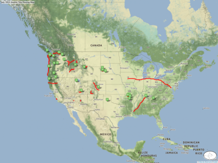
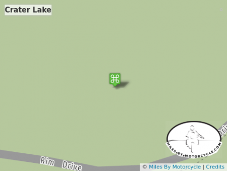


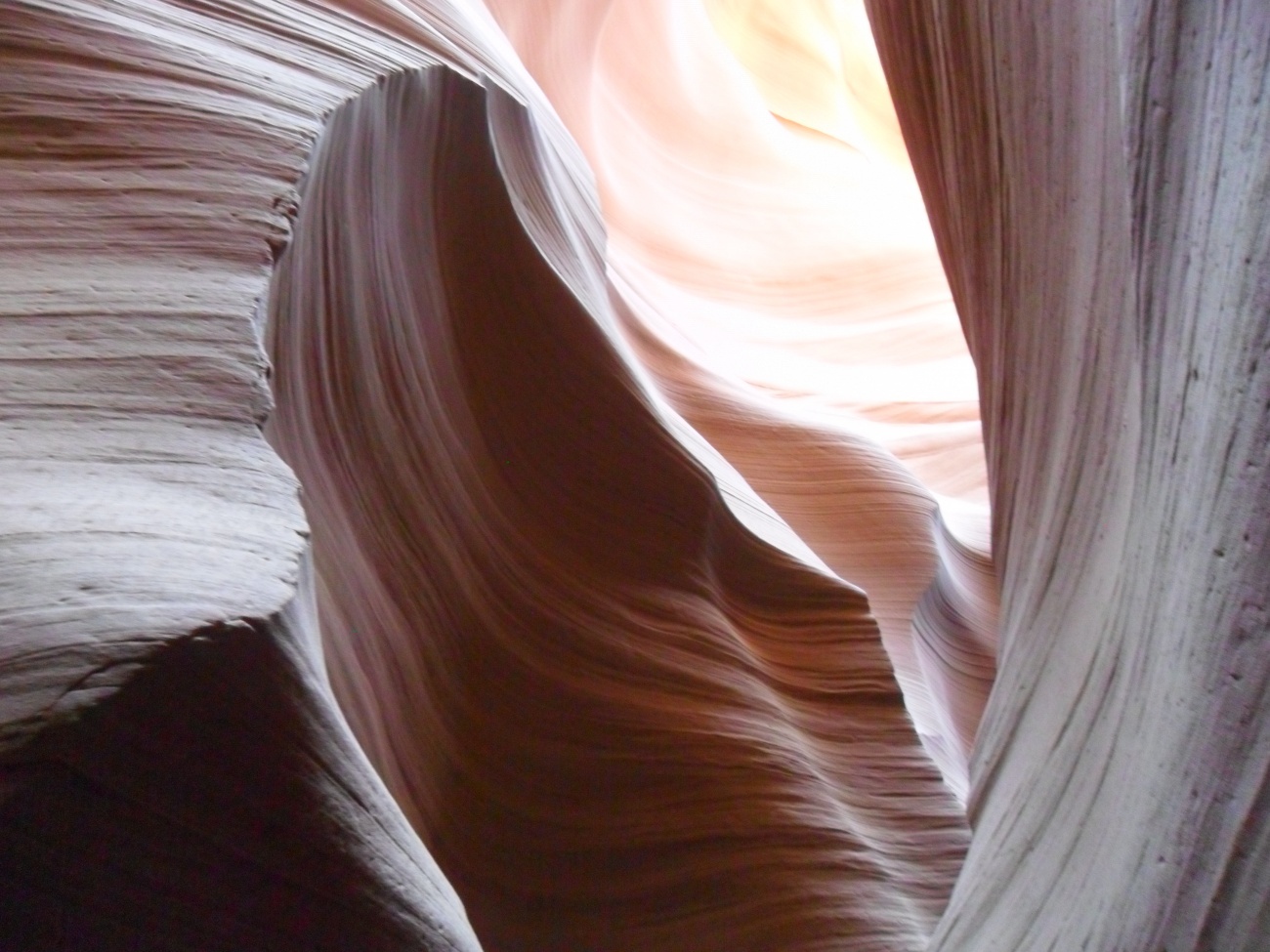
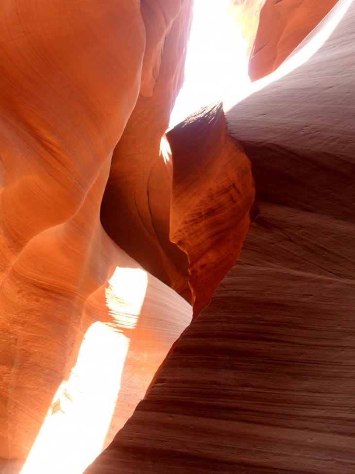
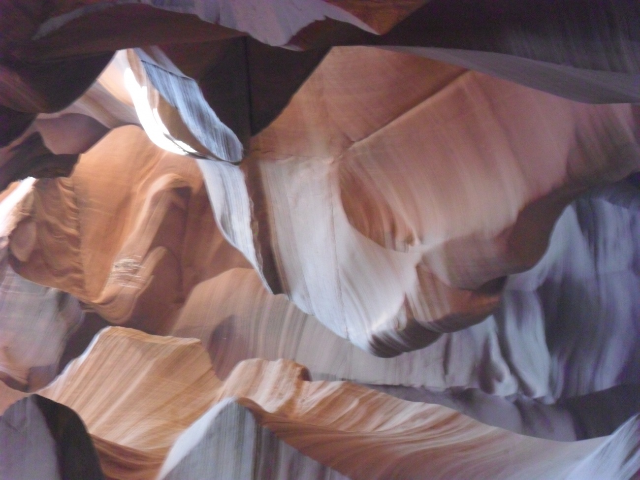
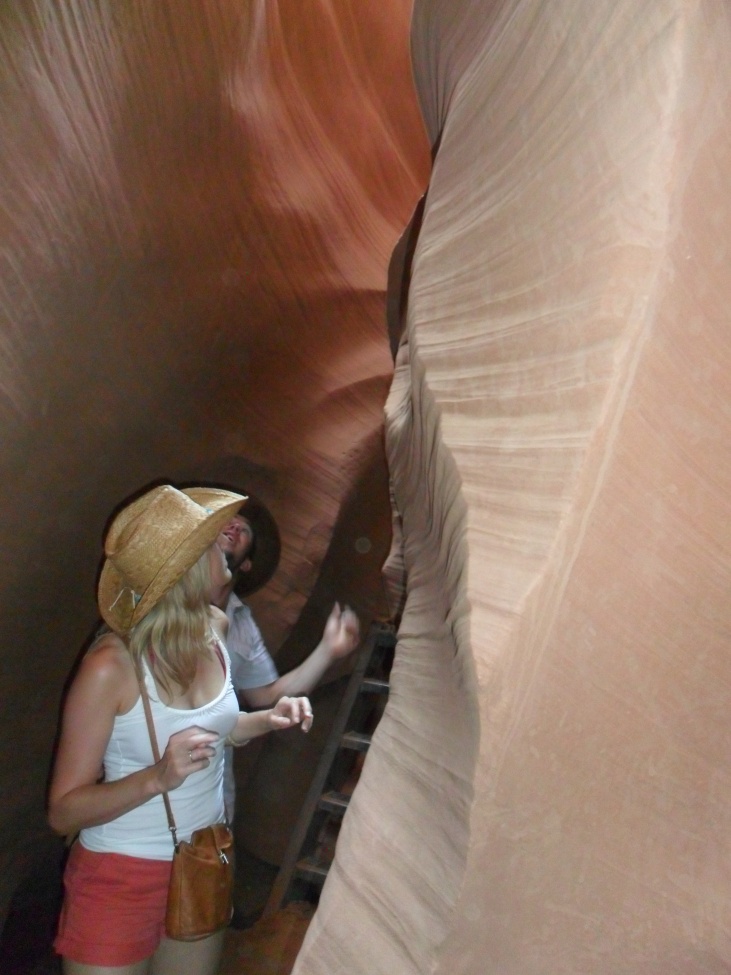
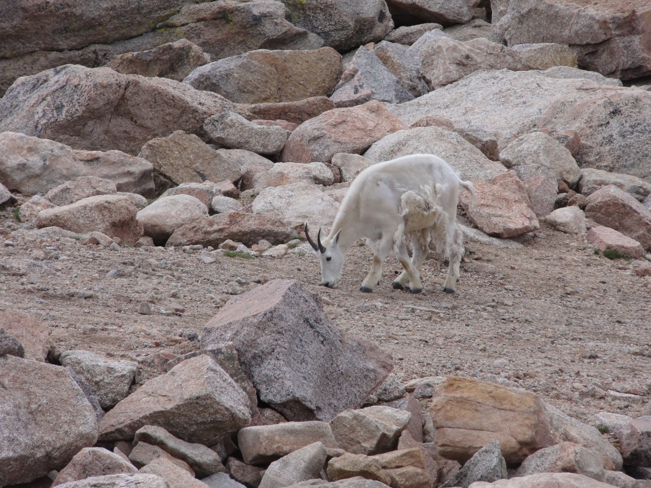
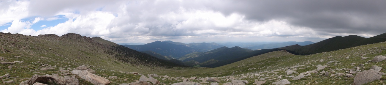
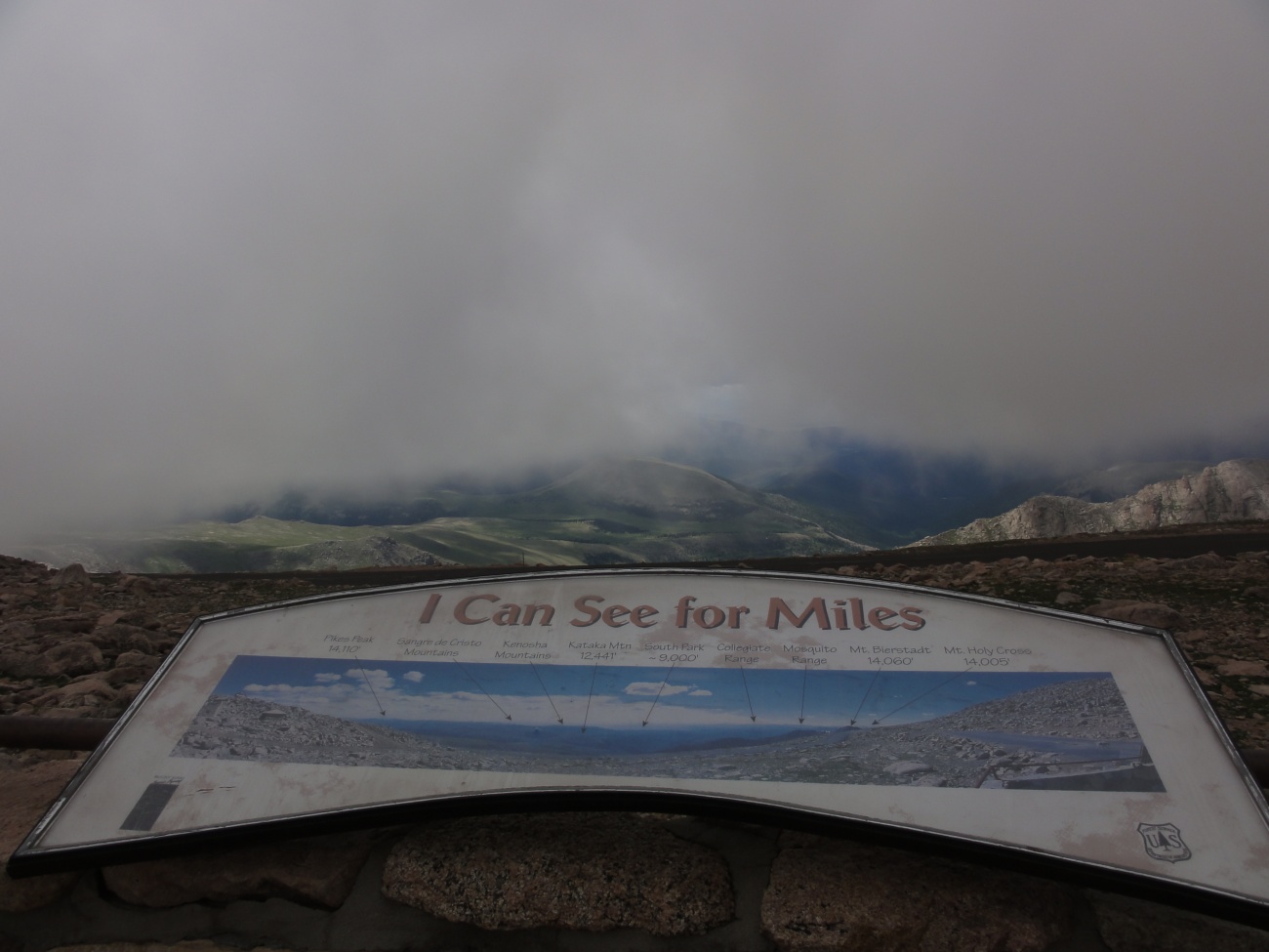
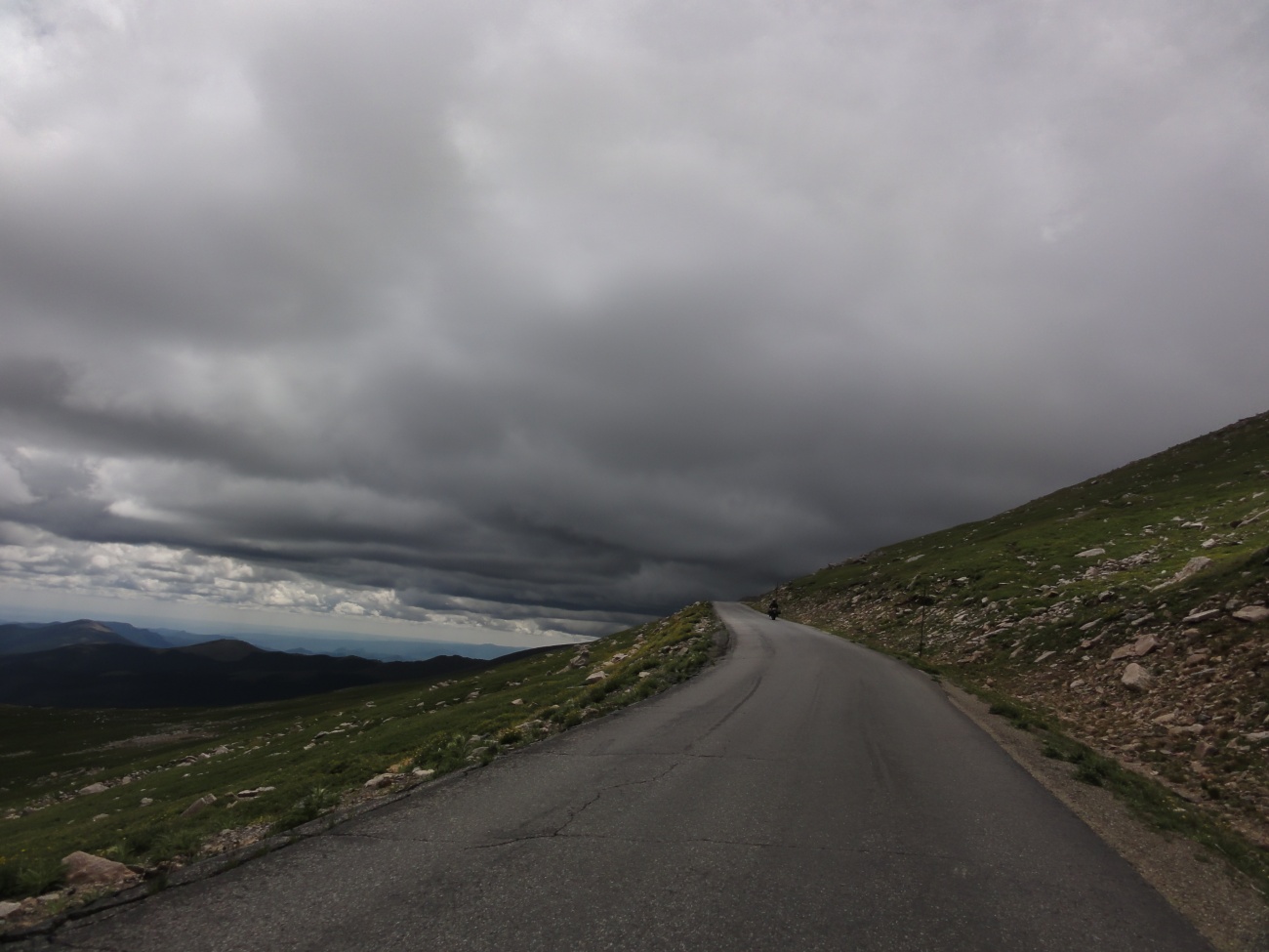
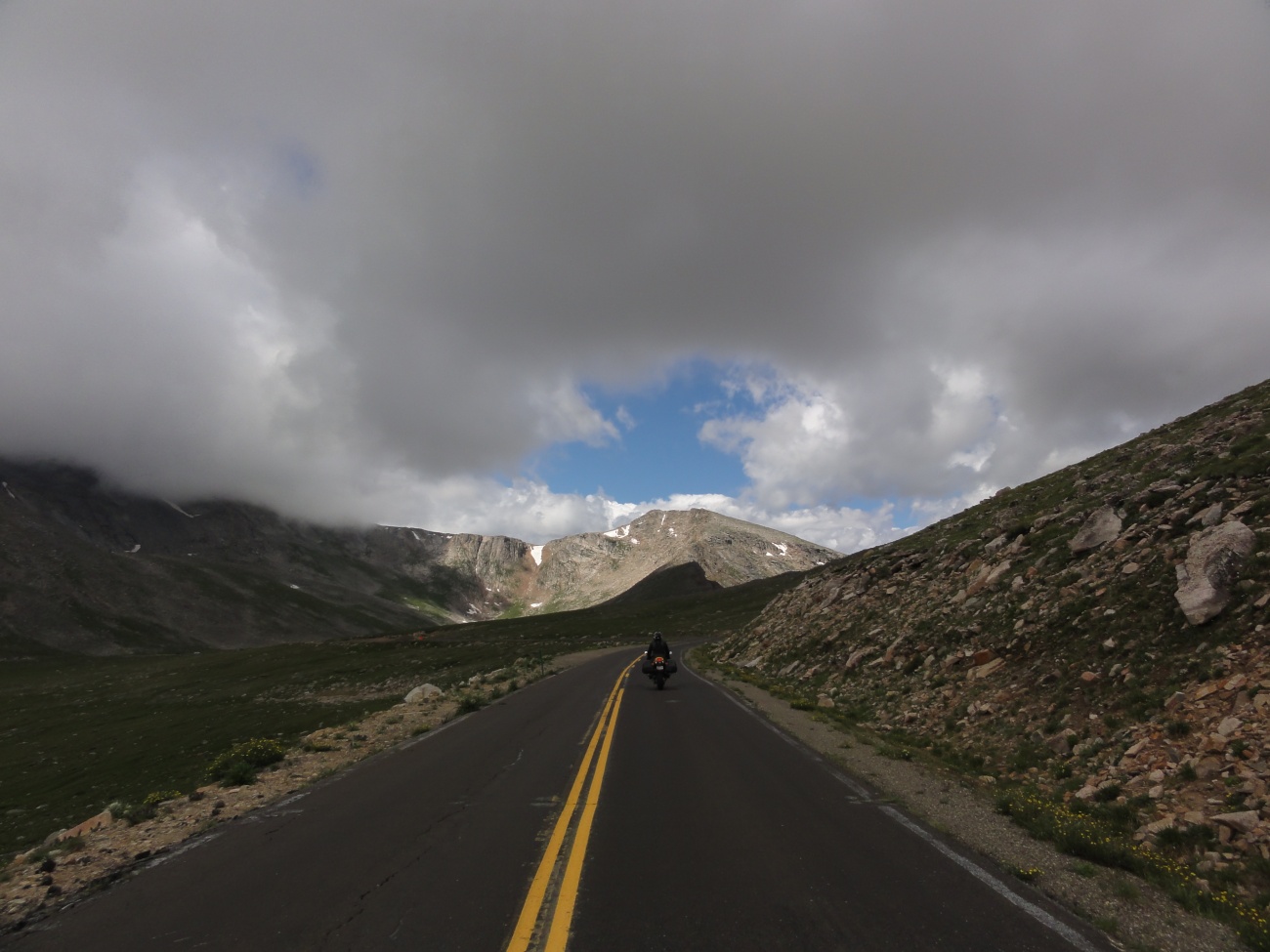

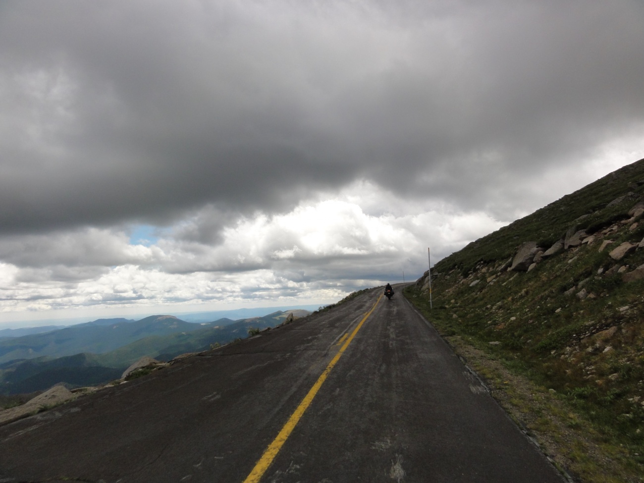
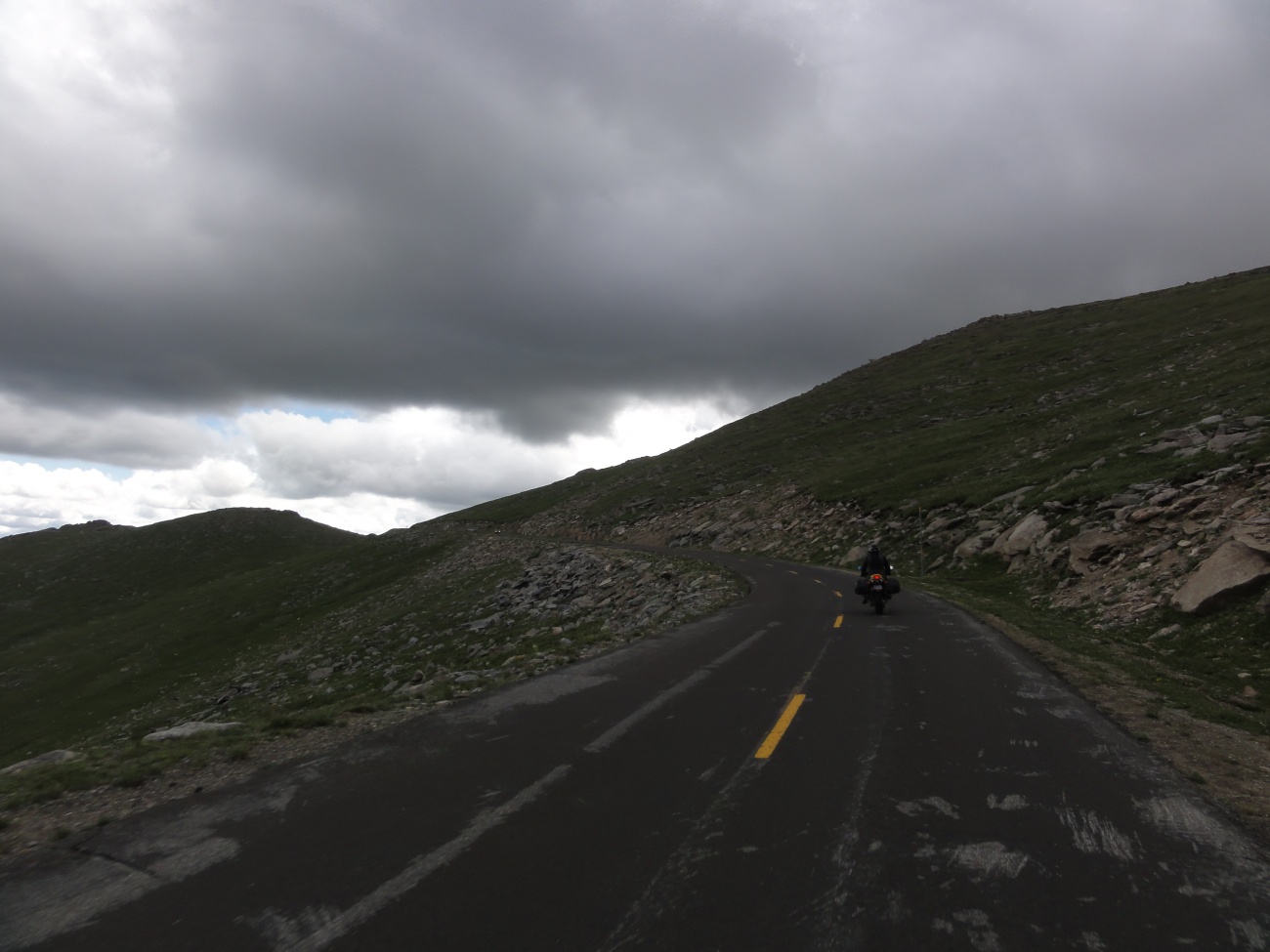

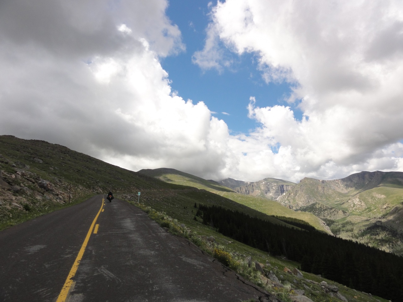


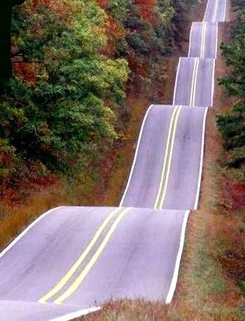

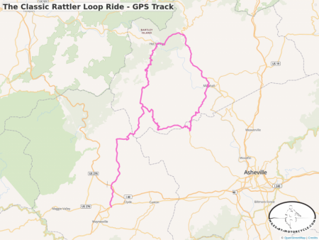
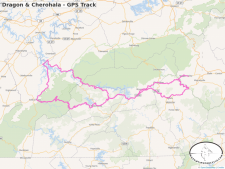

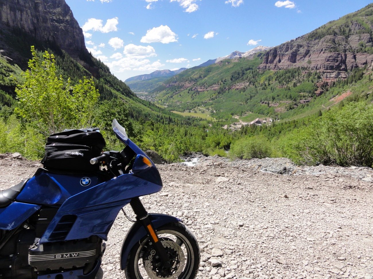
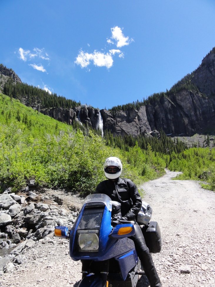
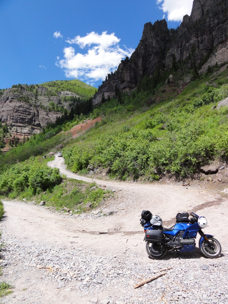
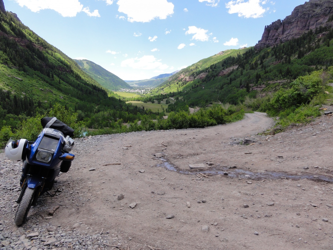
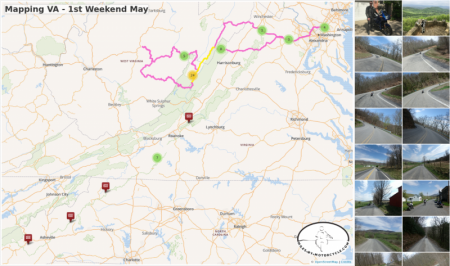
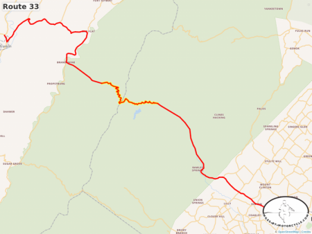
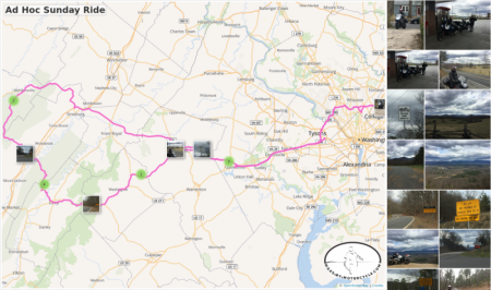
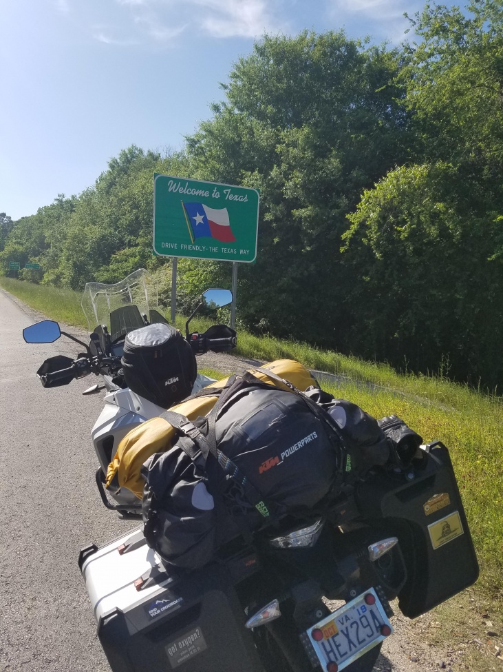
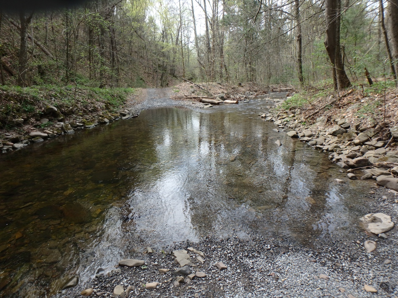

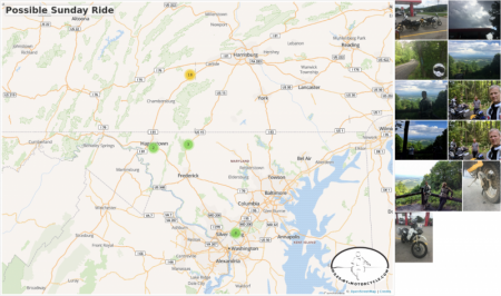
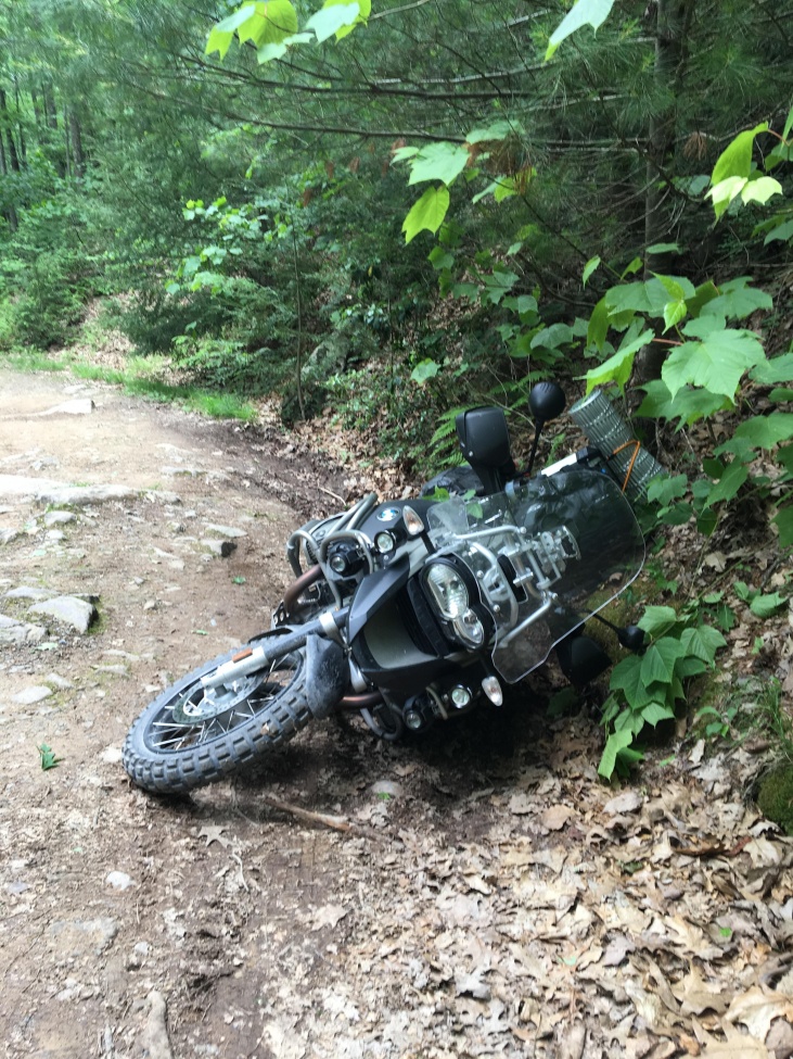

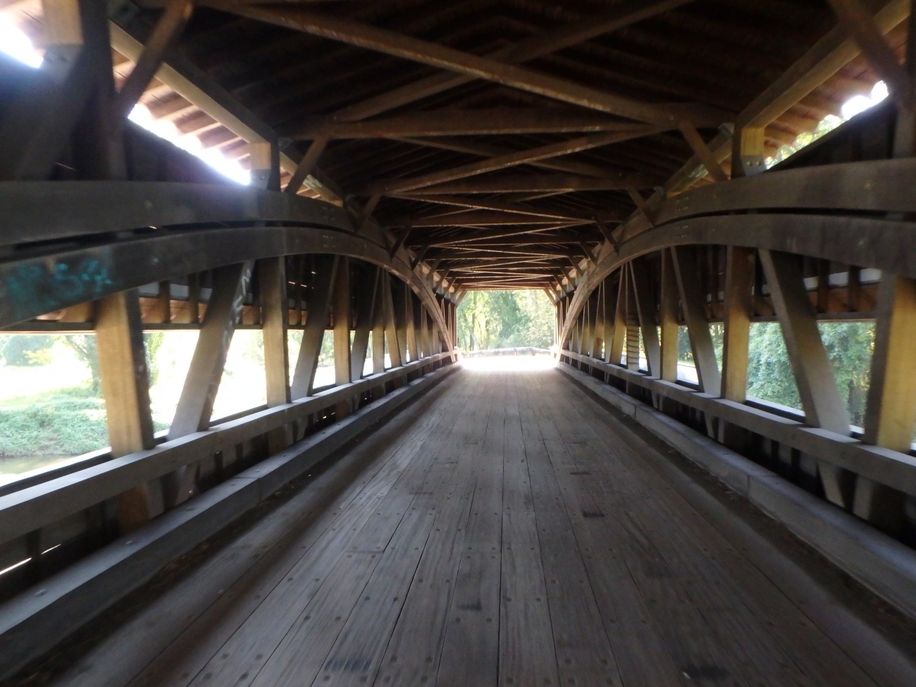
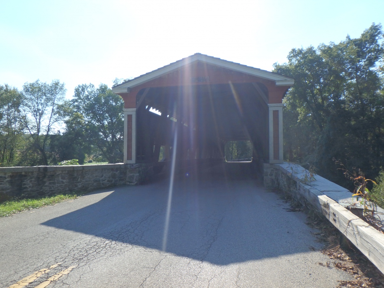
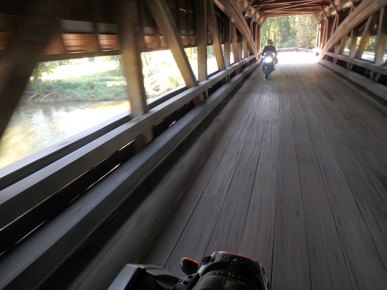
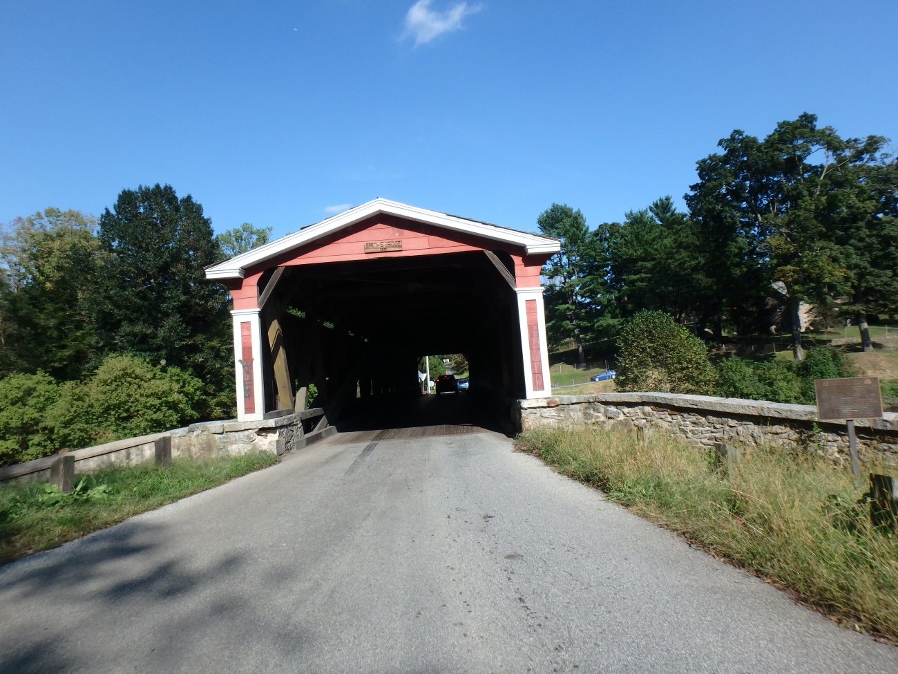
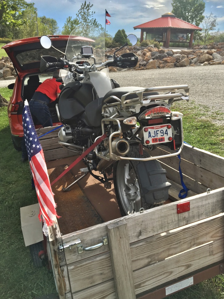
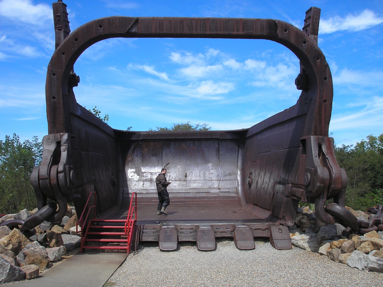
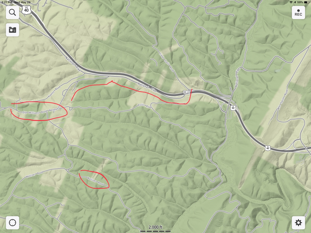
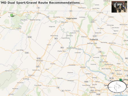
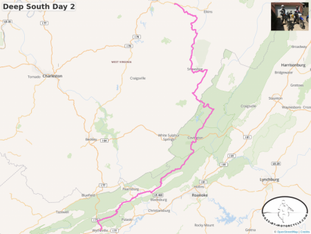

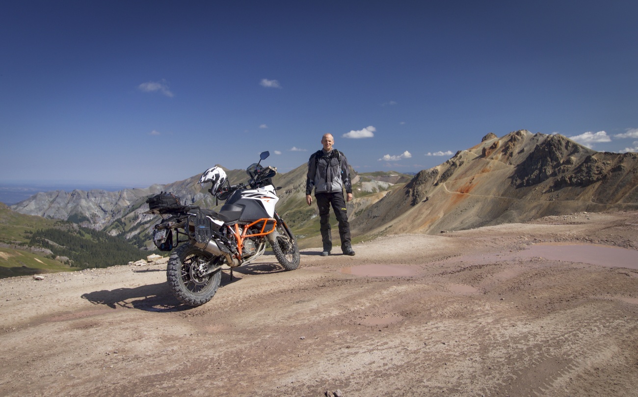

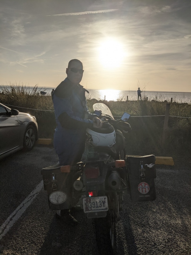
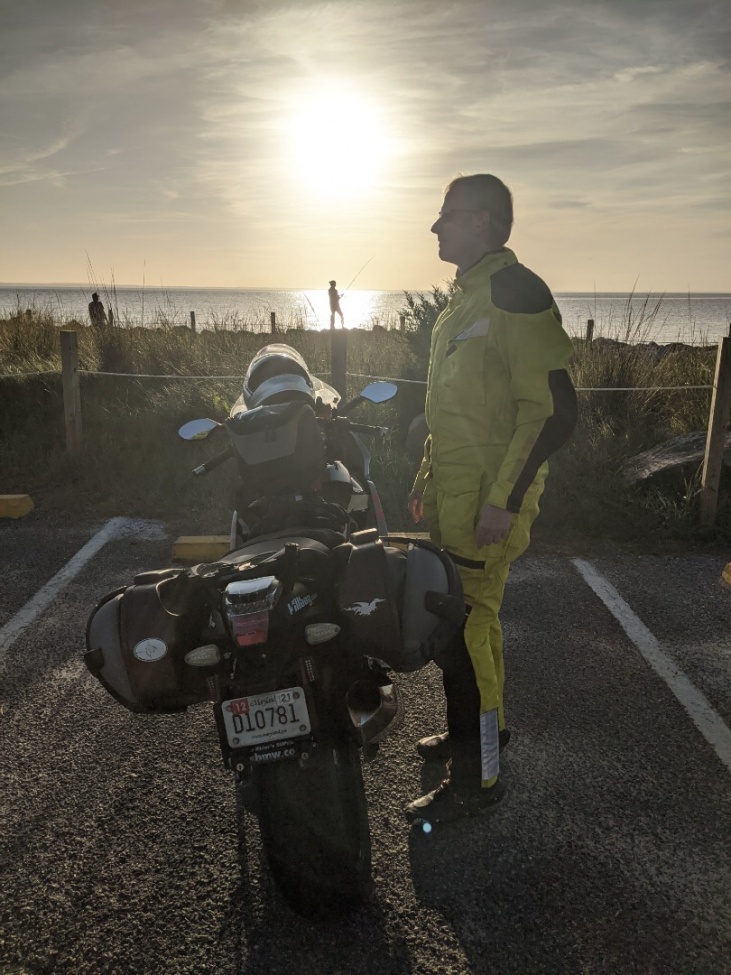
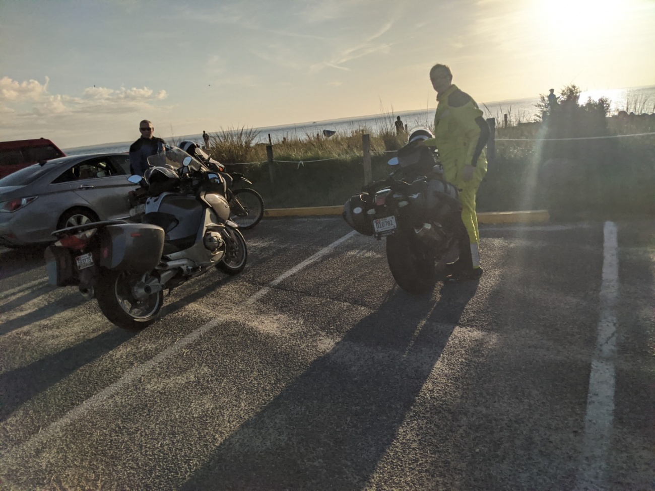
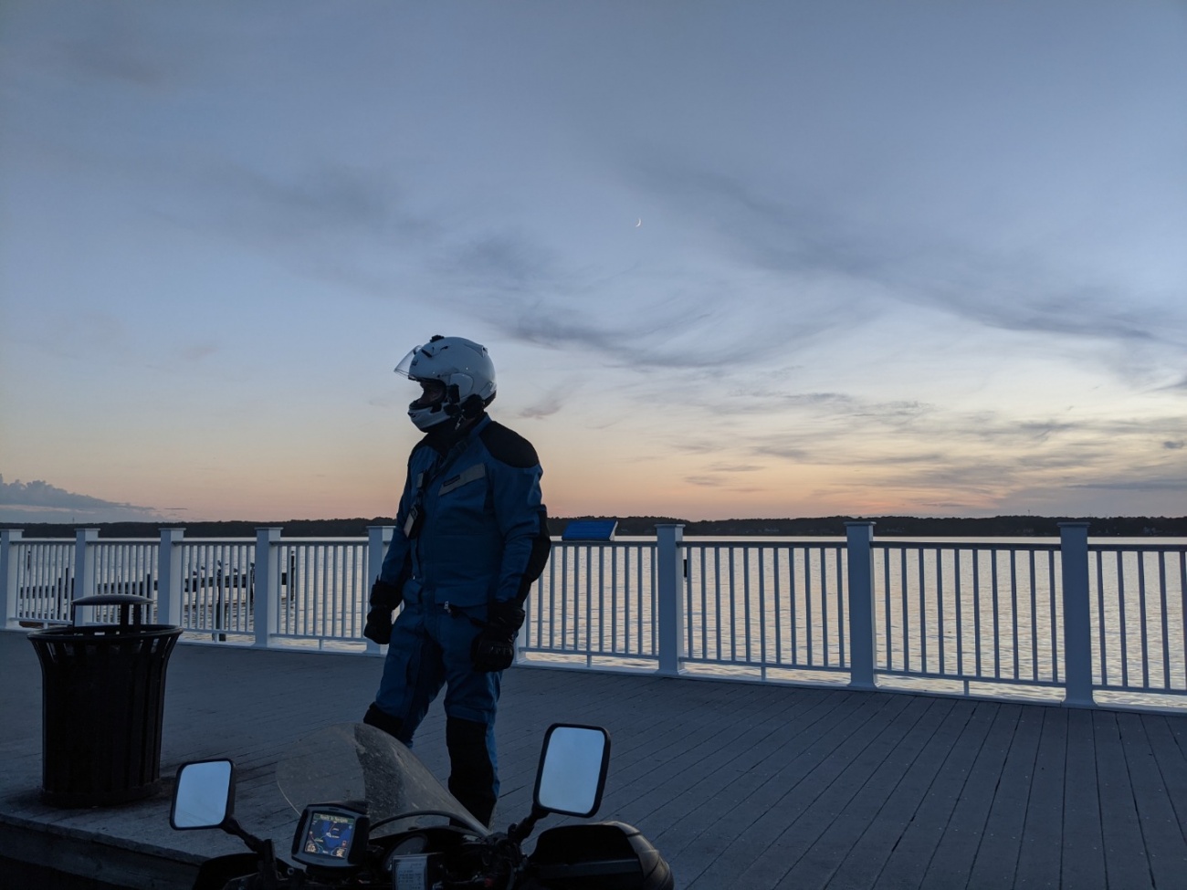
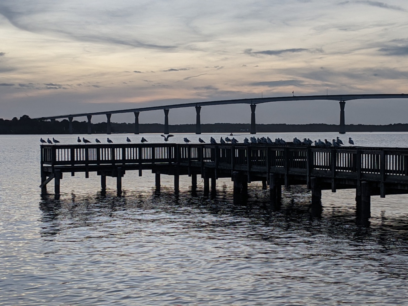
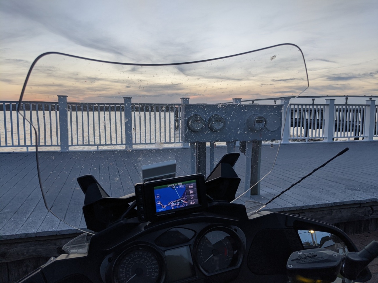
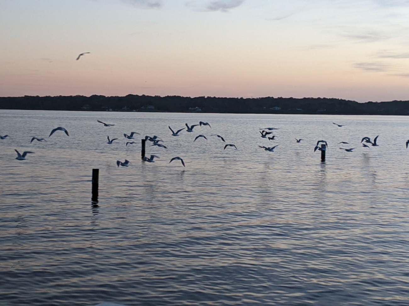
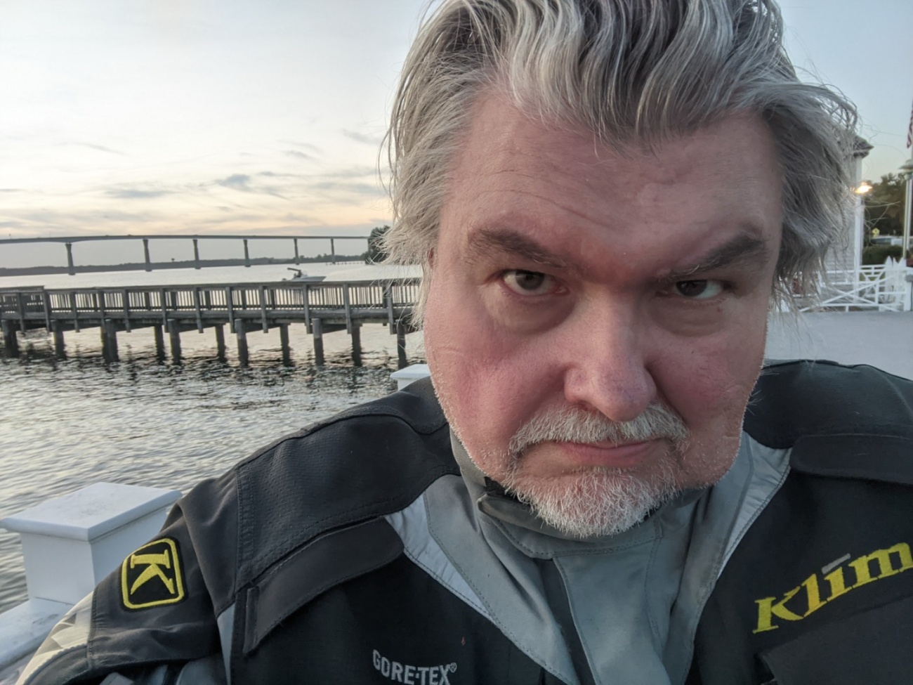
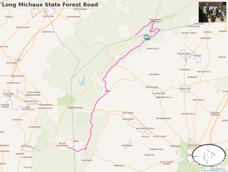
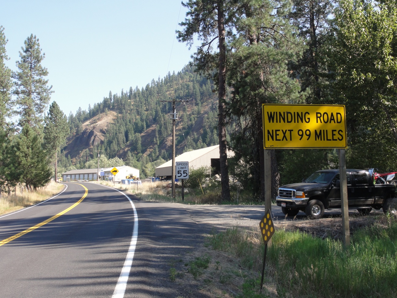
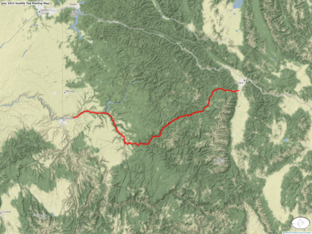
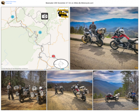


You must be a member of this group to post comments.
Please see the top of the page to join.
formVista ERROR #40204358:We are sorry but that has been a system error.